More heavy rain to come after flooding disrupts travel

 PA Media
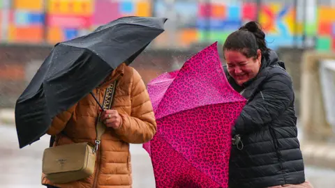
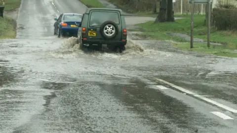
Heavy rainfall disrupted travel in parts of the UK on Wednesday, with more wet weather on the way.
Some measurement sites in the Midlands - at Wellesbourne and Coleshill - recorded close to a month’s rain in a 30-hour period.
In southern England, train services between Bedford and Bletchley were cancelled following flooding on the tracks.
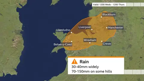
A 24-hour amber weather warning for rain will remain in force for parts of north Wales and north-west England - including Liverpool and Manchester - until 12:00 BST on Thursday.
This area is currently experiencing the heaviest of the rainfall, according to senior BBC meteorologist Nikki Berry, who warned the downpours would continue "for some time".
While parts of north-west England, Scotland and Northern Ireland “still have a fair amount” of rain to come, the southern half of the UK "has already seen the worst," she said.
In Carlton-in-Cleveland, on the outskirts of the North York Moors National Park, where there has been heavy rain, one person died in a mudslide, police said.
Elsewhere in North Yorkshire, fire crews say they have been "inundated with calls" after flash floods caused by heavy rain.
A number of rail routes in northern England continue to be subject to speed restrictions, potentially causing delays, according to National Rail.
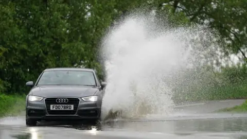
National Highways said there could be disruption on the roads on Wednesday evening, warning that "wet weather makes it harder for tyres to grip and for drivers to see ahead".
Yellow rain warnings will be in place until tomorrow for much of Scotland, the north of England, the Midlands, mid-Wales and north-eastern parts of Northern Ireland.
A further yellow warning for thunderstorms issued for much of the south coast of England will be in place until 19:00 on Wednesday.
Areas under yellow warnings may see "some" flooding and disruption, compared to amber warning areas where floods are "likely".
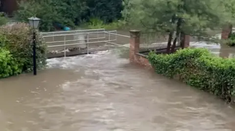
On Wednesday afternoon, the Environment Agency had issued four flood warnings, with over 90 alerts for possible flooding.
The Met Office said downpours were likely to last a long time in many areas, with an increased risk of flooding.
It warned that about a month's worth of rain could fall in some areas of north-west England and north Wales, with heavier rain combining with increasing winds.
In many places there could be 30-40mm of rain, while the north west of England could be hit by 70-90mm, the Met Office said.
The most severe rainfall is expected in the mountains of north Wales, where 100-150mm could fall throughout the amber warning period, which ends at midday on Thursday.
The rain will slowly peter out and it will feel a little warmer again this weekend, with temperatures into the high teens and low-20s.
However, while a few spots will get away with a dry weekend, showers will gradually develop widely as another area of low pressure moves in from the Atlantic.
 PA Media
The east of England had already experienced some disruption on Tuesday, with heavy rainfall leading to the suspension of a football match in Ipswich. Roads have been also been closed in Suffolk.
The Essex fire and rescue service said it had been called to reports of flooding in Ongar, west of Chelmsford, on Tuesday evening.
 Essex Fire Service
The inclement weather comes as scientists confirmed climate change was a major reason the UK suffered such a waterlogged winter this year.
The country faced its second-wettest October to March period on record, and the amount of rainfall on the stormiest days increased by about 20% on average.
Global warming due to humans burning fossil fuels made this level of rainfall at least four times more likely, according to World Weather Attribution, a group of climate scientists.
 BBC/Videoman