©The Daily Diges
Photo: NASA/JPL-Caltech/University of Arizonat
A huge meteorite strikes Mars
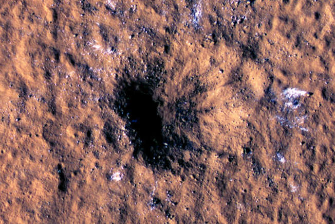
NASA revealed, during a press conference, that a meteorite struck Mars on December 24, 2021. The American space agency unveiled images of the crater formed following the collision.
©The Daily Digest
A crater of 492 feet in diameter
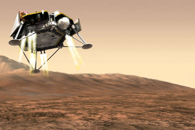
The InSigh mission's seismometer detected two major impacts on the surface of Mars. The larger of the two formed a crater of 150 meters (492 feet) in diameter and 21 meters (69 feet) deep.
©The Daily Digest
Photo: GooKingSword/Pixabay
One of the largest impacts ever observed
In its press release, the space agency said this was "one of the largest impacts ever observed on Mars since NASA began exploring the cosmos."
©The Daily Digest
Photo:NASA/JPL-Caltech/UA/USGS
An even bigger discovery: ice inside Mars
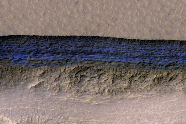
However, what's thrilled scientists more than the recorded seismic activity is what the meteor uncovered when it slammed into Mars: boulder-size chunks of ice blasted inside the crater.

©The Daily Digest
Ice in the poles of Mars
Scientists were well aware of the ice on the poles on Mars, but they didn’t know that ice existed under the ice cap.

©The Daily Digest
Ice can be converted into water, oxygen or hydrogen
"In planning for future human exploration of Mars, we'd want to land the astronauts as near to the equator as possible, and having access to ice at these lower latitudes, that ice can be converted into water, oxygen, or hydrogen. That could be really useful", said Lori Glaze, NASA's director of planetary science.
©The Daily Digest
Photo: NASA/JPL-Caltech
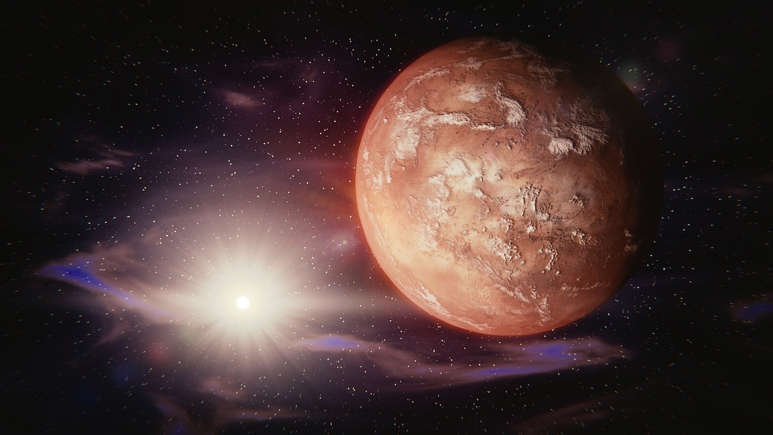
The red planet
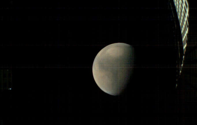
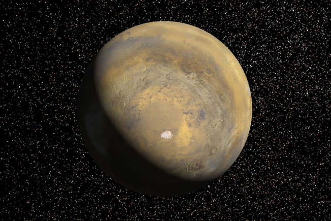
Mars is the planet in our Solar System that has the most similarities with Earth. This is mainly why the red planet is NASA’s favorite destination to explore.
©The Daily Digest
Photos that depict the red planet
So the recent discovery and amazing photos can be added to the collection NASA has of the red planet. Here are some of them:
©The Daily Digest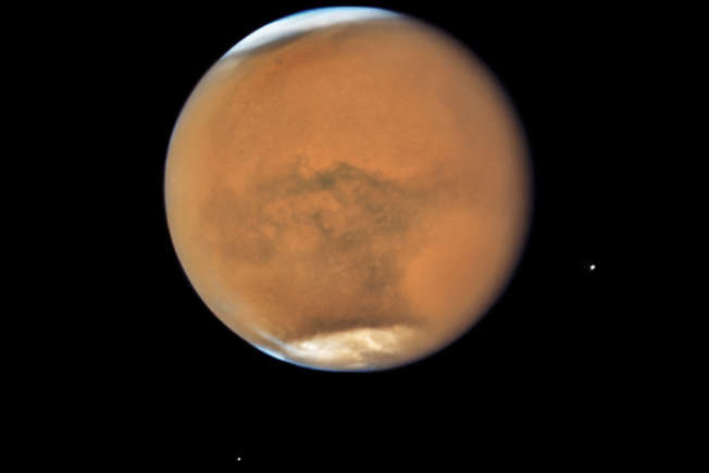
Photo: NASA, ESA, and STScI
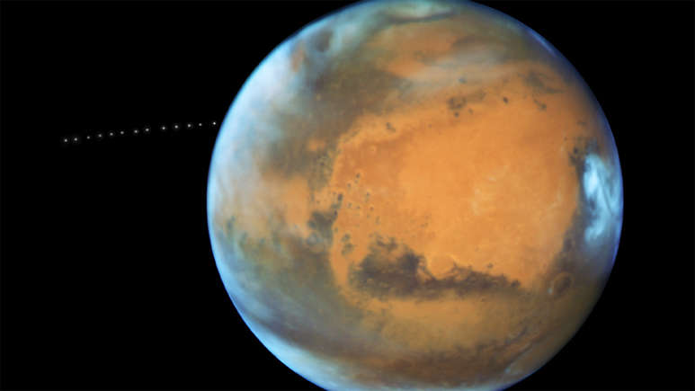
Mars’s two small moons
This image of Mars was taken by NASA's Hubble Space Telescope on July 18, 2018, when Earth, Mars and the Sun were aligned. Mars' two small moons, Phobos and Deimos are visible in this shot.
©The Daily Digest
Photo: NASA/JPL/University of Arizona
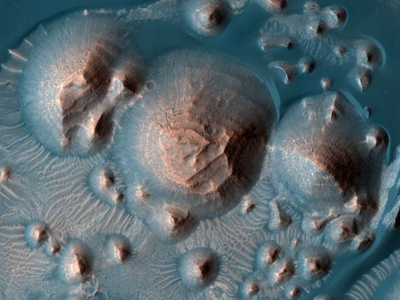
Arabia Terra
Arabia Terra is a vast region located on the northern hemisphere of Mars. It is characterized by its craters dating back approximately 4 billion years. Also seen in this photo are dark dunes, which the HIRISE team is monitoring closely for any wind activity.
©The Daily Digest
Photo: NASA/JPL-Caltech/University of Arizona
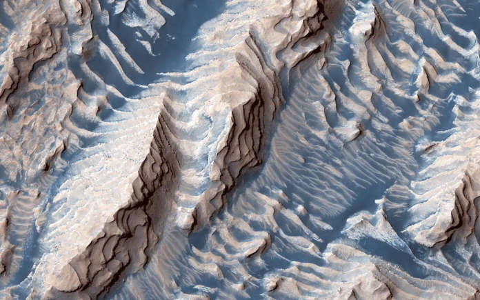
Danielson Crater
Danielson is an impact crater measuring approximately 67 kilometers (41 miles) in diameter, located in the southwest of the Arabia Terra region. This image taken by the Mars Reconnaissance Orbiter spacecraft shows the sand and sedimentary rocks that make it up.
©The Daily Digest
Photo: NASA/JPL/University of Arizona
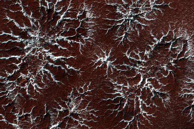
A wonderful contrast of colors
In this image, there’s channels filled with shiny ice, which contrast with the red soil of Mars. The photo was taken at the planet's seasonal polar caps.
©The Daily Digest
Photo: NASA/JPL/LaRC
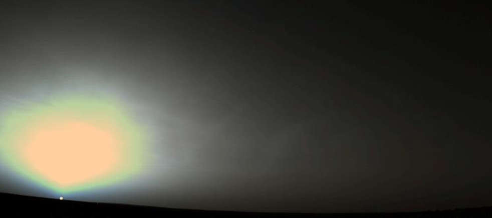
A sunrise on the planet Mars
An intriguing Martian sunrise was captured by the Viking 2 exploration probe on June 14, 1978.
©The Daily Digest
Photo: NASA/JPL/University of Arizona
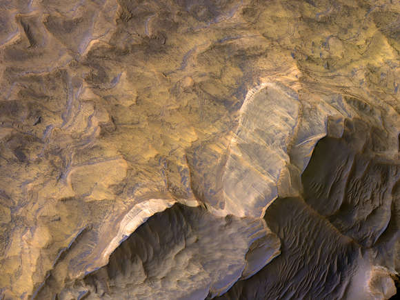
Candor Chasma
This is Candor Chasma, one of the valleys that are part of the Valles Marineris canyons, located close to the equator of the red planet. Its light-colored stratified deposits could be an area made up of sandstone, potentially habitable according to scientists.
©The Daily Digest
Photo: NASA/JPL/University of Arizona
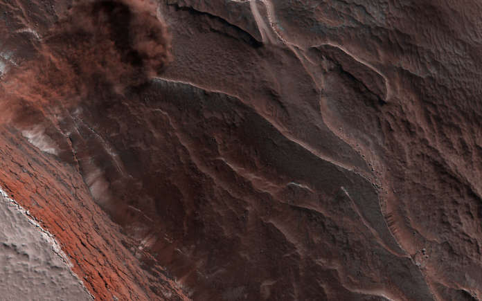
A spring avalanche
This is an avalanche captured by the HiRISE camera, near the north pole of Mars. Every spring, the sun shines on this area of the planet. The heat of its rays causes the detachment of blocks of ice. When reaching the bottom of the cliff, which is more than 500 meters high, these blocks raise a cloud of dust.
©The Daily Digest
©The Daily Digest
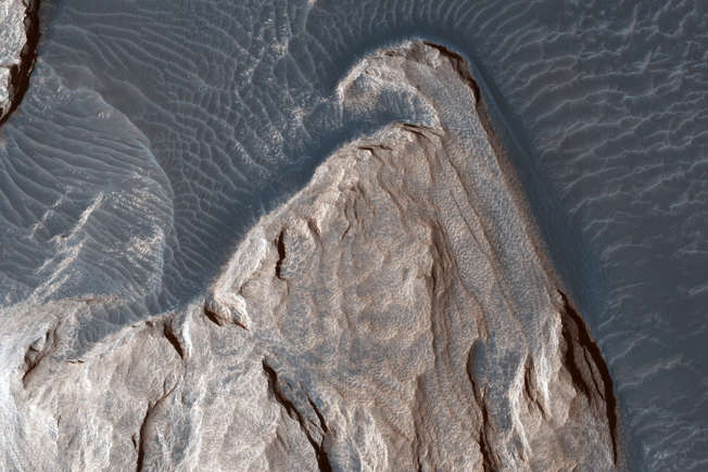
Rock formations
This image was captured in December 2018 by the Mars Reconnaissance Orbiter. The ripples that can be seen in the sand tell us which way the wind has moved around these rock formations.
©The Daily Digest
Photo: NASA, ESA, and Z. Levay (STScI)
Phobos
Phobos is one of the two natural satellites of Mars. This small moon rises west of Mars and circles the Red Planet three times in a Martian day, which lasts about 24 hours and 40 minutes.
©The Daily Digest
Photo: NASA/JPL-Caltech/University of Arizona
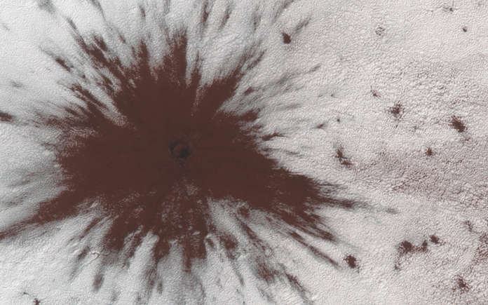
A very young impact crater
This remarkable image shows us an impact crater formed between July and September 2018. This impact occurred in the seasonal southern ice sheet, and visibly pierced it, creating an incredible blast pattern.
©The Daily Digest
Photo: NASA/JPL-Caltech/MSSS/JHUAPL
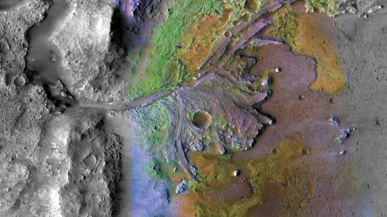
Jezero Crater
The Jezero crater is thought to have formed about 3.7 billion years ago. It is located to the west of Isidis Planitia, and it was chosen by NASA as the landing site for the "Mars 2020" mission, launched on July 30, 2020, and currently in progress.
©The Daily Digest
Photo: NASA/JPL/University of Arizona
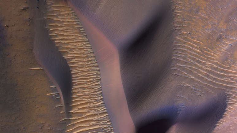
Steep dunes
These dunes were photographed on the slopes of Nectaris Montes, in the canyons of Valles Marineris. The sand dunes that make up these giant canyons can be impressively large, with seemingly very steep slopes, as seen in the image.
©The Daily Digest
Photo: NASA/JPL-Caltech/MSSS
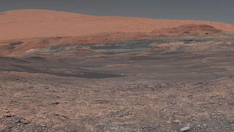
Mount Sharp
This image was taken by the Curiosity rover, deployed on Mars since 2012, on Mount Sharp, a mountain that stands in the middle of the Gale crater. In the center of the image, you can see clay rocks that NASA scientists are eager to study.
©The Daily Digest
Photo: NASA/JPL-Caltech/MSSS
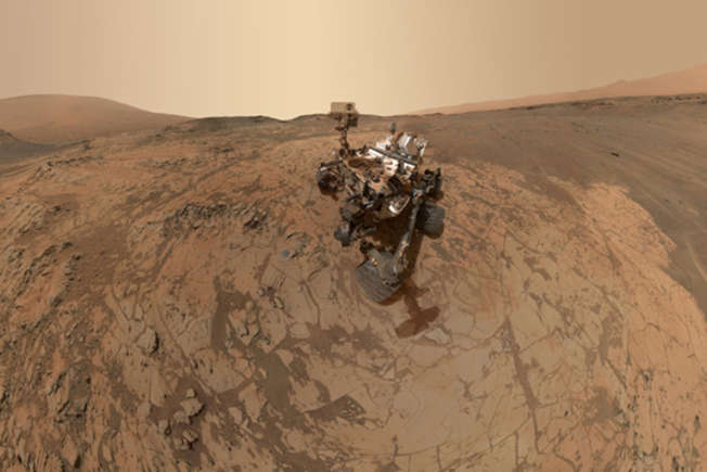
Curiosity selfie
This is Curiosity, the car-size rover sent to Mars for an exploration mission in 2012. One of its objectives is to explore the Gale crater, on which it landed. The "Mars Science Laboratory" mission is still ongoing today.
©The Daily Digest
Photo: NASA/JPL-Caltech
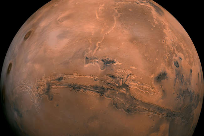
The canyons of Valles Marineris
At the center of this mosaic, which is a compilation of images captured by the Viking Orbiter 1 spacecraft, is a broader view of the Valles Marineris canyons. They stretch over 3,000 kilometers long and 600 kilometers wide.
©The Daily Digest
Photo: NASA/JPL/University of Arizona
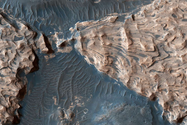
Aram Chaos Crater
In this image, uplifted blocks of light-colored layers can be seen, composed largely of hematite and water-weathered silicates. These elements tell us that the Aram Chaos crater once contained a lake. Its diameter is about 284 kilometers (176 miles).
©The Daily Digest
Photo: NASA/JPL-Caltech/University of Arizona
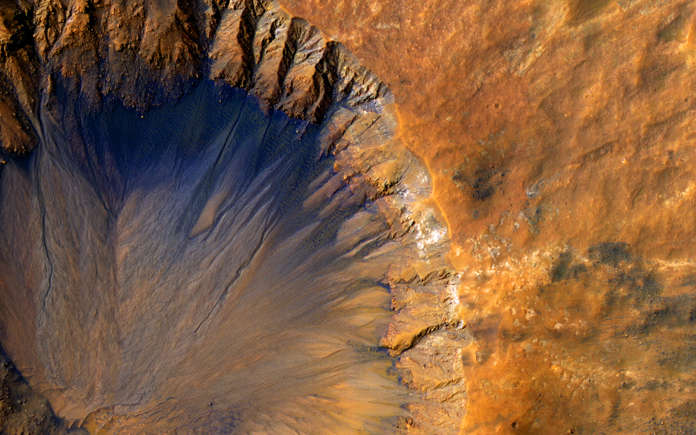
Crater Crisp
The Crisp crater is located in the Sirenum Fossae. According to NASA scientists, this crater would be relatively recent, because its edge is still very sharp.
©The Daily Digest
Photo: NASA/JPL-Caltech/University of Arizona
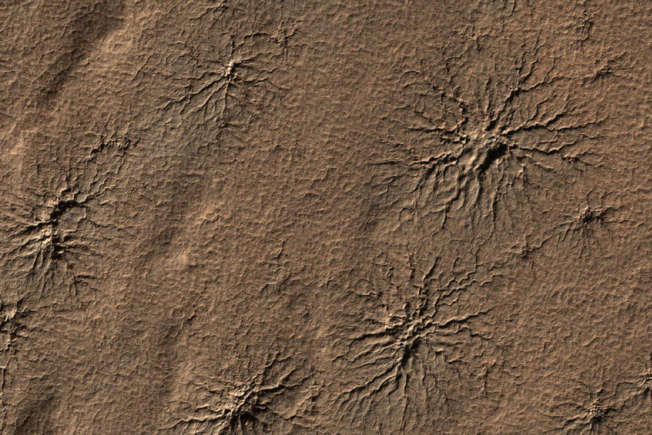
Spider shaped cracks
These spider-shaped cracks are located in the surface of the south polar region of Mars. They were caused by the evaporation of carbon dioxide in the atmosphere.
©The Daily Digest
Photo: NASA/JPL-Caltech
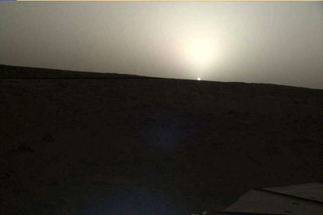
Another Martian sunset
This sunset was captured by NASA's InSight lander on April 25, 2019 at 6:30 p.m. local Mars time.
©The Daily Digest
Photo: NASA, ESA, J.-Y. Li (PSI), CM Lisse (JHU/APL), and the Hubble Heritage Team (STScI/AURA)
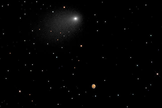
The passage of a comet near Mars
Finally, this is an image captured by the Hubble Space Telescope, which shows the closeness between a Comet and Mars on October 19, 2014.
{ https://thedailydigest.com/en/ }


 Missing scientist found dead after 11 months took two shocking items with her that cast doubt on suicide theory