Ontdek de Fascinerende Wereld van UFO's en UAP's: Jouw Bron voor Onthullende Informatie!
Ben jij ook gefascineerd door het onbekende? Wil je meer weten over UFO's en UAP's, niet alleen in België, maar over de hele wereld? Dan ben je op de juiste plek!
België: Het Kloppend Hart van UFO-onderzoek
In België is BUFON (Belgisch UFO-Netwerk) dé autoriteit op het gebied van UFO-onderzoek. Voor betrouwbare en objectieve informatie over deze intrigerende fenomenen, bezoek je zeker onze Facebook-pagina en deze blog. Maar dat is nog niet alles! Ontdek ook het Belgisch UFO-meldpunt en Caelestia, twee organisaties die diepgaand onderzoek verrichten, al zijn ze soms kritisch of sceptisch.
Nederland: Een Schat aan Informatie
Voor onze Nederlandse buren is er de schitterende website www.ufowijzer.nl, beheerd door Paul Harmans. Deze site biedt een schat aan informatie en artikelen die je niet wilt missen!
Internationaal: MUFON - De Wereldwijde Autoriteit
Neem ook een kijkje bij MUFON (Mutual UFO Network Inc.), een gerenommeerde Amerikaanse UFO-vereniging met afdelingen in de VS en wereldwijd. MUFON is toegewijd aan de wetenschappelijke en analytische studie van het UFO-fenomeen, en hun maandelijkse tijdschrift, The MUFON UFO-Journal, is een must-read voor elke UFO-enthousiasteling. Bezoek hun website op www.mufon.com voor meer informatie.
Samenwerking en Toekomstvisie
Sinds 1 februari 2020 is Pieter niet alleen ex-president van BUFON, maar ook de voormalige nationale directeur van MUFON in Vlaanderen en Nederland. Dit creëert een sterke samenwerking met de Franse MUFON Reseau MUFON/EUROP, wat ons in staat stelt om nog meer waardevolle inzichten te delen.
Let op: Nepprofielen en Nieuwe Groeperingen
Pas op voor een nieuwe groepering die zich ook BUFON noemt, maar geen enkele connectie heeft met onze gevestigde organisatie. Hoewel zij de naam geregistreerd hebben, kunnen ze het rijke verleden en de expertise van onze groep niet evenaren. We wensen hen veel succes, maar we blijven de autoriteit in UFO-onderzoek!
Blijf Op De Hoogte!
Wil jij de laatste nieuwtjes over UFO's, ruimtevaart, archeologie, en meer? Volg ons dan en duik samen met ons in de fascinerende wereld van het onbekende! Sluit je aan bij de gemeenschap van nieuwsgierige geesten die net als jij verlangen naar antwoorden en avonturen in de sterren!
Heb je vragen of wil je meer weten? Aarzel dan niet om contact met ons op te nemen! Samen ontrafelen we het mysterie van de lucht en daarbuiten.
The recent “Doomsday” Oarfish sightings in California, Mexico, and Vietnam are raising concern
Geophysicist Stefan Burns has reported a recent surge in sightings of Oarfish, often nicknamed the “doomsday fish” because of their alleged connection to major natural disasters. These unusual deep-sea creatures have reportedly been spotted or washed ashore in several places recently, including California, Mexico, and Vietnam.
Oarfish, known in Chinese as a dizhenyu or, earthquake fish, can grow to more than 30 feet in length and typically inhabit the deep ocean, far below the surface. Because they rarely appear near shore, beach stranding's are considered extremely uncommon. Some theories suggest they rise toward the surface when they somehow sense seismic activity before an earthquake,
Kiyoshi Wadatsumi, a scientist who studies earthquakes at the nonprofit organization e-PISCO, said, “Deep-sea fish living near the sea bottom are more sensitive to the movements of active faults than those near the surface of the sea.”
According to Kiyoshi Wadatsumi’s explanation, the recent sightings of oarfish in California, Mexico, and Vietnam may indicate that unusual activity is occurring in the deep waters of these regions.
In a recent example, two rare oarfish, both still alive, washed ashore near Cabo San Lucas in Mexico, drawing attention from locals and researchers alike. (The second video shows an oarfish that had washed ashore in Mexico and was still alive.)
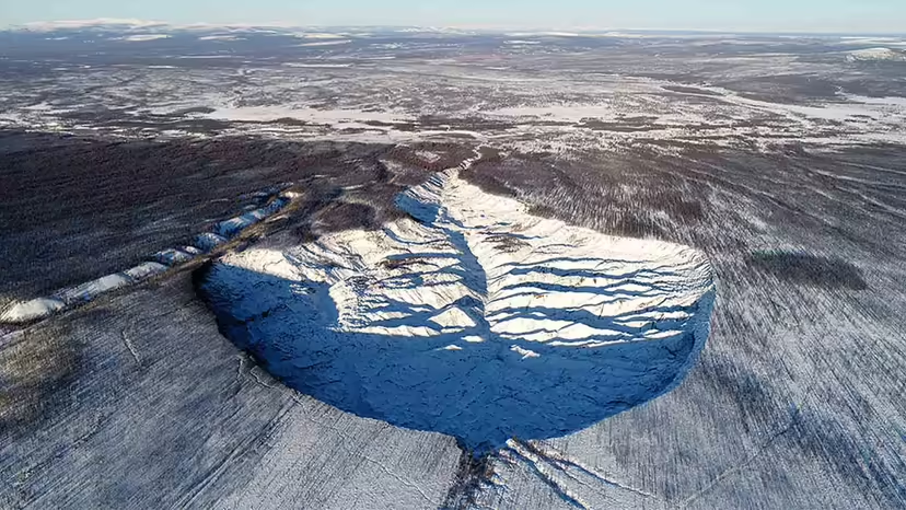
The massive Batagaika megaslump is located in Siberia's permafrost. It was discovered in the 1960s on satellite imagery. Alexander Kizyakov, Lomonosov Moscow State University
Key Takeaways
The Batagaika crater, located in Siberia, is a massive, expanding depression in the Earth's surface, formed due to permafrost thaw.
Its growth, significantly accelerated since the 1960s due to deforestation and climate change, exposes ancient organic materials and releases greenhouse gases, contributing to a feedback loop that accelerates global warming.
This "Gateway to Hell" not only provides valuable paleontological insights but also poses environmental threats.
If you like to peruse the internet for strange, puzzling extreme phenomena — and to be honest, who among us doesn't? — you may already have come across the Batagaika crater. It's a massive, growing hole in the landscape of Siberia that's inspired even serious-minded scientific publications to resort to supermarket tabloid-style terminology such as the Doorway to Hell and the Gateway to the Underworld.
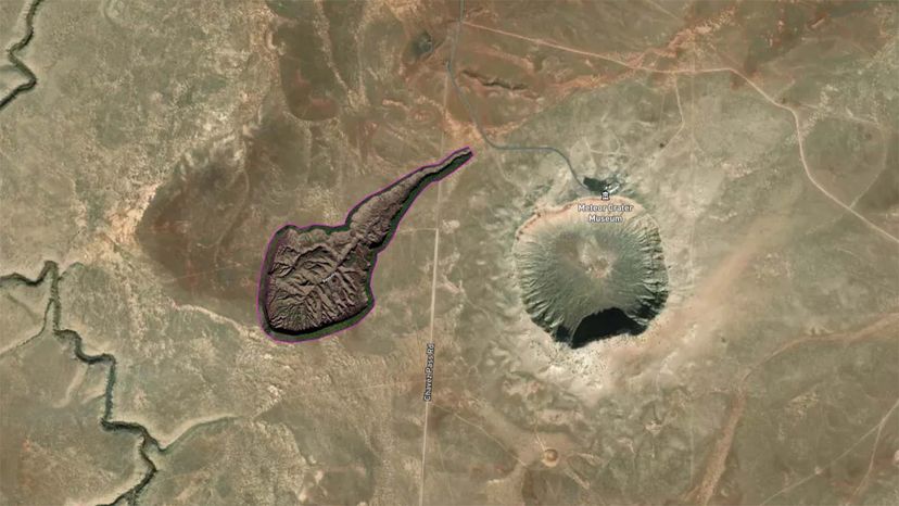
First spotted in the mid-1960s by surveillance satellites that were classified, the Batagaika crater has grown over the past 60 years from an insignificant gully to a massive tadpole-shaped depression that covers 200 acres (81 hectares) and stretches 2/3 of a mile (1 kilometer) in length and is 164 feet (50 meters) deep, according to the U.S. Geological Survey.
"From 1991 to 2018, the crater area increased by almost three times," Sarah Cadieux, a lecturer in New York'sRensselaer Polytechnic Institute's department of Earth and environmental sciences, says via email.
But what is it, exactly, and how did it get there? And why does it keep getting bigger?
Bataiga megaslump is seen here compared to Meteor Crater in Arizona, which measures 0.75 miles (1.2 kilometers) across and about 600 feet (180 meters) deep. The size of the asteroid that produced Meteor Crater is likely to be about 100 to 170 feet (30 to 50 meters). Wikimedia/(CC BY-SA 4.0)
One key to understanding the Batagaika crater is to understand that it isn't actually a crater. That's a term reserved for bowl-shaped holes in the ground that are caused by the impact of meteorites (like the Chicxulub crater), volcanic eruptions, or either a natural or man-made explosion of some sort.
Instead, the batagaika "is a retrogressive thaw slump, the largest in the world in fact," explains Roger Michaelides, an assistant professor of Earth and planetary sciences at Washington University in St. Louis. His areas of expertise include permafrost, the term for soil or rock and ice that stays frozen for long periods of time, which is often found in Arctic regions such as Alaska, Greenland and Siberia.
"Retrogressive thaw slumps belong to a class of terrain types called thermokarst that occur in areas underlain by permafrost," Michaelides says in an email.
While a non-scientist might assume that the "perma" in permafrost means that it stays frozen permanently, Michaelides says that isn't necessarily the case.
"With rising air temperatures across the Arctic, permafrost can thaw, and when it thaws it can result in dramatic changes to the landscape," he says. "In areas of ice-rich permafrost, permafrost thaw induces melting of ground ice, which causes the ground to subside and form irregular depressions in the ground surface. Some of these depressions can fill with pooling water and form thermokarst lakes, and sometimes the initiation of thermokarst can result in large gashes and slumps of ground as permafrost continues to thaw and become unstable. That's more or less what happened with the Batagaika crater."
2. How Did the Batagaika Crater Form?
Cutting down forests around the Batagaika crater during the Soviet era altered the thermal equilibrium of the surrounding permafrost landscape, leading to the depression that showed up in half-century-old satellite images.
"Without a vegetation canopy, more thermal energy from the sun was able to thaw permafrost, leading to the formation of a down-slope gully," Michaelides says. "The formation of this gully can lead to even more thaw of permafrost during subsequent summer seasons, which causes the gully to expand and grow larger. As larger surface areas of exposed permafrost are liable to thaw, this process accelerates and a megaslump can form."
This type of thermokarst formation is often a positive feedback loop, he says. That's when permafrost thaws and bacteria break down the organic matter trapped inside. As it releases carbon matter into the atmosphere as greenhouse gases, these gases warm the planet, creating a positive feedback loop that then thaws more permafrost.
"The result is a massive, slowly expanding collapse feature," Michaelides continues. "As permafrost thaws, its structural strength goes from something like concrete to wet mud, and on a sloping land surface like here, this causes the ground to slump."
As Siberia warms at an unprecedented rate due to climate change, the Batagaika crater has continued to grow as well, and is likely to keep getting bigger. "In some areas, the crater is expanding at a rate of tens of meters a year," Michaelides says.
3. The Science of the Batagaika Crater
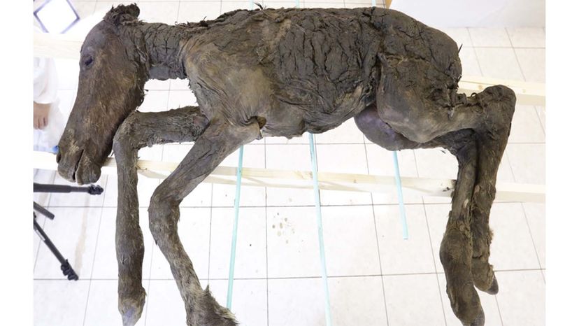
The foal carcass of the ancient horse that lived on the territory of Yakutia 42,000 years ago was discovered in the Batagaika crater. Mammoth Museum of North-Eastern Federal University
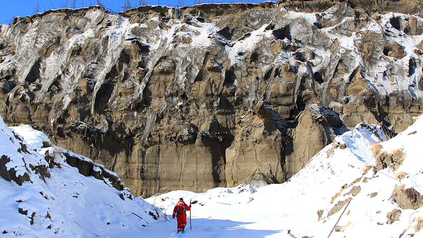
In one way, the growth of the Batagaika crater is a gift to science. "As this permafrost thaws, it also reveals a treasure trove of paleontological information in the form of fossils from the last ice age and potentially older," Michaelides explains.
In 2018, for example, scientists found the remains of an extinct baby horse, with well-preserved skin, hair, tail and hooves that died 42,000 years ago. That specimen yielded the oldest sample of liquid blood ever found, according to Live Science.
But the massive slump also is a potentially worrisome environmental omen.
"As permafrost thaws, methane, carbon dioxide and other greenhouse gases previously bound within the frozen permafrost can be released into the atmosphere," Michaelides explains. "This in turn can set off a positive feedback loop of its own. Rates of methane release from degrading permafrost are difficult to quantify, particularly over broad regions, but advances in satellite remote sensing may someday soon enable this type of analysis on regional and Arctic scales."
4. Thaw and Release of Carbon
The Batagaika crater covers 200 acres (81 hectares) and stretches 2/3 of a mile (1 kilometer) in length and is 164 feet (50 meters) deep. Alexander Kizyakov, Lomonosov Moscow State University
Thawing of permafrost on such large scales not only can yield fossils and preserved remains, like the baby foal, but it also can expose bacteria, carbon and other matter encased in ice for centuries. And that's not a good thing.
"As the crater grows, material that has been frozen and inaccessible for 650,000 years is being exposed. This includes organic matter and carbon," Cadieux says. "It is estimated that permafrost soils hold at least twice as much carbon as the atmosphere does."
Why that's potentially so bad is because microorganisms break down this newly exposed organic matter and release methane and carbon dioxide. If that were to happen slowly and steadily, 220 billion tons (200 billion metric tons) of carbon could be released in about 300 years. But if the permafrost thaws abruptly, it could increase the current permafrost carbon projections by 50 percent, Cadieux explains.
The Arctic has already warmed by almost 5.5 degrees Fahrenheit, (more than 3 degrees Celsius). That's three times faster than the rest of the world. As the air warms, it heats up the ground and thaws more permafrost. Some studies suggest that the sudden collapse of thawing permafrost in the Arctic might double the warming of the planet from greenhouse gases.
There's also the possibility that the Batagaika crater's growth could cause local ecological problems as well, such as further loss of forest, added stress on wildlife and changes to hydrology, Michaelides says, while cautioning that this is not his area of expertise.
5. How Big Could the Batagaika Crater Get?
It's difficult to say. "The underlying mechanisms responsible for its growth — this runaway thermokarst formation superimposed on a downward facing slope — are not going to dissipate," Michaelides says. "As long as the surrounding area is subject to above-zero air temperature for an extended period of the year and there is additional downslope permafrost that the Batagaika megaslump can propagate into, we can expect it to continue growing in size."
Luckily, he says, we have the most advanced satellite Earth imagery available to observe changes. "Permafrost scientists like me who use satellite imagery to study permafrost processes will be able to make use of a host of satellite constellations to monitor the growth of the Batagaika crater in the coming years."
Now That's Interesting
As Michaelides cautions, saying that permafrost "melts" is regarded as a big "no-no" by scientists who study the phenomenon. "Permafrost is frozen ground, containing soil, ice, rock and organic matter," he explains. "Only the ice can melt, everything else thaws. So we can say that ground ice in permafrost melts, but permafrost as a whole thaws. The analogy that I always use is if you have a bag of frozen peas in your freezer. If your freezer stops working, those peas will defrost or thaw. The frozen ice crystals melt, but the peas themselves thaw."
Frequently Asked Questions
What causees thermokarst formations like the Batagaika crater?
Thermokarst formations are triggered by the thawing of permafrost, leading to ground subsidence and the creation of large slumps or gashes in the landscape.
How does climate change affect the size of the Batagaika crater?
Climate change accelerates the thawing of permafrost, causing the Batagaika crater to expand at an unprecedented rate.
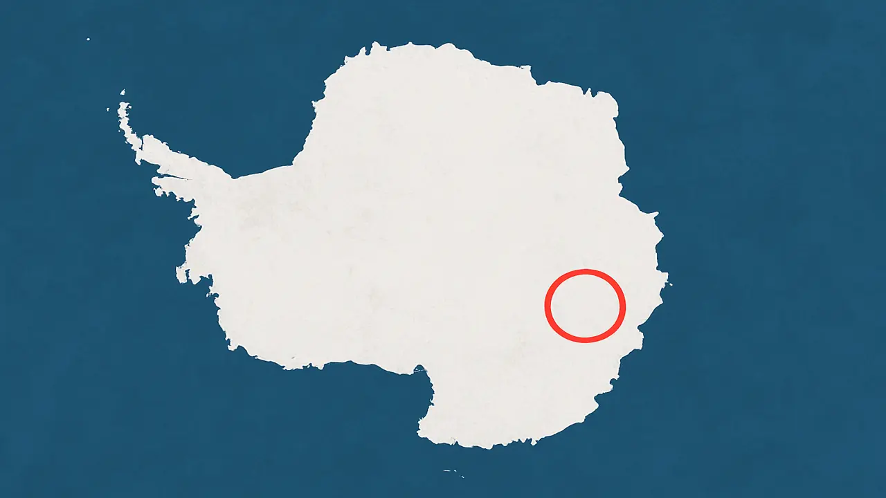
In the icy interior of East Antarctica, satellite instruments have picked up something buried far below the surface. There are no unusual features visible on the ground above. No exposed rock. No mountain chain. Just a flat stretch of ice in a region called Wilkes Land.
Yet whenever gravity-mapping satellites pass over this area, they register the same signal: a dense, circular mass hidden beneath more than two kilometers of ice. It doesn’t resemble any known geologic formation in Antarctica.
Scientists call it the Wilkes Land Gravity Anomaly.
What lies beneath is still unknown. Some believe it could be the remnants of a massive asteroid impact, far older and larger than the one linked to the extinction of the dinosaurs. Others think it might be a buried uplift in the crust, or even the core of an ancient tectonic structure that predates the breakup of Gondwana.
Whatever it is, the anomaly has kept showing up in satellite data for more than two decades. And the more we learn about it, the stranger it seems.
A gravitational fingerprint hidden below the surface
The anomaly was first brought to attention during Earth gravity surveys conducted by NASA’s GRACE satellites in the early 2000s. GRACE, which stands for Gravity Recovery and Climate Experiment, works by measuring minuscule shifts in the distance between twin satellites as they pass over different regions of Earth. Where gravity is stronger, one satellite is pulled slightly more than the other. This data reveals the distribution of mass below Earth’s surface.
When GRACE passed over Wilkes Land, something unexpected happened. The satellites accelerated in a way that could only be explained by an enormous mass buried beneath the ice. Further measurements confirmed it was not an error. The same pull was detected again and again.
This region became known as the Wilkes Land Gravity Anomaly, a name that now represents one of the most enduring geological puzzles on Earth.
What could create such a massive signal?
Scientists quickly developed theories to explain the readings. One of the leading ideas is that this structure under Antarctica might be a buried impact crater, the scar left behind by an asteroid or comet that struck Earth over 250 million years ago. If this is true, the object responsible would have been twice the size of the one that created the Chicxulub crater, which contributed to the extinction of the dinosaurs.
The implications would be enormous. An impact of that scale could have unleashed global tsunamis, ignited wildfires across entire continents, and triggered a chain reaction of volcanic activity. Some geologists have even speculated that it might be linked to the Permian–Triassic extinction, the largest mass extinction in Earth’s history.
However, direct evidence of an impact is still missing. No shocked quartz, no melted glass, no layers of iridium have been recovered, mostly because no drilling has ever reached the suspected site. The entire theory rests on remote sensing data and gravitational modeling.
Not just gravity, but radar and magnetic signals, too
The mystery deepens when other datasets are taken into account. Airborne radar and magnetic mapping missions have also detected anomalies in the same region. These instruments show irregular magnetic patterns and unusual reflectivity beneath the ice. The readings are consistent with either a massive slab of denser-than-usual rock or a geophysical structure unlike anything previously seen in Antarctica.
Some scientists have proposed that the anomaly may be the result of an ancient geological uplift, formed by tectonic forces long before the continent froze over. Others suggest that it could be a remnant of a supervolcano whose cone has long since collapsed and disappeared beneath layers of compacted ice.
Still, none of these ideas explain why the anomaly is so round, so dense, and so isolated from other known features.
Why no one has drilled into Wilkes Land
The biggest barrier to understanding the structure under Antarctica is the ice itself. At Wilkes Land, the ice sheet is more than 2,500 meters thick. That’s deeper than the Grand Canyon. No existing drilling project has come close to penetrating this depth in such a remote and harsh environment.
Antarctic logistics are among the most difficult in modern science. The region sees some of the coldest temperatures on Earth, with high winds and no infrastructure. Getting a team of scientists, drilling equipment, and support personnel into Wilkes Land would be a multi-years.
Even ground-penetrating radar, which has successfully mapped subglacial lakes and ancient riverbeds in other parts of Antarctica, provides only partial data here. The anomaly remains just out of reach, a ghost in the numbers.
Satellites still circle back to it
Despite the lack of direct access, Wilkes Land continues to be a focus for Earth observation missions. It is routinely used to calibrate instruments on new satellite platforms because its gravitational signal is so intense and consistent.
GRACE was retired in 2017, but its successor, GRACE-FO (Follow-On), is still monitoring changes in Earth’s gravitational field, including over Antarctica. Other satellites — such as ESA’s CryoSat and NASA’s ICESat-2, pass over the area regularly, measuring ice elevation and surface movement.
What they all share is a need to account for the pull from Wilkes Land. It affects radar returns. It adds noise to magnetometers. And yet, it has no face. The anomaly exerts influence without revealing its source.
Remote sensing
This situation highlights a broader challenge in geophysics. Remote sensing tools can measure gravity, magnetism, and radar reflections with exquisite precision, but they cannot tell us exactly what lies underground. The data must be interpreted, and interpretations always depend on models, assumptions, and what we expect to find.
In the case of the structure under Antarctica, nothing about it aligns with conventional expectations. It is too dense, too wide, too circular. If it is an impact crater, it is one of the most perfectly preserved ever detected, and yet there are no signs of a crater rim, ejecta, or deformation in the overlying rock layers.
That leaves us with a persistent anomaly, real enough to move satellites, yet invisible to the human eye.
What scientists hope to learn next
Some scientists believe it’s time to take a closer look at Wilkes Land. There have been proposals to send long-range radar drones across the ice, or even to drill down using equipment similar to what was used at Lake Vostok. But the logistics are difficult, and the cost is high.
Others think the answers might already be buried in the data we have. With better tools for processing satellite measurements and more advanced models of the Earth’s crust, they believe we may be able to piece together what lies below without setting foot on the ice.
What’s at stake is more than just an explanation for an unusual gravity signal. If this is the scar of an ancient impact, it might hold evidence of a global catastrophe, perhaps even one that shaped the evolution of life. If it is something else, it could reveal parts of Earth’s interior that have been hidden for hundreds of millions of years.
Alien creature escaping from ice in Antarctica Feb 2026, UFO UAP paranormal sighting news 🚨
Date of sighting: February 2026
Location of sighting: Antartica
Source: Twitter user @crazymoments01
Watch this recently recleased capture of an alien creature thats been preserved in ices for million of years and it looks like its going to escape from the ices and may revive very soon. Many sea creatures have a substance in the blood that prevents them from dieing when frozen, this alien creature probably is far advanced and is just waiting for the right moment to escape.
Een daadwerkelijk gevaar Om het belang ervan te illustreren: mocht deze gletsjer instorten, dan zal de zeespiegel wereldwijd met 65 cm stijgen, zoals bevestigd door onderzoekers van de British Antarctic Survey (BAS).
Waarom stort hij in? Het probleem is dat deze 'Gletsjer van het Einde van de Wereld' daadwerkelijk tekenen van instorting vertoont, en om te begrijpen wat er gebeurt, gaan wetenschappers voor het eerst een nog niet eerder geboord gebied in de Thwaites-gletsjer onderzoeken.
Ernstige gevolgen Het doel van deze expeditie is om inzicht te krijgen in onderzeese tsunami’s en de ernstige gevolgen die deze kunnen hebben of al hebben voor het klimaat.
Het onverklaarbare verklaren Volgens het BAS zullen de onderzoekers proberen te boren in een van de moeilijkst bereikbare en minst bekende gebieden van de Thwaites-gletsjer om uit eerste hand te observeren hoe warm water het bovenliggende ijs doet smelten.
Gevaarlijke zone Dit is uiteraard een “uiterst moeilijke” missie, aldus Dr. Peter Davis, fysisch oceanograaf bij de British Antarctic Survey, die aangeeft dat het een van de “meest instabiele gletsjers ter wereld” betreft.
Warmewaterboor Gedurende twee weken zullen teams van het BAS en het Koreaans Polair Onderzoeksinstituut (KOPRI) gebruikmaken van een warmewaterboor om het ijs te doorboren, waarna instrumenten worden geplaatst om gegevens naar de onderzoekers te zenden.
Onderzoek naar enorme onderzeese tsunami's Volgens Sky News Australia is het doel om informatie te verkrijgen over onderzeese tsunami’s die zich kunnen uitstrekken over tien tot honderden meters.
1 km boren Om deze gegevens te kunnen verzamelen, moet tot bijna 1000 meter diep in het ijs worden geboord, zodat onderzoekers voor het eerst bijna in real time kunnen waarnemen wat warm water doet met ijs op een kilometer onder het oppervlak.
Boren in het hart van de gletsjer Tot nu toe beperkten studies zich tot stabielere delen van de gletsjer, maar dit onderzoek zal plaatsvinden in de hoofdader van de gletsjer.
Onlangs nog onontdekt gebied Om aan te geven hoe riskant deze expeditie is: deze gletsjer is lange tijd onbekend gebleven wegens zijn gespleten structuur en de bijbehorende gevaren.
Nooit eerder verzamelde gegevens en monsters Onder de gegevens die men hoopt te verkrijgen, bevinden zich die waarmee kan worden ingeschat hoe snel de zeespiegel zou stijgen bij een mogelijke instorting van de Thwaites-gletsjer.
Unieke sedimenten en watermonsters verzamelen Bovendien zullen de meetinstrumenten het mogelijk maken om gedurende langere tijd informatie te verzamelen over temperatuur en oceaanstromingen, evenals sediment- en watermonsters, om deze vijandige omgeving beter te begrijpen.
Waar de gletsjer breekt De expeditie zal tot 1000 meter diep boren om het punt te bereiken waar de Thwaites-gletsjer loskomt van de zeebodem en overgaat in een drijvende ijsplaat.
Kwetsbaarste zone (op 1 km diepte) Volgens het BAS is dit het meest kwetsbare deel van de gletsjer, waar warm water binnenstroomt en uiteindelijk de Thwaites-gletsjer van onderaf doet smelten.
Bijna kokend water Om deze zone te bereiken, zullen de onderzoekers het water tot 90 °C verhitten en het onder hoge druk via een slang pompen, waardoor het ijs smelt en een gat van 30 cm doorsnee ontstaat.
Eén meter per minuut (indien alles goed loopt) Men verwacht een tempo te halen van één meter gesmolten ijs per minuut, hoewel alles onzeker blijft tot men daadwerkelijk ter plaatse is en met de boring begint.
25 ton aan uitrusting De uitrusting die de expeditie nodig heeft om twee weken te werken en te overnachten, weegt 25 ton, waardoor er 40 helikoptervluchten nodig waren om alles te vervoeren over de 29 kilometer tussen het basiskamp en de boorlocatie. Als alles slaagt, zal dit avontuur de geschiedenis ingaan.
Consciousness exists beyond death and the process of dying should be considered a ‘negotiable condition’, a bombshell study claims.
Traditionally, death has been defined as the irreversible loss of brain and circulatory function.
But experts are beginning to challenge this view – arguing that consciousness can persist even when the brain stops working.
A researcher from Arizona State University carried out a large-scale review of dozens of studies that focused on what happens when people ‘die’.
This included publications on near-death experiences, research on the electrical brain activity of dying patients and clinical studies of conscious awareness during heart attacks.
Analysis revealed that across heart attack studies, 20 per cent of survivors recall conscious experiences during periods when the brain had stopped working.
Brain recordings in dying humans and animals document surges of activity surpassing baseline waking levels, they found.
Meanwhile some patients who have experienced ‘complete circulatory standstill’ – when the heart stops beating – later demonstrated implicit recall of what was going on around them.
Some experts argue that consciousness persists even after the heart has stopped beating. Pictured: A gamma surge following a heart attack
Laboratory work has also demonstrated that metabolism, brain activity and blood flow can be restored in mammal brains and organs ‘well beyond accepted limits’.
This reveals that ‘biological death is not immediately irreversible’, Anna Fowler, from Arizona State University, said.
‘Emerging evidence suggests that biological and neural functions do not cease abruptly,’ she told the American Association for the Advancement of Science (AAAS) conference in Phoenix.
‘Instead, they decline from minutes to hours, suggesting that death unfolds as a process rather than an instantaneous event. Elements of consciousness may briefly exist beyond the measurable activity of the brain and death, long considered absolute, is instead a negotiable condition.’
She added that the findings ‘invite a redefinition of death as a gradual, interruptible process, one that science may increasingly learn not just to delay but to challenge outright.’
Ms Fowler, whose research is forming part of her thesis, said the findings could have significant implications for resuscitation windows and organ donation timings.
‘After death…they’ve got to procure those organs right away so that they can save the life of another person,’ she explained.
‘But there have been studies that have shown that up to 90 minutes after the declaration of death, that those neural firings are still going off in the brain.’
Analysis revealed that across heart attack studies, 20 per cent of survivors recall conscious experiences during periods when the brain had stopped working
She believes that death should be more ‘process driven’, with phases rather than a singular event.
‘Death, once believed to be a final and immediate boundary, reveals itself instead as a process - a shifting landscape where consciousness, biology and meaning persist longer than we once imagined,’ she concluded.
‘Consciousness may not vanish the moment the brain falls silent. Cells may not die the moment the heart stops. This research proposes that death is not the sudden extinguishing of life, but the beginning of a transformation, one that medicine, philosophy and ethics must now approach with deeper humility and renewed clarity.’
Earlier this week Dr Sam Parnia, director of critical care and resuscitation research at NYU Langone School of Medicine in New York, revealed that some people may even hear their death being announced as the brain remains active after the heart stops.
Dr Parnia has not only studied what happens to the human brain when you die but has also spoken to patients who survived near-death experiences.
That research revealed many occurrences where patients who were clinically dead, noted as when the heart stops beating, who were later revived and described conversations and events taking place in their room with remarkable accuracy.
The reason doctors only look at the heart when determining the time of death is because that's the moment when blood flow to the brain stops.
However, a study led by Dr Parnia in 2023 discovered spikes in brain waves associated with higher cognitive function up to an hour into CPR. It uncovered spikes in brain waves linked to thinking, memory and awareness showing up to 60 minutes after a person’s heart stopped.
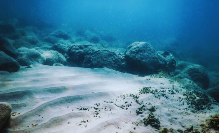
Beneath the ocean’s seafloor, life quietly waits, defying everything we know about survival and evolution. Deep within Earth’s crust, microscopic organisms, known as “intraterrestrials,” live in a state of dormancy, surviving without growing or reproducing for hundreds of thousands, even millions, of years.
Most organisms evolve by adapting to their environment, typically through reproduction and natural selection. These microbes, however, don’t follow the script. Instead, they thrive in suspended animation, only reawakening when the earth shifts in ways that benefit them.
Microbes That Don’t Play By the Rules
Evolution often brings to mind organisms adapting to their surroundings over time. But the intraterrestrials beneath the seafloor seem to defy this idea. These microbes can remain dormant for staggering periods, sometimes millions of years. When they awaken, it’s not through evolution, but through their incredible ability to wait.
According toKaren G. Lloyd, a microbial biogeochemist at the University of Southern California, this isn’t just some freak accident. These microbes are evolutionarily adapted to survive without reproducing. They’ve become specialists in surviving extreme conditions where resources are scarce and the environment is hostile. In fact, it’s their very dormancy that allows them to persist for so long. It’s as though these microbes have evolved not to grow, but to simply survive, waiting for the right moment when the world around them shifts in a way that allows them to thrive again.
If these microbes aren’t evolving through reproduction and growth, what’s the catch? The answer lies in the geology of Earth itself. Instead of waiting for something as short-term as aseasonal change or a temperature shift, these intraterrestrials are playing a much longer game, one that’s tied to the slow-moving geological processes of our planet.
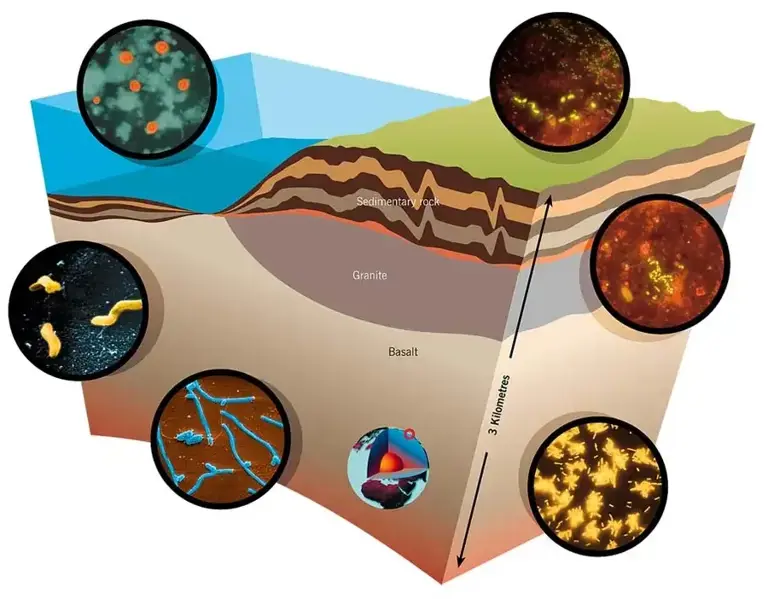
An Illustration Showing The Diverse Microbial Life Living Deep Within Earth's Crust
As stated by Live Science, these microbes are, essentially, waiting for these rare events to occur, waiting for the earth to shift in a way that opens up new resources, whether that’s through volcanic eruptions or the slow movement of tectonic plates that exposes new sediments It’s hard to imagine a more patient form of life.
When you look at how we live our lives, waiting for something as rare as a volcanic eruption seems almost ridiculous. For these microbes, this may be their natural state: to wait in dormancy for the right event that will prompt them to spring back to life.
Surviving the Deep: The Unlikely Ways Life Adapts
These microbes have developed remarkable adaptations that allow them to survive in theextreme conditions deep below the Earth’s surface, where high pressure, frigid temperatures, and limited nutrients are the norm. Their survival is driven by slow, energy-efficient metabolisms and enzymes that are perfectly suited for life in marine sediments. Far from just enduring these harsh conditions, they thrive because of these unique evolutionary traits.
These microbes don’t simply enter dormancy by accident; they’ve evolved to do so. Able to endure years of starvation, immense pressure, and near-freezing temperatures, they keep their metabolic processes running at minimal levels. The fact that they can remain alive for millions of years, ready to spring back to life when conditions shift, is a stunning feat of biological resilience.
Maak kennis met deze 'Blob' Deze blob heeft geen hersenen, ogen of mond, laat staan armen of benen. Wat nog verrassender is dan zijn 720 geslachten – wetenschappers beschouwen dit wezen als een intelligent wezen.
Geen dier en ook geen plant Maar wat is dit voor wezen? Is het een dier, een plant of een schimmel? Volgens dr. Bruno David, de directeur van het Parijse MNHN (Muséum national d'histoire naturelle), is er geen duidelijk antwoord. Aan Reuters liet dr. David weten: "We weten zeker dat het geen plant is, maar we [weten] niet echt of het een dier of een schimmel is."
Physarum polycephalum Taxonomen hebben de blob, samen met 900 andere verwanten, ingedeeld als 'Physarum polycephalum' in het koninkrijk van de protozoa. Het is een slijmzwam die officieel bekend staat als een plasmodium.
Unieke wezens Deze minibeestjes lijken echter niet op conventionele schimmels. Plasmodia zijn uniek omdat, zoals beschreven in het tijdschrift Forbes, "...elke individuele cel vele kernen bevat (de meeste dierlijke cellen hebben slechts één kern)".
Afgebeeld: theatrale poster voor de film 'The Blob', 1958.
Maak je geen zorgen, deze blob is ongevaarlijk Physarum polycephalum heeft zijn bijnaam 'Blob' misschien te danken aan de horrorfilm 'The Blob' uit 1958, waarin een buitenaards wezen met de naam Blob alles op zijn pad verorberde, maar gelukkig voedt de echte 'Blob' zich alleen met schimmels en bacteriën.
Geen hersenen en toch intelligent? Studies hebben aangetoond dat het organisme de kortste route in een doolhof kan vinden en eerder bezochte gebieden markeert met het spoor van zijn slijm – en dat alles zonder hersenen.
Deze 'omelet' kan dingen leren zonder dat hij neuronen heeft Audrey Dussutour, Frans specialist in dierengedrag, is coauteur van een studie over de blob. Daaruit blijkt dat dit eencellige organisme lijkt op een 'anamorfe omelet' en dat het in staat is om dingen te leren ondanks dat het geen neuronen heeft.
Overdracht van verworven kennis Volgens de onderzoekers kunnen de protozoën zelfs verworven kennis doorgeven. Wanneer men twee blobs bij elkaar brengt, draagt het ene organisme zijn kennis over op het andere.
Heeft het echt 720 geslachten? De voortplanting van de blob is niet zoals bij veel andere wezens, waarbij de eicel en de zaadcel samensmelten. Blob brengt informatie rechtstreeks over van een donorcel naar een ontvangende cel, wat op 720 verschillende manieren kan gebeuren. "Praten over geslacht is dus een beetje onnauwkeurig," zo verduidelijkt onderzoekster Audrey Dussutour.
Afgebeeld: Scherm in Parc Zoologique de Paris 2019 dat een vergrote afbeelding geeft van een Physarum polycephalum.
Blob werd voor het eerst tentoongesteld in Parc Zoologique de Paris In 2019 kreeg het mysterieuze wezen een sterrenrol in het Parc Zoologique de Paris. Hier ontdekten de verzorgers van 'Blob' ook dat het van havermout houdt en zich verplaatst om het te kunnen vinden... met een snelheid van vier centimeter per uur.
Blob op zoek naar voedsel Ook Marlène Itan, die de blob verzorgde, ondervond hoe creatief de protozoa kunnen zijn bij het zoeken naar voedsel. "De hele tafel hier lag vol. De blob was namelijk uit de petrischalen ontsnapt omdat hij alle schimmels en eiwitten in de havermout had verteerd. Hij doolde door de schaal en ging toen daarbuiten verder op zoek naar voedsel", vertelde ze aan het Duitse mediakanaal Deutschlandfunk.
Superorganisme Deze slijmzwam kan zijn volume elke dag verdubbelen en groeien tot enkele vierkante meters. Als je 'Blob' doormidden snijdt, is de cel binnen twee minuten weer functioneel. Geen wonder dat dit wezen al bijna een miljard jaar bestaat en dat het de wetenschappers fascineert.
"Dit schepsel behoort tot de mysteries van de natuur" "Dit schepsel is een van de mysteries van de natuur," vertelde dr. Bruno David, directeur van het MNHN aan Reuters.
Een ander bizar wezen De blob is echter niet het enige fantastische wezen dat wetenschappers bestuderen. Het volgende vreemde wezen kan zelfs onder de meest erbarmelijke omstandigheden overleven.
De legendarische beerdiertjes Het zijn echte overlevers die de extreemste temperaturen kunnen weerstaan, maar ook radioactieve straling, zuurstofgebrek of droogte. Zouden de beerdiertjes echter echt onverwoestbaar zijn?
Waar kun je ze vinden? Ze leven in vochtig mos of in de diepzee, op Antarctica, in het regenwoud of in de achtertuin. Eigenlijk overal, maar het is nog steeds bijzonder moeilijk om ze te vinden...
Piepkleine wezens De reden is eenvoudig: ze zijn slechts tussen de 100 en 1500 micron groot. En ondanks hun naam hebben ze niets gemeen met beren. Ze worden beerdiertjes of tardigrada genoemd omdat hun trage bewegingen doen denken aan die van beren. Deze laatste, de wetenschappelijke naam, laat zich vertalen als 'trage stappen'.
Ze overleven tot 151 °C Een onderzoek uit 2006 toonde aan dat inactieve beerdiertjes minstens een half uur een temperatuur van 151 °C kunnen overleven.
Je kunt ze ook invriezen "Ik vermoed dat ze tientallen jaren in bevroren toestand kunnen overleven", verklaarde zoöloog en bioloog Georg Mayer (foto) van het biologisch instituut van de Universiteit Leipzig in 2013. Samen met zijn collega's identificeerde hij eerder onbekende elementen van het zenuwstelsel bij de dieren.
Maar ze hebben een zwakke plek! Maar ze houden duidelijk niet van langdurige warmte. Dat blijkt uit een studie (gepubliceerd in wetenschappelijke rapporten) van de bioloog Ricardo Neves van de Universiteit van Kopenhagen.
Het huiveringwekkende resultaat Het resultaat: 50% van de dieren die gedurende 24 uur aan een temperatuur van 37,1 °C werden blootgesteld, overleefden het niet.
De opwarming van de aarde is ook voor hen een gevaar Dit betekent dat zelfs deze dieren, die bekend staan als overlevers, te lijden kunnen krijgen van klimaatverandering en opwarming van de aarde.
Maar misschien zijn ze intussen de maan aan het bevolken In 2019 stortte een Israëlisch ruimtevaartuig neer op het maanoppervlak. Bij de crash kwamen ook tal van beerdiertjes vrij. Wie weet leven zij nu op de maan...
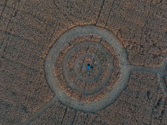
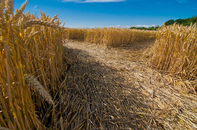
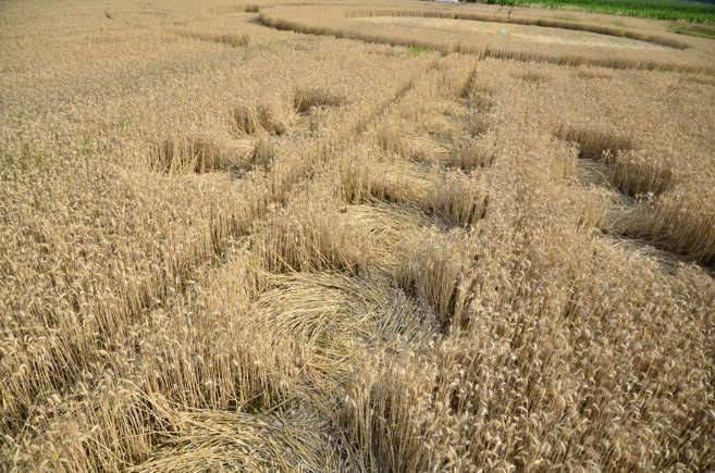
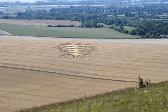
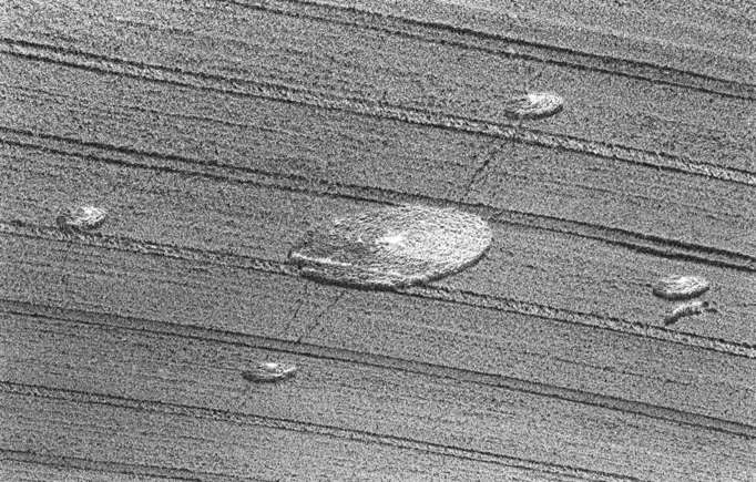
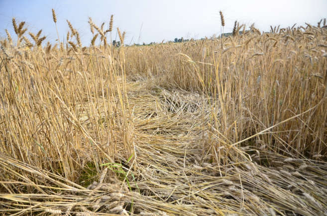
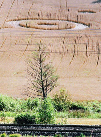
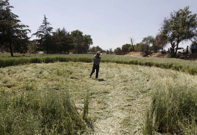
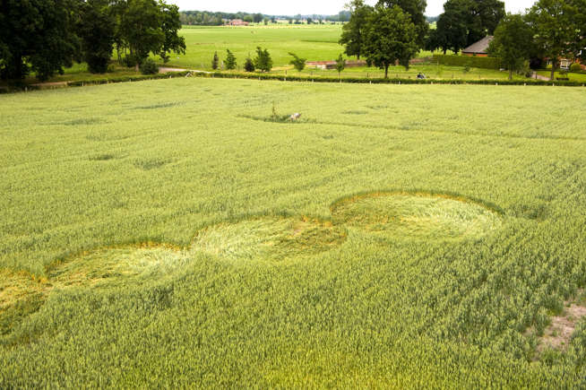
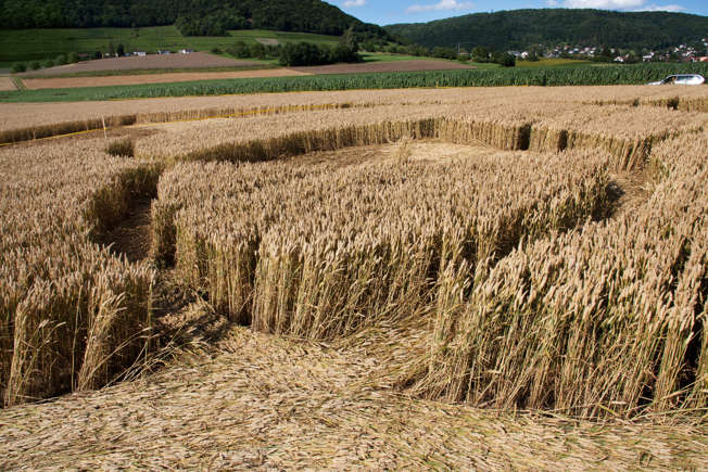
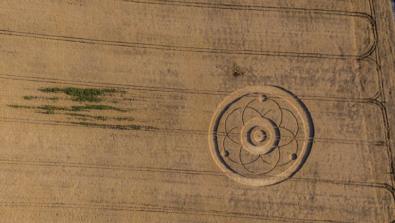
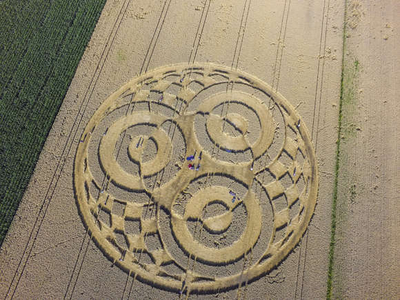
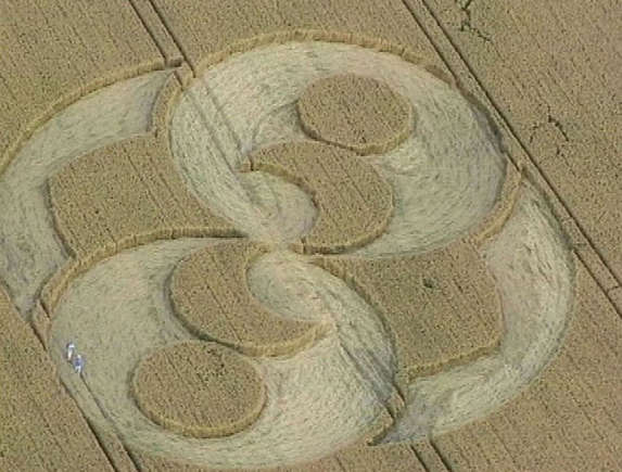
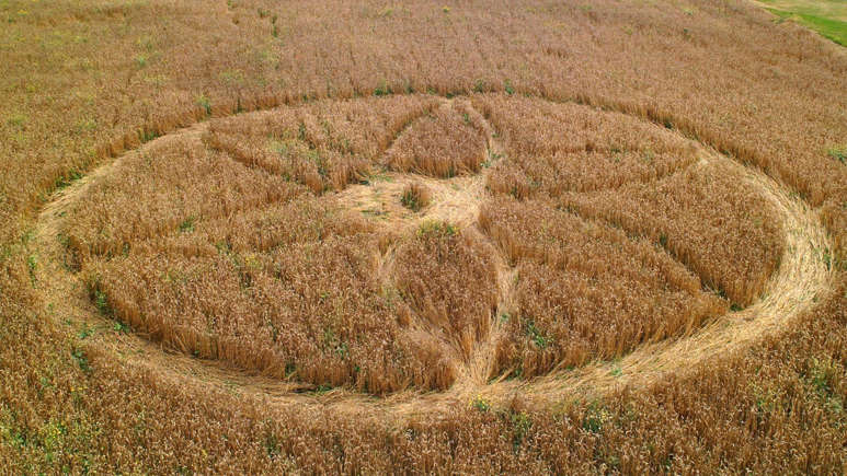
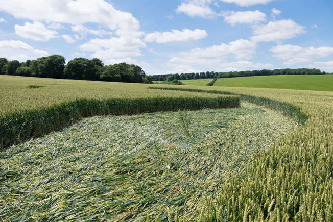
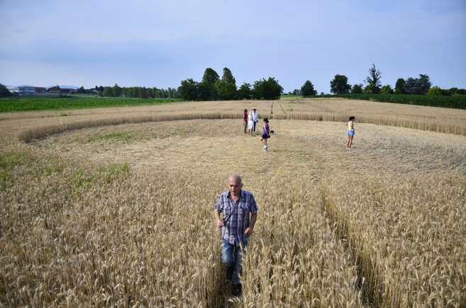
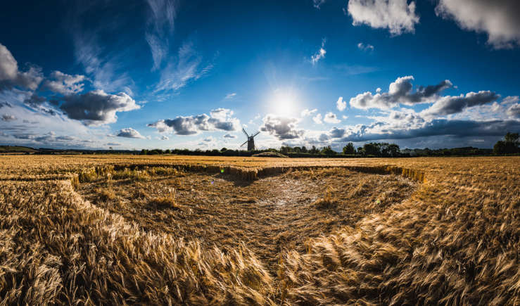
Graancirkels verklaard: wetenschap en speculatie In de jaren tachtig en negentig doken overal ter wereld graancirkels op, wat angst en intriges over hun oorsprong veroorzaakte. Deze cryptische patronen lijken de afgelopen jaren echter verdwenen.Laten we de geschiedenis, feiten en theorieën verkennen over dit mysterieuze fenomeen dat een milieukunstvorm inspireerde. Klik door de galerij om aan de slag te gaan.
Australië In de jaren 1960 waren er talrijke UFO-waarnemingen in Queensland, Australië. Mensen beweerden cirkels te hebben ontdekt in moerasriet en rietvelden. Eén zo'n voorval deed zich voor in 1966 toen een aanzienlijke cirkel werd gevonden in het riet van een moeras in Tully, Queensland.
Antipodees Vergelijkbare vindplaatsen zijn gedocumenteerd in verschillende delen van Australië, zoals Tooligie Hill in South Australia in 1971 en Navarre in Victoria in september 1972.
Lange geschiedenis De oorsprong van graancirkels gaat echter veel verder terug. In 1678 werd van een groep cirkels die in Hertfordshire waren ontdekt, gedacht dat ze het werk van de duivel waren, omdat het onmogelijk leek dat een mens ze had kunnen maken;
Graancirkels In de jaren 1980 was er een aanzienlijke toename van het aantal gerapporteerde cirkels, wat leidde tot de popularisering van de term "graancirkels".
Theorieën Er werden verschillende verklaringen voor hun ontstaan geopperd. Sommigen geloofden dat UFO's verantwoordelijk waren, terwijl anderen een onbekende vorm van energie, mogelijk paranormaal, voorstelden als de schepper.
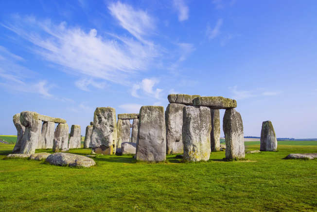
Locatie Verder onderzoek wees uit dat graancirkels in het Verenigd Koninkrijk niet willekeurig verspreid waren. Ze verschenen vaak in de buurt van wegen, bewoonde gebieden en oriëntatiepunten zoals de historische steencirkels van Stonehenge en Avebury.
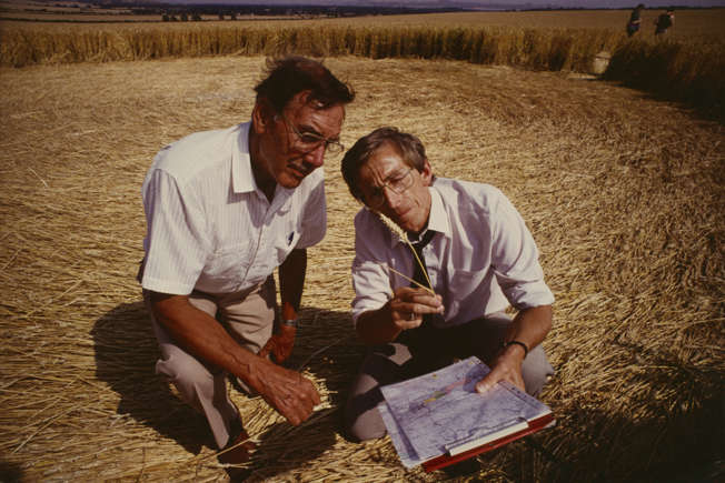
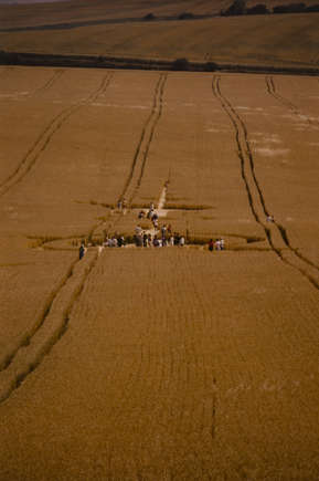
Operatie Merel In 1990 begon een team wetenschappers, de zelfbenoemde "cerealogisten", aan een onderzoek om het mysterie rond deze formaties te ontrafelen. Ze sloegen een kamp op op een heuvel in Wiltshire, uitgerust met detectoren voor warmte, licht en geluid. Hun doel was om elk bewijs vast te leggen van een UFO of een buitenaardse entiteit die verantwoordelijk was voor het maken van de graancirkels.
Resultaat Operatie Blackbird omvatte samenwerking met de BBC en er werd in het gebied gepatrouilleerd door functionarissen van het Ministerie van Defensie. In de tweede nacht registreerde de bewakingsapparatuur knipperende oranje lichten in het aangrenzende veld. De volgende ochtend werden twee grote cirkels met parallelle lijnen ertussen ontdekt.
Bewijs Tijdens het onderzoek van de cirkels werden een bordspel en een houten kruisbeeld ontdekt in het midden van één ervan. Onderzoeker Colin Andrews accepteerde de mogelijkheid dat de knipperende oranje lichten waarschijnlijk werden veroorzaakt door de warmtehandtekening van een hoaxer.
Niet grappig? Colin Andrews informeerde de pers dat hun onderzoek was gehinderd door een grap, wat een tegenslag veroorzaakte. Hij benadrukte de ernst van hun werk en benadrukte dat de grap van korte duur was.
Ondermijnd De personen achter de onderbreking van Operatie Blackbird werden niet geïdentificeerd, maar hun acties beschadigden de reputatie van de "cerealogen".
Samenzwering? Volgens berichten hebben samenzweringstheoretici gesuggereerd dat het leger het bedrog heeft uitgevoerd om de onderzoekers minder geloofwaardig te maken.
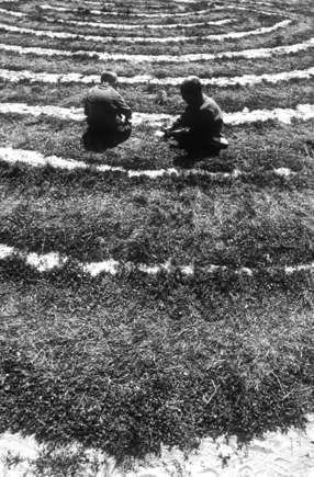
In 1991 schokten Doug Bower en Dave Chorley de wereld toen ze beweerden dat zij degenen waren achter de graancirkels, beginnend in 1978. Ze lieten het proces zien van het creëren van een graancirkel met behulp van basisgereedschap zoals een houten plank, een touw en een baseballpet met een lus van draad om een rechte lijn aan te houden.
Verantwoordelijkheid Bower en Chorley verklaarden naar verluidt dat ze beïnvloed waren door de gebeurtenissen in Australië in de jaren 1960. Ze namen de eer op zich voor alle graancirkels in Groot-Brittannië vóór 1987 en voor meer dan 200 graancirkels van 1978 tot 1991.
Nieuwe golf De onthulling van de cirkels van Bower en Chorley in de jaren 1990 leidde tot een toename van het aantal graancirkels. In 2009 meldde het tijdschrift Smithsonian dat deze geometrische ontwerpen in de loop der jaren groter en ingewikkelder zijn geworden. Anonieme cirkelmakers hebben met hun creaties New Age toeristen aangetrokken.
Wereldwijd Volgens de publicatie zijn er sindsdien wereldwijd op verschillende locaties graancirkels waargenomen. In Zuid-Engeland, waar de meeste activiteit plaatsvindt, richten de cirkelmakers zich op koolzaad-, gerst- en tarwevelden.
Magnetrons Er zijn echter sceptici die betwijfelen of graancirkels uitsluitend door mensen zijn gemaakt. Physics World onthult dat biofysici opgezwollen stengels hebben geïnterpreteerd als bewijs dat de gewassen werden blootgesteld aan microgolven toen de cirkels werden gevormd. Deze ontdekking heeft geleid tot gepatenteerde methoden om de groei van gewassen te versnellen.
Debat Na de bekentenis van Bower en Chorley ontstond er een gepassioneerde discussie tussen degenen die geloofden dat mensen verantwoordelijk waren en degenen die beweerden dat hun bekentenis niet elke cirkel kon verklaren.
Onderzoek Studies gepubliceerd in 1999 en 2001 vonden bewijs van straling op gewassen in graancirkelformaties, wat een raadsel is voor degenen die de cirkels toeschrijven aan door mensen gemaakte houten plankontwerpen.
Prozaïsche waarheid Andere incidenten hebben eenvoudiger verklaringen. In 2002 maakten mensen melding van graancirkels in de buurt van Pike Lake in Saskatchewan, Canada. Later werd echter bevestigd dat deze formaties in feite mesthopen waren die door een nabijgelegen boer waren weggegooid.
Uitleg? Ook de cirkels die in de jaren 1960 in Australië werden waargenomen, zouden kunnen worden toegeschreven aan wallaby's die opium consumeerden. Volgens rapporten betraden deze buideldieren papavervelden die voor medicinale doeleinden werden gecultiveerd, consumeerden ze overmatige hoeveelheden van de gewassen en bewogen ze zich vervolgens in cirkelvormige patronen.
GERELATEERDE VIDEO'S
Crop Circles From The Air 2022 Season UK | Documentary 4K
A rare type of deep underground earthquake occurring in the Earth’s mantle, which can trigger dangerous surface quakes, has finally been isolated and mapped by Stanford researchers.
The earthquakesin question, known as continental mantle quakes, occur in the mantle layer between the crust and the planet’s molten iron core. A recent study, published in Science, and its accompanying mapping of these regions within the Earth, provide important new insights for scientists studying the complex triggers of earthquakesthat can devastate human infrastructure.
A Continental Mantle Earthquake Map
The team’s global map of continental-mantle earthquakes reveals that such events tend to cluster regionally. Two of the main hot spots for their activity exist beneath the Himalayas and the Bering Strait, which runs south of the Arctic Circle between Asia and North America.
Providing researchers with new insights into the crust-mantle boundary and the upper mantle’s role in earthquake events, the new data offers scientists a better understanding of the transport of volcanic magma that drives tectonic movements closer to the surface.
“Until this study, we haven’t had a clear global perspective on how many continental mantle earthquakes are really happening and where,” said lead author Shiqi (Axel) Wang, a former PhD student in the lab of geophysics professor Simon Klemperer at the Stanford Doerr School of Sustainability. “With this new dataset, we can start to probe at the various ways these rare mantle earthquakes initiate.”
While earthquakes that occur at shallower depths are typically associated with more direct impacts on our surface environment, the new research suggests that understanding the effects of deeper continental-mantle earthquakes could provide new insights into Earth science and increase our understanding of how surface quakes occur.
“Although we know the broad strokes that earthquakes generally happen where stress releases at fault lines, why a given earthquake happens where it does and the main mechanisms behind it are not well grasped,” added Klemperer, senior study author. “Mantle earthquakes offer a novel way to explore earthquake origins and the internal structure of Earth beyond ordinary crustal earthquakes.”
For the first time, researchers have mapped continental mantle earthquakes.
Credit: Axel Wang
Our Layered Earth
The mantle and the crust are very different environments. While the crust is relatively cold and brittle, the mantle is warm and soft, extending down for 1,800 miles. The two layers meet in a boundary area called the Mohorovičić discontinuity, or “the Moho.” Researchers debated for decades whether the vicious nature of the mantle would even allow seismic activity.
Typical continental earthquakes occur well above the Moho, only reaching depths of 6 to 18 miles. Subduction zones are outliers, however, whose dense oceanic plates can sometimes push quakes to depths of hundreds of miles. Occasional sensor data suggests that some quakes may run even deeper, perhaps 50 miles below the Moho, and occur not in subduction zones, but under continental land masses.
For the last few decades, researchers have gathered evidence that, on rare occasions (perhaps with only one percent of the frequency of surface quakes), some events can occur within the mantle. However, identification of these events long remained beyond the limits of the sparse data available to researchers.
Identifying Continental Mantle Earthquakes
To address this issue, Wang and Klemperer developed a method that compares two types of seismic waves to distinguish between crustal and mantle earthquakes. One type is the Sn wave, which travels along the mantle lid, and another is the high-frequency Lg wave, which passes through the crust. By comparing wave-size ratios, the pair was successfully able to determine the point of origin for mantle quakes.
“Our approach is a complete game-changer because now you can actually identify a mantle earthquake purely based on the waveforms of earthquakes,” said Wang.
The team collected a trove of data from seismic monitoring stations around the globe and combined it with other information related to factors such as crustal thickness, location of the measurement, and other criteria. From this dataset, they identified 459 continental earthquakes out of 46,000 total quakes that have occurred since 1990.
Understanding Earthquakes
The team notes that many more of these events may be occurring, but simply have not been captured by sensors, and recommends expanding sensor networks into the Tibetan Plateau as a starting point for collecting more data on mantle continental earthquakes.
With the events now discreetly identified thanks to the team’s new method, they plan to follow up by examining each event to determine what, specifically, their underlying cause appears to be. So far, data points to the idea that some are deep aftershocks of crustal quakes, while others may be generated by heat-driven convection as the mantle subducts the Earth’s crust.
“Continental mantle earthquakes might be part of an inherently interconnected earthquake cycle, both from the crust and also the upper mantle,” said Wang. “We want to understand how these layers of our world function as a whole system.”
Ryan Whalen covers science and technology for The Debrief. He holds an MA in History and a Master of Library and Information Science with a certificate in Data Science. He can be contacted at ryan@thedebrief.org, and follow him on Twitter @mdntwvlf.
Meer van UFO'S of UAP'S, ASTRONOMIE, RUIMTEVAART, ARCHEOLOGIE, OUDHEIDKUNDE, SF-SNUFJES EN ANDERE ESOTERISCHE WETENSCHAPPEN - DE ALLERLAATSTE NIEUWTJES


 The recent “Doomsday” Oarfish sightings in California, Mexico, and Vietnam are raising concern