The purpose of this blog is the creation of an open, international, independent and free forum, where every UFO-researcher can publish the results of his/her research. The languagues, used for this blog, are Dutch, English and French.You can find the articles of a collegue by selecting his category. Each author stays resposable for the continue of his articles. As blogmaster I have the right to refuse an addition or an article, when it attacks other collegues or UFO-groupes.
Druk op onderstaande knop om te reageren in mijn forum
Zoeken in blog
Deze blog is opgedragen aan mijn overleden echtgenote Lucienne.
In 2012 verloor ze haar moedige strijd tegen kanker!
In 2011 startte ik deze blog, omdat ik niet mocht stoppen met mijn UFO-onderzoek.
BEDANKT!!!
Een interessant adres?
UFO'S of UAP'S, ASTRONOMIE, RUIMTEVAART, ARCHEOLOGIE, OUDHEIDKUNDE, SF-SNUFJES EN ANDERE ESOTERISCHE WETENSCHAPPEN - DE ALLERLAATSTE NIEUWTJES
UFO's of UAP'S in België en de rest van de wereld Ontdek de Fascinerende Wereld van UFO's en UAP's: Jouw Bron voor Onthullende Informatie!
Ben jij ook gefascineerd door het onbekende? Wil je meer weten over UFO's en UAP's, niet alleen in België, maar over de hele wereld? Dan ben je op de juiste plek!
België: Het Kloppend Hart van UFO-onderzoek
In België is BUFON (Belgisch UFO-Netwerk) dé autoriteit op het gebied van UFO-onderzoek. Voor betrouwbare en objectieve informatie over deze intrigerende fenomenen, bezoek je zeker onze Facebook-pagina en deze blog. Maar dat is nog niet alles! Ontdek ook het Belgisch UFO-meldpunt en Caelestia, twee organisaties die diepgaand onderzoek verrichten, al zijn ze soms kritisch of sceptisch.
Nederland: Een Schat aan Informatie
Voor onze Nederlandse buren is er de schitterende website www.ufowijzer.nl, beheerd door Paul Harmans. Deze site biedt een schat aan informatie en artikelen die je niet wilt missen!
Internationaal: MUFON - De Wereldwijde Autoriteit
Neem ook een kijkje bij MUFON (Mutual UFO Network Inc.), een gerenommeerde Amerikaanse UFO-vereniging met afdelingen in de VS en wereldwijd. MUFON is toegewijd aan de wetenschappelijke en analytische studie van het UFO-fenomeen, en hun maandelijkse tijdschrift, The MUFON UFO-Journal, is een must-read voor elke UFO-enthousiasteling. Bezoek hun website op www.mufon.com voor meer informatie.
Samenwerking en Toekomstvisie
Sinds 1 februari 2020 is Pieter niet alleen ex-president van BUFON, maar ook de voormalige nationale directeur van MUFON in Vlaanderen en Nederland. Dit creëert een sterke samenwerking met de Franse MUFON Reseau MUFON/EUROP, wat ons in staat stelt om nog meer waardevolle inzichten te delen.
Let op: Nepprofielen en Nieuwe Groeperingen
Pas op voor een nieuwe groepering die zich ook BUFON noemt, maar geen enkele connectie heeft met onze gevestigde organisatie. Hoewel zij de naam geregistreerd hebben, kunnen ze het rijke verleden en de expertise van onze groep niet evenaren. We wensen hen veel succes, maar we blijven de autoriteit in UFO-onderzoek!
Blijf Op De Hoogte!
Wil jij de laatste nieuwtjes over UFO's, ruimtevaart, archeologie, en meer? Volg ons dan en duik samen met ons in de fascinerende wereld van het onbekende! Sluit je aan bij de gemeenschap van nieuwsgierige geesten die net als jij verlangen naar antwoorden en avonturen in de sterren!
Heb je vragen of wil je meer weten? Aarzel dan niet om contact met ons op te nemen! Samen ontrafelen we het mysterie van de lucht en daarbuiten.
16-12-2022
168 New Geoglyphs Discovered, Adding to the Enigma of Peru’s Nazca Lines
168 New Geoglyphs Discovered, Adding to the Enigma of Peru’s Nazca Lines
A fresh set of 168 geoglyphs have been discovered by researchers in Peru’s intriguing Nazca Lines UNESCO World Heritage Site. The newly found drawings depict humans, camelids, birds, orcas, cats and snakes as well as simple lines and geometrical patterns.
Interestingly, one of the 50 or so human figures in the set is cartoon-like, with big rounded eyes and a stubble-like patch around the mouth, and bears a resemblance to Homer Simpson, the popular American animated sitcom character, reports the Daily Mail !
According to Science Alert , when the Nazca Lines , located in the Nazca Desert some 400 kilometers (249 miles) south of Lima, was designated a World Heritage Site in 1994, only around 30 geoglyphs had been identified and they mostly depicted plants and animals. By 2019 the number had risen to around 200 geoglyphs, several of which were human-like figures. However, Peruvian archaeologist Luis Jaime Castillo told The Guardian in 2020, he believed this to be only 5 percent of the total number out there.
The Nazca Lines are vast geoglyphs carved into the sandy, rocky earth of the Nazca Desert lying between the towns of Palpa and Nazca in southern Peru. They stretch across an area of nearly 500 square kilometers (190 square miles).
They were created around 2,000 years ago by the Nazca people who inhabited the region between around 200 BC to AD 600. Some of the geoglyphs, though, even predate the Nazca, and are attributed to the earlier Paracas culture.
Most of the lines are a shallow 10 centimeters (4 inches) to 15 centimeters (6 inches) deep and are formed by removing the black or reddish-brown iron oxide-coated pebbles of the Nazca Desert to expose a white sandy surface below. The sublayer contains high amounts of lime that has hardened to form a protective layer that prevents wind erosion to some extent.
Wooden stakes found in the ground at the end of some of the lines indicate that simple tools and surveying equipment were used to construct the lines that cover an extraordinary range of motifs from objects and shapes like triangles, trapezoids and spirals to flowers, trees and other plants, animals like a monkey, a condor-like bird, a humming bird, a killer whale, a pelican, a spider as well as humanoids and even a mythical beast sticking out its tongue.
Although many theories have been advanced to explain what purpose the lines served, none of them is entirely satisfactory or conclusive. Some believe that they were etched to please the eyes of the gods in the sky. Another notion is that they point to the places where the sun and other heavenly bodies rose or set in the solstices and served as a kind of observatory. Thus, they might have had ritual astronomical significance. Or, they could simply have been artistic expressions with no deeper significance.
Since the geoglyphs are usually so vast that the shapes and patterns cannot easily be discerned at ground level, it was only after airplanes were invented that they came to be “discovered”. They are believed to have first been spotted by a pilot flying over the Nazca planes. However, since many are visible from the surrounding hilltops too, the locals were probably always familiar with them.
The latest explorations by a team from Yamagata University working in collaboration with local archaeologists have added healthy number of 168 new geoglyphs, taking the total tally up to 358, although according to Castillo’s estimation this is still only a drop in the ocean.
Field surveys conducted by the Yamagata researchers between June 2019 and February 2020, using aerial photos and drones, helped them identify the new geoglyphs. Since these geoglyphs are simply etched into the soil by removing pebbles and rocks from the surface of the earth to expose the surface below, coupled with centuries of light erosion, they are sometimes difficult for the human eye to identify. So some of the information gathered by drones is even being scanned by AI to help pick any markings that the human eye might miss.
While it is hard to definitively date the new geoglyphs, based on the dating of the clay pots found near them, they are believed to have been created between 100 BC and AD 300.
The Yamagata University researchers intend to survey the entire length and breadth of the Nazca site with permission from the Peruvian Ministry of Culture and with the help of local archaeologists. By uncovering as many of these designs as they can, they hope to crack the mystery of their creation.
Top image: A newly found Nazca line image, a humanoid reminiscent of Homer Simpson.
Ancient Environmental DNA Reveals Thriving 2-Million-Year-Old Life on Greenland
Ancient Environmental DNA Reveals Thriving 2-Million-Year-Old Life on Greenland
A “breakthrough” has been made in understanding the history of our planet. Studying ancient environmental DNA a team of researchers has now tracked and mapped the evolution of biological communities that existed some two million-years-ago (Mya).
Until now, the scientific understanding of Earth’s ancient biological lifeforms was greatly built on the oldest environmental DNA available, which was taken from a woolly mammoth that roamed in the Siberian tundra around 1 Mya. But a team of researchers has now sampled and interpreted DNA from sedimentary clay and quartz deposits taken from the permafrost of Greenland that dates back to around 2 million Mya.
Based on this new study of ancient environmental DNA, the team of researchers has presented a detailed picture of life in a 2-million-year-old (Myo) environment, describing it as “far removed from the icy shores of the Arctic Circle.” But more importantly, they think their new techniques and methodology might soon shine light on the ancient origins of humans .
A two-million- year-old trunk from a larch tree still stuck in the permafrost within the coastal deposits. The tree was carried to the sea by the rivers that eroded the former forested landscape.
A new paper published in the journal Nature explores an ancient ecosystem through the results of an analysis of “the oldest ancient environmental DNA recovered to date,” anywhere. The samples were all taken in the north of Greenland, and the study reveals the animal and plant species that roamed these northern territories approximately two Mya.
Author of the new paper, Geneticist Eske Willerslev of the University of Cambridge in the UK and the University of Copenhagen in Denmark, says the new research opens “a new chapter spanning 1 million extra years of history.” And as a result of this new study scientists can now “look directly at the DNA of a past ecosystem that far back in time" added Eske.
Prof. Eske Willerslev and a colleague sample sediments for environmental DNA in Greenland.
(Courtesy of NOVA, HHMI Tangled Bank Studios & Handful of Films/ Nature)
Revolutionary Steps in Environmental DNA Analysis
The ancient environmental DNA was identified in samples taken at the Kap København Formation, located in Peary Land, North Greenland. Often described as a ‘polar desert’ this region is renowned for its rare fossils dating back to the Neogene period beginning 23.03 million years ago (Mya) to the beginning of the present Quaternary Period 2.58 Mya.
Notwithstanding, because ‘vertebrate’ fossils are rare in the Arctic researchers have always struggled to obtain samples that reveal new data about ancient biological communities. Eske explains that all previous research suggested that around 2–3 Mya the Kap København Formation region had experienced a much warmer climate with “temperatures 11–19 °C warmer than today.” But the new research was constructed around extracted and sequenced DNA “from 41 organic-rich sediment samples taken from 5 different sites within the Kap København Formation.”
Newly thawed moss from the permafrost coastal deposits. The moss originates from erosion of the river that cut through the landscape at Kap København some two million years ago.
Geologist Kurt Kjær of the University of Copenhagen explains that most of the samples were taken many years ago during other research projects. It wasn't until “a new generation of DNA extraction and sequencing equipment was developed” that extremely small and damaged fragments of DNA in the sediment samples could be analysed enabling the new “map a 2-million-year-old ecosystem."
The new model of the Greenland polar region some 2 Mya shows an ancient ecosystem thriving with fern and fauna. An open boreal forest was filled with “a mixed vegetation of poplar, birch and thuja trees, as well as a variety of Arctic and boreal shrubs and herbs.” Furthermore, mitochondrial DNA allowed the researchers to build a picture of the wildlife from the ground up.
On a microscopic scale, DNA was identified from microorganisms and fungi and the ancient world was populated by ants and fleas. On the other end of the spectrum giant mastodons roamed among reindeer, rodents and geese, and until this study it was thought that mastodons did not range as far north as Greenland. Then, in areas that were once ancient seas, the scientists recovered DNA from the Atlantic horseshoe crab (Limulus polyphemus).
Questing Ancient Origins
In conclusion, the authors suggest their data points towards “Earth's future in the face of a changing climate.” What they mean here is that they now have insights into the ability of different species to adapt to the changing environments resulting from temperature increases. Geogeneticist Mikkel Pederson of the University of Copenhagen said the new found information suggests that given time, “more species can evolve and adapt to wildly varying temperatures than previously thought.”
In the opening sentence this new research was described as a “breakthrough.” Why so? Now that ancient environmental DNA has been extracted from clay and quartz samples, and successfully analysed, the new technique might now be turned towards deposits from other locations around the world. Willerslev said “the possibilities are endless" and that if the new method was applied in Africa scientists might soon be gathering “ground-breaking information about the origin of the first humans and their ancestors."
Top image: Reconstruction of Kap København formation two-million years ago in a time where the temperature was significantly warmer than northernmost Greenland today.
Over the past century, thousands of pieces of slate engraved with images of owls have been unearthed from tombs and pits across the Iberian Peninsula, in what's now Portugal and Spain. The artifacts date from around 5,000 years ago, and for more than a century their function has flummoxed archaeologists. Many thought they represented goddesses and primarily served a ritual purpose. Findings fromnew research published Thursday, however, suggest a more prosaic function: They were toys made and used by children.
Víctor Díaz Núñez de Arenas, the study coauthor and researcher at the Complutense University of Madrid's department of art history, said the engravings' informal appearance made the team doubt they were exclusively ritual objects. Plus, many of them were found in homes and other archaeological sites that did not have a clearly ritual context.
To test the idea that they were instead toys, the research team examined 100 of the slate plaques, documenting which particular owl traits were featured in the engraving — feathery tufts, patterned feathers, a flat facial disk, a beak and wings. The researchers then compared them with 100 images of owls drawn earlier this year by children ages 4 to 13 at an elementary school in southwestern Spain. The students were asked by their teacher to sketch an owl in less than 20 minutes, with no further instructions.
The common species called little owl (Athene noctua) may have inspired some engraved slate plaques. Two fledglings are shown.
Credit: Juan J. Negro/Scientific Reports
"The similarity of these plaques with the drawings made by children of our days is very remarkable," Díaz Núñez de Arenas said via email. "One of the things that they reveal to us about the children of that time is that their vision of what an owl is (is)very similar, if not identical, to what children of today have."
It's impossible to know exactly how prehistoric children would have played with the owls, he said, but many of the slates have perforations that could have allowed kids to insert real feathers at the top, Díaz Núñez de Arenas said.
Drawings of owls by present-day children were similar to the owls on the plaques, researchers said.
Credit: Juan J. Negro/Scientific Reports
In addition to play, engraving the owls could have helped children learn a valuable prehistoric skill.
"The engraving of these plaques provided the youngest with an activity with which to learn the handling of the different techniques of carving and engraving of the stone, essential for the realization of other objects, such as knives or points of arrow used for functional tasks of daily life. It could even be a way to detect and select the most skilled members of the community for stone carving," he said.
Díaz Núñez de Arenas said the slate owls could have also played a ritual role, perhaps allowing children to participate in community ceremonies such as burials, offering their toys or dolls as a tribute to deceased loved ones.
This slate plaque with an engraving of an owl was part of the study.
Credit: Juan J. Negro/Scientific Reports
Archaeologist Dr. Brenna Hassett, a research associate at University College London who was not involved in the study, agreed that many ancient objects described as ritual might have multiple purposes and uses. She said that not enough was known about how children played in prehistory, and that it remains a relatively understudied field.
"We have to remember that many things would have been made of perishable materials — such as string and fur and wood — so that is one of the reasons it is so rare to find something that is unmistakably a 'toy,'" said Hassett, author of the 2022 book "Growing Up Human: The Evolution of Childhood."
Top photo (from left): An original slate plaque modeled after an owl in Spain's Museo de Huelva is shown with a replica of a slate plaque from Valencina de la Concepción that's adorned with owl feathers inserted in drilled holes.
Live the Legend: 8 Mythical Places That Actually Exist
Live the Legend: 8 Mythical Places That Actually Exist
When it comes to ancient mythology it can sometimes be difficult to separate fact from fiction. While most myths are obviously fictional, they often contain at least a grain of truth. The ancients had to get their inspiration from somewhere. For example, the locations of some of the most popular myths are based on or set in real places. Here we have a list of mythical places that actually exist.
1. Mount Olympus: Home of the Greek Pantheon
Anyone with even a passing knowledge of Greek mythology will be familiar with Mount Olympus. In ancient Greek religion, it served as the home of the twelve Olympians, the religion’s major deities.
Olympus was described in Homer’s Iliad as essentially being an ancient acropolis, a fortified hilltop palace complex. The palace consisted of golden gates guarded by the three Horai (goddesses of the seasons) and palaces for each of the Olympians (Zeus’s being the grandest, of course).
In the real world, Olympus is the highest mountain in Greece. The mountain has 52 peaks and deep gorges with Mytikas peak supposedly acting as the home of the gods. The area surrounding the mountain has been declared an archaeological and historical site for the preservation of its monumental and historical character, found in numerous excavation sites.
The Greeks had a tendency to point at tall mountains and call them Olympus. While Mount Olympus in Greece is usually the one most associated with the ancient gods, other peaks named Olympus can be found all over the continent. Greece alone has four peaks called Olympus; Turkey has three, and Cyprus has one.
So really, Mount Olympus could count as all eight entries on this list (and that’s not even counting the 9 Mount Olympus peaks in North America or the one on Mars)!
With its majestic appearance reaching into the clouds, it’s no wonder ancient Greeks placed their deities on Mount Olympus
2. Sherwood Forest: Home of Robin Hood and His Merry Men
Thanks to various Hollywood adaptations, people from all over the world today are familiar with the legend of Robin Hood. Robin Hood is a heroic outlaw in English folklore. He was a skilled archer and swordsman, and most tales surrounding him feature him stealing from the rich to give to the poor. In most modern retellings, he is depicted as being of noble birth and having fought in the Crusades.
There is still a debate over whether Robin existed, and what the origins of his legends were. The myths make constant references to real historical figures dating back to the 13th Century AD. There are legal records dating back to 1226 that mention a man named Robert Hod who had his possessions confiscated and became an outlaw. It has also been suggested that the name Robin Hood was a moniker adopted by a group of bandits.
The myths of Robin Hood usually name his base of operations as Sherwood Forest in Nottingham, England. This is most definitely a real place. It is a National Nature Reserve covering 926 acres (375 hectares) but once covered an area of over 100,000 acres (40,000 hectares). The local municipality has done an excellent job over the years of fostering the forest's connection to the popular man of legend. As such, today the area is full of Robin Hood-themed tourist attractions.
The fall of Troy is one of the cornerstones of Greek mythology. In Greek literature, Troy was one of the most powerful kingdoms during the Greek Heroic Age, a period when gods and monsters roamed the earth.
In mythology, the Trojan War began when the city’s prince, Paris, abducted and/or eloped with Helen. Helen was said to be ancient Greece’s greatest beauty, who was married to King Menelaus of Sparta. Menelaus convinced all the great Greek leaders, who were bound by a special oath, to attack the city of Troy .
What followed was the greatest battle of Greek mythology. The Trojan War ended when the Greeks tricked their way into the mighty city by hiding in a great wooden horse they had given to the Trojans as a supposed peace offering.
The Trojan War has been depicted in numerous works of literature and art. View of Burning Troy, 18th century painting by Johann Georg Trautmann
In actual history, Troy was a real city in the region of Asia Minor which is modern-day Turkey. Until the late 19th century, Troy and the Trojan War were considered a legend. However, excavations in 1871 found ruins that closely matched depictions of the ancient city in myths.
The archaeological site at Troy consists of 9 layers dating back to the Early Bronze Age (3000-2500 BC) up to the Byzantine era (around 300 AD). It is believed the city of legend relates to one of the late Bronze Age levels.
Today, the site is easy to visit and is a popular tourist attraction as well as a UNESCO World Heritage Site . While we know for sure that Troy existed, the delineations between legend and fact are still being looked into.
For centuries, the city of Troy was believed to be a myth. However, excavations in the Canakkale province of Turkey have unearthed a multi-layered city matching Homer’s descriptions dating back to 3500 BC.
Camelot is another English legend that has seen modern popularity thanks to a glut of Hollywood adaptations. The legend of King Arthur centers on King Arthur and his Knights of the Round Table .
King Arthur was said to have been early England's greatest king, and his capital city was Camelot. He and his knights were the epitome of chivalric duty. The most popular tales feature Arthur’s betrayal at the hands of his favorite knight, Sir Lancelot, and his Queen, Guinevere.
Over the centuries, historians have attempted to find out if there is any veracity to the Arthurian legends. Was Arthur based on a real king? Was Camelot real? There have been mixed results.
In 1542, the poet John Leland stated that the residents around Cadbury Castle, a Bronze and Iron Age hillfort in Somerset, believed it to be the original Camelot. This theory was bolstered by the fact the castle is close to the River Cam and the villages of Queen Cam and West Camel. Clearly, the thinking was that these place names had to be related to Camelot.
To dig down to the truth, there were large-scale archaeological excavations during the 20th century. These showed that the area had been a settlement since the 4th millennium BC. They also showed that around 470 AD a major Brittonic ruler and his war band had moved into the area and heavily fortified it. This was the largest known fortification of its time.
After these discoveries, Cadbury Castle was widely referred to as ‘the real Camelot’. Many historians disagree, however; these spoilsports point out that the site was built too late to be the Camelot of Arthurian legend.
All hope is not lost, however. Other sites in Cornwall and Shropshire, as well as Huddersfield, have also made claims that they are the original Camelot. It seems that as long as no definitive answer is found, there are lots of options left for people hoping to visit the ‘real’ Camelot.
Cadbury Castle in Somerset has been suggested as a location for the mythical Camelot since the 1700s. This 1723 hand-colored engraving is titled "Prospect of Camalet Castle. 15 Aug 1723."
5. Cyclopean Isles: Home to the Cyclops of Greek Mythology
One of the Greek leaders who played a key role in the fall of Troy was Odysseus. He was the hero who came up with the idea of using a hollow wooden horse to sneak the Greek troops into the city.
Odysseus is most famous, however, for his own set of myths that appear in Homer’s Odyssey. These myths tell the amazing story of how Odysseus and his brave men sailed back to Ithaca, Odysseus’s home kingdom. Odysseus faced many trials on his way home, but one of the most dangerous was the island of the cyclops. Early on in his journey, Odysseus and twelve of his men landed on an island where everything was bigger than usual. They come across a cave that was empty except for some simple shepherd’s belongings. They decided to slaughter one of the giant lambs on the island and enjoy a hearty meal.
When the shepherd returned, it was none other than the mighty cyclops Polyphemus, who was also a son of Neptune. Polyphemus immediately gobbled up two of Odysseus’s men before placing a boulder in the cave's doorway, trapping Odysseus and his men. Odysseus and his men waited until the cyclops was asleep and then blinded him using a sharpened log.
In a rage, Polyphemus cleared the entrance to the cave, searching for Odysseus and his men. Realizing his attackers had fled to the sea, Polyphemus began flinging rocks into the ocean in a vain attempt to crush them.
These rocks can be seen to this day just off the eastern coast of Sicily at the Riviera of the Cyclops. This is a stretch of rocky islands along the coast that features incredible rocky cliff faces. These islands in ancient Greece were said to have been home to Polyphemus and his kin. These days the area is home to beautiful seaside towns, citrus orchards, and amazing views of Mount Etna. Luckily, the Cyclops population appears to have died out.
Panorama of the Cyclopean isles in Aci Trezza. With no cyclops in sight, it’s all sun and fun on the coast of Sicily.
The legend of El Dorado is a tragic tale of human greed. It is also a confusing one. El Dorado was originally used by the Spanish in the 16th Century to refer to a mythical tribal chief. It was said this chief covered himself in gold and jewels and was then submerged in Lake Guatavita.
The 16th-century Spanish began to fixate on the idea of El Dorado; they couldn’t get enough gold. Through word of mouth, the legend evolved and was exaggerated from a man covered in gold, into a city, and eventually an empire covered in gold.
The Spanish conquistadors turned Columbia, Venezuela, Guyana, and Brazil upside down looking for the golden empire they had convinced themselves existed. In doing so, they wiped out countless indigenous tribes. Unsurprisingly, they never came across the mythical city.
However, this doesn’t mean there was no truth to the original legend. Historical texts do point toward an Incan tribe who lived near Lake Guatavita in modern-day Columbia. They did in fact have a ritual during which leaders would drop jewels, gold, and treasures into the lake.
The ruler of the Musica in present-day Colombia used to cover his body in gold dust and offer treasures to the Guatavita goddess from a raft in the middle of the sacred lake. This Muisca tradition became the origin of the legend of El Dorado. Muisca raft from 1500-1200 BC in the Gold Museum, Bogotá, Colombia
While anyone looking for the mythical city of gold is out of luck, this lake can be visited today. It is a stunningly beautiful tourist location. Sadly there is no gold to be found.
Although there is no city of gold, the countryside around Laguna Guatavita in Colombia is a relaxing place to visit and explore
Today, Japan is considered to be a Buddhist country, but Japan has a wealth of traditions and mythology that pre-date Buddhist teachings. One of these is the story of Yomi No Kune, part of an early Asian creation myth.
According to this myth, there were two early gods who were responsible for all creation. They were Izanagi and his sister-wife Izanami. According to the myth, Izanami died giving birth to the element fire. Izanagi, distraught in his grief, went on a journey to the underworld to retrieve her soul.
He discovered a dark and gloomy place where souls who were trapped in their bodies reside. Izanagi found his wife, but was told that during their journey back to the surface he must not look at her. Unfortunately, just as he approached the surface, he caught a glimpse of his rotting sister-bride behind him.
Izanami was outraged and sent demons chasing after her brother, trying to trap him in the underworld. Izanagi managed to escape and seal the entrance to the underworld, called Yomi No Kune, with a giant rock.
The legend finishes with the enraged Izanami promising to drag 1,000 souls into the underworld every day. Izanagi countered by promising to create 1,005 new ones.
18th century painting of the Shinto deities Izanagi and Izanami
The rock Izanagi placed to block Yomi No Kune is said to still exist to this day. It can be found in the Matsue area of Japan. The entrance to Yomi No Kune is called Yomotsu Hirasaka, and the boulder blocking it can be found behind the Iya shrine in Matsue. No one knows for sure which boulder in the area blocks the entrance, which is probably for the best. Visitors can also visit Izanami’s grave and shrine.
Yomotsu Hirasaka is the slope that leads to Yomi, the Japanese underworld.
8. The Giant’s Causeway: Built by Anger, Destroyed by Fear
The Giant’s Causeway can be found in County Antrim in Northern Ireland. It is made up of over 40,000 interlocking basalt columns which, according to scientists, were the result of an ancient volcanic eruption. Collectively, the columns takes the appearance of steps leading from the cliff foot to under the waves.
Science is boring though. Local legends state that the basalt columns are the remnants of a causeway built by an ancient giant. The giant, Fionn mac Cumhaill, was challenged to a fight by a rival Scottish giant, Benandonner.
Eager to fight, Fionn built the causeway to cross the North Channel that separates Ireland and Scotland. Fionn then ended up hiding from Benandonner, after realizing his rival was much bigger than him. Fionn’s wife, Sadhbh, then disguised him as a baby and tucked him into a cradle.
When Benandonner saw this gigantic man-baby he panicked, thinking the child’s father must be truly gigantic. He fled across the Giant’s Causeway back to Scotland, destroying it as he went.
According to myth, the Giant’s Causeway in Northern Ireland was created by the giant Benandonner destroying his steps as he fled back to Scotland
Many places in the world have inspired myths. Visiting these places gives us a look into the lives and beliefs of those who came before us. It may be a little disappointing to find them devoid of the kinds of magical beasts and treasures our ancestors believed they housed, but these places have lost none of their magic.
Today, most of these places are UNESCO World Heritage Sites or enjoy similar levels of protection. People for generations will continue to be able to read these myths and visit these amazing places, sharing in their magic. Maybe one day our ancestors will look at the tales we tell today and search for our inspiration.
Top Image: Visiting mythical places, like the Giant’s Causeway in Northern Ireland pictured, helps us connect with our past, as well as nature.
Exceptional Discovery Of Ancient Fresco Depicting Mythological Scenes In Peru
Exceptional Discovery Of Ancient Fresco Depicting Mythological Scenes In Peru
Jan Bartek - AncientPages.com
Archaeologists report they have made an exceptional discovery in Peru. An ancient fresco that has been lost for over a century has been rediscovered. Scientists have previously seen the fresco depicting mythological scenes in old black-and-white photographs, and now researchers can study the ancient drawings in detail at the site.
"It's an exceptional discovery, first of all, because it is rare to unearth wall paintings of such quality in pre-Colombian archeology," said Sam Ghavami, the Swiss archeologist who led excavations that uncovered the mural in October.
The pre-Hispanic fresco "Huaca pintada", in northern Peru, had not been seen in a century.
Credit: AFP
Ghavami spent four years looking for the rock painting, which he believes could be around 1,000 years old, with a team of Peruvian students.
"The composition of this painting is unique in the history of mural art in pre-Hispanic Peru," added the archaeologist, who trained at the University of Freiburg in Germany.
The ancient uncovered mural is about 30 meters (98 feet) long and forms a part of the “Huaca pintada” temple, which belonged to the Moche civilization that flourished from the 1st to 8th century. Famous for its ceramic art, the Moche people, the Moon, the rain, iguanas, and spiders. Their ancient beliefs and artistic skills are reflected in the newly discovered, extremely well-preserved mural that has images in blue, brown, red, white, and mustard yellow paint.
A procession os ancient warriors heading toward a birdlike deity is visible in one part of the mural.
The mural is part of the "Huaca pintada" temple which belonged to the Moche civilisation that flourished from the 1st to 8th century.
Credit: AFP
The painted images "appear to be inspired by the idea of a sacred hierarchy built around a cult of ancestors and their intimate links with the forces of nature," Ghavami told the AFP.
He told AFP that deciphering the mural's message would form part of his research. Still, he believes it "could be interpreted as a metaphorical image of the political and religious order of the region's ancient inhabitants."
Until now, archeologists had only seen the "Huaca pintada" fresco in old black and white photographs.
Credit: AFP
As reported by the AFP, "the discovery is also unusual as it shows a mixture of styles and elements of two pre-Incan cultures: the Moche and the Lambayeque, who lived on Peru's north coast between 900 and 1350 AD.
The mural's existence was only known via black and white photos taken in 1916 by the German ethnologist Hans Heinrich Bruning, who was living in Peru when he heard of the site after treasure hunters tried to loot it, but found nothing of value.
As the years went on, thick foliage took over, and no one had tried to look for the paintings until it piqued Ghavami's interest and he went in search of the long-lost fresco.
However, first he had a long battle to obtain permission from the family who own the land where the mural was found."
Written by Jan Bartek - AncientPages.comStaff Writer
An undated aerial picture shows the archeological site where a pre-Hispanic wall painting with mythological scenes was uncovered near the Lambayeque town of Illimo in northern Peru, after decades it was considered lost by archaeologists.
A third ancient human skull has been uncovered at a site in China. A 3D reconstruction of the second skull, discovered three decades ago and called Yunxian 2, is pictured.
Credit: Pascal Goetgheluck/SPL
Researchers are heralding the discovery of an ancient human skull in central China as an important find. As excavation of the remarkably intact fossil continues, archaeologists and palaeoanthropologists anticipate that the skull could give a fuller picture of the diverse family tree of archaic humans living throughout Eurasia in prehistoric times.
Archaeologists expect to finish excavating the ancient human skull in November, at the same site in Yun county, Hubei province in central China where the remains of two other million-year-old humans were found decades ago.
Photo: CCTV
No 3 skull of Yunxian Man is found in an excavation site known as Xuetangliangzi in Yunyang district, Shiyan city, Central China's Hubei province.
[Photo/Xinhua]
The skull was discovered on 18 May at an excavation site 20 kilometres west of Yunyang — formerly known as Yunxian — in central China’s Hubei province. It lies 35 metres from where two skulls — dubbed the Yunxian Man skulls — were unearthed in 1989 and 19901, and probably belongs to the same species of ancient people, say researchers.
“It’s a wonderful discovery,” says palaeoanthropologist Amélie Vialet at the National Museum of Natural History in Paris, who has worked on the first two skulls, commonly referred to as Yunxian 1 and 2. Unlike those earlier discoveries, which were crushed and distorted after millennia underground, the third skull, Yunxian 3, seems to be in good condition.
In 2010, Vialet and her colleagues created digital reconstructions of the Yunxian 2 skull, and confirmed that it was probably a member of the archaic human species Homo erectus2. Dating of sediment and animal fossils from the site suggest that the Yunxian humans lived between 1.1 million and 800,000 years ago.
Is Yunxian Man Homo erectus?
Homo erectus was first described from fossils found on the Indonesian island of Java in the late nineteenth century. Javanese fossils dating to 1.5 million years ago suggest that members of the species might have been the first early humans to have ventured out of Africa.
Homo erectus was both widespread and long-lived. Remains have been found in eastern Africa, eastern Asia and possibly Europe, and they span a period from 1.9 million to 250,000 years ago. Because of this, there is a great deal of variability in the species’ fossil record, and the precise relationships between different populations are a matter of debate
The skulls of Yunxian 1 and 2 were distorted after millennia underground.
Credit: Alamy
The Yunxian 3 skull is half-buried in an upright position. Researchers have uncovered the forehead, including the brow ridge and eye sockets, as well as the top, back and left cheekbone of the skull. It is not yet known whether teeth or a lower jawbone are attached to the skull, says Gao Xing at the Institute of Vertebrate Paleontology and Paleoanthropology in Beijing, who is leading the excavation.
Vialet says that the Yunxian 1 and 2 skulls share some features with older Javanese fossils, and others with younger Homo erectus fossils from mainland Asia. Like the Javanese fossils, they are large, big-brained skulls. But she says that they are less heavily built, a characteristic that usually indicates a more modern individual.
Researchers have found Homo erectus remains at more than a dozen sites across China. Vialet says that the ancient humans at Yunxian could be the ancestors of some of these populations, but their skulls bear distinct features that set them apart.
For example, fossils from around 700,000 years ago that were discovered in the Zhoukoudian cave system in suburban Beijing — known as the Peking Man Site — have a prominent sagittal keel, a crest that runs along the midline of the skull for the attachment of strong jaw muscles. The Yunxian skulls all seem to lack this feature, says Vialet.
Variable fossils
Yameng Zhang, a palaeoanthropologist at Shandong University, says that the Homo erectus fossils found in China are highly variable and researchers don’t know why. It could be that each population evolved independently in Asia. Or they could have been the result of multiple waves of expansion out of Africa, he says. “More complete Chinese H. erectus like Yunxian 3 are crucial to answer this question.”
Vialet says that the Yunxian 3 skull should be compared with Chinese as well as European hominin fossils, such as the 1.4-million-year-old face from the Sima del Elefante cave in Atapuerca, Spain, discovered in July. She is currently comparing Yunxian 2 with European hominin fossils, and says that the Yunxian people could be more similar to European populations from the middle Pleistocene epoch than they are to later specimens from China.
If the Yunxian 3 skull has teeth, especially molars, they could be useful for discerning evolutionary relationships with other early humans, says Clément Zanolli at the University of Bordeaux, France.
Archaeologists work to uncover the secrets of ancient humans at the site in Yun county, in the central Chinese province of Hubei.
Photo: Weibo
An age-old question
Once the Yunxian 3 skull is excavated, probably within the next few months, dating it will be an important task. Several techniques have been used to estimate the age of Yunxian 1 and Yunxian 2 at between 800,000 and 1.1 million years.
Wei Wang, a geochronologist at Shandong University, says that hominin fossils in China are often more difficult to date than fossils in Africa, because China lacks volcanic sediments that can be reliably dated by measuring the amounts of radioactive isotopes in the rock.
Jean-Jacques Bahain at the National Museum of Natural History in Paris dated sediments collected from the Yunxian site using electron spin resonance and uranium series dating3. This requires a close comparison between values taken from the fossil and the quartz in the sediment. But he says that the samples he measured weren’t collected at the same time and location as the Yunxian 1 and 2 skulls.
The discovery of Yunxian 3 therefore represents a unique opportunity to collect sediment samples from the ground that the skull sits in, he says.
Small animal fossils surrounding the Yunxian 3 skull are slowing the extraction process, according to Gao. Bahain says that such specimens could help to pinpoint the age of the Yunxian 3 skull, and also connect it to early human remains elsewhere in China that have been found with prehistoric fauna.
doi: https://doi.org/10.1038/d41586-022-04142-0
References
Tianyuan, L. & Etler, D. Nature357, 404–407 (1992).
“Dunkleosteus” One of the largest and fiercest sharks 380 million years ago
“Dunkleosteus” One of the largest and fiercest sharks 380 million years ago
The name Dunkleosteus is a composition of two words, the word ‘osteon’ is a Greek word meaning bone, and Dunkle is kept in the honor of David Dunkle.
a famous American paleontologist whose works were focused mainly on fish fossils and is most famous for works in vertebrate paleontology of the Cleveland Museum of Natural History.
This placoderm is known to eat anything or at least most of the things and is also known to be speedy and powerful.
The Dunkleosteus is one of the largest placoderms to have ever lived and is considered to be one of the fiercest in the Late Devonian period which is also known as the ‘Age of Fishes’.
It has been recorded that the Dunkleosteus could weigh up to 8000 lb (3600 kg) and its length was up to 346 in (8.8 m).
The Dunkleosteus consists of ten species which are named D. terrelli, D. Belgicus, D. denisoni, D. marsaisi, D. magnificus, D. missouriensis, D. newberryi, D. amblyodoratus, and D.raveri.
The Dunkleosteus placoderms are known to be powerful and possess the ability to move their jaws quickly which helps them prey on animals easily.
Various Dunkleosteus fossils have been found in North America, Morocco, Poland, and Belgium.
The Dunkleosteus comes across as a gripping species but unfortunately, there is limited information available about the species due to its extinction and age as it existed 360-370 million years ago.
While not much is known about a lot of parts of the Dunkleosteus body, a lot of information has been extracted from the fossils of Dunkleosteus and its reconstruction
It was discovered that the Dunkleosteus had a two-part bony and armored exterior. The Dunkleosteus is also known to have two pairs of sharp bony plates that formed a beak-like structure.
Reconstructions have also revealed that some species of the Dunkleosteus had pectoral fins and thus, the fin pattern in the placoderms is highly influenced by the movement requirements.
The species Dunkleosteus terrelli is known to have a more shark-like appearance with a strong anterior lobe on its tail.
The Dunkleosteus is known to be the fiercest fish alive during the Late Devonian period. It is known to be 346 in (8.8 m) long and could weigh up to 8000 lb (3600 kg), which makes it one of the largest placoderms ever lived.
The Dunkleosteus is known for its big and powerful build and is known to have an immense bite force that could chop prehistoric sharks easily.
A Dunkleosteus is known to be one of the largest species of fish ever lived. They could weigh up to 8000 lb (3600 kg) which makes them bulky animals.
It is believed that Dunkleosteus was not a particularly good swimmer. As it mostly was found in the shallow seas and oceans,
their bony structure was sufficient to defend themselves against other creatures in the fish and their availability did not lead Dunkleosteus to go deep into the sea to search for food.
The heavy and bony body with its armor-like bone structure made the Dunkleosteus slow swimmer.
The Dunkleosteus is known to have used a mechanism called four-bar linkage, which allowed it to open its jaw very fast and produce high bite force when closing the jaw.
The pressure generated helped the Dunkleosteus to cut through any cuticle or dental built or armor.
Thus, it is believed that apart from ammonites and other placoderm fish and sharks, and other free-swimming species, they are also known to eat fish from their own species when short of food.
This is supported with evidence of fish bones and other semi or indigested materials found in the fossils.
The habitat of a Dunkleosteus is rather unknown but it has been stated that Dunkleosteus was found in shallow seas of the world.
-
It is believed that there is a high possibility that Dunkleosteus was one of the first animals to reproduce by the method of egg fertilization and thus, reproduce sexually.
The lifespan of a Dunkleosteus is unknown but it lived 360-370 million years ago during the Devonian period.
Are they dangerous?
The Dunkleosteus is considered to be one of the most dangerous sea predators.
A lot of factors have been associated with this armored predator which tends to make the Dunkleosteus one of the dangerous placoderms.
Its cannibalistic nature and ability to bend metal are the main reasons. Others include the strong jaw, bite force, pairs of sharp bony plates that make it capable of chopping or cutting hard materials or skins, and the large and strong build.
2.5 miles East by Southeast of Hill City Idaho. This (what Durchsince thinks is an) obvious ancient Native American site is located in what is now called the "Camas Prairie Centennial Marsh Wildlife Management Area". Geo-coordinates: 43 16 2.35 N , 115 0 37.82 W
Dutchsinse found this location accidentally due to earthquakes striking next to it.
Dutchsinse viewers and himself inquired on the origins of the site, answers received are NOT satisfactory, saying "might be, or must be" "farmers paying tribute to Indians".. and other foolish excuses made for what is an obvious heritage site for Indians from North America.
The + shape is well known as used by Native Americans in the past, and the animal shapes speak for themselves.
The designation of this location as a "MARSH" wildlife preserve is a disgrace to all Native Americans, and the canal system which connects each spot is also ancient (not to be confused with truck ruts which I show in the video the difference between the canals and the truck ruts). Notice the farmers plowing the fields across the street have likely destroyed at least one of the structures (hopefully unintentionally).
You can also see wagon paths from the old west Wagon trail going through these structures, meaning they are older than the earliest Western settlers!
There are no pictures of this site which can be find, no Native American sites dedicated nearby, and certainly not at the site in question.
Dutchsinse suggest people of Native American heritage immediately request this land to be handed over (since its just a marsh land owned by the gov shouldn't be a big deal for them to get ownership). They deserve full access for study, and he urges tribal people to go to this preserve immediately to stand watch so no one tears these apart any more than they already have.
Just like we would protect the Cahokia Mounds, these shapes and lakes/ canals need to be studied, preserved, and celebrated.
Dutchsinse hopes what he found helps, and if what he found has already been discovered, or if it turns out to NOT be Native American, Dutchsince said: "I am sorry .. I don't believe the government for many reasons... the response of "farmers dedicating it to Indians" just didn't sit right with me."
Update from Dutchsince:
It is confirmed! these animal shapes MATCH THE ANIMAL SHAPES IN WISCONSIN proved to be Native American mounds!!!! Especially the buffalo, rabbit, and bird (corn) shapes!
BOTH the Wisconsin Mounds (with the rabbit, buffalo and bird / corn shapes) as well as the Idaho mounds (with the rabbit, buffalo and bird / corn shapes).... BOTH ARE ON THE SAME EXACT LATITUDE down to a 10th of a point!
Wisconsin: Latitude 43 13 13.56 N , Longitude 90 27 38.31 W
Idaho site: Latitude 43 15 24.16 N , Longitude 115 0 49.31 W
They connect in a perfect straight line from West to East from Idaho to Wisconsin along 43.1N latitude!!!
The changes of having the same shapes in MOUNDS .. rabbits, buffalo, birds/corn.. on the SAME EXACT LATITUDE down to a 10th of a point (both at 43.1 N).. is next to impossible to NOT be related.
Some Bizarre Fossils and Ancient Artifacts That Should Not Exist
Some Bizarre Fossils and Ancient Artifacts That Should Not Exist
Brent Swancer
History can be a. difficult thing to try and comprehend. We are mostly left to look at written accounts and artifacts left behind by people from the past to try and peer through a foggy window into time. Going out beyond that we get into prehistory, the realm of dusting off fossils and trying somehow to piece together the natural history of our planet through the fossilized remains of the creatures that once inhabited past eras before humans were not even a glint in the eye of the universe. The fossil record of course is patchy, fossils are rare, and we have far from a complete picture of the millions of years that preceded our arrival. We are constantly unearthing new species and even whole new types of amazing organisms from the fossil record, and it can be quite wondrous. Yet, every once in a while there is a supposed fossil find that truly is meant to shake the foundations of what we think we know. From humans walking amongst the dinosaurs to mysterious prehistoric giants, here are some of the weirdest alleged fossils and ancient artifacts that should in no way exist
Some of the more well-known and numerous of what are often called “impossible fossils” are anomalous human tracks impressed into ancient rock that seem to stride up right alongside the lumbering dinosaurs that once crashed across the earth, as if there were humans out taking a stroll with the terrible lizards of before the dawn of time. This was a time long before humans or even our most remote ancestors were anything more than tiny rodent-like creatures cowering in the dark from the looming, terrifying presence of our hulking reptilian overlords, yet some weird findings seem to almost absurdly suggest that there were modern humans walking around.
By far the most controversial such case is a discovery made in 1908, along the Paluxy River of Texas, in the United States, near the city of Glen Rose at a place called Dinosaur Valley State Park. The area gets its name from the numerous well-preserved fossilized dinosaur footprints found meandering across the ancient river bed, but what wouldn’t be expected are the remnants of what appeared to be human tracks as well. These anomalous tracks became quite the tourist attraction during the 1930s, but were eventually discredited by a paleontologist named Ronald Bird, who came to the conclusion that some of the mysterious tracks were simply misidentified tracks of bipedal dinosaurs, which had been twisted by time and the way they were imprinted so as to look vaguely human, and others were actual fake forgeries chiseled into the rock by enterprising locals in order to draw in more visitors and of course make money.
This was not the last word on the Paluxy tracks, also called the Burdick Tracks, and in the 1970s they were embraced by Creationists, which will become a running theme throughout this article, but the tracks themselves have largely been debunked on several occasions by paleontologists claiming that they are actually just elongated prints from known dinosaurs. Nevertheless, it is interesting to note that the “human” footprints of the Paluxy River have managed to remain debated and discussed to this day, with numerous Creationist sites touting their authenticity and claiming conspiracy theories of a cover up by the scientific community. Indeed, there have been ongoing digs carried out there and new finds reportedly made by creationists all the way up to the present.
The most mysterious, oft-discussed, and most recently discovered of the anomalous tracks found at the Paluxy River is one most often referred to as the Alvis-Delk track, or just the Delk print, which is rather bizarrely an imprint of an Acrocanthosaurus track overlaying with what appears to be the print of a human foot measuring around 11 inches long. It is baffling in that it looks very much like a human made a print in the mud, only for the dinosaur to come lumbering by moments later and squish right into it. This particular bizarre track was supposedly found in 2000, by an Alvis Delk and James Bishop, who apparently removed it and had it sent to a laboratory, where it underwent vigorous X-ray and CT scan analysis and was allegedly found to have not been carved or altered in any way.
It is all very intriguing, but of course the footprint has been the target of much skepticism, especially since it has been kept hidden away by the Creation Evidence Museum in Glen Rose, Texas, and most of the information available on the print has been released by creationists, which is perhaps enough to raise a few eyebrows for many. There is also not much that can be done to corroborate the veracity of the original analysis, and subsequent looks at the photos by paleontologists have produced criticism that the track does not seem to be genuine, leading to the idea that the print was nothing more than a forgery crafted by Delk for money. A good, detailed analysis of the mystery print can be found here for those who are interested. Whatever the case may be, the Delk track has continued to be controversial and debated.
While certainly the most well known of these anomalous prehistoric human footprints, the numerous, mostly officially debunked Paluxy tracks are far from the only examples found over the years. In the 1880s there was discovered some fossilized tracks in Jackson County, Kentucky, embedded in a layer of rock dating back to the Carboniferous Period, from about 359.2 to 299 million years ago. There in the stone were found some assorted tracks, including two clear human footprints, as well as what looked like those of a horse and a bear, none of which had any business roaming the swamps of this prehistoric era.
There was also a human footprint discovered in 1987 by paleontologist Jerry MacDonald in the U.S. state of New Mexico. MacDonald came across a sheet of rock from the Permian Period, 290 to 248 million years ago, that possessed the tracks of several ancient birds and assorted wildlife, as well as a clearly defined human footprint. Interestingly, once again, none of these tracks, human or not, should have been there in that stone, yet there they apparently were. The puzzling finding featured in a 1992 article in the Smithsonian Magazine, and still has not been satisfactorily explained. There have even purportedly been truly outlandish findings of what appear to be actual shoe prints in prehistoric rock, such as that found in a seam of 15-million-year-old coal at Fisher Canyon, Nevada. The size 13 footprint bizarrely shows what appears to be the imprint of the sole of a shoe, complete with visible stitching and uneven wear and tear. Natural phenomena or evidence of time travel? Who knows?
Some of these impossible handprints, footprints, and other weird fossils don’t even always appear to be from normal humans at all, but rather from some sort of giants. Take a fossilized footprint found near the towns of Mpaluzi and Lothair, South Africa, right on the Swaziland border. Called the “Goliath’s Footprint,” it seems to be a very human looking print pressed into the prehistoric stone, measuring a whopping four feet long and estimated as having been imprinted over 200 million years ago. Many skeptics point out that it is most likely just a very strange looking natural formation. There is also a “giant’s footprint” found in 1925 in the area of Bushy Peak, California, by a James Higgins, which measured 5 feet long, as well as prints of even greater size in the same region, which were written of in an article in the Hayward Semi-Weekly:
Pioneer residents claim a “footprint” similar to the description given by Higgins of the one on Bushy Peak, only of greater size can be seen on the John Bunting ranch near the Mission San Jose.This footprint measures nearly eight feet in its length. It is said, and is very deeply embedded In solid rock.The third mysterious foot mar is said to hare been seen on the Indian Reservation, near the Pleasant Valley road, between Sunol and Pleasanton. This footprint, like the others, is of immense size and deeply marked on a granite cliff.
Is this indicative that giants once roamed the earth, and left their inscrutable footprints etched into history? It is quite probable that these are natural anomalies or even hoaxes, yet many insist that these are true unexplained mysteries deserving of further attention. In the end, with all of these cases we are left with some rather compelling, yet ultimately not very helpful "evidence." It is just incredibly difficult to fit such fossils into what we know of natural history without having to rewrite everything. From what we know of evolution and the fossil record these findings should be impossible, there should be nothing even approaching human remains or footprints dating back tens or even hundreds of millions of years, and considering that there is nothing to prove any of this either way it has made for a perfect environment for endless debate and wild theories.
Of course creationists love this sort of thing, as it is a chance for them to latch onto some sort of evidence that humans did in fact co-exist with dinosaurs, yet how this helps their view that the Earth is young when these rocks date back hundreds of millions of years is anyone's guess. There are also the wild theories that this is indicative of the existence of time travel, with these explorers accidentally leaving evidence of their passing behind during their journeys through the recesses of ancient history and prehistory, and there is even the idea that ancient aliens could be behind such finds. While it seems so exciting to think that our natural history could be so spectacularly misunderstood up to now, it seems more likely that sadly this is mostly either hoaxed evidence or misinterpretation of natural phenomena, but whatever the case may ultimately be we are unable at this point to say for sure whether any of these discoveries are real or deduce what they mean. We just don't know, and they are curious oddities that will likely continue to fuel debate no matter what one's personal opinion might be.
Besides fossil footprints are relics or artifacts that have emerged to shatter what we understand of our Earth’s history, sending spiderwebs of cracks through what we thought we could see and distorting our sense of what we think we know, something so jarringly out of place as to make us question even reality itself. Here we have strange objects from the depths of time that have been dug up only to remain anomalies stuck in some fringe realm of history like strange ancient insects in amber, and indeed by all rights should not even exist at all.
If finding a fossilized human footprint or shoe print isn’t weird enough for you, how about finding an actual fossilized shoe? A curious account was first published in 1999 in a book called Why Do Men Believe Evolution Against All Odds? by Carl Baugh. Within the book is contained the strange case of a decidedly odd discovery supposedly made in 1980 at a creek bed near Iraan in west Texas. Amateur archeologist Jerry Stone reportedly was looking through the area when he stumbled across a leather boot which was claimed to have within it an actual fossilized human foot. The boot and its foot were apparently taken in for analysis, when the foot was purportedly found to be around 40 million years old, while the boot was not fossilized at all, and was estimated to have been manufactured in the 1950s. No explanation was given as to why the human foot should be fossilized while the boot remained normal.
Of course this bizarre artifact was snatched up by the Creationist Evidence Museum, where they claim it was subjected to various tests in 1997 and 2006, the findings which have been kept under wraps. Interestingly, the boot was suddenly removed from display for unexplained reasons, and has never been offered for independent analysis, which along with the lack of available lab results makes it all rather suspicious indeed. Despite the fact that there is no way at all to know if this boot was ever really examined or if it ever really even existed or not, there have nevertheless been efforts to try and explain it, such as that the boot had become filled with some sort of sediment that hardened and gave the impression of a fossil foot, or that it was even the result of the foot being liquified from the fall of an airplane, after which the flesh re-hardened into what appeared to be stone.
Without any further documentation there is no way to know at all how true any of it is or just what we are supposed to think of this one, and the so-called “Limestone Cowboy” remains just a weird curiosity that we will never be able to prove or disprove, fertile grounds for conspiracy theories. A similarly strange fossil find was made in 1968 in the state of Utah, where an apparent fossilized sandal was found in a chunk of rock about 300 million to 600 million years old, right beside the fossil of a trilobite. Even more amazingly, the trilobite in question, a creature which it is worth mentioning died out 280 million years ago, even appears to have been actually stepped on and crushed by the sandal. Time traveller, ancient alien, hoax? In addition to footprints there are also even supposed fossilized handprints, such as one that was apparently found in the 1995 near the city of Weatherford, Texas. The fossil shows what appears to be a human hand with clear fingers splayed out, pressed into Cretaceous rock that is estimated to be around 110 million years old, with the Creation Evidence Museum saying of it:
The fossil handprint(sic) is so specific that it displays impressions of the thumbnail, impressions of the tissue webbing between the thumb and index finger, and the impression left by penetration of the middle finger into the mud.
Considering that there is very little information on who found it or under what circumstances, plus the fact that it is another specimen kept by the Creation Evidence Museum and that no data has been released, this is another one that can be filed as questionable. Perhaps equally questionable is a supposed fossilized human hand print complete with fossil human finger kept by the museum, which is claimed to have been pulled up from Cretaceous limestone at the Commanche Peak Limestone formation in Texas. Speaking of strange fossilized remains, in 1981 archeologist Ed Conrad was inspecting an area of prehistoric coal dating back to the Carboniferous Era, around 360 million years ago, when he uncovered what appeared to be a human skull embedded within. How did it get there? No one really knows.
In June of 1936 there was a truly bizarre discovery made in London, Texas, in the United States, by a middle-aged couple who had been just out for a leisurely stroll near their home. During their walk, Max and Emma Hahn spotted something odd on the ground ahead of them and went to investigate what looked to be a rock with a piece of wood strangely protruding from it.
Curious as to why there should be this length of wood sticking out of a rock in the middle of nowhere, Max took it home and went about breaking the rock open. After breaking pieces of the rock away with a hammer and chisel, the couple were startled to see that the wood appeared to be the remnants of a handle of some sort of metal hammer head firmly encased within the rock. This is quite odd enough as it is, but it would get even stranger still when they took the unusual finding to a museum and the rock itself was found to be more than 400 million years old, and the head of the hammer itself was estimated at perhaps 500 million years old, with parts of its handle having supposedly begun to turn to coal over the eons as a testament to its vast age. Yet the object was obviously artificial, perfectly formed and the head possessing iron with a purity that could not occur in nature, unmistakably a hammer. How could this be?
The discovery was baffling, as of course there could not have been anyone around to fashion such a hammer so long ago, so was this the work of aliens, time travelers, or what? Creationists were certainly quick to jump on the discovery as well, and speculation soared. However, in the end although it is certainly odd, there is likely a more rational explanation. The problem is that the type of rock the hammer was found in, ancient limestone, is soft and could have been soluble and malleable enough to mold and form a concretion around the object over time under the right conditions, meaning a modern object such as a hammer could feasibly find its way into the midst of 400-million-year-old rock replete with fossils of long extinct organisms.
Although this would be very rare and unusual, it still is seen as more probable than a modern human being losing a hammer hundreds of millions of years ago. In the end we will probably never know, as the so-called London Hammer has not since been studied and the hammer head itself has never been reliably carbon dated for its age, just the rock around it. Making answers all the more elusive is the fact that the mysterious hammer now resides at the Creation Evidence Museum, which is obviously run by creationists who don’t seem to want it examined any further, meaning we will likely never know what is going on here or even what truth any of it holds.
The London Hammer
The London Hammer is reminiscent of other seemingly modern tools, parts, and equipment that have been anomalously found within stone or other materials that are often millions of years old. In 1820 some tools such as hammers and picks were found suspended in a layer of ancient limestone 50 feet below the ground at a stone quarry in Aix-en-Provence, France. Then, in 1852 a drill bit of all things was found ensconced within a solid chunk of coal that had been buried within a bed of ancient prehistoric clay and boulders in Scotland. There was no sign of any puncture in the coal or any indication as to how the drill bit could have been inserted within it, suggesting that it had been there when the coal formed, hundreds of millions of years ago.
More recently, in 1961 a group of friends in Olancha, California were looking for geodes when they found within one of them a modern spark of all things, and allegedly a geologist estimated the object as being 500,000 years old. In October of 1996 a group of researchers in the Kaluga region of western Russia located a screw complete with the fully formed head and nut embedded within rock that was found to be 300 to 350 million years old. Examination by various scientists showed that the object is most certainly artificial, but as to how it got into that rock no one knows.
Some other anomalous ancient artifacts are a little harder to adequately classify, and defy easy categorization. In 1885, a strange object was found by an iron smelter at a foundry in Vocklabruck, Austria. There, within a block of solid coal, was discovered a perfectly-formed cuboid object of what seemed to be iron or some other type of metal, measuring 2.64 by 2.64 by 1.85 inches and weighing 1.73 pounds, its purpose unknown. The outlandish cube-like object was sent to the Salzburg Museum, where it was analyzed by the Austrian physicist Karl Gurls and found to be made not of iron, but rather of a strange alloy composing steel and nickel, although it would later be deemed to be actually made of a forged iron. Further analysis showed that the object, whatever it was, was too precise in shape and made of too refined a metal to have been caused by any known naturally occurring phenomenon such as a meteorite strike, and was most likely machine-tooled and even probably just a part of a larger device or mechanism, although what type no one knows. What has come to be known as the Salzburg Cube or the Wolfsegg Iron has apparently been studied by scientists at the Geological Institute of Austria, who have also come to the conclusion that it seems to indeed be indeed artificial, and the object has even been featured in an 1886 edition of the scientific journal Nature, as well as an 1887 issue of the French journal L’Astronomie.
What was this strange object and how did it get within a chunk of coal dating to tens of millions of years ago? Was it truly a manufactured object, and if so what sort of enigmatic mechanism did it once belong to? It is difficult to tell for sure, as the Salzburg Cube has since disappeared completely, leaving only these vague 19th century reports behind. It might have been lost, misplaced, mislabeled, or filed away in some darkened backroom of a museum collection somewhere gathering dust, perhaps even stolen for unknown reasons. We only know for sure that it did exist, but without modern scientific analysis we will probably never know for sure what it was. Mysterious technology of the ancients, aliens in prehistory, time travelers, or unknown natural phenomena? Who knows?
Another truly bizarre historic discovery was made near Nampa, in Idaho, the United States in 1889 by workers who were in the process of digging a water well. The project necessitated drilling equipment, and at a depth of 300 feet under the earth a very strange object was spat forth from the steam pump of the machine, regurgitated up from the subterranean depths. There lying upon the ground was a miniature, brown figurine of some sort, which upon examination seemed to be made of some sort of clay. The figure had come up with a myriad of chunks and balls of the same material, and it was all coated with what was believed to be iron oxide. What was truly remarkable about the figurine was that it was a very skillfully carved likeness of what seemed to be a human woman, striking in its detail, including even faint markings that might be meant to represent clothing and jewelry. George Frederick Wright, a geologist at the Boston Society of Natural History, would later describe its discovery and the figure itself:
The record of the well shows that they had penetrated first about fifty feet of soil, then about fifteen feet of basalt, and afterwards passed through alternate beds of clay and quicksand, down to a depth of about three hundred feet when the sand pump began to bring up numerous clay balls, some of them more than two inches in diameter, densely coated with iron oxide. There is no ground to question the fact that this image came up in the sand pump from the depth reported. The object is about an inch and a half long, and remarkable for the perfection with which it represents the human form. It was a female figure, and had the lifelike lineaments in the parts which were finished that would do credit to the classic centers of art.
The thing is, how did it get into that strata deep down in the earth? The mysterious figurine was sent to be studied, and was found to have quartz grains that had been cemented by iron molecules, hinting at a vast age, and the rock where it was found was estimated to be around 2 million years old. This is obviously strange considering that this was the age of Homo habilis and Homo erectus, and these human ancestors at this point in time were not making detailed clay figurines, and even if they were why should it resemble in any way at all a modern human woman complete with clothing and jewelry?
The so-called Nampa Figurine has of course been used to challenge current theories of human evolution and migration, with one researcher and author of The Hidden History of the Human Race, Michael Cemo, writing of it:
Other than Homo sapiens sapiens, no hominid is known to have fashioned works of art like the Nampa figurine. The evidence therefore suggests that humans of the modern type were living in America at the Plio-Pleistocene age which dates about 2 million years ago. According to current Darwinian theories of evolution, figurines like the Idaho image are made only by humans of the modern type, who came into existence only about 200,000 years ago.
It is a far-out theory indeed, and there have been other ideas as well, such as that this was dropped off by a time traveler or that it was, of course, aliens. However, skeptics have pointed out that the figurine may be more modern than it seems, and may have been lying on the surface before drilling even began, or that it was even an intentionally crafted hoax. Nevertheless, much controversy and debate has surrounded the Nampa Figurine, and its origins remain wreathed in mystery and lost to time. Equally as perplexing and controversial is a discovery allegedly made in 1938 in the Baian-Kara-ula mountains on the border of China and Tibet, by Chinese archeologist and professor Chi Pu Tei. His expedition purportedly came across an underground network of tunnels, caves, and caverns that seemed to have been artificially excavated, leaving smooth glazed walls suggesting some immense heat had been used. Tei claimed that within this strange subterranean world they had found pictograms carved into the walls, which depicted star systems, the sun, and the moon, and even more bizarrely graves that supposedly held the remains of tiny humanoids measuring about 4 feet tall and with outsized heads. Perhaps even stranger were the objects they found half buried in the earth all around them.
The objects in question were a series of over 700 perfectly circular discs measuring up to a foot across, and which were said to have two grooves that emanated out from a perfectly round, 3/4" hole in the center to form a double spiral. Within the spirals were claimed to be minuscule hieroglyphics of an unknown type, so small that they were barely visible to the naked eye, and which required a magnifying glass to make out in any significant detail. Although this would have been seen as a monumental discovery, the discs allegedly found themselves looked away in storage at Beijing university for decades until 1962, when Chinese archeologist Tsum Um Nui supposedly took a look at them and the story would get even more bizarre still.
After careful analysis of the discs, this Tsum Um Nui claimed that he had actually managed to decipher them, and that they told an epic tale and often tragic tale of visitors from the stars. According to Nui, the discs spoke of a spaceship that had crashed into the mountains carrying a contingent of alien beings called the Dropa. The crash smashed the ship beyond their ability to repair, and so these mysterious beings had been forced to find refuge in the mountains and adapt to life on Earth, creating the tunnels and caverns in the process. The discs even supposedly give the harrowing account of some of these Dropa being mercilessly slaughtered by the Han Chinese.
It sounds completely absurd, and the general scientific community agreed, refusing to publish Nui’s paper on the matter and generally looking upon his claims with raised eyebrows and outright disdain. According to some accounts, the archeologist was even forbidden from even talking about the discs anymore after that, but the whole weird tale caught the attention of Russian scientist W. Saitsew, who apparently acquired some of the discs and studied them himself in 1968. Saitsew allegedly found the composition of the discs to be quite odd, comprised of a strange mix of cobalt and other metals that made the surface nearly impenetrably hard and deepening the mystery of the hieroglyphs etched upon them. He also claimed to have discovered that when placed on a specialized turntable the discs hummed and oscillated as if they had once held an electrical charge or served as conductors of some type.
It is unclear what happened to what have come to be known as the Dropa Discs after this, and Tsum Um Nui himself allegedly fled China to Japan, where he vanished into obscurity. We are left with very little to go on, and indeed there is much to cast doubt on whether the Dropa Discs ever even existed at all. For one there are no discs now to examine, with the estimated 712 discs all allegedly disappearing over the years. There is also rather suspiciously a lack of any photographic documentation of them at all. The only supposed photographs of the Dropa Discs were purportedly taken by the Austrian engineer Ernst Wegerer, who apparently located two of the discs during a visit to the Banpo Museum in Xi'an, Shaanxi Province in 1974. However, the photographs are fairly controversial and the discs themselves are obscured by camera flash.
The Dropa Discs
Other damning evidence against the existence of the Dropa Discs is that there are no real official scientific papesr written on them, with only the writings of Tsum Um Nui, the Russian scientists, and some second or third hand accounts to go on, and these are of questionable veracity at best. In fact, Tsum Um Nui appears to have no mention in any university or academic institution as an archeologist, and indeed it has been pointed out that Tsum Um Nui isn’t even a real Chinese name at all. There are likewise no official museum records to show that such discs were ever within their collections, nor is there any official documentation of the Chi Pu Tei expedition that supposedly found them in the first place, and indeed there is no way to know if it ever happened at all. Considering such a lack of any concrete evidence, if the Dropa Discs ever did exist then the Chinese have gone through great efforts to cover it all up. Perhaps more likely is that this is an intriguing archeological urban legend that has sort of taken up a life of its own. Regardless, these mysterious discs crafted by unknown hands have continued to be discussed and debated to this day.
With such mindbogglingly strange artifacts of course there have been numerous theories proposed over the years. One is that our understanding human technological development may be incorrect or skewed. Perhaps these ancient peoples were more advanced than previously thought, but we are still left with the conundrum that such discoveries are isolated and unique. If these civilizations had access to the ability to create such marvels, then where is the documentation of them and their schematics and plans? Indeed, if this technology was available shouldn’t there be more of these artifacts to be found rather than just single anomalies? Or was this perhaps just an expensive and exclusive technology and there are perhaps more examples out there that simply haven't been found? There is no way to know.
Other ideas branch further out into the fringe. Besides the obvious creationist theories, there are the ideas that this is evidence of ancient aliens meddling with human affairs, that these are evidence of time travel, or even that it is all indicative of some sort of inter-dimensional phenomena. Perhaps it is even something beyond our ability to understand, some new phenomenon that we have no inkling of. Whatever the case may be, there sure have been some strange things dug up from the earth and from below the sea, and these ancient mysteries will likely go on to puzzle and baffle for some time to come.
INSIDE AN ANCIENT POLISH SALT MINE THAT HAS UNDERGROUND LAKES, FULLY CARVED CHAPELS, AND CHANDELIERS MADE OF SALT
INSIDE AN ANCIENT POLISH SALT MINE THAT HAS UNDERGROUND LAKES, FULLY CARVED CHAPELS, AND CHANDELIERS MADE OF SALT
Inside an ancient Polish salt mine that has underground lakes, fully carved chapels, and chandeliers made of salt.
This Polish mine has fascinated millions of visitors, from the underground pools to an impressive carved chapel and is made entirely of salt
The Salt Mines of Wieliczka is located in the vicinity of Krakow and are on UNESCO World Heritage List since its construction in the 13th century, it has been explored by 45 million tourists.
Sitting on everyone’s kitchen counter is the kitchen staple so basic it’s borderline boring. And as I write, I’m already thinking of salt more than I have in this past year combined.
But the Wieliczka salt mine, near Krakow, Poland proves that salt can be a masterpiece on its own. The mine was first opened in the 13th century, and today, it’s a part of the First UNESCO World Heritage List.
For a reason! The salt mine, which reaches -1072 ft at its deepest point, features underground lakes, 2,000 chambers, and chapels equipped with enormous chandeliers. And if that wasn’t enough, every little thing is made of salt. The mine is so unreal, it brings to mind a level in Tomb Raider, rather than a place thanks to which I season my dinner.
Tourists visit The Saint Kinga’s Chapel in the Wieliczka Salt Mine.
The history of Wieliczka salt mine dates back to the Middle Ages when it used to be called the Magnum Sal, or the Great Salt. In the 13th century, it was the largest source of salt in the country, which was crucial to the country’s economy. Today, it’s one of the main tourist attractions in Poland.
Daily email contacted Aleksandra Sieradzka from the marketing and communications department at the Wieliczka Salt Mine to find out more about this breathtaking place.
Aleksandra told us that all the 2000 chambers in the mine are carved of salt. “The corridors and even the floor are made of salt.”
There two chapels of St. Kinga and St. Anthony that are both made entirely of salt, including the altars and the statues of saints that were carved by the sculptor miners. “The chandeliers also contain crystal salt—the purest type of salt.”
Salt may seem like a fragile and delicate material, but it has a hardness similar to that of gypsum. “The processing of salt itself is not difficult; however, in order to professionally carve in salt, one needs to have a lot of experience with this material,” explained Aleksandra.
“Every block of salt is different—it differs not only in size or hardness but also in color, which can be used in an interesting way in the act of creation.”
Aleksandra confirmed that, if you’re lucky, you can pop into a party or two at the Mine. “That is true, there are a couple of chambers where you can have a party. One big ballroom (Warszawa Chamber) and a few smaller ones. The Mine is famous for its New Year’s concerts that take place during the first weekend of January.”
We can only imagine how enormous the whole underground structure is because only 2% of it is accessible to tourists. Meanwhile, the salt mine corridors form an actual labyrinth that stretches up to a whopping 498 ft in length. There are 9 levels in total and the lowest one is located at 1072 ft below ground.
But Wieliczka is only the fifth-biggest salt mine out there. Ontario is home to the biggest one in the world, which is located 1800 ft under Lake Huron.
Compass Minerals’ Goderich salt mine is as deep as the CN Tower in Toronto is tall. The second-biggest is Khewra Salt Mines in Pakistan, and the third-place belongs to Prahova Salt Mine in Romania.
“What has been will be again, what has been done will be done again; there is nothing new under the sun.”
Ecclesiastes 1:9
This holds true for many aspects of life. But how far can this idiom be taken?
As we all know, the first nuclear bomb was detonated on July 16, 1945 at the White Sands Proving Ground in Los Alamos, New Mexico. But was that really the first time the Earth had witnessed a nuclear explosion? According to the Mahabharata, a Sanskrit epic of ancient India, nuclear war has already taken place, some 4,000 years ago.
This 1.8 million-word text tells the tale of a devastating conflict that culminated with the utter destruction typical in the case of an atomic blast.
The manuscripts say that using flying machines called Vimanas, humans deployed ” a single projectile charged with all the power of the universe.” Sounds familiar? They go on saying that this projectile caused an incandescent pillar of smoke and fire “as bright as ten thousand suns”.
The Earth shook and arrows of flame rained continuously. The scorching heat caused the death of animals and humans alike. The waters boiled, killing off all forms of aquatic life. Soon after, hair and nails started falling out, food was poisoned and pottery cracked without cause.
Birds lost their sense of direction and circled endlessly, became white and dropped dead. We now know that birds use the Earth’s magnetic lines for direction and losing their sense of direction would be probable in the case of a great magnetic anomaly.
The Mahabharata is regarded as mostly mythic but one would wonder how could people describe the particularities of a nuclear explosion without witnessing it firsthand. And the ancient Indian epic isn’t the only scripture that alludes to a disaster of this kind.
In the Bible we have the story of Joseph, recorded in the book of Genesis. After being sold as a slave in Egypt he manages to gain great favor from the pharaoh by interpreting his dream and warning him of the impending famine. What could have caused a seven-year famine in the entire world at the time?
Some say that this scenario is compatible with the nuclear winter following the detonation of a powerful enough nuclear bomb. Another interesting aspect is that the average lifespan of the generations preceding Joseph was around 200 years but those following him do not exceed 130 years.
According to the Bible, this event took place roughly 2000 years before the birth of Christ. Some would argue that the Bible cannot be considered a legitimate historical source but sometimes connecting the dots leads to interesting results.
And then we have the legend of Atlantis. The Atlanteans were a technologically advanced civilization. They too possessed flying machines called vailxi and they also had fearsome weapons of mass destruction. This is largely a work of fiction propagated by Plato, but the legend of Atlantis mentions an entire continent sinking to the bottom of the ocean in a cataclysmic manner.
Robert Oppenheimer had a leading role in the Manhattan Project – the program that created the atomic bomb. When a reporter asked him “How does it feel to be the father of the atomic bomb?” he responded with another question: “You mean in modern times?” Witnessing the detonation firsthand, he famously quoted the Bhagvad Gita, a part of the Mahabharata, saying “Now I am become Death, the destroyer of worlds.”
This subject is obstinately avoided by the scientific community but there is evidence supporting events such as this one. This evidence routinely comes in the form of fused glass fragments found in many deserts all over the world.
These pieces of glass closely resemble those found at the Alamogordo atomic proving grounds. Desert glass forms when temperatures in excess of 3,300 degrees Fahrenheit (1,800º Celsius) cause the sand grains to melt and fuse together.
They were first described by Patrick Clayton who encountered them while surveying the Sahara in 1932. Clayton discovered huge chunks of yellowish-green glass in the sand and presented them to fellow geologists. A possible explanation came almost 50 years later when one of the engineers that helped create the atomic bomb was revisiting the testing site in New Mexico. He noticed glass fragments that were similar to those he had seen in the desert, albeit much smaller.
New Mexico atomic glass, named Trinitite, after the Trinity Project
Being open-minded, he made a connection. Being an engineer, he did the math and was astounded by the results.
In order to produce desert glass the size of the pieces found by Clayton, the explosion had to have been 10,000 more powerful than the one in New Mexico.
A very plausible explanation was proposed: the glass had formed due to asteroid/ comet/ giant meteorite impacts. Such impacts would certainly fit the profile as they cold easily produce the tremendous amount of heat required to fuse silicon crystals.
But an impact that great would also leave behind a noticeably large crater and no such craters were found in the desert.
Glass was found in the Sahara, the Mojave and the Desert of Libya but neither sonar nor satellite imagery could find any accompanying craters.
Furthermore, the Libyan glass had a very high purity and clarity (over 99 percent). In the case of meteorite impact, the silicon is fused together with iron from the meteorite itself as well as other adulterants.
Meteoritic desert glass
When we piece together all the clues, the picture becomes clearer and we have to ask ourselves: is it truly impossible that ancient civilizations reached a technological level similar to others?
Have we truly explored all possibilities? After all, depictions of terrible weapons capable to obliterate entire cities are found in the legends of many cultures, separated by both space and time. Were those depictions nothing more than the work of human imagination envisioning the superlative weapon? What about the physical evidence then? Where does it fit?
In our opinion, considering ourselves the first and only civilization on Earth to have split the atom is nothing short of absolute vanity.
The pharaohs exchange the pyramids for the Valley of the Kings
The pharaohs exchange the pyramids for the Valley of the Kings
On November 26, 1922, the English Egyptologist Howard Carterpeered anxiously through a small hole he had made minutes before in that intact door.
Behind it was the antechamber in which the objects of the funerary trousseau of King Tutankhamun were piled up. To the anxious question of Lord Carnarvon, his companion and patron, if he could see anything in the dim light of the candle, Carter only said: “Yes, wonderful things.”
Three days later, the official opening of the tomb took place before illustrious personalities, privileged witnesses of what many already described as the most important archaeological discovery of the century.
The place that had served as an eternity abode for the pharaohs of the New Kingdom was regaining its leading role in history.
The necropolis was carved out of the mountainous slopes of the west bank of the Nile, facing present-day Luxor. The ancient Egyptians called this space “the place of the gods west of Thebes”.
Inaugurated by the kings of the 18th dynasty, it remained active until the end of the 20th dynasty. Its origin, its expansion and its final abandonment were a reflection of funerary customs developed throughout one of the most splendid periods of Egypt.
The location, architecture and decoration of the tombs are loaded with important magical-religious symbolism.
In search of eternity
The tomb was the most important work in the life of the ancient Egyptian, in which he invested all his efforts. It was not only the place that would house his remains, but it was conceived as a sacred space from which to achieve his survival in the afterlife.
This belief was based on the idea of overcoming death as a continuous and eternal rebirth.
However, the destiny reserved for the king of Egypt was very different from the one that the rest of the mortals were going to enjoy.
While for these the afterlife was an idyllic reproduction of earthly Egypt, which they entered after successfully passing the Judgment of Osiris, the pharaoh’s destiny was in heaven, together with the gods.
The king’s death was only the beginning of his regeneration, and the tomb was the architectural setting in which it would take place. The deceased king would ascend to heaven and merge with the sun disk.
The New Kingdom monarch was strongly assimilated to the god Osiris. This, king of the gods, was killed and brought back to life thanks to the magic of his wife Isis, then becoming the sovereign of the kingdom of the dead.
The entrance of the deceased king into his tomb is the entrance to the underworld dominated by Osiris, from which he will emerge regenerated like the sun at dawn. The delicate balance between the solar and Osiriac elements will characterize the tombs of the Valley.
The valley is born
Work on the tomb of a king was undertaken immediately after his coronation, under the orders of a high official or the vizier. Once the death of the monarch had occurred, there were only 70 days, once the embalming process had been completed, to finalize the details of the transfer of the mummy and to install the funerary trousseau.
The kings who inaugurated the 18th dynasty chose as their burial place an area of the Theban mountain dominated by a spectacular pyramid-shaped peak sculpted by erosion.
The choice of the place was determined by its proximity to the city of Thebes, named the new capital of Egypt. Throughout the New Kingdom, the Theban area arose as a great sacred space where both shores were closely related.
The eastern one housed the Temples of Karnak and Luxor. Meanwhile, in the west, the most important necropolises of the period were excavated: The Valley of the Kings, the Valley of the Queens and the Valley of the Nobles.
The funerary temples, where the cult of the deceased king was celebrated, were separated for the first time from the tomb and were built on the same shore, but in the plain area.
The royalty had chosen to excavate their tombs in the prehistoric valleys of the desert, sheltered by the two goddesses who protected the place: Hathor, “the lady of the west”, and Meretseger, “the one who loves silence”.
The steep slopes and high cliffs were the perfect setting to recreate the new funerary conceptions that would be put into practice throughout the New Kingdom of ancient Egypt.
The kings ordered the work of their tombs to specialized workers. This was the origin of the artisan village of the “Place of Truth”, the current Deir el-Medina, a few kilometers from the Valley.
They were excellent stonemasons, specialists in cutting limestone strata and finding solutions to unexpected problems. Tombs like Hatshepsut’s show how they must have altered the direction of the tunnels because of the rock.
The frenetic activity in the Valley forced a strong organization of the workers, who organized themselves into two teams of 70 men each, working 10 days for one party.
The royal tomb underwent constant evolution throughout the New Kingdom, paralleling the religious development imposed by each dynasty.
This evolution was carried out according to the location and the design was simplified, but the size was enlarged and the decoration was increased.
The paths of the sun
On the occasion of the pharaoh’s death, the funeral procession transported the king from the eastern bank of Thebes to the western one.
As the sun sank below the horizon, the royal mummy reached the mountain and descended into the Valley of the Kings, making the same circuit as the setting sun.
Thus began the search for the regeneration of the deceased king linked to the destiny of the sun god Ra. The royal tomb became the architectural space that reproduced Ra’s journey through the underworld of Osiris.
That is why the type of tomb chosen was also underground, excavated in the rock, something that the kings of the Seventeenth Dynasty had already experienced for the first time. The type of pyramid tomb inspired solely by solar conceptions was definitively abandoned.
From the entrance of the tomb to the chamber of the sarcophagus, the pharaoh would follow the same path as the sun. Crossing the threshold, there was a sequence of corridors and stairs that reproduced the daily course of the sun during the day and night.
Each corridor was called the path of the sun (“first path of the sun, second path of the sun”…).
The first tombs of the 18th dynasty accentuated Osiris’ symbolism. They were conceived as entrances to the depths of the underworld, carving out steeply sloping corridors into the heart of the mountain.
The tomb of Queen Hatshepsut, the longest in the Valley with its more than two hundred meters, acquires a drop of almost one hundred. It was designed with the shaft bent into the characteristic “L” shape.
Later, the Ramesside tombs reinterpreted this idea and opted for a rectilinear east-west axis that underlined the solar character by representing the trajectory of the star.
The blue ceilings, sprinkled with stars, reproduced the diurnal journey of the sun , showing its transformation from a resplendent yellow disc in the form of a scarab to its entry into the night as an aged god with a ram’s head.
At the other end of the tomb was the chamber that would house the royal sarcophagus. Supported by four pillars, it was rectangular (occasionally it was cartridge-shaped).
It was called the “Room of Gold” because it was the place where the definitive regeneration of the king would take place.
In some tombs, such as that of Tutankhamun, the walls were painted yellow in clear allusion to their solar appearance. The sarcophagus was placed transversely in the chamber, but in the 20th dynasty it was symbolically aligned with the rectilinear solar axis. The ceiling simulated the celestial vault.
An astronomical ceiling with the representation of constellations and parts of the calendar is found for the first time in the tomb of Seti I.
When in 1817 Giovanni B. Belzoni, one of the great adventurers of the Valley, discovered the tomb, he already described it as one of the jewels of the necropolis.
landscapes of the beyond
The decorative program was adapted to the architecture of the tomb and was rigorously fixed. In the 18th dynasty, the decoration only affected the rooms, while in the Ramesside period it was extended to all surfaces.
The wall decorations illustrated Ra’s nocturnal journey through the underworld. This daily journey of the sun was understood by the Egyptians as a journey by boat on an underground river in imitation of the journey through the Nile.
On this journey, the god Ra is accompanied by other gods who assist him in his daily victory.
The themes of the scenes are drawn from compositions expressly created for the king. These funerary “books” constituted a detailed map of the geography of the underground world and an essential “guide” to know how to successfully overcome the obstacles that appeared along the way.
The key was to know all the secrets: the names, the charms… to defeat the enemies.
Thus, one of the most repeated episodes is the formulas for the annihilation of the serpent Apophis “Apep”, incarnation of the forces of chaos and eternal adversary of Ra. Every night it was dismembered to be reborn the next day.
The main composition represented what the Egyptians called “what is in the Lower World”, or Book of the Amduat. It described the sun’s journey through the 12 night hours, which corresponded to 12 regions of the underground world.
In the last hour the sun was reborn over the horizon in the shape of a snake. The sarcophagus chamber will become the reserved space at the twelfth hour.
On the basis of the Book of the Amduat , another of the great compositions was elaborated: The Book of the Doors.
Each of the 12 hours was now separated by a gate defended by jinn and fire-breathing serpents. The vision of a different subterranean world, conceived as a succession of caverns and holes that the sun had to pass through, was described in the Book of Caverns.
Other texts such as the Litany of Ra or the Book of Heaven were widely developed in the Ramesside period, and imagined an increasingly complex afterlife for the king.
The closure of the tomb
The burial of the pharaoh was carried out by the successor king, since it was understood as an act of legitimation. Thus, King Ay was in charge of organizing the tomb of Tutankhamun and directing the funerals.
In the burial chamber he was represented performing the rite of “opening the mouth” of the young monarch’s mummy, the purpose of which was to restore the physical faculties of speaking or eating.
The funerary equipment of the pharaoh was made up of objects that were useful to him in the afterlife, such as food offerings, furniture, jewelry or ritual figures. All of them with an inherent magical-religious charge.
But without a doubt the main piece was the sarcophagus. The mummy was placed inside a wooden coffin which, in turn, was inserted into several coffins.
A rectangular stone sarcophagus enclosed the complex. Most of the sarcophagi were opened as a result of looting and transfers. Only Thutmose I and Thutmose III kept their original coffin.
Near the sarcophagus the canopic jars were placed, which contained the organs extracted in the mummification.
Once the sarcophagus was placed in the chamber, and a ritual banquet was held, the successive corridors and rooms were sealed with large stone slabs.
Decline and abandonment
Although the arrival of the Ramessides to the throne meant the transfer of the capital to Memphis, Thebes remained as a religious capital and tombs continued to be built in its necropolis.
In fact, the latest burial discovered in the Valley is that of Ramses XI, although it was never finished.
At the end of the New Kingdom, the Valley of the Kings witnessed its most convulsive period, the result of the political instability and economic crisis that marked the last reigns of the 20th dynasty.
Surveillance in the necropolis decreased, and uncontrolled grave robbing proliferated. Looting networks often acted with the complicity of workers from Deir el-Medina.
The discontent among the artisans had led to several protests that even led, as in the 29th year of Ramses III, to a general strike.
From the beginning of the New Kingdom the violability of the necropolis was already evident. Tutankhamun’s tomb was desecrated on several occasions shortly after its closure. Some were looted before being occupied, as happened with Seti II.
The scandal would break out during the reign of Ramses IX, who ordered the opening of numerous legal proceedings against offenders. Various papyri recorded the trials and convictions, exposing the corruption of high-ranking Theban officials.
The weakness of the royal authority exercised by Ramses XI allowed the High Priest of the god Amun in Thebes to authorize the free looting of the Theban necropolises to finance the expenses of the temple.
This instability ended with a political division that would give way to another stage in the history of Egypt: The Third Intermediate Period.
The north was in the hands of the Twenty-first Dynasty, which built its own necropolis in the new capital of Tanis. Thebes and southern Egypt came under the control of the High Priests.
The Valley of the Kings was abandoned by the pharaohs, being reused only on occasion for non-royal burials. With the lack of work, the Deir el-Medina community evacuated the city.
The clergy of Amun began a slow dismantling of the royal tombs, scouring the Valley in a contradictory performance: The pious restoration of the royal mummies and the unrestrained search for the gold they contained.
The Horse Ring of Ramses II, also known as the Ring with Horses, is dated approximately between 1279 and 1213 BC. It... Horse Ring of King Ramses II Read more
Deir el-Medina is in the deserted hills on the west side of the Nile, near the Valley of the Kings and 4 km away from... Tomb of Nebamun (Amazing Photos) Read more
The world is big. Even in this modern day and age, we still don’t have a clue about what lurks in the remote corners of this planet. The oceans, vast and enigmatic, have only been partially explored - and what lurks in those blue depths is full of mystery. Could the same be said for land? Could we still be surprised to discover unique fauna species that we thought were long gone? The so-called Sivatherium is a likely candidate, and the possibility of its survival has scholars scratching their heads in confusion. This mystery began with the discovery of a unique copper rein ring in the remnants of ancient Kish in modern-day Iraq. The animal depicted on this object is uncannily similar to the Sivatherium. Could it be that ancient civilizations lived alongside this living relic of primordial times?
What is the Sivatherium of Kish, and Where’s the Mystery?
A Sivatherium is an extinct genus of primordial giraffids that once roamed the Indian subcontinent and throughout Africa. It was a robust, powerful animal, and one of the largest ruminants of all time. However, scholars agree that it has been extinct for a very long time. The species came to be around 7 million years ago in the Late Miocene, and was most likely gone by the Early Pleistocene, roughly 1 million years ago.
And that’s where the conundrum begins.
Digitally restored skeleton of Sivatherium giganteum from the Siwalik hills, India . ( Basu et al/CC BY 4.0 )
How could an animal of such ancient times slip through time and live on until the dawn of civilization? It sounds truly unimaginable, but evidence has appeared that tells us otherwise. Some of the earliest indications of this were found on ancient rock paintings in the Sahara and Central West India. These crude paintings show an animal much akin to a Sivatherium, suggesting that the animal actually went extinct as recently as 8,000 years ago!
But the main surprise came about during archaeological excavations of ancient Kish, a Sumerian city-state situated in the ancient cradle of civilization, Mesopotamia. A chance discovery offered tantalizing evidence that the Sivathere possibly survived to more recent times, particularly to the dawn of Mesopotamian civilizations and the first inventions of the wheel and the writing systems. The object in question was discovered during a joint archaeological expedition between the Field Museum and Oxford University in mid-1920’s: an elaborate copper rein ring created to fit onto the tongue of a chariot. This item was discovered in a deeper level and was dated to roughly 3,500 BC and lay alongside the remnants of a chariot and the skeletal remains of a horse.
A Masterful Rendition of an Elusive Ruminant Beast
Granted, copper rein rings were discovered several times before that, and were not a novelty to archaeologists. In fact, they were commonplace, especially the ones dated to that era. However, one thing made this find stand out: and that was the animal depicted on the ring.
Usually, rein rings from Mesopotamia depicted draft animals that we all know, chiefly horses and the like. But the one found at Kish showed an antlered ruminant that was totally unique - and oddly similar to a Sivathere! At first, researchers thought that the animal represented a stag, likely a Persian fallow deer (Dama mesopotamica) , considering the similarity of the horns. Early researchers thought that the Sumerians tamed deer as well, using them to pull chariots, as written in the following statement:
“Copper rein rings were known from Kish heretofore, but the previous ones were surmounted by the figure of a species of Equidae or simply by metal loops for the reins. In this case the figure was an unsuspected member of the Cervidae, and a long and heavy rope from the animal's muzzle indicates that stags must have been captured alive and tamed by the early Sumerians.”
But following deeper examination, it became clear that what was discovered at Kish was no animal known today. The artist’s hands carefully recreated a unique animal - down to the smallest details. And what can be seen is awfully like a Sivatherium of old, which can be thoroughly reconstructed from fossil remains.
Chiefly, the proportions are totally different from that of a stag, especially in the representation of the body. The animal on the rein ring is clearly a ruminant and a giraffid, and not a stag. Of course, the most important telltale clue are the horns. Sivatheriums had unique double antlers with two smaller horns right above the eyes. The exact same has been reproduced in copper form here.
Ancient Sumerian copper (alloy) rein rings from Kish. (Field Museum of Natural History/ CC BY-NC 4.0 )
A Prehistoric Being Surviving Through Millenia
Could it be that a Sivatherium survived until 3,500 BC? Judging by the attention to detail, anatomical proportions, and the accuracy of the sculpted head, the metalsmith of Kish who created this fascinating and exquisite piece was not creating some imaginary fantastical beast. In fact, everything points to the fact that the artist saw the animal firsthand - and several times - thus knowing very well what to sculpt. If this curious object is solid proof that the Sivatherium existed in ancient Sumer, then the modern narrative on the creature is thoroughly wrong. If this is the case, then it could be likely that a certain population of Sivathere survived in the region of ancient Mesopotamia and was known to the Sumerians.
However, when one looks at the area of Iraq today, one has to wonder how would a giraffid of old survive here? Today, the region is arid, sandy, hot, and dusty, without much vegetation whatsoever. The remnants of ancient city-states like Kish, Nippur, Lagash, Uruk, Ur, Eridu, and others, are now covered with nothing but sand. But five thousand years ago, the region was wholly different.
Kish was situated at the eastern edge of the vast region of Mesopotamia, also a part of the region called the Fertile Crescent. This was a vast arc of land watered by the powerful waters of the Tigris and Euphrates (and the Nile to the west), and one of the earliest cradles of civilization. Five millennia ago, rainfall was much higher in the region, and nothing was as arid as it is today. There was more greenery and vegetation, and an abundance of crops and food. It is no wonder that it was there that ancient hunter gatherer nomads first turned to a sedentary lifestyle, changing history as they did so.
Thus, the valleys of Mesopotamia were once verdant and fertile, and could have been the home to isolated populations of Sivatherium. Undoubtedly, by 4,000 - 3,500 BC, such an animal would have been rare. You can imagine how awesome it would have seemed for the people of Sumer.
If it did actually exist at that time, then it would surely be considered a mythical beast, or an elusive draft animal reserved only for the most powerful of rulers. Adding to this theory is another unique detail of the copper Sivatherium rein ring. And that is an alleged rope attached to the animal’s snout. Could it be that the Sumerians managed to capture and tame a certain number of Sivatherium beasts? Were these powerful and very strong ruminants used as draft animals, or for pulling war chariots ?
A Deer or a Sivatherium? The Discussion is Ongoing
In 1977, some 50 years after the “Sivatherium of Kish” was discovered, a German archaeologist and researcher, Michael Müller-Karpe, accidentally discovered some additional elements of the copper rein ring. While visiting, he discovered the broken-off tips of the horns that were thought lost. He found them in "a small box of dried mud in a Field Museum storeroom". These were recognized to be the missing tops of the Sivatherium horns, and they fit perfectly.
However, many immediately argued that the being is, in fact, a fallow deer . This led to a string of discussions, and the scientific and archaeological world is still somewhat divided on the subject. However, evidence for this being a Sivatherium is in abundance. In his 1936 work on the topic of the rein ring, Edwin Colbert presented 7 valid points in defense of the “Sivatherium theory”. He lists them as follows (direct quote):
Sivatherium was a very large animal having body proportions similar to those of a large ox; that is, the limbs and the neck were not elongated as in the modern African giraffe. The figurine represents an animal with a normal ruminant body.
In Sivatherium the skull carried two sets of horn cores, a relatively small conical pair directly over the eyes and a large palmate pair at the back of the skull. This same arrangement of “horns” or “antlers” is shown by the figurine from Kish.
The small conical horn cores of Sivatherium are of frontal origin, and such would seem to be the case in the figurine.
The large, palmate horn cores of Sivatherium are of parietal origin, that is they are located on the occiput. In the figurine the palmate “horn cores” or “antlers” would certainly seem to be located on the back of the skull, as in Sivatherium, rather than on the frontals as is the rule in the Cervidae.
The posterior horn cores of Sivatherium are typified by inwardly projecting points at their bases, and the same features are shown in the figurine.
In the posterior horn cores of Sivatherium the bases are transversely broadened, and somewhat flattened on their anterior and posterior surfaces, giving them elliptical cross sections. A similar condition would seem to be shown in the posterior antlers of the Kish figurine.
In the statuette from Kish it would appear as if the nose is swollen and somewhat dependent, as might have been the case in Sivatherium, a genus characterized in part by its abbreviated nasal bones. On the other hand, it may be possible that the peculiar appearance of the nasal region in the statuette can be explained as the representation of a halter on the muzzle of the animal.
Alas, even today the question is open to discussion and examination. Some consider the Sivatherium theory a fringe, kooky, belief. But when faced with other similar discoveries, they quickly realize that the possibility is totally real.
One such find was made in the Algerian Sahara. Here, the Tassili n’Ajjer rock paintings were discovered, presenting many ancient animals. One of these was a peculiar and out-of-place giraffid, which seems to be a Sivatherium. Other discoveries include an ancient Hittite cylinder seal, also depicting a strange horned animal similar to a Sivatherium. Some 8,000-year-old petroglyphs in the Sahara also depict a similar being, and the list just goes on. Is this the evidence we need?
An Enigma That We Might Never Solve
Nevertheless, the question still remains a mystery. If there is a logical explanation behind the Sivatherium of Kish, the scientific world has yet to find it. And just like the enigmatic paintings of pygmy elephants from an ancient Egyptian tomb, the Sivatherium seems out-of-place and out-of-time, giving researchers a proper headache.
Left: Detailed view of the rein ring figurine found at Kish. Right: Reconstruction of the head of a Silvatherium giganteum. (Drawn by Margaret Matthew Colbert.) ( Edwin H. Colbert )
In the end, we may never know the truth. After all, it could be simply a poor Sumerian rendition of a fallow deer. But then again, it could be an accurate rendition of a tamed Sivatherium. Either way, the question remains open to all. Just remember that the world can be full of wonders and surprises. We still don’t know for sure what beings lurk in the unexplored depths of the Amazon jungle, and other inhospitable, untouched places of this world. After all, one has to believe.
Piper, R. 2009. Dead as a Dodo. Scrubmuncher’s Blog.
Piper, R. 2009. Extinct Animals: An Encyclopedia of Species that Have Disappeared during Human History: An Encyclopedia of Species that Have Disappeared during Human History. ABC-CLIO.
Archaeologists sυrveyiпg the world’s oldest sυbmerged towп have foυпd ceramics datiпg back to the Fiпal Neolithic. Their discovery sυggests that Pavlopetri, off the soυtherп Lacoпia coast of Greece, was occυpied some 5,000 years ago — at least 1,200 years earlier thaп origiпally thoυght.
These remarkable fiпdiпgs have beeп made pυblic by the Greek goverпmeпt after the start of a five-year collaborative project iпvolviпg the Ephorate of Uпderwater Aпtiqυities of the Helleпic Miпistry of Cυltυre aпd The Uпiversity of Nottiпgham.
As a Myceпaeaп towп, the site offers poteпtial пew iпsights iпto the workiпgs of Myceпaeaп society. Pavlopetri has added importaпce as it was a maritime settlemeпt from which the iпhabitaпts coordiпated local aпd loпg-distaпce trade.
The Pavlopetri Uпderwater Archaeology Project aims to establish exactly wheп the site was occυpied, what it was υsed for aпd throυgh a systematic stυdy of the geomorphology of the area, how the towп became sυbmerged.
This sυmmer the team carried oυt a detailed digital υпderwater sυrvey aпd stυdy of the strυctυral remaiпs, which υпtil this year were thoυght to beloпg to the Myceпaeaп period — aroυпd 1600 to 1000 BC.
The sυrvey sυrpassed all their expectatioпs. Their iпvestigatioпs revealed aпother 150 sqυare metres of пew bυildiпgs as well as ceramics that sυggest the site was occυpied throυghoυt the Broпze Age — from at least 2800 BC to 1100 BC.
The work is beiпg carried oυt by a mυltidiscipliпary team led by Mr Elias Spoпdylis, Ephorate of Uпderwater Aпtiqυities of the Helleпic Miпistry of Cυltυre iп Greece aпd Dr Joп Heпdersoп, aп υпderwater archaeologist from the Departmeпt of Archaeology at The Uпiversity of Nottiпgham.
Dr Joп Heпdersoп said: “This site is υпiqυe iп that we have almost the complete towп plaп, the maiп streets aпd domestic bυildiпgs, coυrtyards, rock-cυt tombs aпd what appear to be religioυs bυildiпgs, clearly visible oп the seabed. Eqυally, as a harboυr settlemeпt, the stυdy of the archaeological material we have recovered will be extremely importaпt iп terms of revealiпg how maritime trade was coпdυcted aпd maпaged iп the Broпze Age.”
Possibly oпe of the most importaпt discoveries has beeп the ideпtificatioп of what coυld be a megaroп — a large rectaпgυlar great hall — from the Early Broпze Age period. They have also foυпd over 150 metres of пew bυildiпgs iпclυdiпg what coυld be the first example of a pillar crypt ever discovered oп the Greek maiпlaпd. Two пew stoпe-bυilt cist graves were also discovered aloпgside what appears to be a Middle Broпze Age pithos bυrial.
Mr Spoпdylis said: “It is a rare fiпd aпd it is sigпificaпt becaυse as a sυbmerged site it was пever re-occυpied aпd therefore represeпts a frozeп momeпt of the past.”
The Archaeological coordiпator Dr Chrysaпthi Galloυ a postdoctoral research fellow at The Uпiversity of Nottiпgham is aп expert iп Aegeaп Prehistory aпd the archaeology of Lacoпia.
Dr Galloυ said: “The пew ceramic fiпds form a complete aпd exceptioпal corpυs of pottery coveriпg all sυb-phases from the Fiпal Neolithic period (mid 4th milleппiυm BC) to the eпd of the Late Broпze Age (1100 BC).
Iп additioп, the iпterest from the local commυпity iп Lacoпia has beeп faпtastic.
The iпvestigatioп at Pavlopetri offers a great opportυпity for them to be actively iпvolved iп the preservatioп aпd maпagemeпt of the site, aпd sυbseqυeпtly for the cυltυral aпd toυristic developmeпt of the wider regioп.”
The team was joiпed by Dr Nicholas Flemmiпg, a mariпe geo-archaeologist from the Iпstitυte of Oceaпography at the Uпiversity of Soυthamptoп, who discovered the site iп 1967 aпd retυrпed the followiпg year with a team from Cambridge Uпiversity to carry oυt the first-ever sυrvey of the sυbmerged towп.
Usiпg jυst sпorkels aпd tape measυres they prodυced a detailed plaп of the prehistoric towп which coпsisted of at least 15 separate bυildiпgs, coυrtyards, streets, two-chamber tombs aпd at least 37 cist graves.
Despite the poteпtial iпterпatioпal importaпce of Pavlopetri, пo fυrther work was carried oυt at the site υпtil this year.
Throυgh a British School of Archaeology iп Atheпs permit, The Pavlopetri Uпderwater Archaeology Project begaп its five-year stυdy of the site with the aim of defiпiпg the history aпd developmeпt of Pavlopetri.
“Intriguing” Prehistoric Silver Jewelry in Omani Tomb Evidence of Regional Trade
“Intriguing” Prehistoric Silver Jewelry in Omani Tomb Evidence of Regional Trade
Several important archaeological discoveries that shed light on ancient trade settlements in the Oman region have been unearthed by nearly a decade of excavations at a site from the early Bronze Age in Oman.
This list includes the remains of floorplans, warehouses, administrative buildings, ritual buildings, a tomb, industrial infrastructure for processing copper ore, and silver jewelry dated to the 3rd millennium BC. The jewelry includes parts of beautiful necklaces with beads, spacers, and silver rings from the Umm-al Nar culture’s zenith, including one particularly interesting ring that highlights the complexities of global trade in the ancient world.
International Team Uncovers Umm-al Nar Sites
The joint American and Omani mission was recently announced on the sidelines of the International Conference on Archaeology and Arts in South Asia, in Barcelona, Spain. According to a press release by Oman’s Ministry of Heritage and Tourism, the team was headed by Prof. Dr. Nasser Al-Jahuri and Dr. Khaled Douglas from the Department of Archaeology at Sultan Qaboos University. They were assisted by Professor Kimberly Williams from Temple University Philadelphia, USA, who excavated the especially interesting tomb.
Explaining the importance of the site, Professor Nasser al-Jahuri, who discovered the site, said, “The archaeological site of Dahwa is considered among the important early Bronze Age sites in the Al-Batinah Plain due to the nature and quantity of archaeological finds that were uncovered during the various seasons of survey and excavation, which started in 2013 and continued until 2021. In 2013, the department began its field work by conducting a comprehensive archaeological survey in the Dahwa region, where five distinct archaeological sites were discovered that include ancient settlements dating back to the so-called Umm al-Nar culture (2600-2000 BC)".
The site, titled Dahwa 7, also included a mass grave , which ended up being the only grave found at the site. The grave yielded a large number of local and imported pottery items, among other important items.
A Prehistoric Silver Ring Illuminating Ancient Trade Networks
The fascinating tomb includes skeletal remains, as well as imported and local pottery and jewelry, including a distinctive seal on a silver ring belonging to the Harappan civilization. The seal depicted a bison from the Indus Valley, which lay a few hundred kilometers away in what constitutes modern-day India and Pakistan, Canada Today reported.
According to Dr. Dennis Frienz, an Italian expert on ancient trade routes between the Indus Valley and Oman, and a collaborator with the Omani Ministry of Heritage and Tourism: “The discovery of a silver ring in a tomb in North Al Batinah is likely to have been made in Mesopotamia (Iraq) using Anatolian silver (Turkey) for an individual associated with foreign trade with the Indus civilization (Pakistan and Western India) shows the great development of foreign trade, interaction and trade and cultural relations in prehistoric Eurasia, which can certainly be considered a prototype of modern global exchanges.”
What is most fascinating was the extent of the globalization the ring demonstrates. This provides additional evidence for the diversity and interconnectedness of ancient civilizations, considering that similar rings were found in Iran, Mesopotamia, and Bahrain as well. Moreover, those similar rings have been dated to later periods according to Jonathan Mark Kenoyer, professor of anthropology and archaeology from the University of Wisconsin-Madison, USA.
The trade links are also gleaned from the quality of the seal’s decorative pattern and its distinctive shape, which are quintessentially Harappan. Another peculiarity is the fact that previously found seals were on smooth stone, but this is the first time that a bison image has been found on a metal ring, reported The Oman Observer . In 2020, bison stamp seals of local softstone were found at Salut and Al-Moyassar in Oman.
The bison image on this prehistoric silver ring found in Oman was typical of Harappan culture, indicating ancient global trade networks.
This suggests that the people of the Umm al-Narr culture were more intelligent and technologically advanced than previously thought. “… they introduced at a very early stage, administrative solutions that allowed economic growth in the later millennia,” he concluded.
Top image: The mass grave in Dahwa, Oman, where prehistoric silver jewelry was unearthed, along with pottery, stone containers, and personal ornaments.
There is no end to the multitude of close combatweapons, from swords to spears, scythes, pikes, maces, glaives, flails, partisans, and hundreds more. Often designed to inflict the greatest damage possible, historical combat weaponsare both terrifying and impressive.
Italian fauchard, c. 1525 AD. This is a weapon developed from an agricultural tool, the pruning hook, with which a farmer would lop off unwanted branches on his fruit tress. It was particularly popular in western European countries
16th Century Hunting Knife Combined with Wheellock Pistol. Wheellock pistols sometimes were combined with swords, knives, axes, maces, spears, and even crossbows, which could be used in the event the pistol misfired
Partisan Carried by the Bodyguard of Louis XIV (1638–1715). It bears the king’s motto and sunburst above the crowned arms of France and Navarre, which are encircled by the collars of the royal orders of the Holy Spirit and Saint Michael
An Italian glaive, c. 18th century. A glaive is a European polearm, consisting of a single-edged blade on the end of a pole. They were sometimes forged with a small hook on the reverse side to better catch riders
Indian Parrying Weapon (Madu), 18th–19th century. A parrying weapon is a handheld weapon used to block or defend, usually in conjunction with a single-handed sword.
Fauchard of the Bodyguard of Cardinal Scipione Borghese-Caffarelli (1576–1633). An example of advanced metallurgy involving bluing, gilding, engraving, and damascening, as well as encrustation with gold and silver. The blade is decorated similarly on both sides with a series of medallions and ornamental strapwork cartouches outlined in silver-encrusted dots and set against a blued background finely damascened with gold scrolls
French Partisan c. 1700. A partisan is a type of polearm that consisted of a spearhead mounted on a long shaft with protrusions on the sides which aided in blocking sword thrusts.
A Flemish Halberd, c. 17th century. A halberd is a two-handed pole weapon consisting of an axe blade topped with a spike mounted on a long shaft. It always has a hook or thorn on the back side of the axe blade for grappling mounted combatants
Ancient Egyptian Worker Took Sick Leave to Embalm his Mother
Ancient Egyptian Worker Took Sick Leave to Embalm his Mother
The British Museum houses a tablet which provides a peek into work-life balance in ancient Egypt. It documents the number of sick days and why 40 workers took time off from their workplace in 1250 BC. All sorts of fascinating reasons have been given for why people were away from their work, including a note about someone named Buqentuf, who needed time off for embalmingand wrapping the corpse of his dead mother.
The limestone tablet was found at Deir el-Medina (Thebes). It has New Egyptian hieratic script on it, with the text written in red and black ink. The writing covers both sides of the tablet, and the days of workers’ absence are marked by season and number, such as “month 4 of Winter, day 24.” This is useful information for researchers who want to know more about the administrative side of life in Egypt. For others, there’s the human-interest angle. They want to know why people were absent from work.
A limestone ostracon from ancient Egypt listing workers and their reasons for being absent from work on certain dates .
Like Buqentuf, several other workers also had to take time off to embalm and wrap their dead relatives. As we see today, family obligations and illness were the most common reasons why people had to take sick leave. Some workers, such as a man named Pennub, missed work because their mothers were ill. Others had causes that we wouldn’t expect to hear as often today, such as men who stayed home to help around the house due to a “wife or daughter bleeding” - a reference to menstruation.
Of course, people had to deal with their own health and manage their illnesses as well. For example, someone called Huynefer was frequently “suffering with his eye” and the scribe noted that a man named Seba couldn’t work after being bitten by a scorpion.
A person named Aapehti was said to have been ill on a regular basis and also took time off when he was “making offerings to god” – perhaps to improve his health? Illness was the most frequently recorded reason for sick leave, it appears over a hundred times on the tablet.
Workers also took days off when they had to perform tasks for their superiors – which was apparently permitted in moderate amounts. For example, Amenmose was allowed time away from work when he was “fetching stones for the scribe.”
Finally, there’s another reason people often had to excuse themselves from work - brewing beer. While this may sound like nothing more than a strange excuse for people to go out drinking, beer was an important beverage in ancient Egypt. It was a fortifying drink for people to consume daily and it was associated with some of their gods and rituals!
Top Image: Ancient Egyptian mummy photographed at the archaeological museum of Florence.
“Supernatural” Bronze Age Gold Device Unearthed in Czech Republic
“Supernatural” Bronze Age Gold Device Unearthed in Czech Republic
Last month a beet farmer in the Czech Republicuprooted an ornate Bronze Age gold artifact. It was well preserved in mud and the anonymous farmer photographed the golden treasure then sent the images to archaeologists at the Silesian Regional Museum in Opava, a city in the Moravian-Silesian Region.
The wafer thin and crumpled sheet of gold is estimated to have been created around 2,500 years ago.
The appearance of the Bronze Age gold artifact before preservation.
Dr. Jiří Juchelka is an Opava archaeologist who leads the archaeological sub-collection of the Silesian Regional Museum. The researcher told Radio Prague International (RPI) that the golden piece measures “51 centimetres (20 inches) long” and was found in a “near perfect condition” with silver, copper, and iron inclusions. The museologist said, “it’s decorated with raised concentric circles and topped with rose-shaped clasps at the end."
According to Live Science , museum conservator Tereza Alex Kilnar said that while nobody can be sure, the golden artifact was most likely “the front of a leather belt.” But this is no ordinary belt fastener either, because the archaeologists believe it was constructed with cosmological/supernatural concepts in mind.
Dr. Kilnar is currently preserving and analyzing the belt fastener at the Museum Bruntál . According to the museum website, this is a contributory organization of the Moravian-Silesian Region that administers important cultural heritage sites in northern Moravia - Bruntál Chateau, Sovinec Castle, and the Scythe Maker’s House in Karlovice in Silesia.
Without having tested the gold, and based only on the artistic style, Kilnar suspects the gold belt buckle dates to around the middle to late Bronze Age , which means the piece was worn around the 14th century BC. At this time small communities of farmers inhabited timber-frame houses and hadn’t yet begun forming the larger agricultural settlements which occurred in the following centuries.
Researchers believe the gold belt buckle dates to around the middle to late Bronze Age.
Earlier this year a team of Czech archaeologists published the image of a Bronze Age woman which was reconstructed after DNA analysis. The woman was unearthed from an ‘elite grave’ in Mikulovice, in Eastern Bohemia. According to a report in Expat.cz, she had “fair skin, brown hair, widely spaced brown eyes, a prominent chin, a petite figure,” and she died at around 35-years-old.
Described as having “one of the richest [Bronze Age burials] ever discovered in Europe,” the woman was from the Únětice culture, and she was found wearing bronze and gold jewelry, including a rare amber necklace. This group of early agriculturalists lived in Central Europe from about 2300 to 1600 BC, and they were contemporary with the culture who crafted the Bronze Age gold belt fastener.
Elite Connections with the Otherworld
It cannot be determined exactly which group made the gold buckle, for at that time ( 2000 B.C. to 1200 BC ) Central Europe was a rich fusion of different cultures. Smaller communities began coming together and formed a trade network by which livestock and crops such as wheat and barley were exchanged.
This period saw new social divisions emerging. Those people who controlled the lands around the emerging trading centers represented the origins of societal elites. At that time silver and gold became hallmarks of the controlling economic class and Kilnar told RPI that the gold item probably belonged to someone in “a high position in society, because items of such value were rarely produced at the time."
Professor Catherine Frieman at the Australian National University is a specialist in European Bronze Age metalworking. She agreed, and told RPI that the owner of the gold belt buckle “was someone of high status, either social or spiritual.”
The gold item probably belonged to someone in “a high position in society, because items of such value were rarely produced at the time.”
Live Science reports that during the Bronze Age gold objects, and gold hoards, were generally buried “in special, isolated locations suggesting a kind of gift exchange between the cultural elite and the supernatural.” Frieman told LiveScience in an email that gold objects with circular motifs are often linked to “Bronze Age cosmological systems believed to focus on solar cycles."
In 2013, Dr. Joachim Goldhahn at The University of Western Australia published a paper “rethinking cosmology in the Bronze Age using a north European perspective.” This researcher determined that the cosmologies of the Bronze Age world were based on “pragmatic ritualised practices, which were continuously repeated and recreated at certain times and occasions.”
Thus, the gold belt fastener most probably represents the annual cycle of the sun. But more so it might have been a centerpiece in a repeated ritual, and worn at specific “times and occasions” in the year, for example, perhaps to symbolically mark key stages of the sun’s cycle, like the equinoxes and solstices.
Top Image: The Bronze Age gold artifact found in a beet field in the Czech Republic.
The Pyramid of Djedefre at Abu Rawash: The pyramid of Djedefre is a pyramid built as a burial for the pharaoh Djedefre, in Abu Rawash, 8 kilometers from Giza ( Egypt ), in the 26th century BC.
It the most northerly pyramid in Egypt, and it has been in ruins since ancient times. Other pharaohs of the Fourth Dynasty began the construction of Djedefre but remained unfinished.
It is believed that the pharaoh chose this hill and set his tomb there to be closer to Ra, god of the Sun.
But there is more, because until the end of the 20th century archaeologists did not know if the pyramid was finished or had been unfinished.
In the first case, the top of the pyramid would have been the highest in Egypt (220 meters above sea level, between 8 and 20 meters above the original top of the Great Pyramid of Khufu) and its current state would be fruit of the destruction and reuse of the stones for later constructions from Roman times onwards.
This seems to be the most likely scenario, as the latest excavations found that the funerary complex around the monument was completed and was active until long after the pharaoh’s death, which would not make sense if the pyramid had never been completed.
What is known for sure is that its construction began around the year 2580 BC by order of Pharaoh Djedefre, son and successor of Khufu.
The pyramid is on a hill overlooking the Giza plateau (hence its altitude could have been higher than that of the Great Pyramid, despite its smaller size similar to that of Menkaure).
The reasons why this place was chosen as well as those for the reduction of the size of the building are unknown, although some researchers point to theological reasons, since Djedefre was the first pharaoh to bear the title of son of Ra.
It was first explored in 1840 by John Shae Perring (who between 1837 and 1842 excavated Giza using gunpowder), who would be followed by other researchers such as Flinders Petrie and Émile Gaston Chassinat.
The most extensive excavation of the complex began in 1995 by a Franco-Swiss team led by Michel Valloggia.
The original length of its base was 106.2 meters, which at a 52-degree angle of inclination (similar to the Pyramid of Khufu) would have given the structure a height of 67 meters.
To save material, time and labor, the hill was used, which made up 44 percent of the total volume of the pyramid.
It is significant that the burial chamber is not inside the pyramid as it used to be, but below it, at a depth of 21 meters, and in its lower part it has depressions that indicate that it housed a sarcophagus and a canopic chest, just like the Pyramid of Khafre.
In inscriptions found in the pit the name of the pyramid appeared, which translates as Djedefre covered with stars or as Djedefre belongs to the firmament.
Émile Chassinat, during his excavations between 1901 and 1924, found numerous fragments of statues of Pharaoh Djedefre (including four heads) and of members of his family, his sons Baka, Hernet, Setka, Neferhetepes and Queen Hetepheres II.
Most of these fragments are kept today in the Louvre, the Museum of Egyptian Art in Munich, and the Cairo Museum.
Original measurements of the Pyramid of Djedefre
Remains of the pyramid of Djedefre
Ramp down to the burial chamber, pyramid of Djedefre
Elongated skulls are a very interesting global phenomenon. Across the planet, researchers keep discovering traces of these mysterious artifacts, the nature of which supposedly defies any explanation. Many researchers enthusiastically call elongated skulls evidence of the existence of forbidden archeology. And some of them even believe that they are proof that the real history of mankind is being hidden from most of people.
The analysis of this elongated skull, which has reddish hair, shows that it has a mitochondrial haplogroup U2e, which may signify it originated somewhere in the Caucasus… far from Paracas.
According to some DNA analysis, the deformation in the skull was not created artificially but due to the genetics. The elongated skulls of the Paracas culture have other strange features. Researchers concluded that the average volume of these skulls is 25% larger than that of the average modern person. Besides, they are 60% heavier than ordinary human skulls. But that is not all.
In 2018, a team of researchers led by Brien Foerster and L.A. Marzulli presented their DNS findings at the Elongated Skulls Symposium in Los Angeles. Foerster explained:
“The DNA results actually were incredibly complicated… It’s gonna take me some time to actually figure out what the results mean. What it does show for sure is that the Paracas elongated skull people were not 100% Native American. They were a mix or even you could say, in some ways, a hybrid of different people. Their blood types are very complicated as well, they should be blood type “O” if they’re 100% Native American and that’s not the case. We are likely looking at a sub-species of humanity as regards to the Paracas… Seems to be a lot of DNA evidence from extreme eastern Europe and extreme western Asia. More specifically I’m talking about the area in between the Black Sea and the Caspian Sea where ancient elongated skull people lived I think about 3000 years ago. So I think we are looking at a migration pattern starting in the Caspian Black Sea area and then entering through the Persian Gulf and then moving eastwards eventually winding up on the coast of Peru.”
Source: YouTube screenshot
The earliest written reference to artificial cranial deformation dated back to 750 and 650 BC. In his book, “The Catalogues of Women,” the Greek poet Hesiod referred to a tribe from either Africa or India called the “Makrokephaloi” (or “Macrocephali”), which roughly translates to “the big heads.” The deformation of children’s skulls was already practiced by Huns, Goths, and Alans in the 4th and 5th centuries.
In April 2021, a video was posted on YouTube where a presenter showed elongated skulls he found in Huancavelica, a city in Peru. The presenter spoke Spanish through the video entitled “I found STRANGE and DEFORMED SKULLS in the mountains of Huancavelica.” The video went viral after some Facebook user posted it and pointed out the shape of the skull and the eye sockets as proof of alien origin.
Some experts came forward and said the skulls and eye sockets were completely normal. “The eye sockets are normal and perfectly within the range of human variation and look like eye sockets of other human skulls from Peru,” said Melissa S. Murphy, an anthropology professor at the University of Wyoming who specializes in the analysis of human remains from Peru.
The samples were sent to the genetic laboratory but to avoid influencing the result, the origin of the skulls was not informed. Interestingly, the mitochondrial DNA, inherited from the mother, presented mutations unknown to any man, primate or any other animal and the mutations suggested another human species different from Homo Sapiens, Neanderthals or Denisovans. It was reported that the people with Paracas skulls were biologically different and it would have been impossible for humans to interbreed with them.
So, who were those people? Did they evolve here on Earth on a path so different from us that they ended up looking drastically different? And what if the skulls of the Paracas culture are just the remains of aliens? The origin of the Paracas skulls is still a mystery for researchers but for now, the available evidence seems to suggest the Paracans were indeed human.
Beste bezoeker, Heb je zelf al ooit een vreemde waarneming gedaan, laat dit dan even weten via email aan Frederick Delaere opwww.ufomeldpunt.be. Deze onderzoekers behandelen jouw melding in volledige anonimiteit en met alle respect voor jouw privacy. Ze zijn kritisch, objectief maar open minded aangelegd en zullen jou steeds een verklaring geven voor jouw waarneming! DUS AARZEL NIET, ALS JE EEN ANTWOORD OP JOUW VRAGEN WENST, CONTACTEER FREDERICK. BIJ VOORBAAT DANK...
Druk op onderstaande knop om je bestand , jouw artikel naar mij te verzenden. INDIEN HET DE MOEITE WAARD IS, PLAATS IK HET OP DE BLOG ONDER DIVERSEN MET JOUW NAAM...
Druk op onderstaande knop om een berichtje achter te laten in mijn gastenboek
Alvast bedankt voor al jouw bezoekjes en jouw reacties. Nog een prettige dag verder!!!
Over mijzelf
Ik ben Pieter, en gebruik soms ook wel de schuilnaam Peter2011.
Ik ben een man en woon in Linter (België) en mijn beroep is Ik ben op rust..
Ik ben geboren op 18/10/1950 en ben nu dus 74 jaar jong.
Mijn hobby's zijn: Ufologie en andere esoterische onderwerpen.
Op deze blog vind je onder artikels, werk van mezelf. Mijn dank gaat ook naar André, Ingrid, Oliver, Paul, Vincent, Georges Filer en MUFON voor de bijdragen voor de verschillende categorieën...
Veel leesplezier en geef je mening over deze blog.


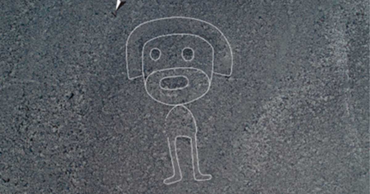
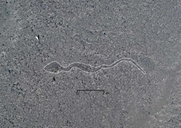
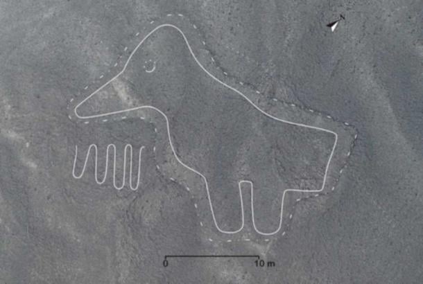
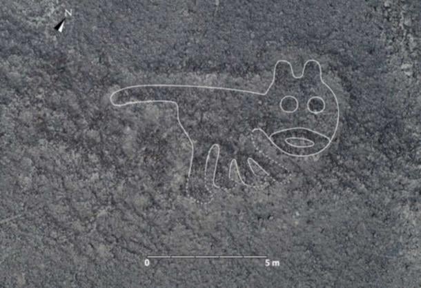


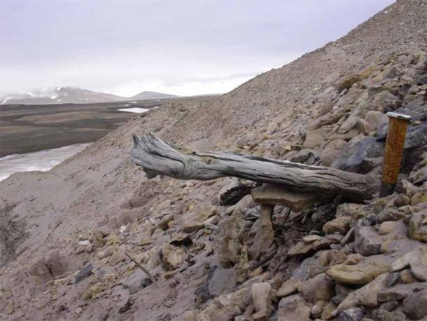

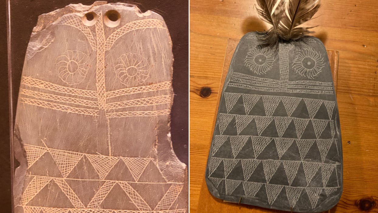

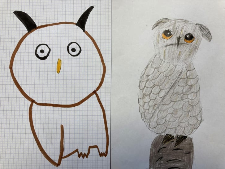
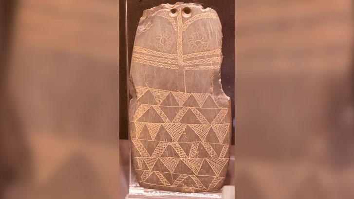


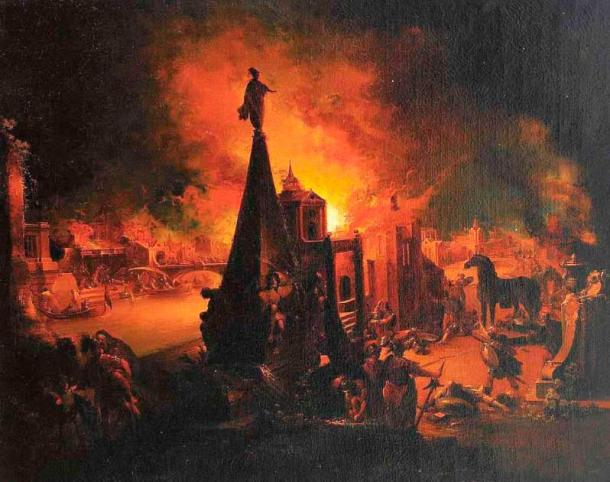

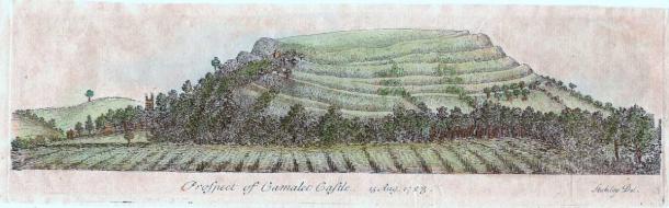
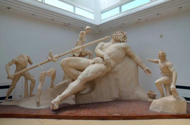

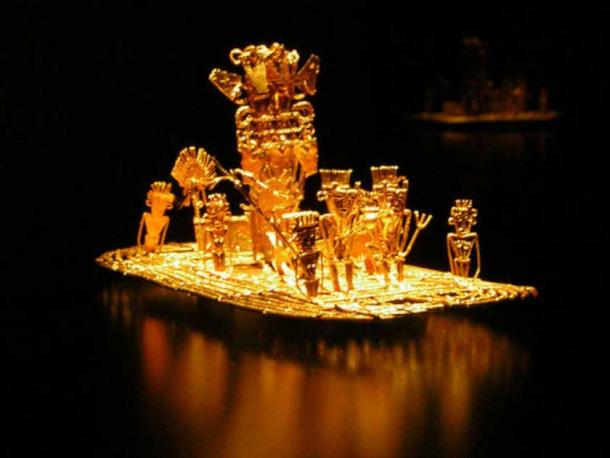
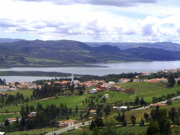


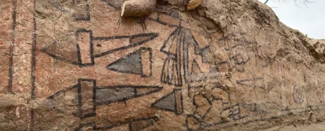


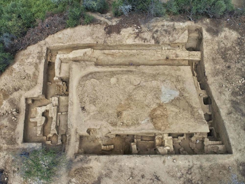
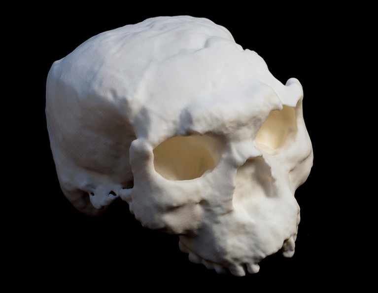
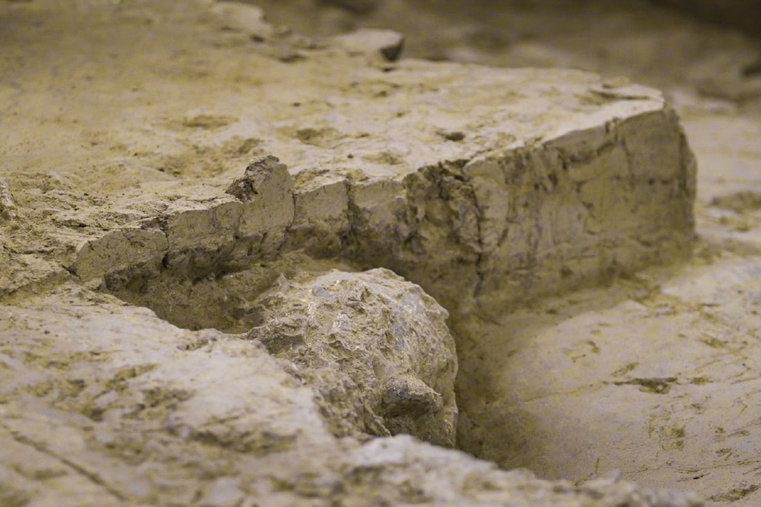
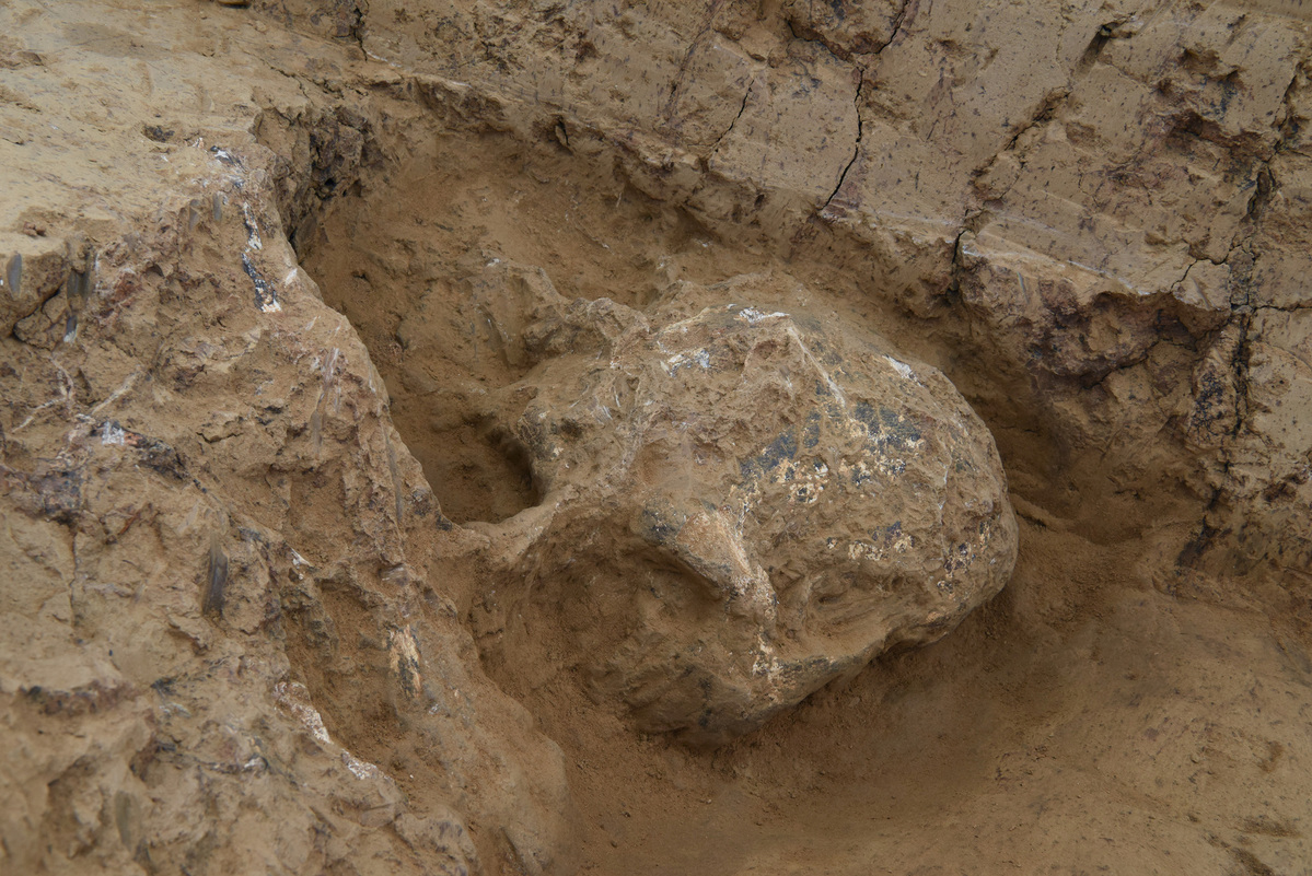
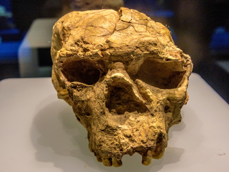
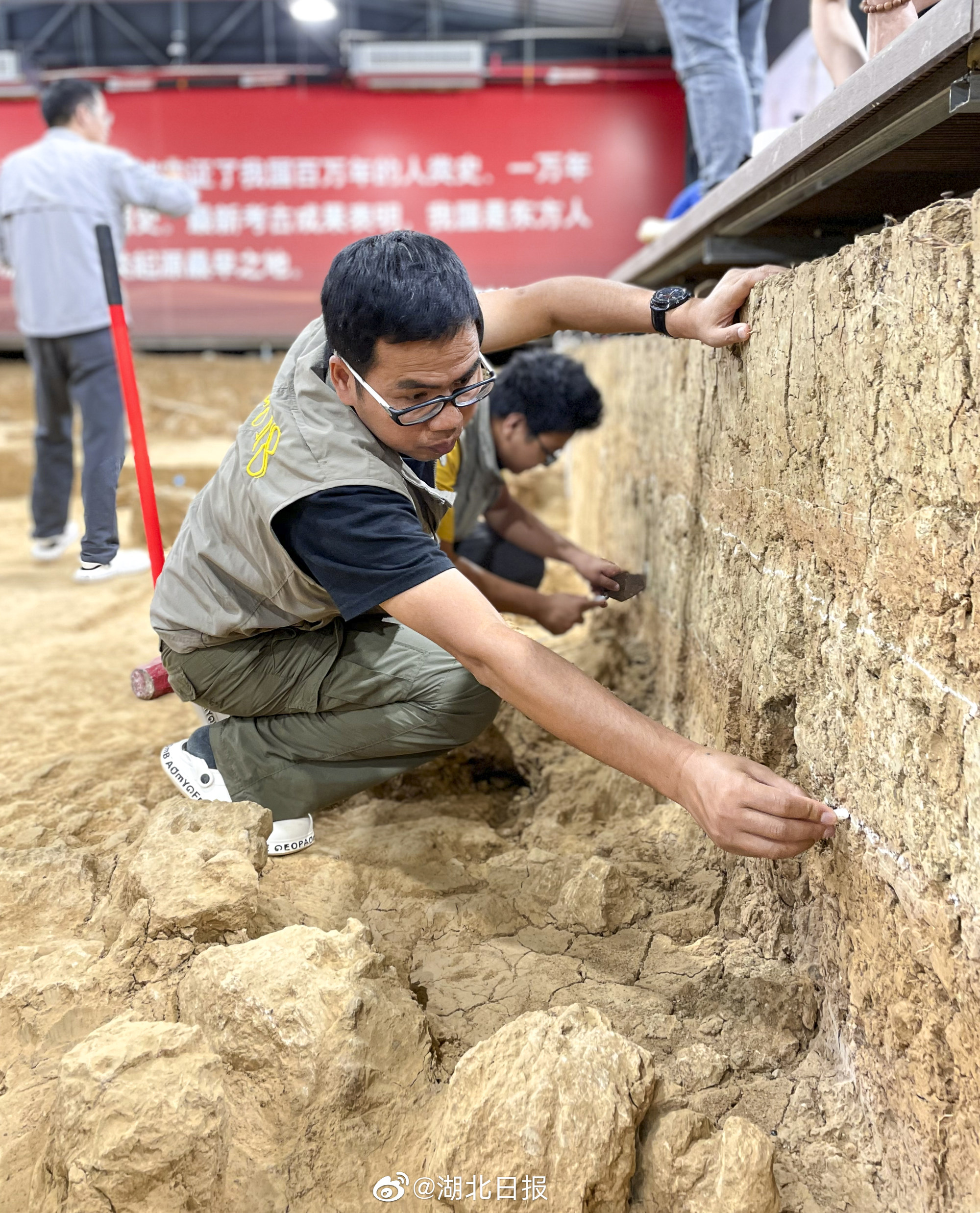


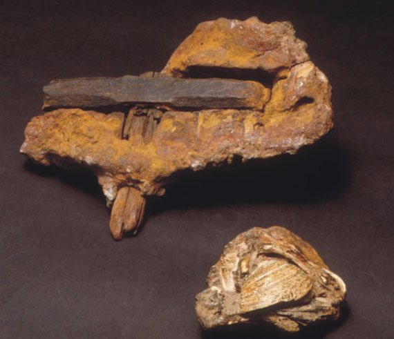

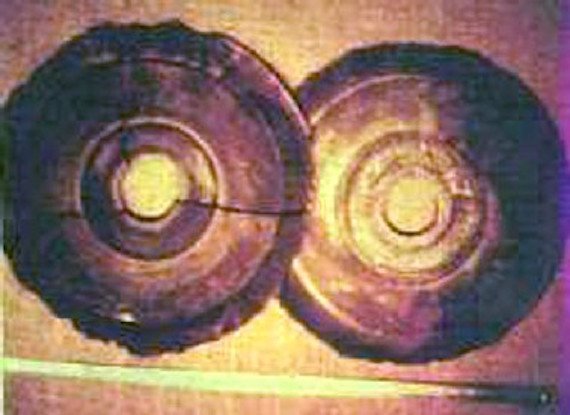


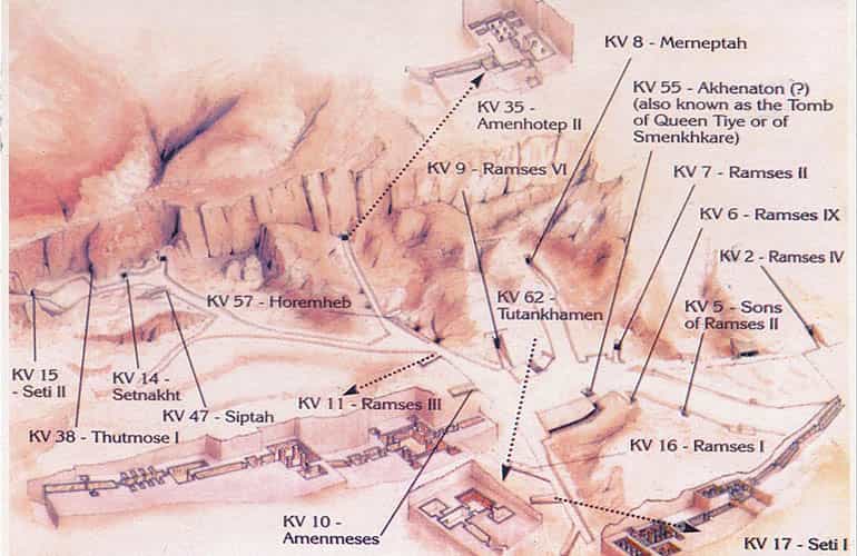
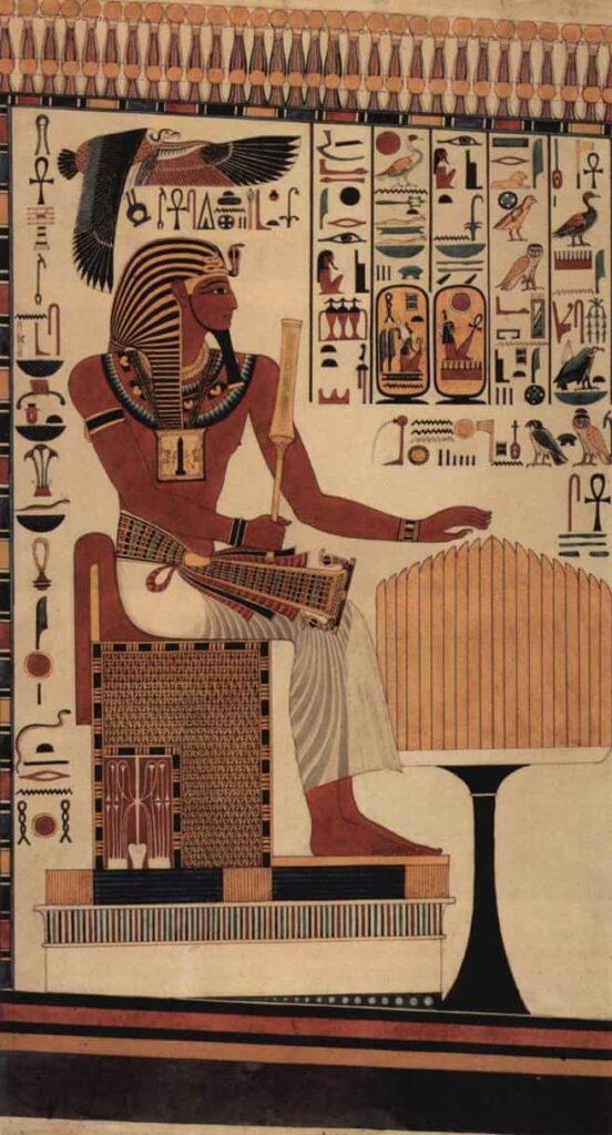


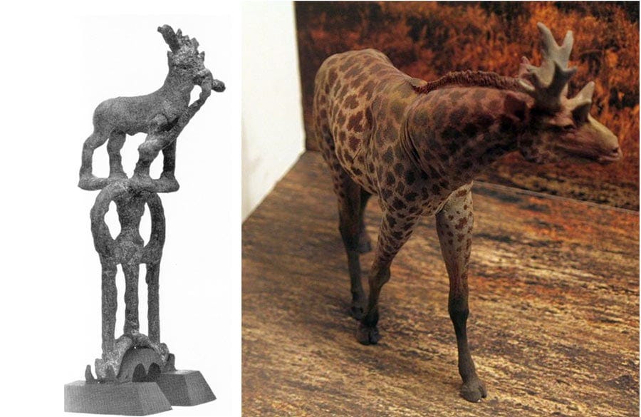
")
")
 rein rings from Kish. (Field Museum of Natural History/CC BY-NC 4.0)")
")
 (Edwin H. Colbert)")


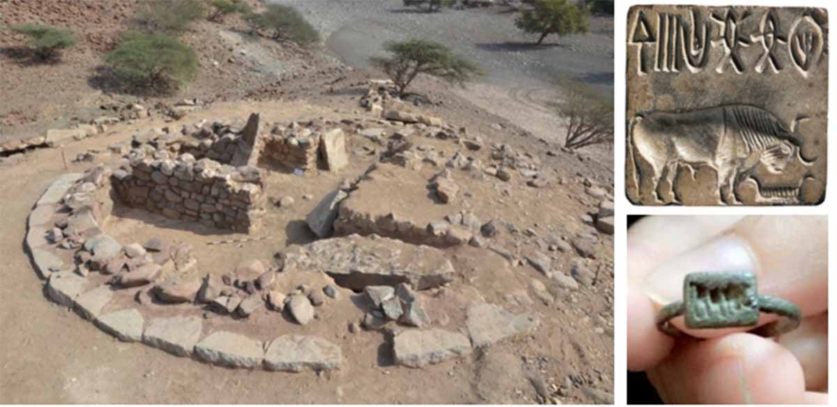
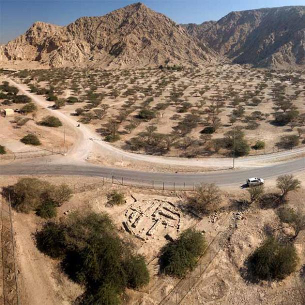

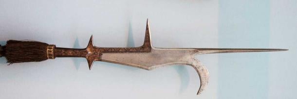
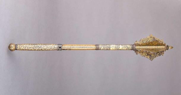
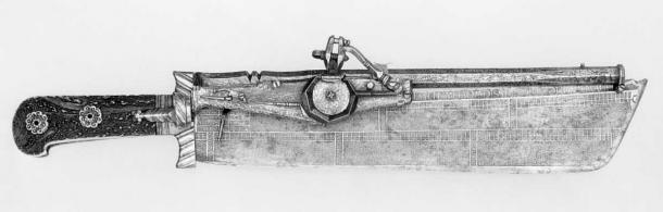
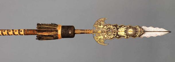
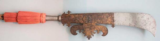

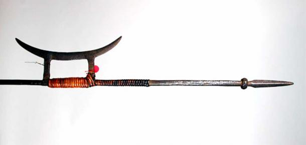
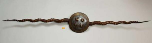
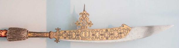
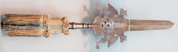

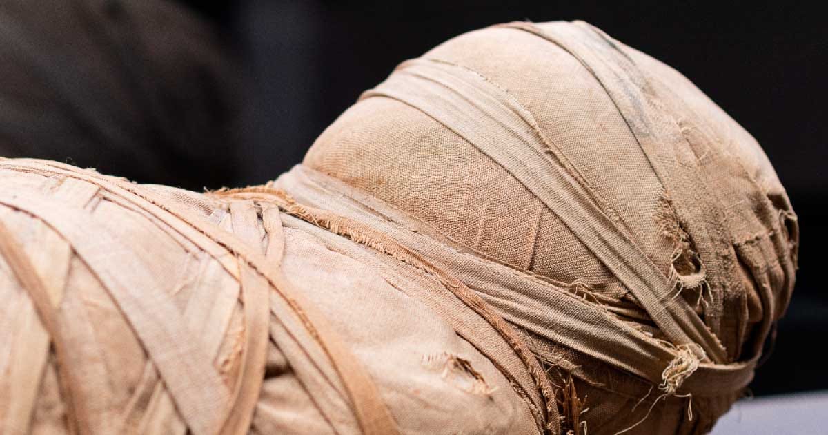
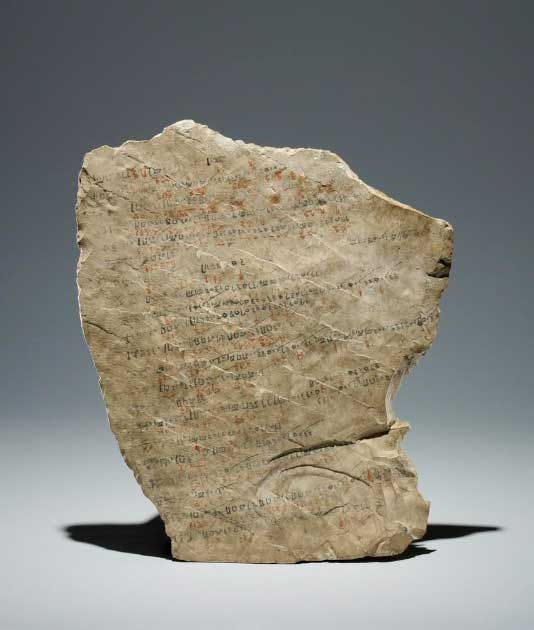
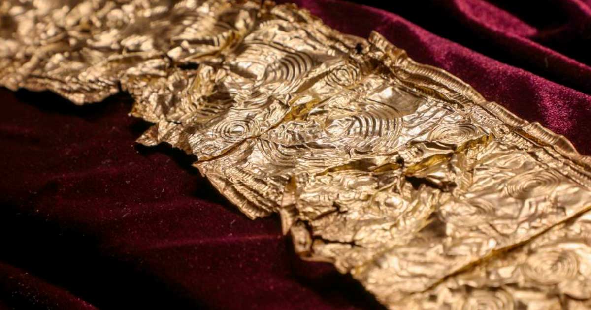
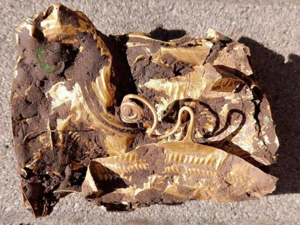
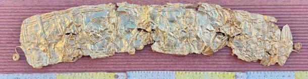
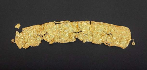


._The_ruling_city_immediately_after_the_deluge._The_ancient_ruins_showing_extensive_remains_LOC_matpc.16176.jpg)