The purpose of this blog is the creation of an open, international, independent and free forum, where every UFO-researcher can publish the results of his/her research. The languagues, used for this blog, are Dutch, English and French.You can find the articles of a collegue by selecting his category. Each author stays resposable for the continue of his articles. As blogmaster I have the right to refuse an addition or an article, when it attacks other collegues or UFO-groupes.
Druk op onderstaande knop om te reageren in mijn forum
Zoeken in blog
Deze blog is opgedragen aan mijn overleden echtgenote Lucienne.
In 2012 verloor ze haar moedige strijd tegen kanker!
In 2011 startte ik deze blog, omdat ik niet mocht stoppen met mijn UFO-onderzoek.
BEDANKT!!!
Een interessant adres?
UFO'S of UAP'S, ASTRONOMIE, RUIMTEVAART, ARCHEOLOGIE, OUDHEIDKUNDE, SF-SNUFJES EN ANDERE ESOTERISCHE WETENSCHAPPEN - DE ALLERLAATSTE NIEUWTJES
UFO's of UAP'S in België en de rest van de wereld Ontdek de Fascinerende Wereld van UFO's en UAP's: Jouw Bron voor Onthullende Informatie!
Ben jij ook gefascineerd door het onbekende? Wil je meer weten over UFO's en UAP's, niet alleen in België, maar over de hele wereld? Dan ben je op de juiste plek!
België: Het Kloppend Hart van UFO-onderzoek
In België is BUFON (Belgisch UFO-Netwerk) dé autoriteit op het gebied van UFO-onderzoek. Voor betrouwbare en objectieve informatie over deze intrigerende fenomenen, bezoek je zeker onze Facebook-pagina en deze blog. Maar dat is nog niet alles! Ontdek ook het Belgisch UFO-meldpunt en Caelestia, twee organisaties die diepgaand onderzoek verrichten, al zijn ze soms kritisch of sceptisch.
Nederland: Een Schat aan Informatie
Voor onze Nederlandse buren is er de schitterende website www.ufowijzer.nl, beheerd door Paul Harmans. Deze site biedt een schat aan informatie en artikelen die je niet wilt missen!
Internationaal: MUFON - De Wereldwijde Autoriteit
Neem ook een kijkje bij MUFON (Mutual UFO Network Inc.), een gerenommeerde Amerikaanse UFO-vereniging met afdelingen in de VS en wereldwijd. MUFON is toegewijd aan de wetenschappelijke en analytische studie van het UFO-fenomeen, en hun maandelijkse tijdschrift, The MUFON UFO-Journal, is een must-read voor elke UFO-enthousiasteling. Bezoek hun website op www.mufon.com voor meer informatie.
Samenwerking en Toekomstvisie
Sinds 1 februari 2020 is Pieter niet alleen ex-president van BUFON, maar ook de voormalige nationale directeur van MUFON in Vlaanderen en Nederland. Dit creëert een sterke samenwerking met de Franse MUFON Reseau MUFON/EUROP, wat ons in staat stelt om nog meer waardevolle inzichten te delen.
Let op: Nepprofielen en Nieuwe Groeperingen
Pas op voor een nieuwe groepering die zich ook BUFON noemt, maar geen enkele connectie heeft met onze gevestigde organisatie. Hoewel zij de naam geregistreerd hebben, kunnen ze het rijke verleden en de expertise van onze groep niet evenaren. We wensen hen veel succes, maar we blijven de autoriteit in UFO-onderzoek!
Blijf Op De Hoogte!
Wil jij de laatste nieuwtjes over UFO's, ruimtevaart, archeologie, en meer? Volg ons dan en duik samen met ons in de fascinerende wereld van het onbekende! Sluit je aan bij de gemeenschap van nieuwsgierige geesten die net als jij verlangen naar antwoorden en avonturen in de sterren!
Heb je vragen of wil je meer weten? Aarzel dan niet om contact met ons op te nemen! Samen ontrafelen we het mysterie van de lucht en daarbuiten.
26-06-2022
Mysterious stone structures were discovered throughout the Sahara
Mysterious stone structures were discovered throughout the Sahara
A team of archaeologists who carried out work on a project in the Sahara, published the discovery of mysterious stone structures, scattered throughout the desert.
Of different sizes and shapes , these mysterious structures could have an antiquity of thousands of years. Experts have declared that this is a unique discovery.
Mysterious structures in the Sahara
Experts studying the mysterious structures have not yet been able to discover the exact dating of their construction. Much less why they were built.
The main people in charge of this research are Joanne Clarke, from the University of East Anglia, England and the Independent researcher Nick Brooks , among other archaeologists.
The experts have also been working on a book where all the work done is described in detail . In addition to all the studies done on the unknown and mysterious structures.
The scientists stated to the media the following:
“The archaeological map of Western Sahara remains literally and figuratively almost blank as far as the international archaeological research community is concerned, particularly far from the Atlantic coast”
Specialists spent almost a decade studying and investigating the mysterious structures. From 2002 to 2009 .
During said working, they classified hundreds; These ranged from rectangular platforms, giant circles, crescents, or straight lines .
Seen with the naked eye, the structures appear to be a combination of forms that goes from the smallest. These are the stone lines, platforms, and circles. Forming a total of 600 meters long in total.
Some of these mysterious structures are believed to mark the location of tombs . However, the rest, until further research is conducted, remain a mystery to archeology.
Lost knowledge?
Unfortunately, the investigations have had to be stopped for the safety of the archaeologists, so it has not been possible to deepen the studies. This is because the area is taken over by terrorist groups.
For example, Al Qaeda operates in the region, and it is widely known that this and other groups often kidnap foreigners .
Experts assure that, as soon as they can, they will continue to excavate the surface in search of other hidden mysteries under the Sahara.
It should be noted that this discovery denotes how much historical information is hidden from the world. Perhaps, lost in time under the sand.
There are many enigmas and curiosities that surround these mysterious structures, to the point of seeing many theories born around them. The most popular is the possible existence of an extinct civilization, which had very advanced knowledge that lived in the remote past.
In this age of exploration a lot of attention has been paid to what lies out beyond our planet and what swims about in the darkest depths of our unexplored seas, but an area that seems to get significantly less attention is the world that lies locked down in the never-ending black night below us. Here caves and caverns stretch out and meander over vast distances, sometimes harboring new discoveries beyond our wildest dreams. Yet the most bizarre and baffling supposed accounts of the deep places of the earth are those concerning strange, unknown civilizations long gone, who are claimed to have dwelled within the earth and that remain lost and unconfirmed.
One of the most seemingly absurd claims of such an underground civilization was detailed in a 1956 bestselling book called The Third Eye, which is an allegedly autobiographical account by a man named Tuesday Lobsang Rampa, outlining his experiences at Chakpori Lamasery, in Tibet. Among the wealth of strangeness in the book, such as Rampa’s operation to drill a hole in his head to release mysterious mental powers, the titular Third Eye, and the strange discovery of his own mummified body from a previous incarnation, there is his curious account of finding a vast subterranean world crafted by inscrutable entities under the Tibetan capital, Lhasa. Here beneath the palace of the Dali Llama, he joined a priest to explore a system of caves whose walls were adorned with strange symbols and drawings by unknown hands. Following one tunnel down into the darkness, Rampa claimed to have come across a vast cavern with an underground lake and a ceiling so high he could not discern its height as the light did not reach all the way up the soaring chasm above.
Here the walls held mysterious geometric diagrams and diagrams, as well as pictures of giants and machines the likes of which he had never imagined, along with inscrutable writing in some puzzling alien language. They then took a side passageway that wound off and purportedly came to an area with a “black house,” within which were ensconced three sarcophagi apparently made of a smooth black stone similar to obsidian and which were covered with an array of strange symbols and what looked to be a star map of some kind. Within these were the bodies of strange giant beings, which the priest who had accompanied him explained as being the bodies of ancient “gods,” who had come to their world eons before. Rampa would say of these bodies:
I looked again, fascinated and awed. Three gold figures, nude, lay before us. Two male and one female. Every line, every mark faithfully reproduced by the gold. But the size! The female was quite ten feet long as she lay, and the larger of the two males was not under fifteen feet. Their heads were large and somewhat conical at the top. The jaws were narrow, with a small, thin-lipped mouth. The nose was long and thin, while the eyes were straight and deeply recessed. No dead figures, these-they looked asleep.
Things got perhaps even more bizarre yet as they continued their journey through the complex spider web of dank caverns, tunnels, and passageways. Within the oppressive gloom here below the earth Rampa claimed that they came across fantastical creatures the likes of which he had never seen skittering about, as well as a brightly lit room hidden behind a sliding wall panel, which held an array of strange dormant machines with inscrutable purposes he could not fathom. When this tour was finished, Rampa claimed that he had then gained the new ability to look through time, and that he saw visions of the ancient ages when these enigmatic giants he has seen had ruled the earth. As incredible as all of this talk of an ancient race of subterranean giants sounds, it is impossible to verify any of this, no evidence has ever been brought forward other than this account, and there has actually been much debate as to Rampa’s true identity or whether this was all a hoax. We may never know.
Tales of ancient races of enormous stature inhabiting the deep dark places of our world are actually rather numerous, and another tale of subterranean giants comes from the state of Missouri, in the United States. In 1885, the New York Times ran a truly astounding story of an ancient underground city that had been found at a depth of 360 feet during the digging of a shaft for a coal mine near Moberly in Randolph County, Missouri. Two men, a David Coates and Mr. George Keating, then delved down into the depths of the shaft to explore what had been discovered down below, and they would later claim that they had come across an immense underground city which was described as follows:
A hard and thick stratum of lava arches in the buried city, the streets of which are regularly laid out and enclosed by walls of stone, which is cut and dressed in a fairly good, although rude style of masonry. A hall 30 by 100 feet was discovered with stone benches and tools of all descriptions for mechanical service. Further search disclosed statues and images made of a composition closely resembling bronze, lacking luster. A stone fountain was found, situated in a wide court or street, and from it a stream of perfectly pure water was flowing, which was found to be strongly impregnated with lime.
This is already a fairly bizarre thing to find underground in Missouri, but within the nearly impenetrable murk of these corridors the two men claimed to have found the actual remains of the city’s denizens, which had apparently been there in the dark undisturbed for millennia, and were described as being true giants far larger than a normal human being. The bizarre remains were described:
The bones of the leg measured, the femur four and one-half feet, the tibia four feet and three inches, showing that when alive the figure was three times the size of an ordinary man, and possessed of a wonderful muscular power and quickness. The head bones had separated in two places, the sagittal and the coronal suturis having been destroyed. The implements found embrace bronze and flint knives, stone and granite hammers, metallic saws of rude workmanship, but proved metal, and others of similar character, they are no so highly polished, nor so accurately made as those now finished by our best mechanics, but they show skill and an evidence of an advanced civilization that are positively wonderful.
Frustratingly, the article mentions that a follow-up excursion would be launched, but then there is no other word on the alleged discovery. Unbelievably, this ancient underground city of giants in North America was just sort of forgotten in the mists of time. Why should this be? Of course there is the very real possibility that this was a fictionalized fake news story, which were unfortunately rather common in the day, but there have been rumors that the phenomenal discovery was covered-up, perhaps by the Smithsonian. This would be yet another conspiracy painting the Smithsonian as a shadowy organization bent on obfuscating and burying bizarre archeological finds, and if so what happened to those gargantuan bones? No one knows, it was never mentioned again, and the lost underground city of Missouri remains just another weird historical oddity.
The idea of such underground giants can be perhaps best be linked to the Hollow Earth Theory, which more or less states that within our planet rather than layers of rock, crusts, and magma is a lush world full of life and even with its own miniature sun, all of which sits deep within the hollow crust that we walk upon. The idea can trace its roots back to the 17th century, when Edmund Halley proposed in 1692 that the earth consisted of a series of spherical shells that all orbited one another around a hollow core, an idea which he concocted in an effort to explain various mysterious discrepancies in compass readings. Within each of these shells, he theorized, could be areas that were capable of harboring life and even civilization.
The idea caught on, and underwent a sort of evolution, undergoing various additions and iterations until it was no longer a series of layered shells, but simply one vast world lying within a hollow space below us. Indeed, in those days the theory gained such popularity that it was accepted as fact by many, and was even believed by those within the scientific community of the time. The idea that there were two major entrances to this underground realm, located at the North and South Poles, was pursued by some expeditions, the most famous being that of a John Cleves Symmes, Jr. in 1822, who remained a vocal, outspoken proponent of the concept and was thoroughly convinced of the theory's validity up to his death. Although eventually the concept of a Hollow Earth fell out of favor, it has nevertheless been held onto by stubborn believers all the way up to the present day, and there are a surprising number of books and websites devoted to trying to gain credence for it.
Although there are many offshoots of the basic core theory of a hollow Earth, an interesting common detail of many of these ideas is that the animals and people who dwell there are larger than those who inhabit the earth above. The giant people of these civilizations are often described as being the ancestors of ancient peoples, and as being highly advanced, with the technology to tunnel up through the ground where their dwellings and evidence of their existence can be detected by us. According to Hollow Earth “truthers,” these stories of ancient subterranean civilizations and giants can be seen as evidence of their far-out ideology.
Sanxingdui Excavation Pits Reveal Sophisticated Ancient Civilization
Sanxingdui Excavation Pits Reveal Sophisticated Ancient Civilization
An advanced 3,000-year-old Chinese culture, whose existence was not known about until the 1980s, has been further revealed by recent excavations. Apparently, the existence of the highly developed southwest Chinese Sanxingdui civilization, in Sichuan province, was omitted from official records, despite hundreds of years of flourishing development! On Monday last, at the Sanxingdui ruins, Chinese archaeologists reported that they have unearthed a treasure trove of artifacts across six sacrificial pits, as reported by the Chinese state news agency Xinhua.
Unprecedented Finds from the Sanxingdui Civilization Site
Since October 2020, the number of artifacts and relics recovered from the Sanxingdui site have reached an astounding total of 13,000.
In the latest Sanxingdui excavations, an area of 1,834 square meters (19,741 square feet) was explored in the sacrificial pit area. The entire sacrificial pit area covers an area of almost 13,000 square meters (139,931 square feet)!
The latest major find was a bronze box decorated with jade. The box had a turtle-back shaped top made of bronze and jade, with turquoise jade embellishments. It also had four dragon-head handles and a few streamers and was likely wrapped in silk and offered as burial sacrifice.
The Sanxingdui bronze chest was described as an “unprecedented discovery” by Li Haichao, a professor at Sichuan University, who is in charge of one of the excavation teams. He added that while the functionality of the vessel remains in doubt “we can assume that ancient people treasured it.”
The latest major find at the Sanxingdui site was a bronze box decorated with jade. The box had a turtle-back shaped top made of bronze and jade, with turquoise jade embellishments. It was likely wrapped in silk and offered as burial sacrifice.
All in all, archaeologists have found 3,155 relatively intact relics at the sacrificial pit site, including 1,238 pieces of bronzeware, 543 gold, and 565 jade artifacts.
A stunning crowned, bronze statue with a snake’s body was also found. According to Ran Honglin, director of the Sanxingdui cultural relics and archaeology research institute, the snake body statue was the most important recent find of all, writes the Global Times .
The bronze statue consists of three distinct sections, with the snake’s body occupying the middle. The figure’s hands are propped up on a bronze drinking vessel called a lei, sitting on a square pedestal. Overall, it is an image of a man with characteristics specific to the Shu kingdom, particularly the protruding eyes. On his head, a vermilion painted zun can be seen, which is the name of another kind of Chinese bronze drinking vessel. Strangely enough, the man’s nose is a pig’s nose.
Such a complex and well-imagined artifact can only point to a vivid imagination and visions of a mystical world by the Sanxingdui people, according to associate professor Zhao Hao from Peking University. He was in charge of the excavations at pit #8, where the pig-nosed bronze statue was found, according to the South China Morning Post .
Among the other recent significant finds, a bronze altar depicting a sacrificial scene that is nearly a meter (3.3 feet) tall was also found in one of the pits. This altar also provides new evidence of the immortal world perspective of the Sanxingdui Shu people. The altar was divided into three sections: the bottom part is a platform featuring beautiful hollow patterns. A muscular person is sitting in the center of each of the three sections from top to bottom.
These nearly 3,000-year-old Sanxingdui bronze heads with gold foil masks look like modern art and say a lot about the advanced metallurgy skills of the Shu people of Sanxingdui.
The Astounding Craftsmanship of Almost-forgotten Sanxingdui
The quality and craftsmanship of the finds at the Sanxingdui ruins indicate a high degree of cultural advancement and sophistication, adding to the mystery and intrigue of this virtually “unknown” civilization.
Sanxingdui, literally meaning Three Star Mound, was accidentally discovered in 1986. And multiple artifact dating has revealed that this civilization existed nearly 3,300 years ago!
The Sanxingdui civilization is viewed to be the same as the ancient kingdom of Shu. In the last two years, Ancient Origins has reported more than once on the finds emerging from this almost-lost Chinese civilization. To date, researchers have remarked on incredible metallurgy skills of the Shu people.
In a recent round of carbon dating on 200 relics, most of the pits were found to be from 1131 to 1012 BC, probably from the late Shang dynasty which lasted from the 16th to the 11th century BC. However, pit number 5 and 6 at the Sanxingdui site were dated to after the Shang dynasty period.
"We had never seen something like these, and we even don't know how to describe their patterns or shapes in short words," Honglin said. "It's also confusing for us to speculate how they were used before further studies. But these artifacts feature a mixture of typical local styles of cultural relics as well as those from the Central China Plains at that time. It demonstrates through close communications, the ancient Shu culture became a key part in early Chinese civilization."
Honglin has also pointed out that these relics are significant for comprehending the diverse nature of Chinese culture and unity in its early days. Full Chinese unification only happened in the Han dynasty (from 202 BC onwards).
The latest round of discoveries at Sanxingdui proves that China was a melting pot of civilizations. For example, the zun drinking vessel motif found on one of the recently unearthed artifacts at Sanxingdui was virtually unknown in the Shu kingdom but dominant in China’s Zhongyuan Central Plains region. Clearly, the zun was a motif borrowed from another civilization as is common in melting pot periods.
Sanxingdui field excavation work is slated for completion in October 2022. However, before that date many more artifacts will be found, telling us more about the roots of the monolithic Chinese civilization we know today.
Top image: Just one of the stunning metal-crafted artifacts recently found in a small portion of the sacrificial pits area at the Sanxingdui site in southwestern China, which had been almost lost to time until the 1980s.
One of the more unusual ancient Egyptian pharaohs was Akhenaten – the tenth ruler of the Eighteenth Dynasty who reigned for seventeen years during the early to mid-1300s BCE. Akhenaten’s short time on the throne nonetheless had some major and historical accomplishments – he changed his name to Amenhotep IV, was married to Nefertiti, probably fathered Tutankhamun, and abandoned Egypt's traditional polytheism and introduced a monotheistic religion worshiping the god Aten. Oh, and he had an elongated skull that may have been found in 1907. Because Akhenaten’s history was seemingly wiped out after his death – and Egypt’s religion returned to polytheism, some have suggested there may have been something unusual about him that a DNA test on his mummy could possibly prove – that he was an alien.
“Unlike the rest of the pharaohs who ordered artists to sculpt and paint his figure with large shoulders and a narrow waist, he ordered that he be represented as he was. This has allowed Egyptologists to know exactly what his appearance was; bulging belly, narrow body and very long and thin limbs . All crowned with a large and elongated head.”
Does that description sound like an alien?
A recent article in UFO Spain (in Spanish) brings to light the question of why the mummy thought to belong to Akhenaten has not been studied further … especially with the possibility that it might contain alien DNA. While ancient Egyptians may have performed the childhood head-binding that resulted in elongated skulls in adults, historians have never been certain that the large heads of Akhenaten, Nefertiti and many of her children, including Tutankhamun, were due to the painful practice or something else. One sign often attributed to Egyptians having elongated heads are the statues and artwork depicting people wearing large cone-shaped headgear. In 2019, a study revealed a probable cause – two mummies found in graves in Akhetaten had wax cones on their heads that were held in place by the headgear. Why? Either as fertility devices or as part of their outfits as dancers.
What about Akhenaten and Nefertiti -- he was a male, she had plenty of children and both had real elongated heads?
Good question. Many Egyptian scholars believe Akhenaten’s unusual head and body shapes were due to a genetic abnormality. Early diagnoses pointed to Frölich's syndrome, which can cause obesity, delayed sexual development, atrophy of the gonads, and altered secondary sex characteristics. While Akhenaten had a feminine appearance and a big belly, Frölich's syndrome also causes infertility and he had many children. That led to researchers suspecting Marfan syndrome, which can cause a sufferer to be taller than average, have a long, thin face, an elongated skull, overgrown ribs, a large pelvis, enlarged thighs and spindly calves – all descriptions of Akhenaten. In addition, Marfan syndrome has a 50% chance of being passed on to the next generation. However, while he had an elongated skull, DNA tests on Tutankhamun in 2010 were negative for Marfan syndrome.
Which brings us back to DNA testing Akhenaten’s mummy for Marfan, Frölich … or alien DNA. UFO Spain offers this speculation:
“Furthermore, Nefertiti and her children also had elongated skulls. This has led to a theory; there may have been extraterrestrial DNA in Egypt, or at least past lineages. This hypothesis gains strength when the history of Egypt is analyzed and it is realized that the only reign that practically mysteriously disappeared from the records was that of Akhenaten. It is not known if he was killed or if he fled, since there is no way to clarify it.”
Bust of Nefertiti
In 1907, Edward R. Ayrton found a mummy in tomb KV55 in the Valley of the Kings. Genetic tests in 2010 confirmed that the person was both the son of Amenhotep III and the father of Tutankhamun, and the age at the time of his death was consistent with that of Akhenaten. However, the results have been disputed. Why? What if the tests showed alien DNA? Could the Egyptian government – or some other world powers – be covering it up? After all, ancient Egyptians seem to have tried to wipe the existence of Akhenaten out of their own history. Nefertiti, who also had an elongated skull, was believed by some to have been Akhenaten’s sister before becoming his wife and Tut’s mother. A mummy thought to be hers was found but never confirmed and her history has all but disappeared as well. Another coverup?
Would another modern and more extensive DNA test on the mummy believed to be Akhenaten answer the question of its possible alien origin? Maybe. Will it ever happen? Many people have kept Akhenaten’s origin secret for thousands of years. There is obviously a reason why.
Disclosure Of Classified X Documents And Archaeological Aztec Origin Objects Found In Ojuelos De Jalisco, Mexico.
Disclosure Of Classified X Documents And Archaeological Aztec Origin Objects Found In Ojuelos De Jalisco, Mexico.
The Aztecs came long after the Maya. The Mexican government had agreed to disclose to the public several archaeological objects that have remained hidden for decades, from the time they were discovered. A helmet-shaped head of Alien, etched in stone tablets of gold and silver, which can be recognized in engraved details – how astronauts that traveling in space ships with other ships scenes actually looks like. Also you can observe comets and planets there.
The Mexica or Aztecs were a people of the Nahuatl culture that existed in the area of Mesoamerica from the twelfth to the sixteenth century. These people are called themselves Mexica (pronounced meshicas) or tenochcas (inhabitants of Tenochtitlan). The Aztec word meaning ‘from Aztlán’ and was their tribal name. In just 70 years, the owners would greatest empire that had existed in Mesoamerica. A lost culture and never seen until now. They are objects filled with details of the lives of these characters in our remote distant and forgotten history, which until now had remained hidden.
Frontal View
Back Side
Several families of Ojuelos city in the province of Jalisco, Mexico, have been collecting for about 50-60 years a total of 400 artifacts extraordinary, with the dream of one day open his own museum, and publicize to the the public such an amazing objects.
HERE SOME OF THE APPROXIMATELY 400 OBJECTS FOUND
Prints, sculptures, rings, pendants. It seems that this former American culture had contact with eyes elongated creatures who lived with them over time and represented their craft in the skies. The same figures Alien contacted many say seeing them today. Or at least it seems. Conclusions. Scientific analysis by Ma Luisa Trujillo of the two objects found: Based solely on the interpretation of all we have, chemical analysis, we can infer that the person who drew up the pieces did not know the process covers and glazes as is now known, whereby the characteristics do not match 100% with some type of nail Today, we might think that used in the composition principles of stoneware but at a lower temperature which completely changes the finish. Covers or stoneware glazes give good results with oxidizing or reducing atmospheres, generally used to initiate a reducing atmosphere and at the end a neutral or oxidizing atmosphere on assessed pieces oxidizing atmosphere was used.
A lot of things viewed as unusual by the people from the present day used to take place in ancient Egypt. While some of these aspects are fascinating, others can be simply regarded as odd. Going beyond this, ancient Egypt has proven to be a fantastic civilization which continues to inspire individuals even today. Out of the countless lesser-known aspects regarding ancient Egypt, some interesting ones are revealed here.
1. World's First Known Female Pharaoh
Ancient Egypt gave the world the first female pharaoh who is still known in the present day. Her name was Merneith. She lived around 5000 years ago, belonging to the First Dynasty. She died around 2950 BC, after ascending to the throne once her husband, Pharaoh Djet, died. The son of the couple, Den, should have become pharaoh, but he was too young. So, around 2990 BC, his mother's reign began. Merneith (who had royal blood, being a descendant of Pharaoh Narmer who had unified Egypt and started the First Dynasty in the past) took care of state matters. Even though not much is really known about her, one thing remains certain: during her administration the ancient Egyptian economy thrived and, later on, thanks to his mother's guidance, Den came to be regarded as the greatest pharaoh of the First Dynasty.
The tomb of the female pharaoh was discovered at Abydos. It was very unusual for the tomb of a woman, being identical to other tombs that had been constructed for great male pharaohs. It included 40 sacrificed servants, many sacrificed animals, and a boat on which the soul of the female pharaoh could sail in the afterlife to meet the Sun god, Ra. In this way, Merneith set the ground for other great female pharaohs who are probably a little more well-known such as Hatshepsut and Cleopatra. However, the reality of female pharaohs is not the only fascinating and lesser-known fact about ancient Egypt. So, let the adventure into the old world of gods and mummies begin!
2. Tutankhamun’s Beard
In ancient Egypt, having hair on one's body was seen as dirty and a sign one was lacking in personal hygiene. Because of this, both men and women shaved off all the hair from their bodies. This included shaving their heads. After doing this, women would wear beautifully adorned wigs with complex designs according to the fashion of the times. In the case of the pharaoh, the beard was a symbol of masculinity and power. But, obviously, the pharaoh could not grow a beard because hair on the body implied uncleanliness. So, an artificial beard would be attached to the pharaoh's face using strings to keep it in place. The funerary gold mask of Pharaoh Tutankhamun presents an example of such a beard.
In the case of the discovery of Tutankhamun's tomb, Carter and his team had not been the best archaeologists. Instead, they were much closer to the image of treasure hunters. As a result, while handling the solid gold funerary mask they managed to break off the beard. Unable to use the same method applied by the ancient Egyptians who had crafted the mask, around the year 1944 the beard was fixed back onto the mask using a piece of wood. That was how the relic was displayed until August 2014 when the beard was accidentally broken off again by some Egyptian employees from the museum. Obviously, these museographers realized the gravity of the situation, so they decided to hide their mistake by gluing the beard back on using adhesive. To make it look even better, they removed the visible remains of the adhesive substance by using some metal tools to scrape them off. Ultimately, the mask ended up looking really bad.
To fix the relic, a restoration commission from Germany showed up. They worked for nine weeks just to remove the adhesive substance. They masked the scratches and reattached the beard using beeswax, the exact substance that had originally been used in this regard by the ancient Egyptians. The eight museographers, including the museum's director, were sent to trial and they will have to pay a large fine.
The famous burial mask of King Tutankhamun on display at the Egyptian Museum in Cairo, Egypt
On the 24th of November 1922, Howard Carter discovered the tomb of Pharaoh Tutankhamun. This was thought to have been sealed and untouched, the only tomb of an ancient Egyptian pharaoh that had escaped the action of tomb raiders. Wrong!
Carter understood that others had entered the place before him. Officially, he promised that the tomb would only be unsealed and opened in the presence of Egyptian officials. So, of course, he illegally entered the tomb the night before the grand event. This was no big deal, because others had been there before him, twice actually. The proof of this was a large crack in the exterior door. This had been sealed back up. Also, the pharaoh's belongings from the antechamber were found in disorder, as the tomb raiders had robbed the place in haste. This had happened shortly after the pharaoh's burial. These thieves had been interested in jewelry and precious metal items. Also, they had come for the things which had to be stolen immediately. This refers to perfumes, precious oils, and clothing items. These could not last for years inside the tomb, so if the thieves wanted to sell them for profit, they had to remove them quickly.
Other cracks on the doors of the tomb clearly suggested the second tomb raiding event. The first grave robbers had only broken into the antechamber. The second ones had a larger team and they had been better organized. Their purpose was to access all of the funerary chambers. There was a written inventory detailing everything that had been placed inside the tomb. Carter discovered it. After consulting it, he understood that, in 1922, less than half off all the jewelry and precious metal items originally deposited inside the tomb had remained. This suggests that the tomb raiders had to get out of there quickly, only taking what they could carry.
Not even the seal on the tomb had been the original one. Instead, this had been replaced by the one of Horemheb. This pharaoh had received the throne from Ay (the vizier who had succeeded Pharaoh Tutankhamun). To hide all of this, repairs were made, and the cracks were covered. However, everything had to be done in great haste due to the lack of time, just as the tomb raiders had previously operated. After the second grave robbing event, the tombs of Ramesses II and Ramesses IV were built close to the tomb of Tutankhamun. Tutankhamun was thought to lack importance as a pharaoh, so his tomb no longer attracted interest. Also, the entry to the tomb was covered by sand and, in time, the place was forgotten. The grave robbers switched their attention towards the tombs of other more important pharaohs which had more to offer.
A lot has been discussed about the process of mummification and its stages. However, fewer people have knowledge regarding the costs of this process. It is obvious that nobody got mummified for free in ancient Egypt. Also, it must be mentioned that ancient Egyptians did not use money. The first coins from the area were introduced around 360 BC, but, despite this, ancient Egyptian priests were highly aware of the value of luxury goods and precious metals. These priests were actually the inventors of the mummification business. Their purpose was to obtain profit, as every person had to be mummified after death if he or she wanted to even have an afterlife.
According to Herodotus, Egyptian priests had come up with three main types of mummification. The first was meant for the rich who had to pay what would be equal to about 20,000 euros today for a premium mummification process. The brain was taken out through the nose, the corpse was eviscerated, bathed in expensive wines, spices and oils, kept with salt for around 70 days, the eyes were replaced with two onions and the organs were nicely placed in specialized canopic jars. After the corpse dried up, it would be wrapped in expensive cloth along with specific amulets and sealed with wax and resin. The mummy was given to the family who also had to pay for a sarcophagus, a pyramid or a tomb, some slaves to kill for the mummy to have servants in the afterlife and a few mummified animals. With a relatively decent sarcophagus costing around five goats or a slave, this entire luxury mummification package proved to be really costly.
The type of mummification meant for the middle-class cost around half the price of the luxury package. In this case, the body was not eviscerated. It was just injected with a certain cedar oil which had the effect of dissolving the internal organs. Because this could get messy, a stopper was introduced in the anus of the corpse until the liquefaction was complete. After that, the stopper was removed and all the liquid allowed to flow out of the corpse which was afterwards kept with salt for 70 days. The mummy was then given to the living family members who took it to a common cemetery. The last type of mummification was reserved for the poor and it was paid by the state. The guts were removed, the corpse was washed and kept with salt for 70 days. After this, it was taken out to the desert and buried there without any amulets on it.
Criminals in ancient Egypt were always burned at the stake to prevent them from having an afterlife. As for nobles who had committed crimes during life, they were allowed to kill themselves and their corpses underwent a simple mummification procedure. The major blasphemers were mummified in goat skin, so that the gods from the world beyond could know of their actions. As for pets, animal mummification cost between 1000 and 5000 euros in today’s money. Those who wanted to impress others would mummify larger animals such as crocodiles or bulls.
Corruption has always existed, and even ancient Egypt had to confront this reality. Horemheb ruled Egypt as a pharaoh between the years 1319/1306 and 1292 BC. He was the first ancient Egyptian ruler who led a serious fight against corruption. During the reign of Akhenaten and that of his son, Tutankhamun, corruption had increased and gotten out of control. Starting as a commoner, Horemheb managed to become a general and, later on, he sat on the throne as pharaoh.
Tutankhamun had died at the age of 18 in suspicious circumstances. He was succeeded by the vizier Ay who was murdered. Horemheb did not want to share their fate. As a pharaoh, he issued drastic laws and worked hard to eradicate corruption. To be sure he was in control, he personally replaced all judges and state officials. He also made bribery punishable by death. This had never been applied before in this regard, the harshest punishment for bribery until the time of Horemheb was a threat that the god Anubis would be very upset with the individual in the afterlife. As he thought Anubis had more important issues to attend to, Horemheb radically changed the system and dealt with punishments personally.
Death was the sentence given to thieves. Mutilation was inflicted upon those who committed fraud and those who set taxes too high for the population. The mutilation referred to here consisted of cutting off the nose and the ears of the trespasser. The person would then be exiled to Tharu, a region ancient Greeks began to refer to as Rhinocolura, because a lot of people who lived there had no noses.
Detail of a statue of Horemheb, at the Kunsthistorisches Museum, Vienna
To a certain extent, the fight against corruption undergone by Pharaoh Horemheb proved successful for a time. The ancient Egyptian ruler actually died a natural death, but, afterwards, his example was no longer followed.
Top image: Ancient columns at the Temple of Horus at Edfu, Egypt.
5 Must See Megaliths of the Mysterious Nuragic People
5 Must See Megaliths of the Mysterious Nuragic People
All over the Mediterranean island of Sardinia exist megalithic marvels that date from almost 4000 years ago. These mostly limestone structures are believed to have belonged to a civilization now known as the Nuragic people. Called ‘nuraghe’, they are a wonder to visit and immerse oneself in the ancient civilization that, for some reason - be it perhaps internal struggles, external invasion or some other reason entirely - had reason to construct thousands of these highly defensive edifices. Here we explore several of the best-preserved sites.
Mysterious Civilization Enduring Through the Ages
Before Sardinia was occupied by the more modern civilizations of the Spaniards, Byzantines, Romans and Carthaginians, a mysterious civilization flourished on the island from the 18th century to the 3rd century BC.
Very little is known about this ancient civilization as they left very little written evidence and very few items providing evidence of how they lived. Even their name, Nuragic, is a term used based on the description of the fortress-like structures that they once built, called Nuraghe. These towering, sturdy architectural feats were constructed during the Bronze Age and are dispersed throughout Sardinia, with there being around 7000 known to exist, but far more thought to have been built.
Here we explore several of the best-preserved sites.
1. Su Nuraxi of Barumini
The Su Nuraxi site is found in the central region of the island, at Barumini, with the clue to its importance being in its very name. ‘Su Nuraxi’ means not a nuraghe, but the nuraghe. It is the most famous nuraghe in Sardinia and is the only designated UNESCO site on the island. The extensive site is one of the best preserved of the 30 Barumesi sites of the area and certainly the best complex as a whole. It was the first site to be explored by archaeologist Giovanni Lilliu and which led to his definition and ‘discovery’ of the Nuragic civilization.
17th century Nuraghe Su Nuraxi, in the south central Barumini region of Sardinia
It includes a complex nuraghe as well a substantial village of huts. It seems this was an important center of power and commerce in prehistoric times.
The structures are made from volcanic basalt stone sourced nearby and was active over 2000 years from 16th century BC to the 7th century AD. The complex includes the tower (or keep) with a bastion at each of its four corners. A village of 50 huts sprawls out surrounding this central structure.
This tower was once 18.5 meters (60 ft) tall and was erected in the Middle Bronze Age (16-14th century BC). It contained 3 rooms over 3 levels, and was topped with a tholos or false dome, a wooden roof which also was used for the other buildings in the village.
2. The Nuraghe Palmavera
The Nuraghe Palmavera is similar to all the nuraghe structures and is one of the largest and most important examples, after the Barumini complex. It is located on the Palmera headland, overlooking a bay the Romans romantically called the ‘Harbor of the Nymphs’ near the modern beachfront resort town of Alghero.
It is believed that Nuraghe Palmavera was built in phases starting in the 15th century BC with a main tower that stands almost 8 meters (26 feet) high and 10 meters (33 feet) in diameter, including the beehive shaped roofs. It is estimated that a village of up to 150-200 huts surrounded the tower, with only 50 existing today. A new phase of development was completed in the 9th century BC with the addition of an exterior wall and additional huts. Although built using limestone blocks and sand, the Nuraghe Palmavera was destroyed by fire in the 8th century AD, but parts of the structure remain intact.
Today, this Nuraghe complex is one of the most popular tourist destinations in Sardinia, along with the Nuragic complex of Barumini, which UNESCO declared a World Heritage Site in 1997.
3. Nuraghe of Santu Antine
This naraghe is a giant amongst giants, with the central tower now reported as being 16.5 meters (54.13 ft.) but once standing at a dizzying 23 to 24 meters (75-78 ft). It is currently the tallest naraghe of all, but it is thought that even higher towers existed in the past.
Santu Antine is located in the northwestern Sardinian province of Sassari, close to the town of Torralba, and is known by local people as Sa Domu de su Re or The House of the King in English. The building is made of basalt and The central tower is composed of three smaller towers that were stacked one on top of the other. Only two of these towers have survived till today. The rooms of these two towers may be reached by climbing up a helicoidal staircase that was incorporated into the structure’s thick walls.
It is surrounded by a small collection of 14 huts that have been identified, which were part of what would have been a much larger settlement. These dwellings have been dated to the 13 th century BC, and articfacts dating to the Roman period have been found in them, showing they were used after long after the Nuralgic civilization had ended. Some huts contained features, such as seats, hearths, and niches that aid in our understanding of their function. One near the entrance had a seat and a hearth, and archaeologists have proposed it would have been used for gatherings or meetings.
The site Nuraghe La Prisgiona is extensive at around 5 hectares and includes 90 Bronze Age buildings that have been excavated so far and those around the main building are very well preserved. It is a real chance to get a feeling of the past as you weave around the enclosures, with the size of the preserved settlement making it one of the most complex sites of its type. The main building is the classic three tower nuraghe but it also features an enclosed courtyard which includes a stone well that reaches a depth of 7 meters (23 feet). The well has yielded several well crafted jugs from the Nuralgic era.
One of the huts includes a long cresent shaped stone seat, long enough to accomodate over a dozen people, and an ornate jug was found here, perhaps for religious use.
The site is located in Arzachena, near Costa Smeralda (Emerald Coast) in the northeast of Sardinia.
5. Nuraghe Losa
Nuraghe Losa is a distinctive and well-preserved nuraghe that is located near the village of Abbasanta, in the central-western region of Sardinia. It is named ‘nuraghe of the tombs’ which refers to the Roman cinerary urns carved into the rocks nearby, as during the Roman era it was used for funerary purposes.
The giant and imposing structure is reminiscent of a ship’s bow.
It is most remarkable for the shape which is triangular and can be compared to the bow of a ship and it is obvious that the masonry techniques were reaching some refinement by this point, the 14th-15th century BC.
There is a main entrance raised above ground level through which a corridor leads to three of the internal towers. A fourth tower is accessed through a separate entrance. These towers are not obvious from the outside as the whole edifice appears as a solid mass of rock. Just why such a fortification was thought required remains a mystery, but this would surely have been virtually impenetrable.
As well as the three rooms, the main keep tower has a small spiral ramp leading to an upper chamber. There are also 3 wells for storage and a cistern in the western tower.
Arial view of Nuraghe Losa showing it’s triangular shape with 4 towers.
Only a small part of the surrounding settlement has been excavated but includes buildings from the late Punic, Roman Republican and Imperial, Late Roman and Byzantine periods.
There is also a Giant’s tomb, another interesting megalithic feature of the island.
A Nuragic Civilization Legacy
While the Nuragic civilization may be extinct and stories of their history now the stuff that legends, the magnificent stone structures that they left behind provide testament to a mighty society with a penchant for extreme defense. This is just a small taste of some of the best of the many sites it is possible to visit from this fascinating if enigmatic era.
Top image: A view of a reconstructed hut at the Nuraghe Antine site at night.
Atlantis found? Diver made 'extraordinary' discovery of huge 'man-made' structure
Atlantis found? Diver made 'extraordinary' discovery of huge 'man-made' structure
ATLANTIS was tipped to have been uncovered after a diver made the "extraordinary" discovery of a mysterious formation "the size of five football fields".
The mythical island, which was said to be a strong naval power that besieged Ancient Athens, was first described by theGreek writer Plato in his texts 'Timaeus' and 'Critias'. In the story, Athens repelled the Atlantean attack unlike any other nation of the known world, supposedly giving testament to the superiority of ancient Greece. The legend concluded with Atlantis falling out of favour with the deities and submerging below the Atlantic Ocean, never to be seen again.
But National Geographic’s ‘Legend of Atlantis’ documentary revealed how a diver stumbled across what was tipped to be a man-made structure, sparking interest in the lost city again.
The narrator said: “Using science and not science fiction, draining the oceans exposes new evidence about Atlantis and other stories of great sunken cities around the world.
“As the waters recede from around the remote Japanese island of Yonaguni, a mysterious formation begins to appear.
“Could it be the creation of an advanced, ancient people?
A diver stumbled across a huge structure underwater
(Image: NAT GEO/GETTY)
The discovery was made in the waters around the Japanese island of Yonaguni
(Image: NAT GEO)
“Yonaguni lies in the East China Sea, the waters here are perilous.”
Kihachiro Aratake, the diver who battled sharks, powerful currents and treacherous weather conditions to explore the site, revealed what he first saw.
He said: "The water was crystal clear.
“I felt as though I was looking down from the seabed from the sky.
“I saw a step-like formation, like terraced fields.
“It can't be formed naturally, without human involvement, so what could it be?”
Professor of Basic Structures of Human Societies Hironobu Kan completed a sonar scan of the area to build a better picture.
The series continued last week: “Using this data, it's possible, for the very first time to drain the water and reveal what lies beneath in exact detail.
“The summit of the mysterious structure begins to appear.
“Water pours off its smooth terraced layers, exposing them once again to the sky.
“And with the monument left high and dry, its true scale becomes clear.”
Known as the Yonaguni Monument, the submerged rock formation is located off the coast of the Ryukyu Islands, in Japan, placing it on the other side of the globe to where Plato said Atlantis submerged.
Marine geologist Masaaki Kimura previously claimed that the formation is man-made stepped monoliths, but that has been described as "pseudo archaeology" by other experts.
Neither the Japanese Agency for Cultural Affairs nor the government of Okinawa Prefecture, in the East China Sea, recognises the features as important cultural artefacts and neither government agency has carried out research or preservation work on the site.
While present-day philologists and classicists agree on Atlantis' fictional character, there is still debate on what served as its inspiration.
Plato is known to have freely borrowed some of his allegories and metaphors from older traditions.
This led a number of scholars to investigate possible inspiration of Atlantis from Egyptian records of the Thera eruption, the Sea Peoples invasion, or the Trojan War.
Others have rejected this chain of tradition as implausible and insist that Plato created an entirely fictional account.
Researchers uncovered ancient urban centres on forested mounds in the Bolivian Amazon Basin.
Credit: Roland Seitre/Nature Picture Library
Mysterious mounds in the southwest corner of the Amazon Basin were once the site of ancient urban settlements, scientists have discovered. Using a remote-sensing technology to map the terrain from the air, they found that, starting about 1,500 years ago, ancient Amazonians built and lived in densely populated centres, featuring 22-metre-tall earthen pyramids, that were encircled by kilometres of elevated roadways.
The complexity of these settlements is “mind blowing”, says team member Heiko Prümers, an archaeologist at the German Archaeological Institute headquartered in Berlin.
“This is the first clear evidence that there were urban societies in this part of the Amazon Basin,” says Jonas Gregorio de Souza, an archaeologist at the Pompeu Fabra University in Barcelona, Spain. The study adds to a growing body of research indicating that the Amazon — long thought to have been pristine wilderness before the arrival of Europeans — was home to advanced societies well before that. The discovery was published on 25 May in Nature1.
A shift in thinking
Humans have lived in the Amazon Basin — a vast river-drainage system roughly the size of the continental United States — for around 10,000 years . Researchers thought that before the arrival of Europeans in the sixteenth century, all Amazonians lived in small, nomadic tribes that had little impact on the world around them. And although early European visitors described a landscape filled with towns and villages, later explorers were unable to find these sites.
Source: Ref. 1
By the twentieth century, archaeologists had yet to confirm the rumours, and argued that the Amazon’s nutrient-poor soil was unable to support large-scale agriculture, and that it would have prevented tropical civilizations — similar to those found in central America and southeast Asia — from arising in the Amazon. By the 2000s, however, archaeological opinion was beginning to shift. Some researchers suggested2 that unusually high concentrations of domesticated plants, along with patches of unusually nutrient-rich soil that could have been created by people, might indicate that ancient Amazonians had indeed shaped their environment.
The hypothesis gained steam when, in 2018, archaeologists reported3 hundreds of large, geometric mounds that had been uncovered because of deforestation in the southern Amazon rainforest. These structures hinted at ancient organized societies capable of thriving in one location for years — but direct evidence of settlements was lacking.
In 1999, Prümers began studying a set of mounds in the Bolivian part of the Amazon Basin, outside the thick rainforest. There, a multitude of tree-covered mounds rise above a lowland area that floods during the rainy season.
Previous digs had revealed that these ‘forest islands’ contained traces of human habitation, including the remains of the mysterious Casarabe culture, which appeared around AD 500. During one excavation, Prümers and his colleagues realized that they had found what looked like a wall, indicating that a permanent settlement had once occupied the area. The researchers also found graves, platforms and other indications of a complex society. But dense vegetation made it difficult for them to use conventional methods to survey the site.
What lies beneath
By the 2010s, a technique called lidar — a remote-sensing technology that uses lasers to generate a 3D image of the ground below — had come into vogue with archaeologists. In 2012, a lidar survey of a valley in Honduras helped lead to the rediscovery of an ancient pre-Columbian city rumoured to exist in the area. The jungle had completely overtaken the settlement since it was abandoned in the fifteenth century, making it all but impossible to see from the air without lidar.
Prümers and his colleagues took advantage of lidar in 2019, when they flew a helicopter equipped with the technology over six areas near sites confirmed to have been occupied by the Casarabe people. The team got more than it bargained for, with lidar revealing the size and shape of 26 settlements, including 11 the researchers hadn’t been looking for — a monumental task that would have taken 400 years to survey by conventional means, Prümers says.
Two of the urban centres each covered an area of more than 100 hectares — three times the size of Vatican City. The lidar images revealed walled compounds with broad terraces rising 6 metres above the ground. Conical pyramids made of earth towered above one end of the terraces (see ‘The settlement beneath’). People probably lived in the areas around the terraces and travelled along the causeways that connected the sites to one another.
“We have this image of Amazonia as a green desert — devoid of any type of culture,” Prümers says. But given that civilizations rose and thrived in other tropical areas, he notes, “Why shouldn’t something like that exist here?”
Mysteries remain
Why these settlements were abandoned after 900 years is still a mystery. Radiocarbon dating has revealed that the Casarabe disappeared around 1400.
Prümers points out that lidar images revealed reservoirs in the settlements, perhaps indicating that this part of the world wasn’t always wet — an environmental shift that might have driven people away. However, consistent pollen records reveal4 that maize (corn) was grown in the area continuously for thousands of years, indicating sustainable agricultural practices.
At the very least, the discovery of long-lost Amazonian societies “changes the general perspective people have of Amazonian archaeology”, says Eduardo Neves, an archaeologist at the University of São Paulo in Brazil. Present-day logging and farming in the Amazon Basin are almost certainly destroying important archaeological sites that have yet to be discovered, he says, but a growing interest in Amazonian archaeology could lead to the protection of vulnerable places.
These discoveries also counter the narrative that Indigenous peoples were passive inhabitants of the Amazon Basin before the arrival of Europeans. “The people who lived there changed the landscape forever,” Neves says.
doi: https://doi.org/10.1038/d41586-022-01458-9
UPDATES & CORRECTIONS
Correction 26 May 2022: An earlier version of this story said that there are hundreds of tree-covered mounds rising above a lowland area in the Bolivian Amazon. Some estimates suggest there are many more than that.
References
Prümers, H., Betancourt, C. J., Iriarte, J., Robinson, M. & Schaich, M. Nature https://doi.org/10.1038/s41586-022-04780-4 (2022).
A Lost Primeval World Has Been Found in a Giant South China Sinkhole!
A Lost Primeval World Has Been Found in a Giant South China Sinkhole!
Chinese explorers have discovered a lost world in an exceptionally deep and large sinkhole in south China. And in this ancient subterranean space they expect to find flora and fauna unknown to science.
A cenote is a natural pit, or sinkhole, caused by bedrock collapsing in karst terrain that exposes groundwater channels. When we read the word cenote it's normally followed up with a story about Aztec or Maya bodies and artifacts. This is because Mexico and Central America virtually float on underground rivers with thousands of cenotes peppering the landscape. However, this sinkhole story is from China, where an enormous karst sinkhole has recently been discovered containing its own untouched primeval ecosystem.
The 630-foot-deep sinkhole in China with primeval forest in its depths.
Karst terrain describes a landscape where the surface can be dissolved by groundwater circulating through soluble salt beds and carbonate rocks like gypsum and limestone. In China, cenotes are called tiankeng (heavenly pit), and a lost world has been found in a hitherto unknown sink hole near Ping'e village in the county of Leye, Guangxi Zhuang Autonomous Region, Central China, according to LiveScience.
The Guangxi Zhuang Autonomous Region borders Vietnam and is a designated UNESCO World Heritage Site . The area is known for its stalactites and stalagmite riddled caves, charging rivers, and towering tooth-like karst formations, and countless sinkholes. According to the Xinhua news agency the latest south China sinkhole is 630 feet (192 meters) deep and the interior measures 1,004 feet (306 meters) long and 492 feet (150 meters) wide. This is about half the depth of the deepest water-filled sinkhole on the planet, the El Zacatón sinkhole in northeast Mexico , which is 335 meters (1099 feet) deep.
Exploring Worlds Lost In Time
According to Newsweek this is the 30th sinkhole discovered in this area of China. George Veni, the US executive director of the National Cave and Karst Research Institute (NCKRI), told Live Science the discovery “is no surprise.” Southern China is “karst topography,” said the cave specialist, and he added that the entire region is a “landscape prone to dramatic sinkholes and otherworldly caves.”
Veni explained that rainwater is slightly acidic and that it picks up carbon dioxide as it runs through the soil, becoming even more acidic. It permeates cracks in the bedrock and wears away tunnels which over time create chambers. When these spaces get big enough they collapse and create sinkholes, like the one recently discovered in China. However, where most of the Mexican sinkholes are full of water, the Chinese speleologists and spelunkers discovered ancient trees measuring 131 feet (40 meters) tall in the latest China sinkhole.
People walk across a bridge in the man-made woods in Kashgar, China, which are said to increase drought when non-indigenous trees are used.
Expedition leader, Chen Lixin, told Xinhua that the dense undergrowth on the sinkhole floor was as high as a person's shoulders. And so bizarre was this lost space that Lixin added that he wouldn't be surprised to learn “there are species found in these caves that have never been reported or described by science.” Zhang Yuanhai, a senior engineer with the Institute of Karst Geology, said the bottom of the sinkhole “seemed like another world.”
Botanists around the world will be waiting with bated breath for news of new tree species, and any such discoveries will perhaps shift focus from China's current íssues with trees. The Gobi Desert and other arid regions in China are expanding because of overgrazing that has depleted border vegetation allowing wind and gravity to erode soils. In response, China has planted 66 billion trees in the past four decades as part of its fight against expanding deserts. Covering an area the size of Ireland every year, these new trees have successfully slowed down China′s deserts.
Notwithstanding, Troy Sternberg, a geographer at the University of Oxford, UK, says “it’s kind of foolish to plant trees in a desert” and that this will worsen water scarcity . A 2019 Nature article explains that most of the billions of trees planted in China “are not native to the regions where they have been planted and they use a lot of water.” This in effect compounds the negative effects of global warming by reducing the available water for human consumption.
Top image: An aerial photo of the giant China sinkhole or tiankeng at Leye-Fengshan Global Geopark, in south China's Guangxi Province, which was huge and is home to an amazing primeval forest. Source: Zhou Hua / Xinhua
Ancient Alien City Found! 2,000 Year Old City At Center Of Ocean! Video, UFO Sighting News.
Ancient Alien City Found! 2,000 Year Old City At Center Of Ocean! Video, UFO Sighting News.
Date of discovery: May 10, 2022
Location of discovery: 16°37'27.65"S 143°35'47.39"W
Guys, I was looking over the islands and found an ancient alien city from about 2,000-3,000 years ago. This city is under the ocean and covers a distance of .5 miles by .25 wide.
Someone asked me on my video comments, what makes you think this is alien? Humans had compares back then. True, the compass was invited about 2,000 years ago, but this has nothing to do with compasses. It has everything to do with structure design, and stone block transportation to the center of the ocean. Look closely at the nearest house...its very conservative and simple. Now look at the stone structure under the ocean near it. They are 1-2 meters thick stone blocks! How many ships 2,000-3,000 years ago could carry even one half ton block of stone to the center of the ocean? How many ships could carry the tens of thousands of stone blocks to the center of the ocean? I rest my case. A UFO clearly could do such things with ease. The stone structures are so elaborate, thick, huge and complex that there is no way this was a human city. 100% proof that ancient alien cities exist. This...could be part of Atlantis, the legendary city of Mu.
New X-Ray Technique May Have Proven Shroud of Turin is 2,000 Years Old
New X-Ray Technique May Have Proven Shroud of Turin is 2,000 Years Old
A shroud is a long piece of cloth, usually made of cotton or linen, that is wrapped around a corpse before it is buried or placed in a tomb – most often without a casket. The most famous shroud is the Shroud of Turin, which appears to be stained with the image of a man that many believe was Jesus, who, according to the biblical story, was only it for three days before he came back to life. The Shroud of Turin seems to come back to life as well – rising up in the news every few years as the debate over its authenticity rages on. Just a few weeks ago, a million-dollar prize was offered to anyone who can prove the shroud is not a forgery or show how it was forged. This week, an Italian scientist unveiled in a studya new X-ray technique he claims has proven the Shroud of Turin is 2,000 years old. Does he win the prize?
Secondo Pia's 1898 negative of the image on the Shroud of Turin
“We have therefore developed a method to measure the natural aging of flax cellulose using X-rays and then convert it into time elapsed since fabrication. The new dating method, based on a technique called Wide Angle X-ray Scattering, was first tested on linen samples already dated using other techniques, on samples that had nothing to do with the Shroud, and then applied to a sample taken from the Shroud of Turin.”
In an interview with National Catholic Register, Italian scientist Liberato De Caro explains how to the polymer chains of cellulose which make up cloth fibers gradually break over centuries due to the combined effect of temperature, humidity, light and chemical agents in the environment. He has spent 30 years studying this aging process using X-rays and developed a method of modeling it for various fibers of various ages. The end result is the Wide Angle X-ray Scattering (WAXS) technique which he proved to be reliable using fabrics ranging in age from 3000 BCE to 2000 CE. He then applied the technique to a sample of the Shroud of Turin and graphed the results.
“These curves show that the sample of the Shroud of Turin (orange curve in the picture) should be much older than the approximately seven centuries indicated by the radio-dating carried out in 1988.”
In 1988, carbon-14 dating (radiocarbon dating) was used on Shroud samples by three separate laboratories which all concluded it was about seven centuries old and not authentic. De Caro claims carbon-14 dating is affected by contamination and fabric is filled with air spaces that can trap and hold contaminants no matter how thoroughly it is cleaned – the reason the 1988 carbon-14 dating gave different results on samples from the edge of the shroud compared to those from the middle. WAXS is non-destructive, can be performed on smaller samples and can be repeated for comparisons. In fact, De Caro’s tests were made on fibers from the same section as the 1988 tests … and delivered different results.
So … which test is right?
“However, the earlier study of pollen trapped in its fibers had already shown a consistent presence of pollen from the Middle East, in particular from the ancient region of Palestine, as if the Shroud had been in that geographical area and not in Europe for a significant period of its history.”
De Caro claims that another study on the pollen trapped in the shroud’s fibers shows the pollen came from the Middle East, not from Europe where the known history of the shroud began in the 1300s. In other words, the pollen proves the shroud was in the Middle East before the 1300s and WAXS shows it’s about 2,000 years old.
Bingo … drop the mic … pay Liberato De Caro the money. Right?
“It would be enough to take 1-mm-long samples from these threads, combine them with other linen samples taken from other ancient fabrics of known date, and involve several laboratories in a dating experiment using the technique we have developed that uses X-rays. It could also be carried out as a blind experiment, that is, without laboratories knowing which samples are taken from the Shroud compared with those taken from other linen fabrics, to avoid any possible bias in the data analysis by the authors of the research.”
To his credit, De Caro admits that even though his study was peer-reviewed, conducting the WAXS tests again in different labs with blind samples should be conducted to confirm the 2000-year age of the shroud. It should be noted that the majority of the reports on De Caro’s study have been made by religious media sites, not scientific ones.
It remains to be seen if this research is enough to prove the Shroud of Turin is not a 700-year-old fake and win the million-dollar prize.
Are the study results enough to prove it’s the burial shroud of Jesus? They’re going to need a bigger X-ray machine for that.
The mayor of the Turkish city wherein Gobekli Tepe is located recently offered a fantastic theory for the ancient archaeological site's origins: aliens. The eyebrow-raising assessmentreportedly occurred earlier this week as Zeynel Abidin Beyazgül, who presides over the community of Urfa, was speaking to Turkish media outlet Milliyet. In discussing the 12,000-year-old complex, the mayor mused that "every person who sees Gobekli Tepe, scientist or normal person, states that there is a mystery and secrets here. But they can't find it." Beyazgül then boldly declared that "I will tell you about these mysteries and secrets," which he apparently believes center around an extraterrestrial hypothesis.
To that end, the mayor surprisingly argued that "the statues in Gobekli Tepe depict something other than humans. They seem to be coming from somewhere else. They remind me of aliens." Lest one think that Beyazgül was merely waxing poetic, he pointed out a number of elements about the site which informed that thinking. Specifically, the mayor noted that the aforementioned sculptures show people who are wearing attire that appears to be out of place for the era in which the complex was built. "People of the time wore pelts, but here, we see V-shaped motives," he noted, wondering "if the first humans wore pelts, who are these people?"
Additionally, Beyazgül pointed out the peculiar depiction of handbags in some of the artwork at Gobekli Tepe and observed that "those purses are akin to the modern purses of today. If we think that those purses were made by the men of the time, we would be wrong. The probability of another living creature making that purse is more likely." Beyond the artwork at the site, the mayor also expressed skepticism that the massive stones used to construct the complex could have been moved by humans and, instead, asked "did beings from outer space come and do this?"
While the theory that extraterrestrials may have had a hand in Gobekli Tepe is not a particularly new idea to ancient alien enthusiasts, the fact that Beyazgül seemingly endorsed the concept is rather remarkable. That said, unless some Earth-shattering artifact is unearthed at the site someday, the possibility that extraterrestrials had a hand in building the complex is likely to remain a matter of conjecture, despite the mayor's tantalizing assertions. With that in mind, what's your take on the Beyazgül's musings? Do you think aliens built Gobekli Tepe or was it the work of human hands? Share your theory with us at the Coast to Coast AM Facebook page.
A palaeontologist examines a dinosaur fossil from the Triassic period (around 250 million to 200 million years ago) in Brazil.
Credit: Carl de Souza/AFP via Getty
In December 2020, a paper in the journal Cretaceous Research sent shock waves through the palaeontology community1. It described a dinosaur species that the authors named Ubirajara jubatus — the first dinosaur found in the Southern Hemisphere to display what were probably precursors to modern feathers. The 110-million-year-old fossil had been collected in Brazil decades earlier — but no Brazilian palaeontologist had ever heard of it. The authors of the paper were from Germany, Mexico and the United Kingdom.
It was the latest instance of what some researchers now call palaeontological colonialism, in which scientists from wealthy nations obtain specimens from low- and middle-income countries without involving local researchers, and then store the fossils abroad. The practice can sometimes be illegal. For instance, according to Brazilian law, the country’s fossils belong to the state, although the authors of the Ubirajara paper say that they had a permit signed by a Brazilian mining official allowing them to export the specimen. “As far as the authors are aware, the specimen of Ubirajara was obtained legally,” says David Martill, a co-author and palaeontologist at the University of Portsmouth, UK.
The practice can also deprive nations of knowledge and heritage, say researchers. “Fossils are special to us,” says Allysson Pinheiro, director of the Plácido Cidade Nuvens Palaeontological Museum in Santana do Cariri, Brazil, near where U. jubatus was found. “We have literature, arts and crafts, and music based on them.”
Unlike previous incidents, however, the publication of Ubirajara sparked a revolution.
Through the Twitter campaign #UbirajaraBelongstoBR, Brazilian researchers protested against the paper, which was eventually withdrawn, and called for the fossil’s return. The Ubirajara specimen is currently located at the State Museum of Natural History Karlsruhe in Germany, but officials say that the museum is involved in negotiations to send it back to Brazil.
The Ubirajara jubatus fossil sparked outrage among Brazilian palaeontologists and citizens.
Credit: Felipe L. Pinheiro
Even more significantly, the incident prompted paleontologists and paleontology associations across Latin America to join forces to end the practice. The growing movement is even attracting interest from scientists in Mongolia and other countries beyond Latin America that are affected by colonial palaeontology.
Juliana Sterli, president of the Argentinian Paleontological Association in Buenos Aires, describes the Ubirajara episode as the “last drop”. “In previous situations, we didn’t express ourselves,” she says.
Global awareness
One of the fruits of the movement has been the publication of journal articles surveying the extent of palaeontological colonialism in Latin America and elsewhere. In March, for instance, a report2 reviewed decades of papers describing fossils from Mexico and Brazil. The authors analysed almost 200 studies published between 1990 and 2021, and found that more than half did not include local researchers. Of the Brazilian fossils described, 88% were stored outside Brazil.
Some in the community, however, have disputed the paper’s findings. Martill says that the paper “is a pseudo-scientific study with a highly cherry-picked data set”, and adds that it ignores practices by US palaeontologists and focuses on European researchers. Martill was a co-author on papers highlighted by the survey.
Juan Carlos Cisneros, a palaeontologist at the Federal University of Piauí in Teresina, Brazil, and a co-author of the survey, says that it omitted some US collections of Brazilian fossils dating from before 1990. That is because the survey focused on vertebrate holotypes (specimens used as benchmarks for describing a species) studied after 1990, he explains. That is when Brazil passed a decree that requires international institutions studying fossils from the country to partner with Brazilian institutions. Cisneros adds: “It seems a clumsy attitude for researchers involved in such questionable practices to defend themselves by expressing that, in other countries, similarly questionable things are done.”
In the past, when issues of scientific colonialism were brought up with colleagues in wealthy countries, incidents were chalked up to anecdotal occurrences, he says. “Now that this is published in a scientific journal, there’s no way to ignore it anymore.”
Jeff Liston, president of the European Association of Vertebrate Palaeontologists, who is based in Edinburgh, UK, and has studied the illegal fossil trade in China, says that the scientific community has been aware of issues related to colonial palaeontology for some time — but the debate in the past few years has brought the discussion to a broader audience.
There are plans for more publications on the issue in Latin America — including papers discussing how journals can help to solve the problem. The palaeontological associations of Argentina, Brazil, Chile and Mexico plan to submit a letter describing how colonial practices are affecting palaeontology in the region to a scientific journal. “One of our goals is to raise global awareness about the responsibility of peer-reviewed journals in fighting colonial practices,” says Hermínio de Araújo Júnior, president of the Brazilian Paleontological Society, who is based in Rio de Janeiro.
In the March paper2, for example, the researchers found that none of the studies they reviewed reported having permits for taking the fossils abroad. “A big step would be to request the proper permits to study the material that they are putting into the journal,” says Karen Moreno Fuentealba, president of the Chilean Association of Paleontology, which is based in Santiago. “It would certainly be a way to enforce proper scientific behaviour.”
Some journals, such as Palaeontology, have already adopted policies that require authors to respect local laws when collecting and exporting samples. “PLoS ONE was one of the first journals to have a very tight set of ethical guidelines in terms of having to show collecting and export permits,” Liston says. (Naturealso has this type of policy; Nature’s news team is editorially independent of its journal team.)
A Latin American alliance
Latin American researchers have also raised global awareness of colonial palaeontology at international conferences. Last December, Cisneros presented research at the third annual Palaeontological Virtual Congress, in which he and his team analysed the impact of the #UbirajaraBelongstoBR campaign. The hashtag became a trending topic on Twitter in Brazil between December 2020 and January 2021, after the Cretaceous Research paper was published.
“Not only science communicators engaged in the conversation, but also influencers from the gaming world, artists and the news media gave it wide attention,” says Aline Ghilardi, a palaeontologist at the Federal University of Rio Grande do Norte in Natal, Brazil, who created the hashtag.
Liston notes these positive outcomes, but says that there were negative ones, too. Members of the public threatened the scientists and institutions involved in the Ubirajara research. The Karlsruhe museum’s Instagram account drew more than 10,000 comments — many of them negative — and was deleted in 2021.
In July, a panel will discuss scientific colonialism at the virtual Latin American Congress of Vertebrate Paleontology. The goal, according to Cisneros, is to promote true cooperation between palaeontologists. “We don’t want researchers from other countries to stop working here. What we hope for is that partnerships are more equitable and reciprocal. And that our laws are respected, as we respect the laws of other countries.”
Palaeontologists in Mexico work to preserve mammoth skeletons found during an excavation in 2020.
Credit: Rodrigo Arangua/AFP via Getty
Martill says he has no problem cooperating with local researchers, but he has questions about how far the movement will go to revise the field. “Should we be expected to [collaborate with local partners] when, say, a Brazilian fossil is in a German collection and has been for many years?” he asks, additionally wondering whether seeking out experts simply to add local collaborators could lead to tokenism. “I think this should be up to authors who do the science to decide who is an author.”
It’s important to acknowledge that ethical standards today are different from those of the past, even in Latin America, says Elizabeth Chacón Baca, president of the Mexican Society of Paleontology, headquartered in San Nicolás de los Garza. In Mexico, for example, fossils used to be offered as gifts by political leaders or academics to their international counterparts. “Scientific interest must prevail,” she says. “We must protect and defend [our heritage], but always with a tone of open dialogue.”
Ripple effects
Latin American palaeontologists hope that their efforts will have an impact beyond their countries. According to a study published last December by Ghilardi and others3, the countries most affected by ‘parachute science’ — publications that make no mention of local collaboration — are the Dominican Republic, Myanmar and Namibia. In the first two, in particular, foreign researchers have become interested in fossil inclusions in amber deposits.
Palaeontological colonialism “used to be a discussion among friends and peers in between two sessions at a conference”, says Devapriya Chattopadhyay, a palaeontologist at the Indian Institute of Science Education and Research in Pune and a co-author of the study. Now, “it is getting quite a bit of deserved attention”.
“I’m really excited about this whole movement, especially in Brazil,” says Bolortsetseg Minjin, founder and director of the Institute for the Study of Mongolian Dinosaurs in New York City. She has helped to repatriate dinosaur fossils taken illegally from Mongolia, and sees parallels between her efforts and the campaign to repatriate the Ubirajara dinosaur.
Minjin strongly advocates that fossils remain in their places of origin. “In Mongolia, fossils have been out of the country for the last 100 years,” she says. “Now we are facing an issue: how to find the next generation of scientists?” When children don’t grow up seeing fossils as part of their heritage and aren’t exposed to knowledge that excites them, she says, there is little motivation to become scientists.
doi: https://doi.org/10.1038/d41586-022-01093-4
References
Smyth, R. S. H., Martill, D. M., Frey, E., Rivera-Sylva, H. E. & Lenz, N. Cretaceous Res. https://doi.org/10.1016/j.cretres.2020.104686 (2020).
Hundreds of prehistoric paintings have been found in subterranean chambers with barely enough oxygen to breathe.
Low oxygen causes hypoxia that can induce exalted mental states.
A new study says the artists chose these hard-to-reach caverns in search of an oxygen-starved high.
Artists of all types have been known to ingest a — shall we say — creative lubricant or two. One of the paradoxical things about art, even for people who love making it — maybe especially for those people — is that it’s sometimes hard to get started, despite the fact that it’s even harder to stop.
A new paper suggests this problem and solution go way back.
As archaeologist Yafit Kedar from Tel-Aviv University in Israel was in France enjoying some cave art deep within the ground, she started to wonder why their creators would choose to create images so far away from natural light sources. These places are also airless, where what little oxygen there could have been would have been consumed by the burning torches the painters needed in order to see what they were painting.
Maybe, she thought, the reason these long-ago artists chose to create in such remote chambers was because of their lack of fresh oxygen. Perhaps the painters would have been down there creating in a hypoxic, trancelike state. In that pre-agricultural, pre-chemistry time, cave painting might have been a way to get inspirationally baked.
There are some 400 known prehistoric cave paintings found in Western Europe dating back to the Upper Paleolithic period from 40,000 to 11,00 years ago.
This might not be the only historical example of people inducing an oxygen-starved state to achieve transcendence or something like it. A 2006 study from scientists at the National Institute of Geophysics and Volcanology in Rome hypothesized that hypoxia might have been the source of the trances out of which Delphic oracles extracted their visions.
Plutarch had written that trances began when the oracle—really generations of female oracles, all of them ceremonially named “Pythia” — inhaled sweet noxious fumes from cracks in the ground beneath the temple. Lead author of the 2006 study Giuseppe Etiope suggested that these gasses may well have been nothing more miraculous than carbon dioxide and methane filling a poorly ventilated space, thus casting Pythia off into a netherworld of semi-consciousness.
On the surface, the air we breathe is 21 percent oxygen. Kedar and her colleagues created computer models that revealed the likely levels of oxygen in the painted caves. They found that in some such caverns, oxygen levels can drop to 18 percent in just 15 minutes. Some models fell to 11 percent. Hypoxia is likely at oxygen levels below 14.5% percent.
Fire torches exacerbate the problem. Up near the surface in a cave open to outside air, a burning fire’s exhaust flows up and out while fresh air comes in beneath it. In a narrow passageway, however, the carbon dioxide and oxygen mix, and the lighter oxygen floats upward and on out of the cavern toward the surface.
The deeper a painter went with their torch, the more extreme was the loss of oxygen. Some of Kedar’s models of deep caverns found just 9 percent oxygen, the lower limit of survivability.
Kedar hopes to validate the modeled outcomes by measuring oxygen levels in existing painted caves. For now though, the models point to the “transformative nature of an underground, oxygen-depleted space.”
The Lascaux Cave in south-western France, thought to have been painted around 20,000 years ago.
Hypoxia releases dopamine and can produce euphoria, visions, and out-of-body sensations. Modern visitors have reported experiencing some of these same sorts of mental phenomena when viewing the artwork.
The paper suggests that, “The cave environment was conceived as both a liminal space and an ontological arena, allowing early humans to maintain their connectedness with the cosmos.” The hypoxic mind may well have found it easy to imagine that they were seeing beyond the rock, and indeed, beyond their world.
Prehistoric hand paintings at the Cave of Hands in Argentina, thought to be over 10,000 years old R.M. Nunes/Shutterstock" src="https://s.yimg.com/ny/api/res/1.2/silDPBn1lkuiqBjXdQtGJw--/YXBwaWQ9aGlnaGxhbmRlcjt3PTk2MDtoPTYzMztjZj13ZWJw/https://s.yimg.com/uu/api/res/1.2/sv.Vue755cVqzeESKZCEGg--~B/aD0zMjc7dz00OTY7YXBwaWQ9eXRhY2h5b24-/https://media.zenfs.com/en/the_conversation_464/c57fbdcfa426c1c1f31d98c3da94cd52" data-src="https://s.yimg.com/ny/api/res/1.2/silDPBn1lkuiqBjXdQtGJw--/YXBwaWQ9aGlnaGxhbmRlcjt3PTk2MDtoPTYzMztjZj13ZWJw/https://s.yimg.com/uu/api/res/1.2/sv.Vue755cVqzeESKZCEGg--~B/aD0zMjc7dz00OTY7YXBwaWQ9eXRhY2h5b24-/https://media.zenfs.com/en/the_conversation_464/c57fbdcfa426c1c1f31d98c3da94cd52" width="651" height="429" style="display: block; margin-left: auto; margin-right: auto;" />
Prehistoric hand paintings at the Cave of Hands in Argentina, thought to be over 10,000 years old
“The images envisioned in such a hallucinatory state appear to float on the cave surfaces (walls, floors, and ceilings) as if these constituted a membrane connecting the upper and lower worlds,” write the authors.
Considering the likelihood of hypoxic conditions inside caves, it may be that it was the promise of a transcendent experience that drove the painters deep into the ground rather than any inherent meaning attached to the caves. As the paper concludes:
“It was not the decoration that rendered the caves significant; rather, the significance of the chosen caves was the reason for their decoration.”
Paleontologists Find Perfectly Preserved Dinosaur Fossils From the Day of the Asteroid Impact
Paleontologists Find Perfectly Preserved Dinosaur Fossils From the Day of the Asteroid Impact
Behind the scenes. Ian Kellett on location in Tanis filming the Triceratops skin whilst still in the ground.
BBC
Scientists believe they have been given an extraordinary view of the last day of the dinosaurs after they discovered the fossil of an animal they believe died that day.
An upcoming BBC documentary looks at a slew of fossils found at the Tanis site in North Dakota. It includes the Thescelosaurus leg, seen in a video here, and the skin of a triceratops, pictured above.
The site is rich in well-preserved fossils, including fish, a turtle, and even the embryo of a flying pterosaur encased in an egg.
Scientists believe that tiny glass-like particles of molten rock lodged in the gills of fish fossils found at the site were kicked up by the asteroid's explosive impact, the BBC said.
"We've got so many details with this site that tells us what happened moment by moment. It's almost like watching it play out in the movies," Robert DePalma, a graduate student from the University of Manchester, UK, who leads the Tanis dig, told the BBC.
Prof Phil Manning, DePalma's PhD supervisor at Manchester, told BBC Radio 4's Today program that the discovery was "absolutely bonkers" and something he "never dreamt in all my career."
"The time resolution we can achieve at this site is beyond our wildest dreams. This really should not exist, and it's absolutely gobsmackingly beautiful," Manning said.
A discovery so 'fabulous' it has attracted skepticism
In the BBC documentary, Robert DePalma, a relative of film director Brian De Palma, can be seen sporting an Indiana Jones-style fedora and tan shirt.
He christened the paleontological site "Tanis," the last resting place of the Ark of the Covenant in the 1981 film Raiders of the Lost Ark, per The New Yorker.
The findings from Tanis, and the work of DePalma, have attracted controversy over the years.
The New Yorker first wrote about the Tanis site in 2019 before presenting the findings in an academic journal.
While paleontologists usually cede their rights and curation of the fossils to institutions, DePalma, who had collected few academic laurels until the discovery of the site, insists on contractual clauses that give him oversight over the specimens. He has controlled how the fossils are presented, per The New Yorker.
In response to the article, Kate Wong, science editor of Scientific American, said in a 2019 tweet that the findings from the site "have met with a good deal of skepticism from the paleontology community."
A few peer-reviewed papers have since been published, and the BBC said that the dig team promises more.
The BBC also said that it has called outside consultants to verify the specimens.
Prof Paul Barrett from London's Natural History Museum looked at the leg and said it was a Thescelosaurus that likely died "more or less instantaneously."
"It's from a group that we didn't have any previous record of what its skin looked like, and it shows very conclusively that these animals were very scaly like lizards. They weren't feathered like their meat-eating contemporaries," Barrett told the BBC.
However, Prof Steve Brusatte, an outside consultant on the documentary from the University of Edinburgh, told the BBC he was skeptical about the dinosaurs' findings for now and would like to see the hypotheses being subjected to the scrutiny of peer review.
"Those fish with the spherules in their gills, they're an absolute calling card for the asteroid. But for some of the other claims – I'd say they have a lot of circumstantial evidence that hasn't yet been presented to the jury," he said.
Prof Brusatte said that it is possible that some of the animals died before the asteroid strike but could have been exhumed and then buried again by the impact.
But ultimately, Brussate said the quality of the fossils trumps the controversy about the event's timing.
"For some of these discoveries, though, does it even matter if they died on the day or years before? The pterosaur egg with a pterosaur baby inside is super-rare; there's nothing else like it from North America. It doesn't all have to be about the asteroid."
Erich von Daniken: Hopi Star Lore, and the Origins of Human Civilization, Off-Worldly Technologies
Erich von Daniken: Hopi Star Lore, and the Origins of Human Civilization, Off-Worldly Technologies
Erich von Daniken, Gary A. David, and Michael Cremo present compelling evidence of a no-human influence of evolution of our civilization. From the Cargo Cult to Megalithic Structures, indigenous tribes and ancient texts, all pointing toward some unknown advanced form of intelligence which guided humanity’s evolutionary path .
What do you think? Let us know in the comments. Hope everyone has a great weekend.
The Maykop: Lost Bronze Age Culture of the Exotic Caucasus Region
The Maykop: Lost Bronze Age Culture of the Exotic Caucasus Region
In 1897, Professor Nikolay Veselovsky, a Russian archaeologist and orientalist, specializing in the history and archaeology of Central Asia, uncovered one of the greatest archaeological finds of recent history in a small North-Western Caucuses town called Maykop. The Maykop Mound, or Chieftain’s Grave, contained countless ancient riches and spoils from a previously unheard-of Bronze Age civilization.
Comparison with similar artefacts from other cultures roughly contemporary with the 4th-3rd-century Maykop culture of the Caucasus region between the Black Sea and the Caspian Sea.
The Maykop catacomb had a large central chamber split into three differently sized rooms which each held a body lying in the crouched position. The largest of these tombs was reserved for the principal occupant, who was adorned with a richly decorated garment, hundreds of semi-precious stones, a weapons set, a bronze cauldron, and a number of polished clay pots .
One of the most exquisite items was a black fur coat , the earliest fur garment found in Eastern Europe. The unusual tunic was made out of souslik fur, a type of squirrel endemic to the region, and it’s estimated 25 to 30 skins were needed to craft it. The silver pins found on the attire, and sheer amount of silver and gold, indicated the wearers highborn status.
The treasure trove was so great that by 1898 the entire collection had been transferred to the Hermitage in St Petersburg and prepared for display for the Tsar and his family at the Imperial Archaeological Commission, where it became the star exhibit. In the following century, much would be brought to light about the mysterious Maykop.
Early Maykop objects from the chieftain’s grave at Maikop, Russia. The lion, bull, necklace, and diadem are gold; the cup with engraved design is silver; the two pots are ceramic; and the other objects are arsenical bronze. The bronze blade with silver rivets is 47 cm (18.5 inches) long and had sharp edges.
From its initial discovery in 1897, the age of the Maykop civilization quickly became a heated topic of debate. Archaeologists were mainly torn between a 3rd millennium BC or 4th millennium BC date.
In 1911, Tallgren proposed a 2000 BC dating by comparing the silver vessels found at Maykop to Priam’s Treasure, a horde of gold coins that had been excavated in 1873. But by the 1920s, an even earlier date was being suggested.
Rostovstev, finding similarities between the art of Ancient Egypt, refuted Tallgren’s argument, describing the Maykop objects as “more primitive” and “much older.” In addition, Schmidt, by analyzing the newly discovered artifacts unearthed at the Early Dynastic Royal Cemetery of Ur, joined Rostovstev in proclaiming a third millennium BC date.
During the 1930s to the 1950s, a plethora of archeological digs in the Caucasus region would contribute to a developing understanding of the Maykop culture and in particular their relationships with other primitive societies. They revealed that the Maykop were not bound solely to the Kuban area but occupied the entire northern Caucasus region.
In 1956, Alexsandr Iessen reviewed the available material and agreed with earlier claims that Maykop art had a likeness to the Priam Treasure and the art of Ancient Egypt. As a result, he proposed the early Maykop period to be between 2300-1900 BC, and the late phase to be between 2100-1700 BC. His framework, despite only resting on the evidence of less than 20 graves and only one settlement, was widely accepted in the academia for several decades.
The Maykop culture existed between the Black Sea and the Caspian Sea, with the Yamna culture to the north and the Kura-Araxes culture to the south.
Alongside this, extensive research In the 1950s and 1960s by Munchaev firmly established the co-existence of the Maykop and the Kura-Araxes people , an early South Caucasian kingdom, who were usually dated to 2800-2100 BC. Adding to this, Safranov in the 1970s placed the Maykop within the archaeological time period of Tripolie 2, which was conventionally dated to 2600-1700 BC.
However, Andreeva, using the same methods as Safranov, came to a strikingly different verdict. She argued that Maykop art resembled pottery of the period Gawra XII-VIII in Northern Mesopotamia, which strongly indicated a 4th millennium BC date. Over the next few years, the 3rd millennium and 4th millennium schools would play out their debate in academic papers, journals, and lectures.
But with the emergence of radio-carbon dating in the early 1980s, new and valuable insights surrounding the Maykop culture would emerge. In 1983, Kavtaradze, in the inaugural radio-carbon survey of the Caucuses area, offered a 4th millennium date for the Kura-Araxes who had earlier been established as contemporaneous with the Maykop, countering Munchaev’s 3rd millennium thesis.
Closer to home, in 1991, the first radio-carbon datings of Maykop sites were undertaken from animal bones found at Galjugal, in the valley of Terek. Korenevskij’s data recommended a 4th century millennium date, further reinforcing the link between the Kura-Araxes and the existence of the Maykop culture in the late Tripoli period of the area, with several studies in the 1990s further corroborating his hypothesis.
So, radio-carbon dating had finally settled the dating of the Maykop to the 4th millennium BC, a point of contention that had been blazing for nearly 100 years.
The 3rd millennium school was left severely weakened, especially since their conclusions were only based on the comparison of art objects, which ignored the archaeological context. Despite this, the resemblance of objects from the Great Cemetery at Ur to Maykop pieces by Schmidt, remained a persuasive claim. Yet, if the 4th and 3rd millennium dates were both correct, it would suggest that the Maykop survived for a staggering 1500 years. The uniformity of Maykop materials proved this was impossible and implied a shorter timeline of existence, for a longer chronology would inevitably contain objects of greater variation and divergence.
The busiest part of early human civilization in the Caucasus region, specifically between the Black Sea and the Caspian Sea in the upper left of this map, included the pre-Maykop peoples, the PIE speaking peoples and the Proto-Uralic tribes.
Throughout the years, two distinct periods of the Maykop were acknowledged, namely the pre-Maykop period and the Maykop period.
In 1929, the first evidence for the Pre-Maykops appeared at an archaeological excavation at Agubekovo. Additional discoveries in the 1950s and 1960s led academics Formozov and Stoljar to contend that Maykop-like settlements existed in the 5th millennium BC.
Following on from this, a multitude of Pre-Maykop communities were discovered in the South of Kuban, the steppe of the Lower Kuban, and the Kislovodsk and Terek valley regions. The archaic objects uncovered in these areas were visibly distinct, and were commonly characterized with ovoid bodies without handles, pointed and rounded bottoms, grey, red, and brown colors, pearl ornaments, and rim incisions.
Further investigations revealed a unique set of Pre-Maykop treasures that had no comparison to other Maykop articles. Obsidian tools, stone bracelets, polished stone axes , human and animal clay figurines, and cross-shaped mace heads were all soundly dated to the 5th millennium BC. Supplementary radio-carbon testing of animal bones from Svobodnoe, Jasenovaja, and Mesoko again pointed to a date in the second half of the 5th millennium BC.
Silver vessel with animal frieze and landscape depiction, found in Large Kurgan of Maikop, Russia.
In addition, an assemblage of graves from the Lower Kuban and Stavropol plateau, which included flint tools, rare pottery, small items of personal decorations made of stone, bone, copper, and shell clearly illustrated a society predating the Maykop. Signs of a typical Early Bronze age burial at Verkhniy Akbash, where the cadaver was crouched on the side with hands in front of feet, likewise confirmed a 5th millennium date.
Following the pre-civilization, it’s generally believed that the Maykop culture inhabited the foothills of the West and North Caucuses and the steppe lowlands of Lower Kuban, Manych, Terek, and Stavropol.
A unique type of grave sets the Maykop apart from their other Bronze Age neighbors. The body was usually placed on its side with hands in front of the face and with a layer of earth shoveled on top. Personal mementos and items of value were conventionally positioned next to the deceased.
In 2004, Korenevskij, using ceramic evidence, divided the Maykop into 2 types. The Galjugaj-Sereginskoe were distinguished by the prevalence of simple spherical and pearl shaped vessels with rounded bottoms, jars with short necks, cups with thin necks, cone-shaped clay objects, and vessels of precious metals.
The second kind were the Psekupskoe and Dolinskoe, who could be determined by more complex forms of pottery and decoration such as squat round forms which were decorated, patterned, and polished, and a noticeable absence of the spherical forms crafted by their Galjugaj-Sereginskoe compatriots.
Korenevskij intimated that the Galjugaj-Sereginskoe belonged to an earlier phase, with the Psekupskoe and Dolinskoe an Eastern and Western branch of the Maykop that split up at a later stage.
A gold diadem, massive gold and silver figures of bulls and gold lion plaques sewn on cloth, from the Maykop, or Maikop archaeological site in southern Russia.
Most commentators believe that the Maykop were influenced by the Near East, an idea first proposed by Alexsandr Iessen in the 1950s because of the pervasiveness of foreign imports at Maykop burial mounds.
Fortifying this new strand of thought was Safranov, who, in the 1970s advanced the viewpoint that Maykop culture may have come from the Arameans of Harran, a semi-mythical people said to have inhabited Ciscausasia in modern-day northern Syria. She argued material from the Chuera collection, from as far back as 24000 BC, shared startlingly similar details to Maykop crafts.
A more recent examination linking the Maykop to the Sumerians, the earliest known civilization in Southern Mesopotamia, comes from Trifonov, Petrov, and Savelieva, who reanalyzed the scepters found in the Chieftain’s Grave, presenting them alternatively as tubes for communal beer drinking.
They compared the tubes to ancient Sumerian drinking vessels, which were often made of a long, hollow reed, and through residue analysis they found traces of barley starch granules. Furthermore, in an arrangement similar to the practices of early royal funerals of the Near East, the tubes were positioned closest to the body to emphasize the importance of feast in the funerary processions.
Some have gone further, stating that not only were the Maykop intertwined with the Near East, but that they had a sizable sway in the ancient world. In 2008, Ivanova-Bieg remarked on the numerous Maykop artifacts that reflected the developed stage of Near Eastern societies. She called for a “change in chronological perspective allowing for Maykop as a centre of innovation in its own right” .
Gold Bull artefact and silver vessel from the Maykop Culture of the Northwest Caucasus (c. 4th-3rd millenniums BC).
Her call was answered in 2019 by Hansen, who, in his attempt to dismantle the grand narrative that all pre-historical technological advancements originated in Egypt and Mesopotamia, pointed to the Maykop as an important intermediary site for the formulation and spread of new ideas.
His new approach argued that Egyptian and Mesopotamian success was down to their adaptation of techniques produced in peripheral areas, like the North Caucuses where the Maykop resided.
Before, early theorists had recognized a strong Mesopotamian bent to Maykop objects, but usually attributed it to direct Mesopotamian influence on the Maykop.
Using later radio-carbon dating of the Chieftain’s Grave, Hansen showed that the crypt was built around 3700-3500 BC, a thousand years older than previous estimates, implying that it was the Maykops that influenced the Mesopotamians.
It revealed that the Chieftain’s Grave represented the oldest evidence for metal vessels and the earliest use of lion iconography in the heraldry of a ruler, showing that tentative steps towards state formation were already being made by the Maykop in the first half of the 4th millennium.
To add to this, similar copper tools found in the Chieftain’s Grave have also been found in Mesopotamia and as far as the island of Crete. The relatedness of the knives, swords, and axes in Maykop, Mesopotamia, and Crete, advocated the Maykop as an important middle-man in the spread of technology during the 4th millennium BC.
Maykop influence has been found even further afield than Crete. In an astounding discovery, Maykop weapons, bows, and quivers were found in Göhlitzsch, Germany, identical to similar armaments from a site in Novosvobodnaya near Maykop.
Thus, the Maykops had an impact on the development and distribution of technologies during the 4th millennium BC, being a major player in a system of innovation that incorporated the East, Caucuses, and Central Europe. No doubt the richness of the Caucuses region in ores, pastures, and timber proved extremely attractive to the evolving urban centers that the Maykop became inextricably linked too.
Auroch reconstruction based on the Gold Bull artefact from Maykop.
The Maykop: Pioneers That Changed The Western Steppes
Andrew Sheratt has characterized the Maykop as the “world’s first barbarian society” operating on the peripheries of the urban centers of the Near East. Indeed, the Maykop were instrumental in the diffusion of lifestyle and technology to the steppe region.
Acting as an intermediary between East and West, they were also an integral part of the technological revolutions of the 4th millennium BC, which included the wheel, wagon, the domestication of donkeys, sheep, and horses, and the cultivation of olives and wine. Several innovations in metallurgical and wool have been attributed to the Maykop, who were not only effective transferrers of knowledge but trailblazers in their own right.
Top image: The early Bronze Age Maykop culture of the Caucuses region between the Black Sea and the Caspian Sea dates to the 4th-3rd millennium BC and was connected to more places than you might think!
Does Ta Prohm Temple Depict a ‘Domestic’ Dinosaur?
Does Ta Prohm Temple Depict a ‘Domestic’ Dinosaur?
Mainstream paleontologists say that dinosaurs went extinct 65 million years before the evolution of modern humans. This, however, has not stopped the suggestion that some dinosaurs may have survived as relict populations and have appeared in human artwork. An example of artwork put forward as evidence for this view is a cryptic carving at Ta Prohm, a beautifully overgrown temple in Angkor, the capital city of the former Khmer Empire.
Ta Prohm was built during the reign of the Khmer ruler, Jayavarman VII (1181-1218 AD) as a monastery for Mahayana Buddhism. After the dissolution of the Khmer Empire, the temple was abandoned and reclaimed by the forest until the 19th century, when archaeological excavations at the site of Angkor began.
Ta Prohm is most famous today for the fascinating appearance of the giant tree roots which have wound their way through the loosened stones. However, that beautiful view is being carefully watched and maintained these days to ensure that the temple will not deteriorate further or become unsafe for the countless visitors who marvel at the site each year.
The famous 'Tomb Raider' doorway, Ta Prohm Temple, Angkor, Cambodia.
The reason that Ta Prohm has become important for those interested in living populations of dinosaurs is a creature engraved on the walls of the temple that, to some, bears a striking resemblance to a stegosaurus. What makes this creature saurian in appearance are protrusions on its back that look like the dorsal plates of the well-known dinosaur. This is an especially popular claim among young earth creationists who believe that it represents evidence that dinosaurs lived with humans late enough that they were engraved on temple walls.
Could this creature be a dinosaur? To the modern mind, it does resemble a dinosaur. There are, however, several problems with this hypothesis. The first problem is that the alleged plates also resemble artistic flourishes that occur in many other carvings around the temple.
They do look a little different from the other flourishes, but the possibility that they are flourishes cannot be ruled out. If the flourishes are removed, the creature bears less resemblance to a dinosaur and more resemblance to something like a rhinoceros.
Without the plate-like carvings above its back, there isn’t really much of a reason to suppose that this creature is a stegosaurus or any other dinosaur for that matter. For one thing, the animal lacks the prominent spikes on the back of the tail that are so characteristic of the dinosaur. Since this is a very distinctive feature of the animal, it seems unlikely that an artist would leave out that detail. Furthermore, on the back of the animal’s head are what appear to be ears or horns which the stegosaurus probably did not have. The creature’s head is also not the right shape.
Supporters of the position that the animal is a stegosaurus have suggested possibilities such as that the animal represents a stegosaurus species that lacked spikes. A particularly interesting suggestion is that the carving is a depiction of a domesticated stegosaurus where the spikes have been removed for safety reasons and the animal has been muzzled. According to this view, the ear-like structures are part of a harness.
To respond specifically to these two possibilities, it is possible that there existed an undiscovered species of stegosaurus that lacked spikes, but this requires us to make extra assumptions and back up what is currently speculation with even more speculation. We must not only assume that it represents a dinosaur, a fact that has not been established, but that it represents a dinosaur for which we don’t have evidence for its existence yet. This suggestion clashes with Occam’s razor.
The second explanation is problematic since we don’t have any unambiguous evidence that the stegosaurus was alive in historical times let alone that it was domesticated by humans. We have found no fresh bones or harnesses, or anything which would suggest domestication of large creatures like a stegosaurus. If there ever were domestic dinosaurs, this would be the only known evidence of it.
It Could be a Dinosaur, Or a Rhinoceros or Boar…
In light of this, it is more likely that the creature depicted on the temple is meant to represent a creature more well-known to the ancient Khmers. Scholars have noted that the creature bears resemblance to a boar, rhinoceros, or stylized chameleon, among other animals. It does not exactly resemble these animals either, but there are just as many reasons to suggest that it is a rhinoceros, its ears and the shape of its head, as there are to suggest that it is a stegosaurus, the protrusions resembling dorsal plates.
The creature’s identity is ambiguous at best. We cannot say for certain that it is not a dinosaur, but since we do have definitive evidence that the Khmers encountered rhinoceroses, boars, and chameleons but not living dinosaurs, it is more likely in light of the evidence and Occam’s razor, that it is one of the more mundane animals suggested and not a relict population of stegosaurus.
Others believe the Ta Prohm dinosaur is actually a rhinoceros.
Another issue has to do with the environment itself. Since we have no indisputable evidence of recent dinosaur remains that are not fossilized and encased in solid rock that is millions of years old, any living dinosaurs would have to be extremely rare and most likely restricted to a remote area where they would be safe from predators, such as humans, and abrupt changes in their environment.
As a comparison, the Wollemi pine tree, a relict population of a tree that was widespread in the Mesozoic, exists only in a very isolated part of Australia which has probably changed little over many millennia.
The prehistoric Wollemi pine, one of the rarest trees in the world.
At the time the temple was built, Cambodia was the home of a major urban civilization, the Khmer Empire and has been continually inhabited by humans since at least the Lower Paleolithic. Humans have definitely disturbed the environment in southeast Asia, felling forests and establishing farmland, towns, and cities.
As a result, it is by no means isolated from influences which could upset the environment and drive a vulnerable relict population into extinction. While this doesn’t make it impossible that there was a population of dinosaurs in the area to be detected by humans so late in history, it does make it less likely.
The only reason to conclude that it is a dinosaur is because it fits into some people’s preferred explanations, such as young earth creationists who believe that dinosaurs and humans coexisted or fringe thinkers who believe in a surviving relict population of dinosaurs that didn’t go extinct, which are valid, logically coherent positions, but ones that are not currently supported by any indisputable evidence.
Currently we have no unambiguous evidence from the fossil record or historical records that humans and dinosaurs coexisted; as a result, the explanation that the creature is a stegosaurus is a less likely position than the position that it is a rhinoceros, chameleon, boar, some other modern animal, or even a mythical creature. We have definite evidence that the rhinoceros, boar, or chameleon coexisted with humans and could have been encountered by humans and described by artists.
On the other hand, we do not have any evidence that dinosaurs were in the region at the same time as humans or that humans would ever have encountered them. Also, the densely populated Khmer Empire is an unlikely place to find a relict population of large prehistoric reptiles. More likely explanations need to be ruled out before the less likely explanation that the artist encountered a live dinosaur can be considered preferable.
Beste bezoeker, Heb je zelf al ooit een vreemde waarneming gedaan, laat dit dan even weten via email aan Frederick Delaere opwww.ufomeldpunt.be. Deze onderzoekers behandelen jouw melding in volledige anonimiteit en met alle respect voor jouw privacy. Ze zijn kritisch, objectief maar open minded aangelegd en zullen jou steeds een verklaring geven voor jouw waarneming! DUS AARZEL NIET, ALS JE EEN ANTWOORD OP JOUW VRAGEN WENST, CONTACTEER FREDERICK. BIJ VOORBAAT DANK...
Druk op onderstaande knop om je bestand , jouw artikel naar mij te verzenden. INDIEN HET DE MOEITE WAARD IS, PLAATS IK HET OP DE BLOG ONDER DIVERSEN MET JOUW NAAM...
Druk op onderstaande knop om een berichtje achter te laten in mijn gastenboek
Alvast bedankt voor al jouw bezoekjes en jouw reacties. Nog een prettige dag verder!!!
Over mijzelf
Ik ben Pieter, en gebruik soms ook wel de schuilnaam Peter2011.
Ik ben een man en woon in Linter (België) en mijn beroep is Ik ben op rust..
Ik ben geboren op 18/10/1950 en ben nu dus 74 jaar jong.
Mijn hobby's zijn: Ufologie en andere esoterische onderwerpen.
Op deze blog vind je onder artikels, werk van mezelf. Mijn dank gaat ook naar André, Ingrid, Oliver, Paul, Vincent, Georges Filer en MUFON voor de bijdragen voor de verschillende categorieën...
Veel leesplezier en geef je mening over deze blog.


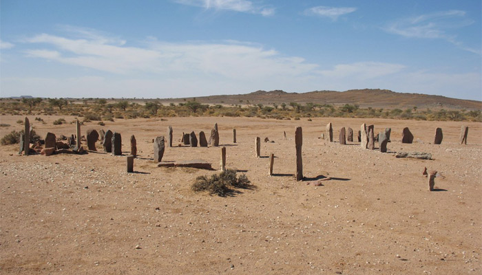
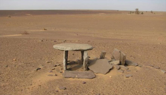


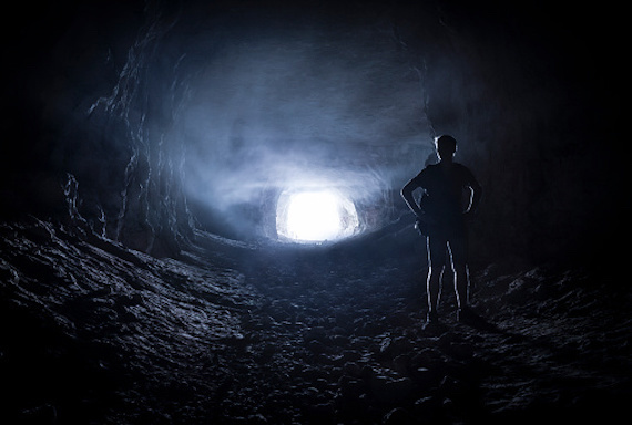

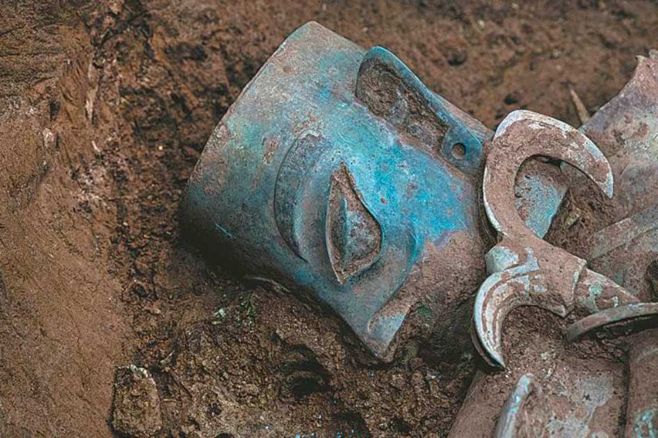
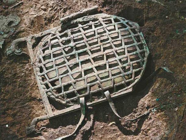
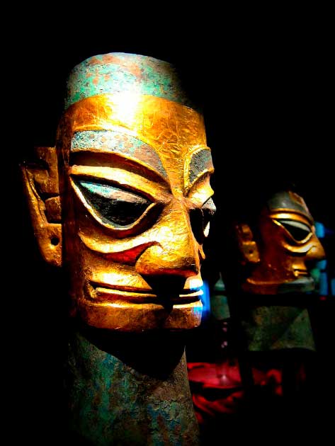

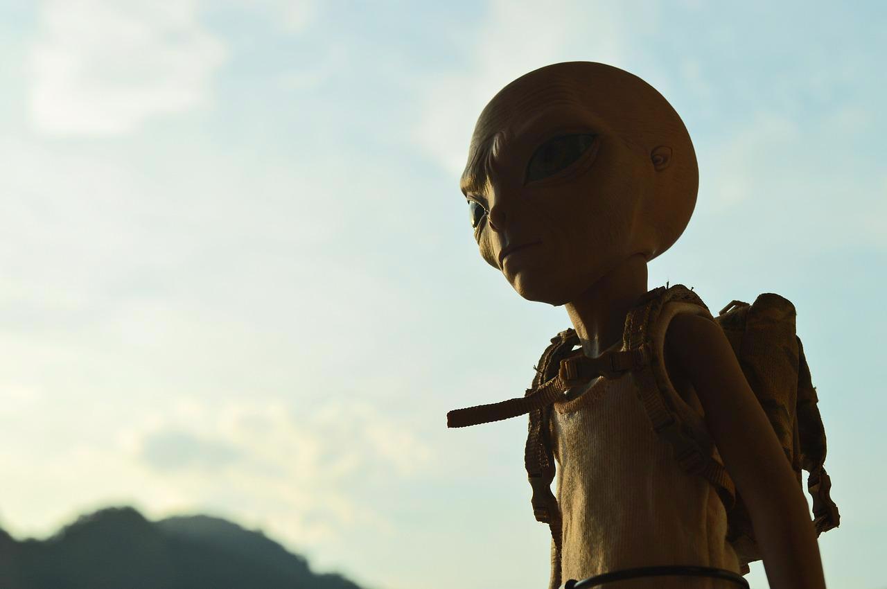
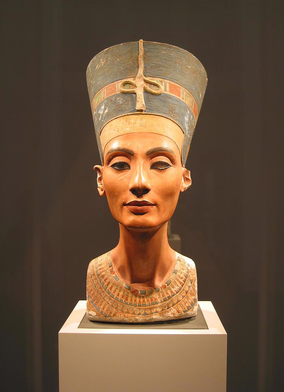


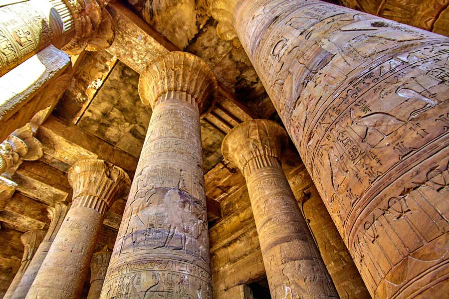
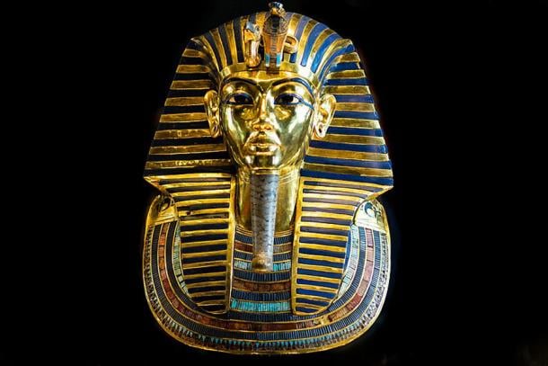
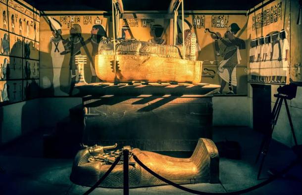
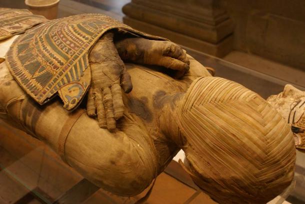
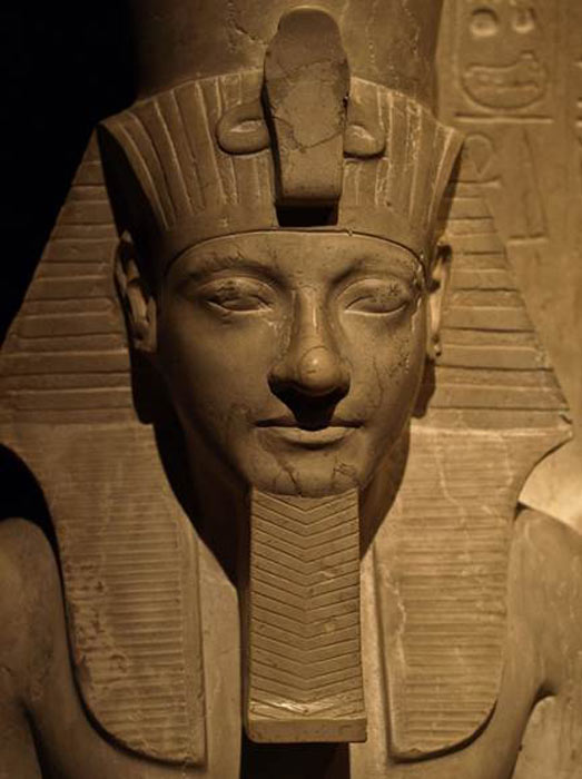

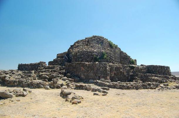
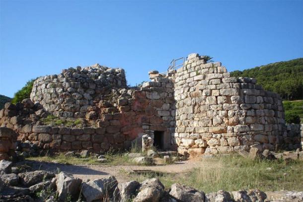
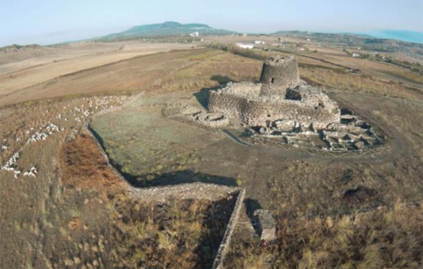
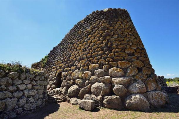
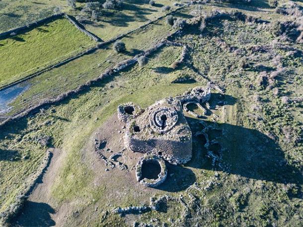


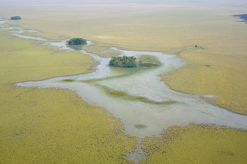
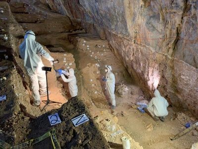
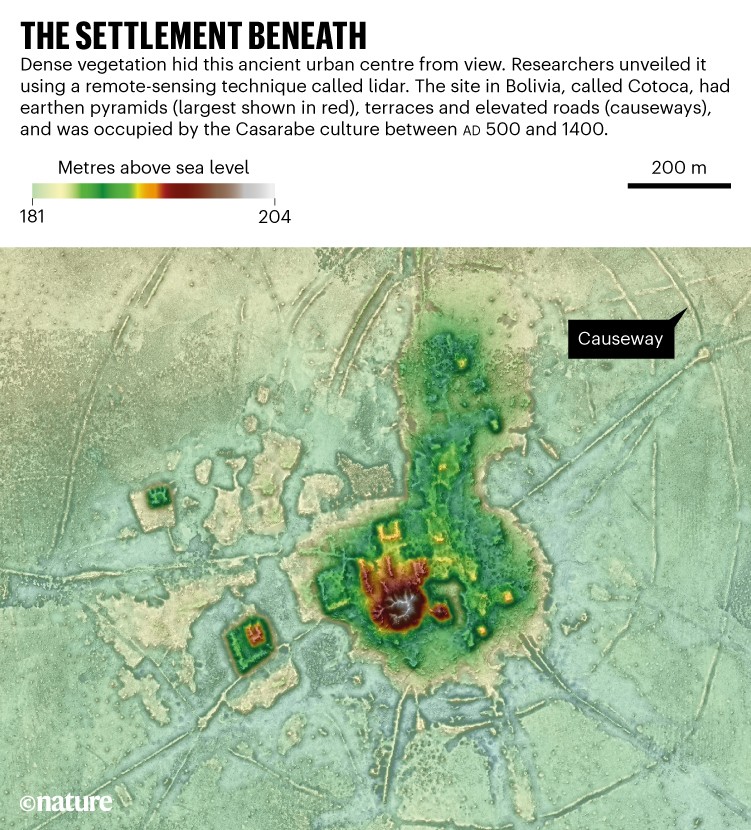
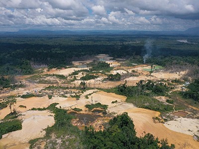
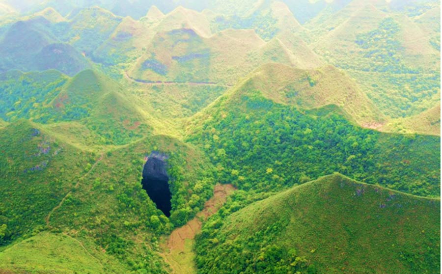
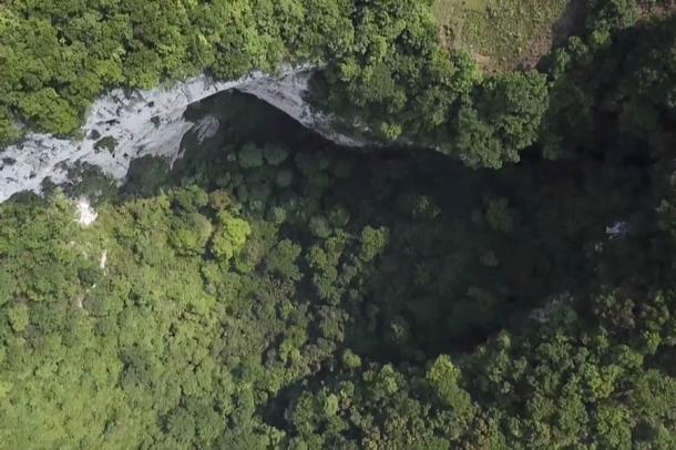
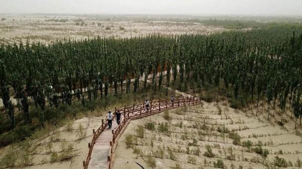


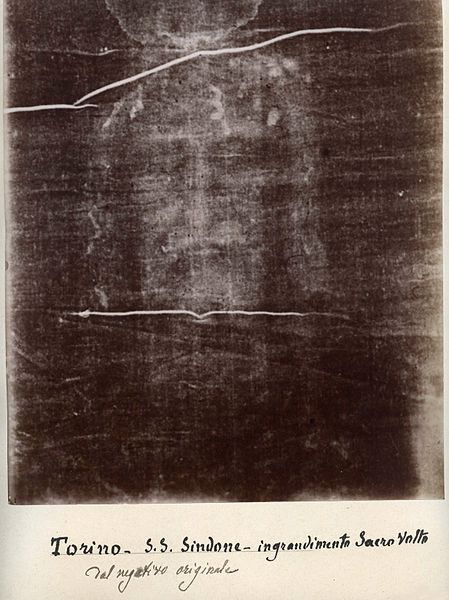


(41).jpg)
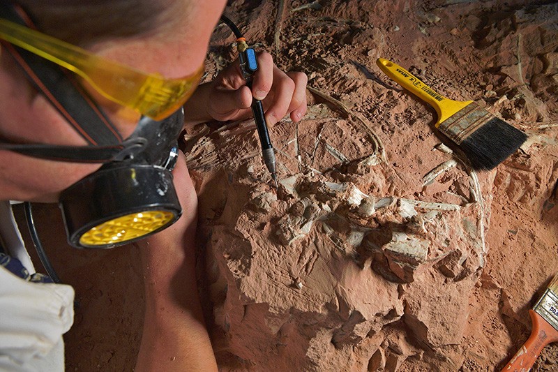
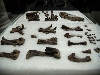
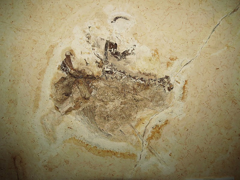
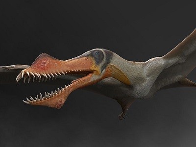
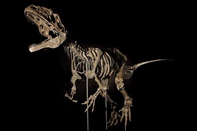
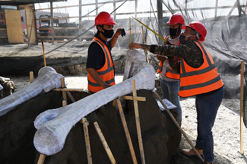
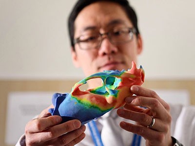
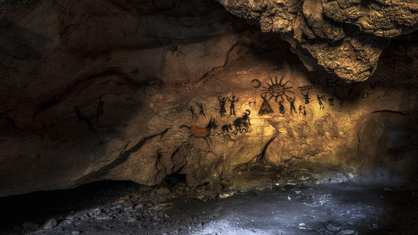


(34).jpg)