The purpose of this blog is the creation of an open, international, independent and free forum, where every UFO-researcher can publish the results of his/her research. The languagues, used for this blog, are Dutch, English and French.You can find the articles of a collegue by selecting his category. Each author stays resposable for the continue of his articles. As blogmaster I have the right to refuse an addition or an article, when it attacks other collegues or UFO-groupes.
Druk op onderstaande knop om te reageren in mijn forum
Zoeken in blog
Deze blog is opgedragen aan mijn overleden echtgenote Lucienne.
In 2012 verloor ze haar moedige strijd tegen kanker!
In 2011 startte ik deze blog, omdat ik niet mocht stoppen met mijn UFO-onderzoek.
BEDANKT!!!
Een interessant adres?
UFO'S of UAP'S, ASTRONOMIE, RUIMTEVAART, ARCHEOLOGIE, OUDHEIDKUNDE, SF-SNUFJES EN ANDERE ESOTERISCHE WETENSCHAPPEN - DE ALLERLAATSTE NIEUWTJES
UFO's of UAP'S in België en de rest van de wereld Ontdek de Fascinerende Wereld van UFO's en UAP's: Jouw Bron voor Onthullende Informatie!
Ben jij ook gefascineerd door het onbekende? Wil je meer weten over UFO's en UAP's, niet alleen in België, maar over de hele wereld? Dan ben je op de juiste plek!
België: Het Kloppend Hart van UFO-onderzoek
In België is BUFON (Belgisch UFO-Netwerk) dé autoriteit op het gebied van UFO-onderzoek. Voor betrouwbare en objectieve informatie over deze intrigerende fenomenen, bezoek je zeker onze Facebook-pagina en deze blog. Maar dat is nog niet alles! Ontdek ook het Belgisch UFO-meldpunt en Caelestia, twee organisaties die diepgaand onderzoek verrichten, al zijn ze soms kritisch of sceptisch.
Nederland: Een Schat aan Informatie
Voor onze Nederlandse buren is er de schitterende website www.ufowijzer.nl, beheerd door Paul Harmans. Deze site biedt een schat aan informatie en artikelen die je niet wilt missen!
Internationaal: MUFON - De Wereldwijde Autoriteit
Neem ook een kijkje bij MUFON (Mutual UFO Network Inc.), een gerenommeerde Amerikaanse UFO-vereniging met afdelingen in de VS en wereldwijd. MUFON is toegewijd aan de wetenschappelijke en analytische studie van het UFO-fenomeen, en hun maandelijkse tijdschrift, The MUFON UFO-Journal, is een must-read voor elke UFO-enthousiasteling. Bezoek hun website op www.mufon.com voor meer informatie.
Samenwerking en Toekomstvisie
Sinds 1 februari 2020 is Pieter niet alleen ex-president van BUFON, maar ook de voormalige nationale directeur van MUFON in Vlaanderen en Nederland. Dit creëert een sterke samenwerking met de Franse MUFON Reseau MUFON/EUROP, wat ons in staat stelt om nog meer waardevolle inzichten te delen.
Let op: Nepprofielen en Nieuwe Groeperingen
Pas op voor een nieuwe groepering die zich ook BUFON noemt, maar geen enkele connectie heeft met onze gevestigde organisatie. Hoewel zij de naam geregistreerd hebben, kunnen ze het rijke verleden en de expertise van onze groep niet evenaren. We wensen hen veel succes, maar we blijven de autoriteit in UFO-onderzoek!
Blijf Op De Hoogte!
Wil jij de laatste nieuwtjes over UFO's, ruimtevaart, archeologie, en meer? Volg ons dan en duik samen met ons in de fascinerende wereld van het onbekende! Sluit je aan bij de gemeenschap van nieuwsgierige geesten die net als jij verlangen naar antwoorden en avonturen in de sterren!
Heb je vragen of wil je meer weten? Aarzel dan niet om contact met ons op te nemen! Samen ontrafelen we het mysterie van de lucht en daarbuiten.
02-06-2025
A virtual soundscape reveals how Derinkuyu may have sounded 2,000 years ago
A virtual soundscape reveals how Derinkuyu may have sounded 2,000 years ago
More than 60 meters below the surface of central Turkey, the remains of Derinkuyu form one of the most complex underground settlements in the world.
A room in the deep interior of the underground city of Derinkuyu. Depositphotos.
It takes time for your eyes to adjust underground. In Derinkuyu, even artificial light falls strangely against the rough-cut walls. The carved tunnels narrow and widen at irregular intervals. Stone staircases descend in switchbacks. Air drifts through vertical shafts. In places, the space feels close and silent. In others, it carries a low, natural echo. There is no sunlight here, but there is architecture. And now, there is sound.
Derinkuyu: The Ancient Underground City Designed to Outlast the Surface
More than 60 meters below the surface of central Turkey, the remains of Derinkuyu form one of the most complex underground settlements in the world. The city reaches down seven levels, with chambers for sleeping, cooking, worship, and gathering. At its height, it may have held as many as 20,000 people. What was once hidden as a defensive structure has become one of the region’s most studied archaeological sites. Now, thanks to new work by Sezin Nas, a researcher at Istanbul Galata University, its sound is also being reconstructed.
Nas specializes in interior architecture and acoustic environments. She has created a 3D virtual soundscape of Derinkuyu based on its spatial forms and material properties. Her focus was not on modern reverb or sonic art, but on physical acoustics, how stone, void, and structure shaped what people heard as they moved through the city.
A new study uses 3D modeling to recreate the sounds of daily life in Derinkuyu, an ancient underground city in Turkey.
Credit: Wikimedia Commons / Nevit Dilmen CC BY 3.0
Reconstructing Derinkuyu’s acoustic design
To build the sound model, Nas selected three spaces for detailed analysis: a church, a domestic living area, and a kitchen. These areas were chosen for their function and variation in spatial volume. Using architectural surveys and acoustic simulation tools, she mapped the surfaces, volumes, and materials. Then, she modeled how sounds, voices, tools, footsteps, fire, would behave in each room.
Derinkuyu was not silent. It was carved from soft volcanic rock called tuff, which absorbs some frequencies but carries others. Ventilation shafts, often mistaken for simple air ducts, served as both airflow systems and vertical communication lines. Nas emphasized this dual function. A single shaft could move both air and sound across levels, linking different parts of the city without direct sightlines.
These design features were not secondary. They were structural. In Nas’s model, sound is shown to travel in ways that mirror social and architectural priorities. Openings near cooking areas allowed for shared sensory cues. Narrow passageways between levels blocked sound, creating acoustic boundaries that likely shaped patterns of privacy and control.
One of the rooms of the intricately carved undergrounds city of Derinkuyu.
Depositphotos.
Derinkuyu was not the only underground city in Cappadocia, but it is the deepest and most spatially complex. Most of the surviving tunnels were cut by hand during the Byzantine period, though earlier phases may date back even further. The site’s layout reflects both practical and defensive concerns. Entrances were concealed. Rolling stone doors could be used to block off corridors. Livestock was housed below ground. Water was sourced from wells that reached deep into the rock.
For centuries, these spaces were known locally but remained undocumented by formal archaeology. Since their rediscovery in the 1960s, sites like Derinkuyu have been measured, mapped, and visited by millions of tourists. Yet until Nas’s work, few efforts had been made to study how they sounded when they were inhabited.
Nas presented her findings at the 188th Meeting of the Acoustical Society of America in May 2025. She described Derinkuyu as an “interior environment on an urban scale,” distinct from open-air soundscapes typically studied in urban acoustics. By reconstructing its sonic behavior, she argues, researchers can better understand how residents used space, communicated, and structured their routines.
The soundscape is not a guess. It is built from data. Nas’s model incorporates not only geometry but also human behavior. Different rooms produce different reverberation times. Kitchens absorb more sound due to their lower ceilings. Churches echo longer. In between, passageways create acoustic transitions that affect how one space flows into another.
Tunnels in every direction make the enormous Derinkuyu complex.
The region of Cappadocia, where Derinkuyu is located, has long been shaped by geology. The area’s soft volcanic substrate allowed for extensive excavation. Entire villages were carved directly into rock faces. By the early medieval period, Christians fleeing persecution expanded these spaces into multi-level underground complexes.
Derinkuyu may have been occupied intermittently over many centuries. Archaeological evidence points to phases of construction and reuse, often tied to periods of threat. Its layout includes features like defensive bottlenecks, food storage rooms, and central gathering spaces. Everything about it was designed to support life under siege.
The physical conditions underground are stable. Temperatures remain constant year-round. The architecture protects against both heat and cold. But living underground also shaped experience in other ways. Light was scarce. Sound carried differently. The absence of wind and open air created an environment defined by enclosed resonance. Nas’s model captures those differences in a way that drawings and photographs cannot.
Architectural design shaped how sound traveled
A collection of images from the underground tunnels of Derinkuyu. Credit: Sezin Nas
“There is a notable gap in the literature regarding the acoustic environment and soundscape of underground cities,” Nas said.
Her research reveals that the city’s ventilation shafts served not only for airflow but also for communication. Voices and sounds could carry between rooms and levels, creating an interconnected audio environment.
“This multifunctional use of the ventilation system strongly highlights the exceptional construction process of the site and plays a central role in shaping its soundscape,” she said.
“Listening to the reconstructed soundscape provides insights into how sound influenced spatial experience, communication practices, and social organization within the underground city.”
Virtual soundscape revives the sounds of daily life in Derinkuyu, the ancient underground city of Turkey
To reconstruct the sound environment, Nas analyzed three key spaces: a church, a kitchen, and a living area. She studied their acoustic properties – how sound would bounce, echo, and fade – based on size, material, and use. The result is a 3D virtual soundscape that reimagines what the city may have sounded like in its prime.
Nas presented her findings on Wednesday during the 188th Meeting of the Acoustical Society of America and the 25th International Congress on Acoustics, held from May 18 to 23.
Sound as a bridge to cultural memory
“Derinkuyu underground city is considered an interior environment on an urban scale,” Nas said. “Listening to the reconstructed soundscape provides insights into how sound influenced spatial experience, communication practices, and social organization within the underground city.”
She hopes her work with the sounds of ancient life in Turkey will encourage greater use of soundscapes in historical research. Beyond technical insight, she views the study as a way to honor and preserve a forgotten layer of cultural identity.
“This research also highlights the role of historical sound environments,” Nas said. It is “an important and often overlooked component of cultural heritage.”
A tool for future design
Beyond archaeology, Nas sees potential for applying this work to modern planning. As urban development pushes into underground infrastructure, understanding how sound behaves in buried environments becomes increasingly important. Most studies of urban acoustics focus on surface cities. Underground spaces are treated as isolated exceptions.
An image of the underground city of Derinkuyu. Depositphotos.
Derinkuyu offers a counterexample. It was not a tunnel or a bunker. It was a functioning urban environment, carved to support collective life. Its soundscape reflects that design. Nas argues that acoustic modeling can contribute to both historical preservation and future construction.
More broadly, the project adds a new dimension to how we study ancient environments. Architecture is often recorded visually. Sound is harder to capture. But for people living in places like Derinkuyu, sound was part of how space was navigated, understood, and controlled. Children learned where they were by the echo of a footstep. Adults heard voices through shafts before they saw faces. The city’s structure taught people how to listen.
What Derinkuyu reveals
The 3D reconstruction of Derinkuyu is not a re-creation of ancient life. It doesn’t guess what people were thinking or feeling. What it does is document how space worked, how it changed sound, and how those changes shaped experience.
Sound was never separate from architecture. It was one of the ways people understood where they were. A child would know a main room by the way it echoed. A parent might hear a pot drop two levels above. The structure itself trained people to listen.
This kind of work is rare. Archaeology usually records what can be drawn or photographed. Sound is harder. It fades. But in places like Derinkuyu, it never really disappeared. The shape of the rooms, the angles of the walls, and the width of the shafts still control how noise moves. That information is still there, waiting to be measured.
By treating sound as something worth studying, not just as an effect, but as part of how a space functioned, Nas adds something to the record that was missing. Not a story, not a theory, but a way to hear a place that once stayed quiet to the outside world. Fascinating!
Derinkuyu Turkey – Explore the Largest Underground City in the World!
Was there an unknown ancient civilization in the Amazon?
Was there an unknown ancient civilization in the Amazon?
LiDAR has revealed roads, ditches, and lost cities under the Amazon rainforest, pointing to an ancient civilization in the Amazon that reshapes what we thought we knew.
Was there an unknown ancient civilization in the Amazon? This is a LiDAR scan showing the remnants of cities.
Was there ever an unknown ancient civilization in the Amazon? Hear me out.
From above, the Amazon appears continuous and unbroken. Dense canopy stretches in every direction, with no visible trace of roads, towns, or walls. Only rivers interrupt the green, winding through a forest that seems untouched.
But when LiDAR technology is used to remove the forest from view, the surface underneath tells a different story. Across parts of the basin, the ground is cut with straight roads, enclosed plazas, large circular ditches, and geometric earthworks. These forms are measured, repeated, and aligned. They do not follow the patterns of erosion or chance. They follow planning.
Some sites cover dozens of hectares. Others are linked by raised paths that extend for kilometers. The scale suggests more than scattered settlement.
For centuries, the Amazon was seen as a wilderness, barely touched by humans. European explorers described thick forests and small, scattered tribes. Later expeditions confirmed this view. They found no stone cities or temples, no written records, no roads or farmland, only isolated communities and a forest that seemed to resist human order.
But earlier accounts had mentioned something different. In the 1500s, explorers like Francisco de Orellana claimed to see large towns along the Amazon River, linked by roads and bordered by cultivated fields. These reports were dismissed as fantasy. The dominant view held that the rainforest’s poor soil could not support agriculture on a large scale, let alone dense population or city building.
The image of a wild, untouched Amazon became an academic fact. The idea of an ancient civilization in the Amazon was pushed to the margins.
LiDAR exposes a buried past
LiDAR, short for Light Detection and Ranging, works by firing rapid laser pulses from an aircraft toward the ground and measuring how long it takes for each pulse to return. In open areas, it maps elevation. In dense forest, it does something more remarkable: it penetrates the tree canopy and captures the shape of the land beneath. When processed, the data strips away vegetation and reveals the raw terrain, down to features less than a meter across.
This tool has transformed archaeology in heavily forested regions, where traditional excavation is slow and limited by visibility. In the Amazon, its impact has been nothing short of revelatory.
Over the past decade, coordinated efforts by research teams in Brazil, Bolivia, and Peru have used LiDAR to scan key regions of the basin. The work is ongoing, but even the earliest surveys changed the conversation. In Acre, western Brazil, more than 450 geoglyphs were identified—massive geometric structures built by shaping the soil into perfect squares, circles, and complex enclosures. These features, often connected by long straight paths, were first spotted in deforested areas but were later confirmed beneath intact forest using LiDAR.
Further south, in the Bolivian department of Beni, LiDAR scans published in Naturein 2022 revealed more than twenty pre-Columbian settlements belonging to the Casarabe culture. These sites were hidden under forest cover, but the scans showed large mounds, platform complexes, central plazas, and long causeways linking settlements across kilometers. Some of the mounds rose over 20 meters and were flanked by defensive ditches and canals. Unlike anything previously documented in Amazonia, these features displayed a high level of planning and construction.
In eastern Peru, similar patterns are now emerging. Preliminary surveys around the Ucayali River basin have uncovered networks of raised fields, canals, and fish ponds, all pointing to long-term human occupation and land management.
What archaeologists are uncovering in the Amazon is not a scatter of isolated villages but networks, and landscapes shaped by sustained human effort. The settlements mapped so far reveal patterns of construction that point to planning across entire regions. Causeways connect one site to the next. Defensive ditches and canals follow coordinated alignments. Plazas, mounds, and platform structures repeat with variations in scale, not concept. These are not random clearings in the forest. They are parts of a larger system built and maintained by organized populations over generations.
These discoveries provide tangible evidence for something once considered speculative: that an ancient civilization in the Amazon modified its environment at scale, building cities, roads, and agricultural systems across a region long believed too hostile to support permanent settlement.
The Casarabe culture and its forest cities
In the Bolivian lowlands of the Llanos de Mojos, a seasonally flooded region once thought too unstable for dense settlement, LiDAR has revealed more than twenty pre-Hispanic sites buried beneath forest cover. These were not isolated hamlets or short-lived encampments. The scans show tiered platform mounds, wide rectangular plazas, elevated causeways, and large reservoirs, built not for survival, but as part of a planned system.
These structures belonged to the Casarabe culture, which occupied the region between 500 and 1400 CE. Their cities were constructed from earth and timber, materials that blend back into the forest over time. But what remains shows scale, repetition, and organization. Roads run in straight lines for up to ten kilometers. Mounds rise in tiers above the wetland floor. Defensive ditches form outer rings around settlements.
Some of the largest sites cover more than 100 hectares. Between them, smaller communities appear at regular intervals, connected by raised paths. This distribution suggests a regional layout, not just individual settlements. The population spread across these networks may have numbered in the tens of thousands, though no definitive count exists.
Earlier assumptions held that the Llanos de Mojos could not support permanent habitation. The Casarabe defied that view by modifying the landscape itself. They raised fields above flood zones, constructed storage ponds, and directed water flow through canals. Their forest cities did not rely on stone, but they were built with knowledge, labor, and long-term intent.
Traces across the Amazon basin
The evidence uncovered in Bolivia aligns with a broader pattern found throughout the Amazon. In Brazil’s Acre state, aerial surveys and LiDAR scans have recorded more than 450 geoglyphs: large geometric earthworks shaped into circles, squares, and intersecting forms. Many of these structures date back as far as 1000 BCE. They are often aligned to cardinal directions and grouped in clusters, suggesting recurring design principles rather than isolated construction. While their precise function is still being examined, their scale and consistency indicate planned effort across multiple generations.
Elsewhere in the basin, other signs of deliberate landscape modification have emerged. In parts of Brazil, Peru, and Bolivia, archaeologists have documented networks of raised agricultural fields, canal systems, and fish ponds. These were not experimental features but large-scale infrastructure. Their design reflects an understanding of seasonal flooding, water management, and soil preservation.
One of the most enduring traces of past habitation is the widespread presence of Terra Preta, or “dark earth.” This soil is markedly different from the naturally acidic and nutrient-poor soil that dominates the region. It contains high concentrations of charcoal, bone fragments, plant material, and organic waste. Created through the controlled use of fire and composting over time, Terra Preta retains its fertility for centuries. It is found in patches across the basin, often near ancient habitation zones, and sometimes in layers several meters deep.
The existence of Terra Preta suggests that farming in the Amazon was not only possible but sustained through intentional soil management. Its spread, coupled with the engineered landscape features, supports the presence of an ancient civilization in the Amazon that worked with its environment at scale, designing for stability rather than short-term subsistence.
Collapse and forest return
The forest did not dismantle these systems. It covered what people no longer maintained.
Following European arrival in the sixteenth century, infectious diseases—smallpox, measles, influenza—moved faster than colonizers themselves. They spread along trade routes and rivers, reaching communities deep in the interior. With no immunity, Indigenous populations declined rapidly. In many regions, the loss exceeded 80 percent within a few generations.
As populations fell, infrastructure fell with them. Roads became impassable. Canals and reservoirs clogged with sediment. Agricultural fields, once raised above seasonal floods, were abandoned and overtaken by vegetation. Without labor to clear and repair, the landscape returned to forest.
Trees grew over plazas. The causeways disappeared beneath vines and soil. Without stone architecture or written archives, little survived in a form visible to later explorers. Most accounts dismissed the forest as untouched wilderness.
Oral memory endured in some communities, but it lacked the physical evidence needed to reshape historical understanding. That evidence remained underground, until LiDAR began revealing the patterns once more.
What counts as civilization
The evidence of an ancient civilization in the Amazon challenges long-standing assumptions shaped by stone-built cultures. In many regions, complexity has been measured by the presence of masonry, inscriptions, and centralized rule. None of these elements are prominent in the archaeological record of the Amazon. Yet the patterns revealed by LiDAR—straight roads, tiered mounds, structured settlements, and water systems, show consistent planning over large areas.
The infrastructure in these regions was made from earth, not stone. Roads were built by raising and compacting soil. Ditches were cut with precision and served as boundaries, drainage, or transport channels. Plazas and platform mounds follow repeating dimensions. These features required organized labor, tools, and long-term upkeep. Their scale and repetition suggest cultural norms that extended across settlements.
In several areas, specific tree species are found in higher densities near archaeological sites. These include Brazil nut, cacao, and palms useful for food or construction. The distribution patterns are not random. Researchers studying forest composition have identified these clusters as possible indicators of past cultivation or forest management. Some trees may have been planted, protected, or selected over generations. These practices shaped the surrounding ecology and altered the forest structure in ways still visible today.
There are no monumental ruins, but the remains are consistent. Canals, causeways, mounds, and engineered soils appear together. The data supports long-term settlement and resource planning across regions previously thought to be sparsely occupied. The evidence reflects systems designed to function within the forest, using available materials and knowledge adapted to seasonal change.
The traces left behind do not resemble those of known empires, but they show sustained presence and control over terrain. What survives is not a monument, like we see elsewhere. What we are seeing in the amazon is a record of construction, maintenance, and adaptation across generations. This, too, fits within the definition of civilization.
What remains to be uncovered
Now there is an unimportant thing to remember. Less than one-tenth of one percent of the Amazon has been mapped with LiDAR. In that limited coverage, archaeologists have already recorded hundreds of geoglyphs, roads, and settlement sites. The findings suggest that large parts of the forest may still contain the remains of pre-Columbian construction, buried under vegetation and unrecorded.
Research teams in Brazil and Bolivia continue to expand the scanned areas. Each survey adds new features, ditches, mounds, causeways, canals, that had not been visible by satellite or ground inspection. In some cases, previously studied sites have been reinterpreted in light of this new data. Patterns have become clearer. Settlements once thought isolated are now understood as connected.
Elsewhere in the basin, sites are being lost. Deforestation for pasture, timber, and agriculture is clearing land faster than it can be studied. Earthworks that remained intact for centuries are being cut through by machines or leveled for planting. In many areas, no record is made before the ground is altered.
The distribution of known sites suggests that the visible record represents only a fraction of what exists. Large regions with similar soil, river access, and forest cover remain unscanned. The scale of human modification across the basin is still being measured. Until more of the forest floor is revealed, the full extent of ancient activity remains incomplete.
Why are pyramids everywhere? A global pattern or universal logic
Why are pyramids everywhere? A global pattern or universal logic
Ancient pyramids appear on almost every continent, built by civilizations that never met. Is it coincidence, convergent logic, or a forgotten connection?
Why are pyramids everywhere? This is a beautiful photo of the Great Pyramid at sunset.
Why are pyramids everywhere? In the Egyptian desert, the pyramids stand still under a shifting sky. Their limestone blocks, weathered and pale, still hold their lines after more than four thousand years. The shape is deliberate: wide at the base, narrowing as it climbs, ending in a point that once caught the sun.
Half a world away, the jungle presses against broken stone. In Guatemala, temple steps rise above the trees, stacked high by Maya masons who built for ceremony, not burial. Their pyramids were climbed, not sealed. The shape is familiar, but the meaning was different.
The most well-known of these is the tomb of Qin Shi Huang, which remains sealed beneath a massive earthen pyramid surrounded by a buried army of terracotta soldiers.
These structures have no shared blueprint. Their builders never met, never traded, never wrote of one another. They spoke different languages and worshipped different gods. Still, the shape repeats. From the Andes to the Nile, from the Sahara to the Yangtze, the pyramid keeps showing up, always rising, always reaching.
A rare view of the summit of the Great Pyramid of Giza.
The shape that touches the sky
The pyramid is not just a symbol. It’s a shape grounded in physics and built from the simplest logic of weight and balance. A wide base. Sloping sides. As the structure rises, it narrows. That design doesn’t happen by accident. When you stack stone or mudbrick and let gravity do the rest, the most reliable shape you get is a pyramid. The weight holds itself together. It pushes down, not out. And because of that, pyramids can stand for thousands of years without columns or internal framing. They’re not easy to build, but we are told and reassured by mainstream
In Egypt, the earliest pyramid-like structures are believed to have begun as mastabas: rectangular tombs with flat tops and sloped sides. Around 2600 BCE, that changed. Djoser, a king of Egypt’s Third Dynasty, commissioned his architect, Imhotep, to stack mastabas into tiers. That experiment became the Step Pyramid at Saqqara, the first pyramid in Egypt. Later builders and architects are believed to have refined the idea, smoothing the angles and expanding the scale. By the time of Khufu, the shape had reached its peak: the Great Pyramid at Giza, aligned almost perfectly to the cardinal points, built from more than two million blocks of stone.
Step pyramid of Djoser. Credit: Jumpstory
Some of those blocks are still difficult to explain. The core limestone came from quarries nearby, but the smooth outer casing, now mostly gone, came from Tura, across the river. The granite beams above the King’s Chamber, some weighing more than 50 tons, were transported from Aswan, over 800 kilometers to the south. No records explain how they were moved. Ramps are the leading theory, but no ramp system found so far fully accounts for the scale, precision, and elevation involved. For all the study and excavation, the logistics behind the Great Pyramid remain one of archaeology’s most persistent puzzles. And one of my favorite mysteries about the pyramids.
In Central America, the pyramid took on a different role. The Maya, Aztec, and earlier cultures like the Olmec built stepped pyramids not as tombs but as stages. These were sites of ceremony, processions, and offerings to the gods. Temples sat at the top. Staircases ran down the middle. Unlike the sealed pyramids of Egypt, these were designed to be climbed. Many were built over earlier structures, layer by layer, as each new ruler added their mark to the past. One of the largest pyramids on Earth is located in North America, in the city of Puebla. It is called the Great Pyramid of Cholula.
How the Pyramid of Cholula supposedly looked like.
Back to Africa and Egypt. To the south of Egypt, in what is now Sudan, the Nubian pyramids rose after Egypt’s golden age had faded. The Kingdom of Kush built hundreds of small, narrow pyramids in the desert near Meroë and Napata. They were sharper in angle, often just 6 to 30 meters tall, but their purpose was similar, to honor and bury kings, queens, and elites. They reflected Egypt’s influence, but with distinct local style.
In China, the shape appears again. The burial mound of Qin Shi Huang, the first emperor to unite China, was built in the 3rd century BCE and shaped like a low, flat pyramid. It’s still sealed. Remote sensing suggests a vast complex beneath the soil, rivers of mercury, miniature palaces, walls — but the tomb itself remains untouched. Other imperial mausoleums in the region follow the same form: wide at the base, rising to a flat point, then covered in earth and left to blend into the hills.
Independent invention or shared idea?
As much as some would like to believe otherwise, there’s no evidence that ancient Egypt and the civilizations of the Americas ever made contact. The oceans were too wide, the timelines too far apart. They didn’t share a language, trade goods, or leave behind anything that connects them. And yet, both built pyramids. Large, angular, enduring. The resemblance has confused and intrigued scholars for over a century. It still does. But most experts agree: it’s coincidence.
Archaeologists call it convergent design. The pyramid solves practical problems. If you’re stacking stone or mudbrick and want the structure to last, gravity does most of the planning for you. Build up, and the shape naturally tapers. It’s stable. It’s strong. And if the base is wide enough, it will stand for a very long time. Just look at the pyramids in Egypt.
One of the most curious ancient Egyptian megastructures – the Bent Pyramid. Credit: Yann Arthus-Bertrand
The pyramid is what happens when you stack stone long enough, said one archaeologist when I was living in Mexico (Yup, I lived there for over 15 years). He argued that it is the most efficient way to build tall without needing much engineering.
That’s true in theory maybe. The shape is efficient. But in practice, building a pyramid wasn’t easy. It took organization, manpower, and long-term planning. Moving heavy stone, lifting it into place, and keeping the structure aligned over dozens of vertical meters demanded far more than instinct. So we have to remember that these weren’t casual constructions. Some pyramids, like for example Cholula, took several generations to build.
And also, practicality wasn’t the only reason pyramids were built, either. In many places, height carried symbolic weight. Mountains were often seen as sacred, places where gods lived or where the living could reach toward the sky. By building upward, people recreated that connection. A pyramid placed the dead, the divine, or the ceremonial high above the ground. That elevation wasn’t just by chance or just because a king back in the day wanted something pointy.
The shape also served power. A pyramid stands out. It can be seen from far away. It doesn’t need decoration to feel important. It can be built over time, layer by layer, each generation adding to the one before (just like cholula). It doesn’t crack or lean, well at least not if it was built right. For rulers who wanted to mark the land, or be remembered long after they were gone, it was a shape that worked.
A pattern across continents
Each region built its own kind of pyramid, shaped by the materials they had, the way their societies worked, and what they believed. In Egypt, mainstream experts maintain that the pyramids were tombs (I kind of disagree). In Mesoamerica, they were said to have been used as temples. In China, they sealed emperors underground. In Sudan, they marked the graves of royalty. The designs varied, but the basic form stayed the same, wide at the base, rising to a point.
In Egypt, pyramid construction reached its height during the Old Kingdom. As political power and resources declined, it is believed that the building slowed and eventually stopped. In Mesoamerica, the tradition lasted much longer. The Maya were still building pyramids into the 15th century, often adding new layers on top of older ones. In Sudan, the Napatan and Meroitic kingdoms revived the form long after Egypt had moved on. Their pyramids were smaller and steeper, but just as symbolic.
The Chinese pyramids are harder to spot. Most are covered in earth and blend into the landscape. The largest belongs to Qin Shi Huang, the first emperor of a unified China. His tomb has never been opened, but surveys suggest there’s a vast underground complex beneath it, palaces, walls, and rivers made of mercury.
A screengrab showing an aerial view of the Pyramid of El Cerrito. Image Credit: Video Master Producciones / Youtube.
Why the pyramid worked
If you asked me to reply logically, I would probably say that a pyramid holds its own weight. That’s the simplest reason it shows up in so many ancient cultures. The wider the base, the more weight it can carry above. When people were building with stone, without mortar or steel, this mattered. You could stack layer after layer, and the shape would stay intact. It didn’t need columns or supports. It stayed up because of the way it was built. The question remains, however, how some of the supermassive stones were transported in ancient Egyp, and stacked to the height the stones were stacked. But then again…The structure wasn’t the only reason. Height made a difference. A pyramid could rise above everything around it. In open landscapes, it became a fixed point on the horizon. For rulers, that visibility meant power. It gave their cities a center. It reminded people who was buried there, or who held the land.
In many places, height also carried spiritual meaning. Mountains were seen as sacred. They stood between the world of people and the world of gods. By building upward, ancient cultures brought that idea into daily life. A pyramid wasn’t a mountain, but it borrowed the shape. It gave form to beliefs that were otherwise invisible.
There are other ideas, too. Some people believe that different pyramid-building cultures inherited the design from a lost civilization. Others say there was contact between continents long before recorded history. A few suggest more unusual explanations. Archaeologists don’t accept these theories, because they aren’t supported by evidence. But their persistence shows how much mystery the pyramid still holds. For something made of stone, it remains hard to pin down.
Magnetic Shifts and Human Migrations Traced in Lake Chala, 150,000 Years Old
Deep in the green border of Kenya and Tanzania is a volcanic crater lake that quietly keeps an ancient geophysical journal. For thousands of years, Lake Chala has lain in a volcanic caldera, its calm waters hiding the seismic and geomagnetic theatrics playing out over deep time. Scientists drilling into its bottom sediments recently have revealed a 150,000-year history of Earth's magnetic oscillations—a finding that bridges planetary physics to early Homo sapiens migrations!
Lake Chala's location, shielded from raging rivers and floods, and a gentle runoff from the crater's surrounding ridges and forests, has resulted in sediment layers so undisturbed and linear that they are a virtual perfect geological timeline. Unlike most lake cores convoluted with flood sediments or seismic events, the sedimentary record in Lake Chala holds year-by-year histories, and it is thus an unrivaled platform for paleoenvironmental study.
It was here that Dr. Anita Di Chiara and colleagues from Italy's National Institute of Geophysics and Volcanology pulled out a core sample that is now a key to reconstructing the earth's ancient magnetic behavior. They’ve published their finds in the journal Geochemistry, Geophysics, Geosystems.
Reading the Magnetic Script of Earth
As volcanic ash and other sediment settle onto a lake bottom, they capture microscopic magnetic grains. These grains align themselves to the Earth's magnetic field of the day, behaving as tiny frozen compass needles. There have accumulated on top of each other in a vertical record of geomagnetic history over thousands of years—a chronology carefully deciphered by Di Chiara's group.
Whereas polar magnetic records are plentiful, equatorial information such as that of Lake Chala is scarce. And that is its value. Earth's magnetic field originates with the chaotic flow of its molten outer core, and whereas pole-based records show the wild oscillations and reversals, an equatorial view can show the more subtle, world-encompassing changes.
"Having an equatorial record is sort of special," Di Chiara said in an interview with Live Science. "It's a key piece in the puzzle."
Following the Magnetic Pulse of the Past
The Lake Chala sediment core chronicles six large geomagnetic excursions—periods during which Earth's magnetic field tottered, lost strength, or temporarily reversed without actually going through a complete pole reversal. One of these excursions is completely new to the geological record and provides new information on the unstable nature of Earth's core.
These outings are not innocent curiosities. The field protects the planet against solar wind—barrages of charged particles that can trouble satellites, radio communications, and even planetary climate patterns. When the field weakens, Earth lies open to enhanced cosmic radiation.
But how did these variations affect people living in and around Lake Chala in ancient times?
A Landscape Witness to Human Odyssey
Between 150,000 years ago and now, Lake Chala's sediments record a period of intense human transformation. It was the time the anatomically modern humans emerged, left Africa, and went on to fill Eurasia.
Although a magnetic anomaly may not have been detectable to early Homo sapiens, its environmental impact—alterations in climatic patterns, radiation flux, or even animal migration—would have quietly influenced the survival tactics and migrations of early human societies.
Het lijkt op de foto een gruwelijk beest, de pas ontdekte Mosura fentoni. Gelukkig is hij maar zo groot als je wijsvinger (en al heel lang uitgestorven). Die drie ogen en enorme scharen worden dan toch iets minder angstaanjagend.
Het zijn paleontologen van het Canadese Royal Ontario Museum die het 506 miljoen jaar oude roofdier hebben gevonden. Ze troffen fossielen van het beestje aan op de beroemde vindplaats de Burgess Shale in Yoho National Park en schreven erover in een artikel in het tijdschrift Royal Society Open Science.
De radiodonten De Mosura fentoni heeft een ronde bek met tanden en een lichaam met zwemvliezen aan de zijkant. Het dier maakte deel uit van een uitgestorven groep uit het Cambrium, de radiodonten. Ook de veel beroemdere meterslange grote broer Anomalocaris canadensis behoort daartoe.
Bekijk hier beelden van de Anomalocaris canadensis, het meest iconische lid van de radiodonten. Hij kon wel een meter lang worden en is voor het eerst beschreven in 1892.
Maar Mosura heeft ook een uniek kenmerk dat geen enkele andere radiodont heeft: een buikachtig lichaamsdeel aan de achterkant, dat uit meerdere segmenten bestaat.
“Mosura heeft zestien dicht op elkaar zittende segmenten met kieuwen aan de achterkant van zijn lichaam. Dit is een mooi voorbeeld van evolutionaire convergentie met moderne groepen, zoals degenkrabben, pissebedden en insecten, die ook een aantal segmenten hebben met ademhalingsorganen aan de achterkant van het lichaam”, legt onderzoeksleider Joe Moysiuk uit. Hij is conservator paleontologie en geologie in het Manitoba Museum. Waarom de Mosura dit heeft, is nog niet helemaal duidelijk, maar het heeft vermoedelijk te maken met een voorkeur voor een bepaalde habitat of gedragskenmerken, die een efficiëntere ademhaling vereisten.
De zeemot Het roofdier heeft als bijnaam ‘de zeemot’. Door de brede zwemvliezen in het midden en het smalle achterlijf lijkt hij enigszins op een mot. Het heeft zelfs geleid tot de officiële naam. Die verwijst namelijk naar een fictief dier uit het Japanse filmgenre kaiju (letterlijk: vreemd beest), waar de Mothra er eentje van is. De Mosura is echter slechts in de verte verwant aan echte motten en vertoont net zo goed gelijkenissen met spinnen, krabben en miljoenpoten. Het dier behoort tot een veel diepere tak in de evolutionaire stamboom van deze dieren, die gezamenlijk bekendstaan als geleedpotigen.
“Radiodonten waren de eerste groep geleedpotigen die zich vertakten in de evolutionaire stamboom, dus ze bieden belangrijke inzichten in de voorouderlijke eigenschappen van de hele groep. De nieuwe soort laat zien dat deze vroege geleedpotigen al verrassend divers waren en zich op een vergelijkbare manier aanpasten als hun verre moderne verwanten”, zegt medeonderzoeker Jean-Bernard Caron, curator bij ROM.
Unieke anatomische details De fossielen leveren nog meer interessante informatie op over de Mosura. Zo laten ze details zien van de inwendige anatomie, waaronder elementen van het zenuwstelsel, de bloedsomloop en het spijsverteringskanaal. “Er zijn maar heel weinig fossiele vindplaatsen op de wereld die op dit niveau inzicht bieden in de zachte anatomie. We zien sporen van zenuwen in de ogen die betrokken waren bij de beeldverwerking, net als bij levende geleedpotigen. De details zijn verbazingwekkend”, aldus Caron.
Open bloedsomloop In plaats van slagaders en aders zoals wij die hebben, had Mosura een ‘open’ bloedsomloop, waarbij het hart bloed in grote inwendige lichaamsholten pompte die lacunae worden genoemd. Deze lacunae zijn bewaard gebleven als reflecterende vlekken die het lichaam vullen en doorlopen tot de zwemvliezen in de fossielen.
“De goed bewaarde lacunae van de bloedsomloop in de Mosura helpen ons bij het interpreteren van vergelijkbare, maar minder duidelijke kenmerken die we eerder in andere fossielen hebben gezien”, voegt Moysiuk toe. “Het blijkt dat deze structuren op grote schaal bewaard zijn gebleven, wat de oeroude oorsprong van dit type bloedsomloop bevestigt.”
61 fossielen De 61 fossielen van Mosura zijn op een na allemaal tussen 1975 en 2022 door het ROM verzameld, voornamelijk in de Raymond Quarry in Yoho National Park. “Museumcollecties, oud en nieuw, zijn een bodemloze schat aan informatie over het verleden. Als je denkt dat je alles gezien hebt, hoef je alleen maar een museumlade open te trekken”, besluit Moysiuk.
Titanokorys gainesi.
De Burgess Shale De Burgess Shale is een wereldberoemde fossiellocatie in Canada, bekend om zijn uitzonderlijk goed bewaarde fossielen uit het Cambrium, meer dan 500 miljoen jaar geleden. Het ligt in de Rocky Mountains van British Columbia en werd in 1909 ontdekt door de Amerikaanse paleontoloog Charles Doolittle Walcott. Het bijzondere aan de fossielen is dat ook zacht weefsel, zoals spieren, ingewanden en voelsprieten bewaard zijn gebleven. Eerder schreven we al over een andere nieuwe radiodont die daar is gevonden, de Titanokorys gainesi. Die is niet zo groot als zijn beroemde soortgenoot, maar met een geschatte lengte van een halve meter nog altijd reusachtig voor zijn tijd. “Dit is één van de grootste dieren uit het Cambrium ooit gevonden”, aldus onderzoeker Jean-Bernard Caron destijds.
There’s a sunken structure older than the pyramids resting beneath the sea off Israel’s coast — part of a 9,000-year-old village known as Atlit Yam.
Submerged in shallow water just a few hundred meters from the shoreline, Atlit Yam remained hidden for thousands of years. It wasn’t swallowed by sand or jungle, but by the sea itself, it was actually the result of a sudden and catastrophic event in the distant past. You might even call it the Atlantis of the Middle East.
What has been uncovered since its discovery has challenged long-held assumptions about the timeline of civilization, agriculture, engineering, and how early humans lived together in permanent communities.
Atlit Yam is not just older than the pyramids. It’s older than writing, wheels, and metallurgy. And yet it shows signs of sophisticated planning, water management, and even ceremonial architecture. Despite all this, no one can say for sure who built it, what they believed, or why they vanished so suddenly.
How a sunken structure older than the pyramids was preserved beneath the sea
The site came to light in 1984, when marine archaeologist Ehud Galili was conducting a routine survey of the seabed near the modern Israeli town of Atlit. What first appeared to be random stone formations turned out to be the remains of a large, carefully organized Neolithic settlement. Today, Atlit Yam lies about ten meters underwater, spread across more than 40,000 square meters.
Radiocarbon dating places the site between 6900 and 6300 BCE, making it thousands of years older than Egypt’s earliest monumental architecture. Excavations have revealed rectangular stone houses with plastered floors, open courtyards, hearths, storage pits, and even an elaborate freshwater well dug directly into the coastal aquifer. Surrounding the village are tools, fishing gear, animal bones, and remnants of grain, suggesting a population that relied on a mix of farming and fishing.
The reason Atlit Yam is so well-preserved has everything to do with the water. The sea didn’t erode it. It protected it. Like many other sites across the world. The mud and silt created a perfect seal, preserving not just stonework but fragile organic materials as well. The sunken structure older than the pyramids is one of the best-preserved prehistoric coastal sites in the world precisely because of its sudden submersion.
The stone circle at the heart of the mystery
When I said structure, this is what I was mainly referring to.
Near the center of Atlit Yam, archaeologists uncovered a semicircle of seven massive stones, each one standing upright around what was once a spring. They are not scattered or toppled. They were placed with care, each upright block locked into position nearly 9,000 years ago.
Some of them weigh several tons. And yet they were moved, raised, and aligned by hand, without the help of wheels or metal tools. Their surfaces are smooth in places, but not untouched. Shallow basins have been carved into the tops of some, subtle recesses that hint at purpose. Perhaps they once held water. Perhaps something else.
No one knows for certain why the stones were arranged this way. The arc they form is too precise to be accidental. Some researchers suggest they may have served as a gathering place, a site for shared rituals or seasonal ceremonies tied to water. Others believe the alignment might be more than symbolic. A few have proposed that the stones were positioned in relation to the movement of the Sun or stars. I believe the latter.
Their arrangement invites comparison to other megalithic sites like Stonehenge, but this one is older by thousands of years. If the people of Atlit Yam were observing the sky and measuring time through stone, it would place the beginnings of astronomy far earlier than most histories allow. And I concur.
Stonehenge’s stones formed during the time of the dinosaurs. Credit: Jumpstory
What is peculiar is that there are no carvings here. There are no calendars. There are no visible signs to confirm the theory. What remains is the weight of the stones, their deliberate placement, and the quiet sense that they once meant something more. Nothing has been proven. But to stand in front of them, even underwater, is to feel the pull of a question we have not yet learned how to ask.
Burials, disease, and sudden destruction
Among the site’s most poignant discoveries are its graves. Archaeologists found several human burials within the village, including one especially intimate example: a woman and child interred together, their bodies laid out with care and respect. The grave offers a rare look at social bonds and burial customs from a time before writing.
Scientific analysis revealed the woman had suffered from tuberculosis, making her remains one of the earliest known cases of the disease in the archaeological record. This pushed the origin of tuberculosis thousands of years earlier than previously believed.
But while individual deaths are expected in any community, the end of Atlit Yam itself was anything but ordinary. The entire site appears to have been abandoned all at once, with no evidence of warfare, famine, or prolonged decay. The leading theory is that a massive tsunami — triggered by a volcanic collapse on Mount Etna in Sicily — swept across the eastern Mediterranean and drowned the entire village. Geological deposits along the coast support this theory.
A disaster of that scale would have been sudden and devastating. The people of Atlit Yam likely had no time to flee. Their homes, belongings, and lives were simply engulfed.
A glimpse into the lives that once moved through these walls
Nothing about Atlit Yam feels accidental. The layout of its homes, the channels that once carried water, the central well — they all speak to people who understood how to live in one place, and how to live together. This was a community with structure. Not just in the stones, but in the way they approached survival
They farmed the land, harvested the sea, and buried their dead with care. They planned where to place their homes and how to access freshwater. That kind of order doesn’t appear without conversation, cooperation, and shared memory.
What they left behind may be even more telling. Among the artifacts found at the site are tools made from obsidian, a volcanic glass that doesn’t occur naturally along the Israeli coast. The closest known sources lie in modern-day Turkey, hundreds of kilometers to the north. That kind of material doesn’t drift in with the tide. It has to be carried, traded, passed hand to hand. Whatever their route, the people of Atlit Yam had ties that reached beyond the shoreline.7
Atlit Yam was a functioning settlement. The layout of the homes, the location of the well, the presence of storage areas and work spaces — all of it points to people who understood how to live in one place for a long time. Nothing about the site suggests a seasonal camp.
They worked with the land, made use of the sea, and organized their space with purpose. Then the sea changed, and their world disappeared.
The people behind Atlit Yam have no name
Atlit Yam offers no names, no written words, no symbols we can follow. The people who built this place left behind walls, wells, and stone tools, but not their voice. No inscription marks who they were, where they came from, or how they saw the world around them.
Some archaeologists suggest the site was part of a larger Neolithic tradition that once stretched across the Levant. Others believe it may have belonged to a distinct coastal culture, shaped by the shoreline and the sea. There are theories, but no certainty. What remains is a site without a signature.
Much of it is still buried beneath layers of silt. What has been uncovered is only a fragment. Working underwater is slow. The tides shift, sand drifts, and every excavation demands patience and care. It may take years before the rest of Atlit Yam comes into view, if it ever does. Whatever answers remain are still underwater.
What the site does show, even in its silence, is a community that had settled into a way of life. The homes were carefully built. The dead were buried with intention. The well was dug deep, and the carved stones placed around the spring suggest that meaning, not just survival, shaped this place.
There is no gold at Atlit Yam. No mythic ruins or towering monuments. What survives is something quieter. A village that stayed intact because it vanished all at once, pulled beneath the sea in a single, irreversible moment. The memory of its people wasn’t passed down. It was preserved by accident.
Now, as archaeologists work to recover its outline, stone by stone, we’re left to imagine what was lost. These people were watching the skies, digging wells, growing food, and burying their dead before the pyramids were even a thought. They are not mentioned in any history, but their presence remains, just below the surface.
The sea covered their world, but it did not erase it. And in that silence, we begin to hear their story.
RELATED VIDEOS
The Lost City of Atlit-Yam | FULL DOCUMENTARY
9,000-Year-Old Underwater City! | The Lost Village of Atlit Yam #israel #palestine #history
The ancient stone rings that predate writing. An illustraton of the so-called Senegambian stone circles.
Curiosmos.
We often assume civilization began with writing. But across continents, long before alphabets or empires, ancient people carved meaning into stone and arranged it into circles. These ancient stone rings, some more than 7,000 years old, are aligned with the sun, moon, and stars. Their builders had no known writing system, no cities, and no monuments, only the sky above and stone beneath.
What drove them to create these structures? Were they calendars? Ceremonial sites? Cosmic memory devices? The answer may lie hidden in the way these circles track time, space, and something more timeless, human curiosity.
The first circles of meaning
The oldest stone structures in the world are not pyramids or palaces, but rings. They appear in deserts, forests, savannas, and steppes. Though separated by thousands of miles and built by unrelated cultures, these circles share one thing: alignment with the sky.
Archaeologists have found ancient stone circles that predate writing by thousands of years. Some track solstices. Others point to bright stars. All of them suggest a deep understanding of cycles and a need to record them in permanent form.
Why circles? The shape has no beginning or end. It reflects continuity of seasons, of time, of life and death. That universality may explain why circles appear in cultures that never met, speaking languages no longer remembered.
Nabta Playa: A stone calendar in the desert
A photograph showing the stones of Nabta Playa.
In southern Egypt, buried beneath sand for millennia, lies Nabta Playa, a site older than Stonehenge. Built around 7,000 years ago by nomadic pastoralists, it features upright stones arranged in a circle with alignments that track the summer solstice.
Some researchers believe the stones point to Sirius and Orion’s Belt, suggesting a celestial function that goes beyond seasonal tracking. Nearby carved stones, including depictions of cows, hint at rituals tied to fertility, rain, or life cycles. Yet the people who built Nabta Playa left no written record.
They had only the stars to guide them, and stones to preserve what they saw.
Arkaim: Russia’s forgotten observatory city
An infographic describing Arkaim. Image Credit: Wikimedia Commons.
I think a few of my readers have heard of this site. In the southern Ural Mountains lies Arkaim, a Bronze Age settlement with a circular layout and a mysterious past. Built roughly 4,000 years ago, its concentric walls and radial streets seem more than defensive. Researchers have noted solar and lunar alignments in its structure, leading some to describe it as an ancient observatory.
Arkaim’s origins are tied to early Indo-European migrations. Sky worship was common among these groups, and Arkaim may have served as a center for both astronomical observation and religious ceremony. Unlike Nabta Playa, it was a lived-in settlement, not just a ceremonial space. But its circular plan suggests a symbolic link to the sky above, a mirror of the heavens on Earth.
The Senegambian circles: Africa’s mysterious monuments
Scattered across Senegal and The Gambia are more than 1,000 stone circles, forming the largest concentration of megalithic structures in West Africa. Many date from the 3rd century BCE to the 9th century CE, but some may be older. Thousands of upright stones, often precisely placed, stretch across the landscape in repeating patterns.
Most were built over burials, but their scale and precision raise more questions than answers. Some researchers propose astronomical functions. Others see them as markers of territory or lineage. Almost nothing is known about the people who built them. Yet their work remains, quiet and immovable, still pointing at the sky.
What were the ancient stone circles really trying to say
We may never know exactly why these ancient stone circles were built, but when we step back and look at the patterns, a picture begins to form. Many of them are aligned with the solstices or lunar events, which suggests their builders were tracking time. This wasn’t just about counting days. It may have been a way to mark the rhythm of seasons, migrations, or sacred moments in the year.
Some of these ancient structures feel like gathering places. The way the stones are arranged, the way they open into space, hints at ceremonies or communal rituals. People may have met there to watch the sky, share stories, or honor something greater than themselves.
Then there are the details that raise even more questions. Certain sites reflect sound in strange ways. Others follow exact mathematical layouts. These elements suggest more than just tradition or instinct. They point to deliberate design, a kind of planning that reaches into science as well as spirit.
In a few places, the alignment of stones seems to echo the sky above. Stars have earthly counterparts. The layout becomes a reflection of the heavens. It’s as if these builders were creating a memory on the ground, one that would preserve what they saw in the sky.
Taken together, the rings speak to a kind of intelligence we don’t often associate with ancient people. They understood space and time. And they used stone to hold on to that knowledge.
Circles across the world and across time
An image of a half-buried stone pillar at Gobekli Tepe. Shutterstock.
One of the most remarkable things is how often these stone circles appear in places that had no contact with each other. From the deserts of North Africa to the grasslands of Russia and the mountains of South America, circles keep appearing. Different people, different continents, but the same shape again and again.
Within these circles, familiar symbols often repeat. Bulls. Vultures (like at Göbekli Tepe). Rays of sunlight. The meanings may not have been the same, but the images speak to shared concerns. Life and death. Light and darkness. The turning of the sky.
Even now, we still rely on circles to shape our understanding of time. Our clocks are round. Our calendars turn in cycles. We still think in seasons, in repetitions, in return.
Maybe these ancient rings weren’t just tools or temples. Maybe they were a way to remember. Not just information, but feeling. Not just facts, but presence. They were made to last, and they have. Even if the language is lost, the shape remains. Even if the names are gone, the stones are still watching the sky.
What if the first civilizations were older than we think
What if civilization didn’t begin with cities or writing, but with memory and the sky? What if the first civilizations were older than we think?
For generations, we were taught that civilization began in Sumer and Egypt — around 3000 BCE — when humans finally settled, wrote laws, and built cities. That idea shaped everything from textbooks to popular documentaries. But over the last few decades, archaeologists have uncovered something far older. Massive stone temples, planned settlements, and mysterious ceremonial structures have emerged from beneath the soil of Turkey, Syria, and Jordan. T
hey tell a story few were expecting: that the first civilizations were older than we think, and that they didn’t begin with farming or rulers, but with ritual, alignment to the stars, and shared cultural memory.
These sites are forcing historians to rethink not only when civilization began, but what it even means to be civilized.
Civilization, we’ve been told, followed agriculture. Once people farmed, they stored grain. With storage came surplus. With surplus came hierarchies, trade, religion, and writing. But this neat progression is being disrupted by evidence that large, organized communities existed long before farming, and long before anyone thought complex societies were possible.
The first real cracks in the timeline appeared in the 1990s, when excavations at a hilltop in southeastern Turkey revealed a set of carved stone enclosures unlike anything seen before. But that was just the beginning. And as one of my favorite authors say it quite often, “things keep on getting older.”
Tell Qaramel: Towers before the plow
In northern Syria, archaeologists found something unexpected: a site called Tell Qaramel, dating back to around 10,700 BCE. That’s nearly 7,000 years before the pyramids. Here, multiple circular stone towers were constructed with carefully laid foundations and multi-level floors, all during a time when people were still hunting and foraging.
There was no farming, no pottery, and no writing. Yet the structures show planning, cooperation, and a clear sense of permanence. They challenge the idea that architectural sophistication had to wait for agriculture. They’re one of the first signs that the first civilizations were older than we think, and organized in ways we still don’t fully understand. I do not think that people are actually aware of the number of amazing, incredible, and mind-boggling sites that exist in Iraq.
Çayönü: Ritual and order before state control
South of Tell Qaramel lies another site, Çayönü, which was occupied between 8800 and 7000 BCE. The layout was astonishingly deliberate. Rectangular homes arranged along shared paths, communal buildings with stone-paved floors, and — perhaps most disturbingly — a room filled with rows of human skulls embedded in the floor.
This wasn’t chaos. It was ritual. Scholars now believe this “skull building” served as a ceremonial site, part of a belief system passed from generation to generation. There’s no evidence of kings or taxation, yet the people of Çayönü lived with structure, meaning, and continuity. It’s one more clue that the first civilizations were older than we think, and less dependent on domination than we assumed.
Wadi Faynan: City behavior without a city
Photographs of the ancient site of Wadi Faynan 16.Image Credit: Faynan Heritage.
In the Jordanian desert, where survival today is a challenge even with modern tools, lies the site of Wadi Faynan — a settlement nearly 10,000 years old. It lacks walls, palaces, or temples, but it shows something else: early irrigation, cooperative labor, and multi-room housing.
There was no ruling class. No evidence of military enforcement. Yet people worked together to manage water, food, and construction. This type of social coordination has long been associated with formal city-states — but Wadi Faynan had none. It’s a quiet but powerful example that the first civilizations were older than we think, and may have valued function over formality.
Nevalı Çori: The first temples?
An artefact recovered from Nevali Cori.
Before Göbekli Tepe stunned the world, a nearby site called Nevalı Çori hinted at a forgotten chapter in human history. Dated to around 8500 BCE, this small village held something remarkable: carved pillars, humanoid statues, and a structure that appears to have been a ritual hall or temple.
All of this happened before the widespread use of farming, metal, or permanent cities. The stonework was advanced. The figures were symbolic. The layout suggested planning. It was not just shelter — it was a sacred space.
Nevalı Çori is one of several sites now revealing that the first civilizations were older than we think, and driven as much by shared meaning as by material need.
What were these people building — and why?
Ok, but let’s step back for a minute and ask an important question. Why? If not for survival, then what drove people to carve massive stones, align temples to the solstice, and plan settlements with symmetry? These were not random experiments. They reflect something deeper: the need to remember, to pass down knowledge, to make sense of death, stars, and time itself.
In place after place, from Göbekli Tepe to Karahan Tepe, we find symbolism without writing, cooperation without kings, and architecture without agriculture. These early builders were not primitive. They were highly intelligent, spiritually driven, and deeply aware of their place in the world.
If you ask me, the evidence is mounting: and we have to start rewriting our history books and acknowledge that the first civilizations were older than we think, and rooted not in wealth or war, but in meaning.
Rethinking the definition of civilization
But it is also time for one more thing. We need to redefine the word for “civilization”. For too long, civilization has been defined by what leaves behind the most impressive ruins, pyramids, palaces, writing systems. But this definition overlooks something crucial: intention.
What if a circle of carved pillars in Turkey carries more civilizational meaning than a walled city? What if skulls arranged in a sacred floor say more about culture than a stone tablet of taxes? What if the first civilizations were older than we think, simply because they were never about power, but about… say… memory?
We are not discovering “primitive ancestors.” We are uncovering the deep roots of cultural intelligence.
A future built on forgotten pasts
Every new find and every carved totem, buried tower, and stone map of the stars adds to a growing truth: the beginning of civilization didn’t start with kings. It started with questions. Who are we? Where do we go when we die? What moves in the sky above?
The answers were written not in ink, but in stone, passed silently from hand to hand for thousands of years. And they remind us that the first civilizations were older than we think, and perhaps wiser, too.
So guess it is time to finally acknowledge that the story of human civilization doesn’t begin in 3000 BCE. It begins in silence, in ritual, in stones aligned with the stars. Long before cities and scribes, people were building structures that spoke to the soul, not the state. If we want to understand where we come from, we must look beyond kings and kingdoms. The first civilizations weren’t lost. They were simply buried — waiting for us to listen. Waiting for us to discover.
Depictions of the Milky Way Found in Ancient Images of Egyptian Goddess
Depictions of the Milky Way Found in Ancient Images of Egyptian Goddess
An interest in understanding the role that the Milky Way played in Egyptian culture and religion has led University of Portsmouth Associate Professor of Astrophysics Dr. Or Graur to uncover what he thinks may be the ancient Egyptian visual depiction of our galaxy.
Various Egyptian gods are either associated with, symbolize, or directly embody certain celestial objects. In his study, Dr. Graur reviewed 125 images of the sky-goddess Nut (pronounced "Noot"), found among 555 ancient Egyptian coffins dating back nearly 5,000 years.
Combining astronomy with Egyptology, he analyzed whether she could be linked to the Milky Way and his findings are now published in the Journal of Astronomical History and Heritage.
In scenes reflecting the day and night sky, Nut is shown as a naked, arched woman, sometimes covered with stars or with solar disks. Nut's arched posture is seen as evoking her identification with the sky and its protection of Earth below.
As the goddess of the sky, Nut is often depicted as a star-studded woman arched over her brother, the earth god Geb. She protects the earth from being flooded by the encroaching waters of the void and plays a key role in the solar cycle, swallowing the sun as it sets at dusk and giving birth to it once more as it rises at dawn.
However, on the outer coffin of Nesitaudjatakhet, a chantress of Amun-Re who lived some 3,000 years ago, Nut's appearance deviates from the norm. Here, a distinctive, undulating black curve crosses her body from the soles of her feet to the tips of her fingers, with stars painted in roughly equal numbers above and below the curve.
The Milky Way over the sand dunes of the Egyptian Western Desert near El-Fayoum. Note the similarity between the Great Rift and the undulating black curve that bisects Nut’s body.
Dr. Graur said, "I think that the undulating curve represents the Milky Way and could be a representation of the Great Rift—the dark band of dust that cuts through the Milky Way's bright band of diffused light. Comparing this depiction with a photograph of the Milky Way shows the stark similarity."
He added, "Similar undulating curves appear in four tombs in the Valley of the Kings. In the tomb of Ramesses VI, for example, the ceiling of the burial chamber is split between the Book of the Day and the Book of the Night. Both include arched figures of Nut displayed back-to-back and separated by thick, golden undulating curves that issue from the base of Nut's head and travel above her back all the way to her rear."
"I did not see a similar undulating curve in any of the other cosmological representations of Nut and it is my view that the rarity of this curve reinforces the conclusion I reached in a study of ancient texts last year, which is that although there is a connection between Nut and the Milky Way, the two are not one and the same. Nut is not a representation of the Milky Way. Instead, the Milky Way, along with the sun and the stars, is one more celestial phenomenon that can decorate Nut's body in her role as the sky."
In a study published last year (April 2024), Dr. Graur drew from a rich collection of ancient sources, including the Pyramid Texts, Coffin Texts, and the Book of Nut, to compare them alongside sophisticated simulations of the Egyptian night sky and argue that the Milky Way might have shone a spotlight on Nut's role as the sky in Egyptian mythology.
It proposed that in winter, the Milky Way highlighted Nut's outstretched arms, while in summer, it traced her backbone across the heavens. Dr. Graur's conclusions about Nut and the Milky Way have evolved since that initial paper. He said, "The texts, on their own, suggested one way to think about the link between Nut and the Milky Way. Analyzing her visual depictions on coffins and tomb murals added a new dimension that, quite literally, painted a different picture."
The astronomical ceiling from the tomb of Seti I (KV 17). Note the undulating black curves between rows of yellow half-circles that border the two halves of the ceiling.
Both the current and previous studies are part of a larger project by Dr. Graur to catalog and study the multi-cultural mythology of the Milky Way. He said, "I chanced upon the sky-goddess Nut when I was writing a book on galaxies and looking into the mythology of the Milky Way. My interest was piqued after a visit to a museum with my daughters, where they were enchanted by the image of an arched woman and kept asking to hear stories about her."
There is no doubt that the relationship between ancient Egyptian mythology and the sky is deep and complex. Even now, thousands of years after that civilization was at the peak of its power and influence, there is still more to be discovered about the nature of that relationship, as Dr Graur’s work so clearly demonstrates.
Top image: Nut’s cosmological vignette on the outer coffin of Nesitaudjatakhet. Nut’s body is covered in stars as well as a thick, undulating black curve that runs from the soles of her feet to the tips of her fingers. This curve, surrounded by stars on both sides, is reminiscent of the Milky Way’s Great Rift.
Throughout history, natural disasters have wiped out cities, monuments, and entire civilizations. Some of the world’s most famous landmarks have been lost due to catastrophic events like earthquakes, volcanic eruptions, and floods. These once-thriving places now exist only in ruins or stories. Here, we explore a collection of historical sites that nature took away, some well-known and others long forgotten.
Pompeii was a prosperous Roman city located near modern Naples. In 79 AD, Mount Vesuvius erupted, releasing clouds of ash, pumice, and toxic gases. The city was buried under meters of volcanic debris, instantly killing thousands of its residents. Remarkably, Pompeii remained frozen in time for centuries, preserving homes, streets, and even the positions of people caught in the disaster. Today, it provides one of the clearest insights into life in ancient Rome. The eruption also destroyed nearby Herculaneum, another significant Roman settlement.
Port Royal was a thriving Caribbean port and notorious pirate haven in the 17th century. On June 7, 1692, a massive earthquake struck, causing two-thirds of the city to sink into the sea. The earthquake was followed by a deadly tsunami, which drowned many survivors and left the port in ruins. Once one of the wealthiest cities in the New World, Port Royal’s destruction became a cautionary tale about decadence and immorality. Today, its submerged remains are a popular site for underwater archaeologists exploring its sunken treasures.
The Lighthouse of Alexandria, also known as the Pharos of Alexandria, was one of the Seven Wonders of the Ancient World. Built in the 3rd century BC, it stood over 100 meters tall and guided ships safely to the busy port of Alexandria. Several earthquakes between the 10th and 14th centuries weakened the structure until it eventually collapsed into the Mediterranean Sea. Though long gone, the lighthouse’s foundations were discovered underwater, and it continues to inspire modern designs of lighthouses around the world.
Helike was a wealthy Greek city located near the Corinthian Gulf. In 373 BC, a powerful earthquake struck, followed by a massive tsunami that submerged the entire city. Helike disappeared beneath the waters, and for centuries, its existence was thought to be a legend. In the 20th century, archaeologists discovered its ruins under layers of silt and water. The sudden destruction of Helike may have contributed to the stories of Atlantis, as the city’s fate seemed so sudden and mysterious.
Nan Madol is an ancient city built on artificial islets off the coast of Pohnpei in Micronesia. Once a political and ceremonial hub for the Saudeleur Dynasty, it was constructed with massive stone walls and canals. Over time, the region was hit by severe tsunamis and typhoons that eroded parts of the city, leading to its abandonment. The remote location and challenging conditions have preserved much of the city, but it remains threatened by ongoing natural forces. Nan Madol’s ruins are an impressive testament to early island engineering.
The legend of Atlantis, first described by the philosopher Plato, tells of a mighty civilization that vanished beneath the sea in a single day and night. Many believe it was destroyed by an earthquake or tsunami, though its exact location remains a mystery. While no conclusive evidence has been found, some speculate that Atlantis may have been inspired by real ancient cities like Helike or Santorini. Whether real or myth, the story of Atlantis continues to captivate and inspire explorations for the lost civilization.
Founded by the Spanish in 1565, St. Augustine is the oldest continuously occupied European city in the United States. However, much of its early settlement was destroyed by hurricanes in the 17th and 18th centuries. These storms caused massive flooding, damaged buildings, and washed away parts of the original city. Old St. Augustine’s historic landmarks were repeatedly rebuilt after each storm, but the original structures were largely lost to time and nature’s wrath. Today, the city is a testament to resilience, though remnants of the old city still remain buried beneath layers of history.
Baiae was a lavish resort town for the Roman elite, famous for its thermal baths and opulent villas. Located on the Bay of Naples, the city was built on a geologically active area. Volcanic activity and a phenomenon called bradyseism, where land slowly rises and falls, caused Baiae to sink beneath the waters of the Mediterranean. By the 8th century, the city was completely submerged. Today, divers can explore the well-preserved ruins of villas, mosaics, and statues that once belonged to some of the most powerful Romans.
Akrotiri was a bustling Minoan city on the island of Santorini, flourishing in the Bronze Age. Around 1600 BC, a massive volcanic eruption buried the entire settlement under ash, preserving it much like Pompeii. The eruption was one of the largest in human history and likely caused significant climatic and seismic changes in the region. Excavations of Akrotiri have revealed well-preserved frescoes, pottery, and buildings, offering a unique insight into Minoan life. Unlike Pompeii, no human remains have been found, suggesting that the residents evacuated before the disaster struck.
La Ciudad Perdida, or the “Lost City,” is an ancient Tairona settlement hidden deep in the Sierra Nevada mountains of Colombia. It was built around 800 AD and served as a major cultural and trade center. The city was abandoned after severe flooding, which contributed to its decline, along with disease and conflict. Thick jungle growth overtook the city, hiding it for centuries until its rediscovery in the 1970s. Today, its terraced platforms, stone paths, and plazas are some of the few remnants of this lost civilization.
Dwarka, mentioned in Hindu scriptures as the kingdom of Lord Krishna, is believed to have been a thriving port city. Archaeological evidence suggests that it existed around 3000 BC but was submerged due to rising sea levels. Underwater excavations near the modern city of Dwarka have revealed remnants of walls, structures, and stone anchors, indicating a once prosperous maritime center. While much of Dwarka remains a mystery, its legend continues to captivate both archaeologists and historians, who are still uncovering clues about its lost glory.
Yaxuná was a prominent Mayan city located in the Yucatán Peninsula, with its history dating back to 500 BC. The city thrived for centuries but was severely impacted by repeated hurricanes and flooding, leading to its eventual abandonment. These natural disasters caused widespread damage to its infrastructure and agricultural systems, weakening its economy and political power. Today, the ruins of Yaxuná, including pyramids and ceremonial structures, remain covered by jungle growth, though some areas have been excavated and preserved.
Pavlopetri, located off the coast of Laconia, Greece, is considered one of the oldest known submerged cities, dating back to around 3000 BC. It was a thriving coastal settlement, but repeated earthquakes and subsidence caused the land to sink, eventually submerging the city beneath the sea. Archaeologists have discovered well-preserved streets, buildings, and tombs underwater, offering a unique glimpse into the life of an ancient Greek city. Pavlopetri’s underwater ruins continue to fascinate both scholars and divers today.
Founded in 1519, Old Panama City was a vital Spanish colonial outpost and the first European settlement on the Pacific coast of the Americas. In 1671, the city was attacked by pirates, leading to widespread fires that devastated much of its infrastructure. The final blow came in the form of an earthquake, which further destroyed what was left of the city. The Spanish authorities decided to relocate and rebuild Panama City at a new site, leaving the old ruins as a haunting reminder of its turbulent past.
Phanom Rung is a Khmer temple complex in northeastern Thailand, built between the 10th and 13th centuries. The site was constructed on the rim of an extinct volcano, and over the years, it suffered from severe flooding and erosion. These natural forces damaged many of its structures, and the site was eventually abandoned. Though partially restored, the temple complex still bears the scars of centuries of neglect and exposure to the elements. Phanom Rung remains an important cultural and historical site, drawing visitors from around the world.
Villa Epecuén was a popular tourist resort town in Argentina, located along the shores of Lago Epecuén. In 1985, heavy rains caused the lake’s water levels to rise dramatically, flooding the town completely. For over 25 years, the city remained submerged under nearly 10 meters of water. Eventually, the waters receded, revealing the ghostly ruins of the once-thriving resort. Today, Villa Epecuén stands as a stark reminder of nature’s power, with its crumbling structures drawing curious visitors and photographers.
Lost cities buried beneath volcanic rock. Hre we have the remnants of Akrotiri.
Lost cities buried beneath volcanic rock are some of the most unusual discoveries in archaeology. They didn’t fall apart slowly. They didn’t fade over centuries. These cities were buried all at once, under ash, in the middle of ordinary life.
It’s easy to think of volcanoes only as forces of destruction. But sometimes, they do the opposite. When the ash settles fast enough, it seals everything in place. Streets, homes, tools, food, and even people stay right where they were.
Pompeii is the clearest example. But there are others too. These places show us more than ruins. They show how people really lived, in clear detail, just before it all ended.
Akrotiri: The Bronze Age city hidden beneath Santorini’s ash
Before Athens left its mark on the ancient world, another city stood quietly on the island of Thera. Known today as Akrotiri, it was a Minoan settlement with well-planned streets, multi-story buildings, running water, and walls covered in vivid frescoes. The paintings showed ships at sea, blooming plants, and people at festivals — scenes that suggest a society with comfort, order, and culture.
Then the volcano erupted. Around 1600 BCE, Thera collapsed in on itself. Ash and debris buried the entire city.
When archaeologists began excavating Akrotiri in the 20th century, they found something rare. The streets were still intact. Pottery stood where it had been left. Color remained on the walls. It looked as if the people had only just stepped outside.
No human remains were found, which suggests that residents may have fled before the eruption. But the silence left behind feels complete. Over time, the site sparked speculation that it might have influenced the story of Atlantis, a powerful city lost to disaster and time.
Even without the myth, Akrotiri stands as one of the clearest windows into Bronze Age life in the Aegean. It isn’t just preserved. It’s alive with detail.
Pompeii: Where Roman life was frozen at the moment of death
It started with a column of smoke rising over Mount Vesuvius. People watched it from the streets, not knowing what was coming. By nightfall, ash covered everything. In Pompeii, life was still moving, meals being prepared, families resting, and children playing in courtyards.
Some were sitting down to eat. Others were lying down to sleep. A few tried to run. The ash came quickly. It buried the city exactly as it had been.
An example of the so-called plaster casts of Pompeii.
Seventeen centuries passed before Pompeii was seen again. When archaeologists began to dig, they didn’t just find ruins. They found a city that felt intact. Loaves of bread still sat in ovens. Graffiti still covered the walls. Shops, homes, and narrow alleys stood in place.
Even the people remained. You could see the folds in their clothing. In some cases, you could still see the looks on their faces.
Pompeii isn’t just a ruin. It’s a full snapshot of Roman life, caught in its final hours. This wasn’t the Rome of emperors or marble temples. It was a city of bakers, shopkeepers, children, workers. And every corner of it tells a story too ordinary — and too real — for a textbook to capture.
Ceren: A buried village that preserved the voices of everyday people
Most ancient sites focus on rulers, monuments, and warfare. Ceren tells a quieter story.
In what is now El Salvador, this small farming village was once part of a Maya-related culture. Around the year 600, a nearby volcano erupted without warning. Ash covered the village so quickly that it preserved almost everything exactly as it had been.
Archaeologists didn’t uncover palaces or royal tombs. They found homes, storage huts, planted fields, and tools left where they had last been used. Sleeping mats were still laid out. Food was still inside the cooking pots.
No human remains were found, which suggests the villagers had time to leave. What they left behind offers a rare and detailed view of everyday life.
Ceren was not a place of kings. It was a working community. The site shows how people cooked, stored food, built their homes, and farmed the land. It remains one of the few places in the Americas where the lives of ordinary people were preserved so completely.
Why volcanic eruptions can preserve what centuries usually destroy
Volcanic eruptions happen fast. Ash falls, roofs collapse, the sky turns dark, and towns disappear in a matter of hours. What starts as destruction can sometimes leave behind something else entirely.
When the ash settles quickly and thickly enough, it acts like a seal. It locks out air and moisture, which are the main forces behind decay. That’s why things like wood, food, fabric, plants, and even footprints can survive for thousands of years.
This is what makes cities buried by volcanic eruptions so different from most archaeological sites. In most places, time works slowly, wearing everything down. Walls collapse. Objects break apart or go missing. Organic materials rot away.
But in places like Pompeii or Akrotiri, everything stays where it was. Walls still stand. Food is still in the oven. Tools are still beside the people who used them. These are not just ruins. They are preserved spaces. Rooms, streets, and homes. They show us what life looked like on the day everything stopped.
They don’t just tell us what people built. They show us what people were doing.
What these buried cities still reveal about us
The lost cities buried beneath volcanic rock were not just preserved. They were paused.
The people who lived in them had no idea their final moments would be sealed in ash and rediscovered centuries later. But here they are, almost untouched, in ways that history rarely allows.
We don’t just find buildings or tools. We find meals left half-finished. Sleeping mats still in place. Homes arranged with care. We see what people took with them, and what they left behind. These are details we almost never get to see, and they make the past feel immediate.
But these discoveries also raise difficult questions. What does it mean to dig up the past when it includes real human lives? Should the remains of those who died be put on display? Who gets to decide how their stories are told?
Everything we build fades eventually. Cities fall. Habits change. Memory slips away. Unless something holds it in place. Civilizations come and go. History is clear about that.
These cities became more than anyone ever intended. They were sealed, protected, and passed on. Not through writing or monuments, but through layers of ash and centuries of silence. And in that silence, they still speak.
Scientists Discovered Ancient City Preserved in Volcanic Rock
How Herculaneum Is Better Preserved Than Pompeii | Herculaneum Uncovered | Timeline
Cerro El Cono is a solitary, pyramidal hill in the Peruvian Amazon rainforest whose origins remain mysterious and that holds spiritual significance for Indigenous people.
Cerro El Cono is isolated from a nearby mountain range and has an unusual shape.
(Image credit: Newscom/Alamy)
QUICK FACTS
Name: Cerro El Cono, also known as "Montaña Cónica"
Location: Sierra del Divisor, Peruvian Amazon rainforest
Why it's incredible: El Cono stands alone in the rainforest and has a mysterious pyramidal shape.
Cerro El Cono is a 1,310-foot-tall (400 meters), pyramid-like formation in the Amazon rainforest. It rises steeply from the relatively flat jungle landscape of eastern Peru, making it visible from as far west as the Andes — 250 miles (400 kilometers) away — on a clear day.
The formation, whose name translates to "cone hill," is located in a mountainous region on the border between Peru and Brazil known as the Sierra del Divisor. The mountains are visible in the background of most photographs of Cerro El Cono, but the formation is isolated from the other peaks and has an unusual pyramidal shape, making it stand out from the rest of the mountain range.
The origins of the strange peak have remained mysterious due to its remote location. While some sources suggest that the cone could be an extinct volcano, others say it might simply be an unusual rock formation.
Indigenous people have another explanation for the bizarre mountain: According to the Peruvian newspaper La República, Cerro El Cono is a spiritual entity for local tribes and groups, some of which revere the peak as an "Andean Apu" — a sacred mountain god or spirit. In the mythologies of Peru, Bolivia and Ecuador, Apus emerged from Earth to guide and protect the people living close by.
A fourth explanation — one for which there is no evidence — is that Cerro El Cono sits on the ruins of a pyramid built by ancient Indigenous tribes, according to La República.
Cerro El Cono stands adjacent to the Ucayali River, which is a major tributary of the Amazon River. The surrounding jungle is a biodiversity hotspot and home to several vulnerable species, including giant armadillos (Priodontes maximus), jaguars (Panthera onca) and various types of monkeys, according to The Guardian. The peak itself is forested and forms part of a large area that has been considered a biodiversity conservation priority since the 1990s.
Concern that this ecosystem may become degraded by infrastructure, illegal logging and gold mining prompted the creation of the Sierra del Divisor National Park in 2015. Butrecent surveysindicate that the protected park, which is 1.5 times the size of Yellowstone National Park, has not removed threats from illegal deforestation and wildlife poaching.
RELATED VIDEOS
Enigmatic Pyramid in the AMAZON protected by Indigenous Tribes (Cerro el Cono)
Unexplained Megalithic Structures Located Deep In The Amazon Jungle That Baffle Scientists
Scientists Discovered Ancient Tribe Hidden Deep In The Amazon Jungle That Doesn't Make Sense
Around the world, ancient myths describe devastating events—floods, fire from the sky, days of darkness, and the collapse of entire civilizations. These stories have often been treated as fiction or metaphor. But what if they preserve clues about a forgotten cycle of global cataclysms?
Instead of isolated folklore, many of these myths may represent fragmented memories of real events that occurred long before modern history began. And instead of being random, those events may have followed patterns. Some researchers now argue that we are missing an ancient understanding of how destruction comes not just once, but again and again.
Ancient stories that echo the same warning
Cultures that never interacted still left behind remarkably similar tales. Flood myths exist on every continent. The Epic of Gilgamesh in Mesopotamia, the story of Noah in the Middle East, the legend of Manu in India, and the flood narratives among the Hopi, Maori, and Yoruba people all describe overwhelming deluges that erased earlier worlds.
These are not tales of heavy rain or local disasters. They describe oceans rising over mountains, entire lands disappearing, and only a handful of survivors rebuilding what was lost.
Many traditions also speak of fire from the sky. Norse mythology ends in flames. Zoroastrian teachings include a world-cleansing fire. The Aztecs believed one of their previous suns ended in flames. Some Aboriginal Australian stories describe stars falling and setting the land alight.
A close-up image of the Aztec sunstone. Shutterstock.
Darkness is another common thread. Egyptian texts mention days without sunlight. Hindu scriptures speak of an age of darkness, Kali Yuga. The Bible refers to the sun being darkened. In Mesoamerican myth, some world ages ended in a darkened sky and the absence of light.
These themes—water, fire, and darkness—are found across ancient myth, separated by geography and language. The repetition suggests more than coincidence. It hints at cultural memory of a forgotten cycle of global cataclysms.
Not linear, but cyclical time
Ancient civilizations did not always see time the way modern cultures do. Today we think in terms of progress and linear development. But in many ancient traditions, time moves in great cycles, each ending in destruction before renewal.
In Hindu cosmology, the Yuga cycle describes four ages. Each age sees a decline in morality and order, ending with devastation before the return of the golden age. According to some interpretations, we are nearing the end of Kali Yuga, the darkest phase.
The Aztecs described five previous suns, each representing a world age. Four have ended in catastrophe. The fifth, our current age, is believed to end with earthquakes.
An artists rendering of what Atlantis may have looked like in the past.
Plato described a lost civilization—Atlantis—that fell in a single night of floods and earthquakes. He claimed this was not unique but part of recurring global resets known to Egyptian priests. He spoke of time as containing repeated “cataclysms” that wiped clean the memory of humanity.
These ideas all reflect an awareness of a forgotten cycle of global cataclysms. Civilizations were seen not as permanent, but as vulnerable to periodic collapse.
Earth’s long rhythms and forgotten science
Some researchers believe these myths preserve real events—possibly triggered by natural cycles we’ve only recently begun to understand.
One of these is Earth’s axial precession, a 26,000-year wobble that shifts the position of stars in the sky over time. Some ancient sites, like the Sphinx and Stonehenge, appear to align with stars in ways that match not the present sky, but the sky of ancient epochs. This has led to speculation that ancient cultures were tracking time on cosmic scales.
Another candidate is cosmic impact. The Younger Dryas Impact Hypothesis suggests that around 12,800 years ago, a fragmented comet struck Earth, causing sudden cooling, mass extinctions, and enormous fires across North America. This timing aligns closely with many flood myths and with the end of advanced prehistoric cultures like the Clovis.
An artistic illustration of a comet impact. Did fragments of a comet hit Earth 12,000 years ago? Depositphotos.
Even solar activity might play a role. Some traditions describe the sun behaving strangely—growing dark, changing color, or acting violently. These could be ancient observations of solar flares, magnetic disruptions, or atmospheric changes following comet impacts.
While mainstream science debates these theories, the ancient stories do not shy away from describing worldwide destruction. The key question is whether they are describing fiction—or a pattern we have forgotten.
Myth as encoded memory
Writers like Graham Hancock, Randall Carlson, and others have popularized the idea that myths are not superstition, but information preserved through symbolism and story. They argue that ancient structures, oral traditions, and ritual calendars were part of a global system meant to remember past cataclysms. One example according to some authors is Göbekli Tepe.
Many ancient monuments are aligned with stars, solstices, or equinoxes. Some appear to be maps of the sky or calendars tracking long cycles. Petroglyphs and sacred texts often describe disasters in symbolic terms—dragons, floods, heavenly fire—that may represent real events experienced by ancient people.
While these theories are controversial, they force us to ask difficult questions. Why do myths around the world describe similar events? Why do so many refer to a world before the current one? And why were ancient people so focused on preserving this knowledge?
Perhaps they were trying to pass on more than culture. Perhaps they were trying to warn us.
A message for the present age
Modern life feels stable—until it doesn’t. Earthquakes, volcanoes, solar flares, asteroid near-misses, and rapid climate shifts all remind us how fragile civilization really is.
The ancient world may have known this better than we do. Their stories speak not only of disaster but of recovery. The survivors of the last cycle built again. They told their children. They carved the warnings into stone.
Maybe myths are more than imagination. Maybe they are fragments of a survival manual.
The forgotten cycle of global cataclysms might not be a relic of the past. It might be a reality we are part of, one we no longer see because we stopped looking. The ancient world remembered. The question is whether we are still capable of doing the same.
Why were so many ancient cities built on top of each other?
Why were so many ancient cities built on top of each other?
Cities usually grow outward. But some grew upward — not from ambition, but from memory. Across the ancient world, entire civilizations were built one layer at a time, not by accident, but through centuries of people refusing to leave the ground they called home.
Beneath the streets of Aleppo, under the hills of Turkey, and across the plains of Mesopotamia lie the bones of cities long gone. Not buried by nature always, sometimes by choice. Sometimes layered on purpose. These are places where people didn’t just return to rebuild after collapse — they stayed put and built again, directly on top of the past.
The phenomenon of ancient cities built on top of each other is not a quirk of history. It is one of the most consistent and revealing patterns in the archaeology of early civilization. At sites like Çatalhöyük, Tell Brak, and Jericho, we find stacked layers of mudbrick, ash, and stone that represent thousands of years of unbroken occupation. When I look back at these, I kind of feel that every layer tells a story. And it is not just one of progress, but one of survival, one of adaptation, and the human instinct to stay grounded in place.
But before I go any further, I would like to take a moment to explain the words “tell,” “tepe,” and “tappeh”.
What do “tell,” “tepe,” and “tappeh” mean?
If you’ve ever come across names like Tell Brak, Göbekli Tepe, or Tappeh Sialk, you might have wondered what those words mean. So, they’re not just names. They’re clues about the history hidden beneath the surface.
In archaeology, a “tell” is an artificial mound formed by layers of human settlement built up over time. The word tell comes from Arabic and means “hill.” These mounds form when people live in the same place for hundreds or even thousands of years. Each time a building collapses or burns down, the debris stays behind. New buildings go up right on top. Over time, the site rises higher and higher, creating a mound filled with history.
The massive pillars at Göbekli Tepe. Image Credit: Wikimedia Commons.
In Turkish, the same kind of mound is called a “tepe,” which also means “hill.” That’s why we see names like Göbekli Tepe in modern-day Turkey. The name literally translates to “Potbelly Hill.”
In Persian (Farsi), the word is “tappeh.” In Iran, many ancient sites use this term, like Tappeh Sialk or Tappeh Hesar. Just like tells and tepes, these are mounds formed from ancient cities that were built, destroyed, and rebuilt over and over again.
So while the words are different, they all point to the same idea. Whether it’s a tell, tepe, or tappeh, it means you’re looking at a place where people stayed for a long time, rebuilding their homes on the same ground again and again. And underneath each one lies layer after layer of forgotten history.
Why did people rebuild in the same place?
I will try and explain this the best way I can so it makese sense.
But before we start I would like to clear somehing: rebuilding on top of older ruins wasn’t just about tradition. It made practical sense for a lot of reasons, and those reasons were often tied to survival.
First, there was the need for water. Fresh sources like rivers, springs, and wells didn’t move. If a site had good access to water, people would come back to it again and again. In dry regions, staying close to reliable water could mean the difference between life and death.
Then there was the value of fertile land. Soil that could support crops wasn’t available everywhere. Once people learned how to work the land in a specific place, it made sense to stay there. Moving away could mean losing hard-earned knowledge about how to survive in that environment.
Geography also played a role. Many early cities were built on hills or near mountain passes, where they had a better view of the surrounding area and could defend themselves more easily. Others were near trade routes, allowing them to control movement and commerce. Giving up those positions would have been a big loss.
Materials mattered too. Building supplies like stone, timber, and mudbrick were valuable and not always easy to find. After a disaster — whether from war, fire, or time — people often reused whatever they could. Rebuilding on the same ground saved effort and made use of what was already there.
Finally, there was a deep sense of connection to place. People returned to where they had grown up, where their ancestors were buried, where stories had been passed down. These locations held emotional weight. Staying put wasn’t just practical. It helped people hold on to who they were.
Çatalhöyük: Where life and memory were stacked in mudbrick
Catalhoyuk is considered one of the earliest known cities on Earth.
Without a doubt, one of my favorites.
In the heart of what is now central Turkey lies one of the earliest known cities in human history — Çatalhöyük. First settled around 7500 BCE, this Neolithic site grew into a dense community of thousands. What makes it so fascinating isn’t just its age, but how it was built and rebuilt over time.
People at Çatalhöyük lived in tightly packed mudbrick houses. Instead of streets, they walked along rooftops, entering their homes through holes in the ceiling using ladders. When a house was abandoned or collapsed, a new one was constructed directly on top of the old foundation. Over the span of about 1,200 years, this cycle created 18 layers of construction, stacked one above the other.
The layers weren’t just architectural. They were deeply personal. Families buried their dead beneath the floors of their homes. That meant every new house was also resting on the memory of those who had lived there before. Çatalhöyük was more than a city. I feel it was a place where memory, ancestry, and everyday life were physically tied together. Layer across layer.
Tell Brak: A city that grew from a sacred center
General_view_of_Tell_Brak
Over in northeastern Syria stands Tell Brak, another key to understanding the layered nature of ancient cities. It began as a small settlement around 6000 BCE, but over time, it developed into one of the first large urban centers in the world.
Its early structures were likely ceremonial — shrines and sacred enclosures that marked the site as spiritually important. As the population grew, homes, administrative buildings, and roads began to form around these sacred spaces. And like at Çatalhöyük, the site was rebuilt again and again as each generation adapted to new conditions.
Some of Tell Brak’s layers are thin, representing short-term activity. Others are deeper, the result of longer, more stable phases of occupation. What holds it all together is continuity. Despite changes in leadership, culture, and environment, people kept coming back. They didn’t abandon the place when things got hard. They built over it and moved forward.
Tepe Gawra: Sacred patterns that never faded
A storage jar from Tepe Gawra. Credit: Wikimedia Commons.
North of Mosul in modern-day Iraq lies Tepe Gawra, a site known not just for its long history, but for how that history was shaped by religious life.
Tepe Gawra was occupied from about 5000 BCE and contains 16 layers of construction. As temples fell out of use, new ones were often built on top of them. In some cases, the exact layout was preserved, even as decorative elements or materials changed. This suggests more than just practicality. It points to a deep respect for sacred space.
Generations of people reused the same ground to worship, plan, and gather. The buildings changed, but the meaning behind them did not. Tepe Gawra shows how spiritual identity was literally rooted in place.
Jericho: A city layered with 11,000 years of survival
A map of the ancient city of Jericho.
Few places on Earth have been occupied as long as Jericho. Located near the Jordan River, it is one of the oldest continually inhabited cities in the world. Excavations at Tell es-Sultan, the ancient core of Jericho, reveal more than 20 layers of human settlement dating back to around 9000 BCE.
One of the most striking finds is a massive stone tower and wall system that dates to the Neolithic era, long before similar structures appeared elsewhere. As each civilization passed through, it built on top of what came before. Homes, fortifications, and tools from different ages now lie stacked in the soil, preserved in a vertical record of resilience.
Jericho isn’t just a story about one people or one culture. It’s a case study in continuity. Despite conquest, natural disaster, and political change, the city remained. The location mattered more than the name or ruler of the day.
Aleppo and Damascus: Where history still breathes beneath the surface
Frontal view on the Citadel of Aleppo. Image Credit: Wikimedia Commons.
Some ancient cities are still very much alive. Aleppo and Damascus, both located in Syria, are among the world’s oldest continuously inhabited cities. Unlike Çatalhöyük or Tell Brak, these are not archaeological sites frozen in time. They are living, breathing places where people still go to work, shop in markets, and pray in centuries-old mosques.
But beneath those streets lie the buried remains of Bronze Age buildings, Roman roads, and medieval fortifications. Excavations are difficult because life continues above them. Still, what’s already been uncovered tells a clear story: layer after layer, civilization after civilization, all built in the same place.
In cities like Aleppo and Damascus, I dont see the past as being buried and forgotten. I see it built into the streets and buildings people still use today. The layering never really stopped.
Staying in place wasn’t always a choice. Sometimes, it was the only option.
So what do we learn from the amazing examples above? Not every ancient city was rebuilt because people wanted to keep a tradition alive. Sometimes they stayed because the ground still gave them what they needed. There was a spring nearby. Or the fields still produced grain. Or the road still led to trade.
But other times, they stayed because the land had become part of who they were. The memory of ancestors, rituals, and buried homes gave the place weight. Walking away would have meant walking away from everything that gave their lives shape.
That’s why we find temples built over older temples. Streets rebuilt along the same lines. City walls rising again where they once fell. In other words, this wasn’t nostalgia. It was actually a way to keep going while staying grounded in what came before.
Photograph from 1900 showing a bladesmith from Damascus. Credit: Wikimedia Commons
Technology is now catching up to what was always there
We’ve known for centuries that cities were built on older cities. But only recently have we started to understand just how many layers are hidden beneath the surface, and how much we’ve missed by only looking at what we can see.
With ground-penetrating radar, LIDAR, and other tools, archaeologists are finding older foundations below familiar sites. What we thought was the beginning turns out to be the middle. Cities like Troy and Uruk have become deeper, both in time and meaning, thanks to what these tools reveal. But LiDAR has made some amazing discoveries in the Amazn rainforest as well, where it practically discovered traces of a long-lost civilization whose traces were buried beneath dense layers of vegetation.
What I also find extremly intersting and peculiar is that in places like Jericho or Damascus, the remains of dozens of earlier settlements lie just below modern streets. They’re not ruins in a museum. They’re still part of the living city, buried but not gone.
Every time a shovel hits stone in these places, it brings up more than debris. It brings up decisions of the ancestors. To rebuild. To stay. To remember. And thats kind of what Zahi Hawass told me during one of my podcasts when I asked him about Giza, and how much “stuff” was still buried beneath the surface there. He replied saying that if you were to excavate in present-day Giza, youd likley come up with an item of two of the ancient Egyptian civilization. And I guess this applies to other sites across the world.
How Were the Pyramids Built? Engineers Suggest a New Theory
How Were the Pyramids Built? Engineers Suggest a New Theory
Story byTheo Burman
The pyramids may have been built using a sophisticated hydraulic system, according to a new study in Egypt.
Evidence of ancient Egyptians using water pressure to lift stone blocks was discovered at the Step Pyramid of Djoser, with a research team concluding its architecture matched that of a "hydraulic elevation mechanism."
Why It Matters
The theory could be the earliest evidence of hydraulic engineering in monumental architecture, and provides an explanation of how the pyramids were erected with tools previously thought unavailable at the time. If correct, it means that the Egyptians had a far greater understanding of hydraulic technology than previously thought.
What To Know
Most mainstream theories propose that the Egyptians used ramps and brute manpower as the primary methods for lifting the limestone blocks that make up the pyramids.
However, the study argues that the internal layout of the Step Pyramid, combined with the surrounding landscape, suggests that engineers may have used a volcano-style mechanism in which water-driven pressure helped elevate stones from within the structure.
The system would have operated in tandem with natural topography and artificially created reservoirs, potentially linking to a tributary of the Nile to create a temporary lake.
Stock Image: General view of the Step Pyramid of Djoser at Saqqara on February 9, 2024 in Giza, Egypt.
The main pieces of evidence supporting the hydraulic theory were the discovery of a "dry moat" surrounding the pyramid, as well as a massive stone structure known as the Gisr el-Mudir. These features resemble components of a modern water treatment system, including sedimentation and purification basins.
The Gisr el-Mudir could have functioned as a check dam to trap and regulate water flow, which in turn could have powered the lifting mechanism inside the pyramid. However, this setup implies a level of hydraulic sophistication way beyond all prior assumptions about how advanced ancient Egyptian engineering was.
What People Are Saying
In the abstract of the report, the researchers said: "The Step Pyramid of Djoser in Saqqâra, Egypt, is considered the oldest of the seven monumental pyramids built about 4,500 years ago. From transdisciplinary analysis, it was discovered that a hydraulic lift may have been used to build the pyramid.
"Based on our mapping of the nearby watersheds, we show that one of the unexplained massive Saqqâra structures, the Gisr el-Mudir enclosure, has the features of a check dam with the intent to trap sediment and water.
"The ancient architects may have raised the stones from the pyramid centre in a volcano fashion using the sediment-free water from the Dry Moat's south section. Ancient Egyptians are famous for their pioneering and mastery of hydraulics through canals for irrigation purposes and barges to transport huge stones."
What Happens Next
Researchers continue to investigate how the pyramids were built, with more focus being put into the possibility of hydraulic power.
The oldest structures on Earth were built before history began — And they don’t match the history books
The oldest structures on Earth were built before history began — And they don’t match the history books
Before cities or writing, ancient builders carved massive stone sites with cosmic precision. Some are over 10,000 years old—and they don’t match the history books.
Long before the birth of cities, kings, or written language, someone was carving monuments out of stone with uncanny precision. These weren’t simple shelters or scattered rocks. They were massive, organized, astronomically aligned structures—built by hands we still don’t understand. And in many cases, long before we were supposed to be capable of building anything at all. In this article, I will take you across some of the oldest structures on Earth.
What we’ve found at sites like Göbekli Tepe, Karahantepe, Nabta Playa, Gunung Padang, and the deepest layers of Baalbek doesn’t align with the timeline printed in textbooks. If the dates are correct—and mounting evidence suggests they are—then our timeline of civilization is off by thousands of years. Despite this overwhelming evidence, history is not being corrected or updated. We continue to tach the same outdated information in school. Despite physical evidence that suggests that history as we know it is far more complex than what we believed only a couple o decades ago. In this article, I will take you across some of my favorite ancient sites and explain why they don’t match history as we are being told.
Göbekli Tepe Was Buried on Purpose—But Why?
A view of the megalithic stones at Göbekli Tepe. Most of the site still remains buried beneath the surface. 7Image Credit: Wikimedia Commons.
Tthis is, I think, one of my favorite ancient sites and literally one of the oldest strcutres on Earth, and I have written about it on various oacacions where I have outlined why this site is such a history breaker. Tucked beneath a dusty hill in southeastern Turkey, Göbekli Tepe stunned the archaeological world when it was first excavated in the 1990s. Carbon dating placed the site at least 11,500 years old, making it not only older than the pyramids, but older than agriculture, pottery, or any form of writing.
Carved T-shaped megaliths, each weighing up to 20 tons, stand in circular formations. They’re decorated with reliefs of wild animals, abstract symbols, and possibly mythological beings. The stonework is not rough or experimental—it’s precise. Intentional. Studies have demonstrated that he builders of this ancient site used advanced geometrical reasoning. And then there’s the strangest part: the entire complex was deliberately buried in antiquity. Someone not only built it—they entombed it. No one knows why.
What purpose did it serve? A temple? A place of ritual gathering? A sky-watching observatory? Nothing about Göbekli Tepe fits the narrative of primitive nomads just learning how to sow seeds. Tis site breaks history because sites like it should not have been possible according to mainstream experts. Yet there it is. Göbekli Tepe is truly a history changer and not many people know about it.
Karahantepe Adds Depth—Literally and Figuratively one of the Oldest Strcutures on Earth
Human depictions and 3D sculptures in the 11,000-year-old Karahantepe complex. Credit: Anadolu Agency
And a short distance away from Göbekli Tepe we have another shocker.
Just 35 kilometers from Göbekli Tepe lies Karahantepe, a site of the same age that may be even more complex. Unlike Göbekli’s open-air circles, Karahantepe includes deep, carved chambers—entire rooms built into the bedrock. More than 250 stone pillars have been uncovered so far, along with stylized human heads and abstract sculptures embedded in the walls. Who could have built these gigantic strcutres over 11,000 years ago? Where they really hunter-gatherers as mainstream experts suggest, or is there something more complex about these ancient people?
The complexity and site of this site was not a one-off anomaly. I believe that whoever built Göbekli Tepe was part of a broader cultural world—possibly a network of sacred or ceremonial sites. Karahantepe expands the story, suggesting the region was teeming with early symbolic architecture. And yet, just like Göbekli, it appears and disappears with no clear lineage, no gradual development, and no evolutionary trail. It’s as if it came from nowhere.
Nabta Playa May Have Tracked the Stars Before Egypt Had a Name
This is what some of the stone cricles of Nabta Playa look like. Reddit.
We cannot go through an article mentioning the oldest structures on Earth without mentioning this incredible acient site. In the Nubian Desert of southern Egypt, Nabta Playa looks at first like a scatter of rocks in the sand. But its alignment tells another story. Dating back 7,000 to 9,000 years, the stones were arranged to mark the rising of Sirius, the brightest star in the night sky—an event that would later become central to Egyptian calendar systems.
Long before pharaohs, this site may have served as both a ceremonial ground and a celestial clock. Buried cattle remains suggest ritual sacrifice, possibly tied to early pastoralist religion. This hints at a connection between astronomy, myth, and seasonal survival long before formal religion or kingdoms took shape. Though smaller in scale than Göbekli or Karahantepe, Nabta Playa reveals something similar: a deep concern with time, sky, and cosmic order. All from people we call “prehistoric.”
Gunung Padang Could Be the Oldest of Them All
The top of Gunung Padang. This ancient site is one of the most controversial. Credit: Wikimedia Commons.
Indonesia’s Gunung Padang might be the most controversial site on this list—but it could also be the most astonishing. On the surface, it looks like a stepped hill made of volcanic stone. But excavations in the last decade have revealed terraces, chambers, and layers of construction that extend 20 meters deep. Some geologists argue the deepest layers could date to as early as 20,000 BCE—a time when the Earth was still in the grip of the last Ice Age.
If proven true, it would be the oldest known human-built structure on Earth by a wide margin. But mainstream archaeologists remain skeptical. The core question is whether the deeper layers are artificial or natural. The debate is ongoing. Regardless of the final verdict, the site challenges our assumptions. At the very least, it shows human activity at the site far earlier than previously believed. At most, it suggests a lost chapter of human development buried—literally—beneath layers of time and earth.
Baalbek’s Megastones Hint at a Forgotten Foundation
Another one of my favorite sites.
High in the Bekaa Valley of Lebanon, the ruins of Baalbek are often credited to the Romans, who built temples to Jupiter and Bacchus atop its massive stone platform. But beneath those classical columns lies a deeper mystery—one that predates Roman engineering by millennia. At the heart of the platform are the Trilithon stones: three limestone blocks each weighing over 800 tons. Nearby, an unfinished stone known as the Stone of the Pregnant Woman weighs more than 1,000 tons. Even with today’s technology, moving and placing these megaliths would be a challenge.
No one knows how they were transported, lifted, or aligned with such precision—and the builders left no inscriptions, no clear cultural fingerprints. Some researchers argue the deepest layers of Baalbek’s foundation could stretch back to the pre-pottery Neolithic, possibly linked to the same horizon as Göbekli Tepe and Karahantepe. If that’s true, then Roman temples were built atop something far older—a platform whose origins remain undocumented. Baalbek’s base may not yet be as precisely dated as the others on this list, but it raises the same unsettling question: Who built the foundation—and when?
Why Were They Building at All?
This is the question that lingers. Why were people with no cities, no writing, no metallurgy, and supposedly no organizational complexity carving massive stones and aligning them to the stars? Some researchers believe these were spiritual centers. Others think they were calendars—designed to track the solstices, lunar cycles, or stellar movements crucial to seasonal survival. Still others suggest they were gathering places where ideas, stories, and collective memory were shared in symbolic form.
But here’s the problem: none of this fits with how we define “prehistory.” We were taught that humans built monuments after developing agriculture and complex societies. These sites flip that script. Maybe, just maybe, the desire to build came first—and everything else followed.
If even one of these sites is as old as the evidence suggests, then the timeline of human history needs serious revision. The builders were capable of organizing labor, understanding celestial cycles, and shaping stone on a massive scale. These weren’t scattered efforts. They show patterns — of intent, of knowledge, and of memory we no longer share. There’s still too much we don’t know. But it’s clear we’ve been starting the story too late.
Did lost civilizations before history vanish in a forgotten global disaster?
Did lost civilizations before history vanish in a forgotten global disaster?
Did lost civilizations before history disappear in a global catastrophe? From sunken cities to ancient monuments, new clues suggest we’ve barely scratched the surface.
The official story of human civilization begins around 6,000 years ago, with the rise of early city-states in Mesopotamia and Egypt. But new discoveries are challenging that timeline. What if we’ve overlooked an entire chapter—an era of lost civilizations before history, wiped out by a global catastrophe and forgotten beneath layers of earth, myth, and rising seas?
The mysterious climate crash that changed everything
Roughly 12,800 years ago, the Earth experienced a sudden, violent cooling event known as the Younger Dryas. Within decades, global temperatures dropped, megafauna went extinct, and entire ecosystems unraveled. No one knows exactly what caused it.
One of the most controversial theories—the Younger Dryas Impact Hypothesis—suggests that fragments of a massive comet struck Earth, triggering wildfires, floods, and atmospheric collapse. If such an impact occurred, it could have erased entire cultures in one swift blow.
But is there any trace of what may have existed before that disaster?
Gobekli Tepe is, by far, the oldest temple in the world and apparently, it is connected to a massive comet impact from around 13,000 years ago.
The discovery of Göbekli Tepe in southeastern Turkey stunned archaeologists. This is wihtout a doubt one of my favorite sites, for many reasons. Dated to around 9600 BCE, it predates Stonehenge and the pyramids by millennia. Its massive stone pillars, many over 5 meters tall and weighing up to 20 tons, were arranged in circular enclosures—carved with animals and symbols whose meanings are still unknown.
And yet, Göbekli Tepe is not alone.
Karahan Tepe (Turkey), just 35 km away, is even older and features human-like statues and T-shaped pillars similar in style.
Nevalı Çori, buried under a modern dam, showed early megalithic architecture from around 8500 BCE.
Wadi Faynan (Jordan) and Ain Ghazal (Amman), both Neolithic sites, reveal complex social structures and large-scale building from 8500–7500 BCE.
Tassili n’Ajjer (Algeria), though harder to date precisely, holds cave paintings of beings in strange suits, possibly over 10,000 years old.
These discoveries raise a serious question: How did people with no known agriculture or writing build such monuments? Did they inherit knowledge from an earlier culture—one wiped clean from the record?
Cities beneath the sea
During the last Ice Age, sea levels were more than 100 meters lower than today. As the glaciers melted, coastlines vanished. Much of humanity’s early settlements—always near water—would now lie submerged, often beyond reach of standard archaeological tools.
And yet, some of them have been found.
Dwarka, off the coast of India, is an underwater city with stone walls, grids, and anchors, dated by some researchers to at least 7500 BCE.
Pavlopetri (Greece), a sunken Bronze Age city, features streets, buildings, and a central square—submerged around 1000 BCE, but possibly older.
Atlit Yam (Israel), buried beneath the Mediterranean, contains stone houses, graves, and a stone circle—dated to 7000 BCE.
These cities suggest an entire world of early human habitation may now lie underwater—unmapped, unstudied, and forgotten. We know more about the surface of Mars then the surface of our oceans. And that is a fact.
Gaps too large to ignore
Archaeology is often focused on what can be confirmed. But it’s the missing pieces that tell another story. There is a gap of thousands of years between the Ice Age and the rise of “official” civilizations like Sumer and Egypt. Yet in that gap, we find stunning stonework, monumental architecture, and sudden cultural shifts.
Even the Sphinx at Giza has been reexamined by some geologists, who point to weathering patterns consistent with heavy rainfall—rain that Egypt hasn’t seen since at least 7000 BCE. Of course this is a massive controversy and this timeline is not acepted in mainstream science.
If these structures predate what we call history, who built them?
Are myths memory?
Ancient cultures from every corner of the world carry stories of floods, sunken lands, and golden ages lost to time. The Greeks had Atlantis. The Hindus speak of long cycles of destruction and rebirth. The Sumerians recorded kings reigning for thousands of years before the flood.
For decades, such stories were dismissed as metaphor. But as more evidence comes to light, researchers are beginning to ask: Were these myths rooted in real events—the fading memories of a civilization that fell beneath the waves?
The future of the past
Advances in LIDAR scanning, satellite imagery, and underwater exploration are rapidly transforming our view of the past. New sites are being discovered in the Amazon, under jungles in Cambodia, and possibly even beneath the sands of Egypt.
As our tools improve, so do the odds of finding proof—of cities that came before, of cultures lost to sea and flame, and of a history far deeper than textbooks allow.
What if we’re the second or third version of civilization?
What if everything we’ve built rests on the bones of a world we’ve already lost? The clues are mounting—and the silence between them might be the loudest signal of all. Did lost civilizations before history disappear in a global catastrophe? From sunken cities to ancient monuments, new clues suggest we’ve barely scratched the surface. And what if we are just a second or ever thrid version of civilization. But more on that, in a different article.
Shocking DNA findings from two mummies discovered in Northern Africa may rewrite the family tree of human history.
Scientists from the Max Planck Institute in Germany found that these ancient corpses unearthed in present-day Libya carried the DNA of a previously unknown group of humans from 7,000 years ago.
This lost group in the Sahara Desert had a distinct genetic makeup that was much different than scientists expected to find out among ancient humans traveling in and out of Africa.
Between 5,000 and 14,500 years ago, this desert region was a lush and fertile area known as the Green Sahara.
That has led scientists to believe that ancient humans in this part of the world would have interacted more with other human tribes arriving from sub-Saharan Africa and the Middle East.
Instead, this lost group appears to have completely isolated themselves from other human populations migrating to the Green Sahara.
In fact, the mummy DNA had significantly less Neanderthal DNA than ancient humans living outside of Africa in that era, challenging what researchers assumed about the ancient world and how much these cultures intermingled.
First author Nada Salem from the Max Planck Institute for Evolutionary Anthropology said: 'Our research challenges previous assumptions about North African population history and highlights the existence of a deeply rooted and long-isolated genetic lineage.'
Scientists have discovered 2 mummies in present-day Libya which appear to be from a long lost lineage of early humans
The skeletons were identified as being from two women, buried in the Takarkori rock shelter in southwestern Libya.
Instead of sharing a similar genetic makeup with modern populations from Africa, the Middle East, and Europe, these women had close genetic ties to a group of scavengers from 15,000 years ago.
The German researchers said these foragers lived in caves in present-day Morocco during the last Ice Age.
Both the group from the Ice Age and the newly discovered mummies from the Green Sahara have a DNA makeup that is completely different from sub-Saharan Africans.
This appears to prove that the two populations on the continent stayed relatively separate, even though this fertile region provided ample opportunity for the communities to meet and eventually interbreed.
In comparison to ancient humans found outside of Africa from 7,000 years ago, the Takarkori mummies have only a small trace of Neandertal DNA - far less than the one to two percent in Middle Eastern farmers of that time period.
Researchers noted that this unique lineage of humans no longer exists in its original form in the modern world.
The DNA of the Takarkori mummies now only makes up a part of the greater genetic puzzle in humans today.
However, the team explained that 'this ancestry is still a central genetic component of present-day North African people, highlighting their unique heritage.'
Scientists from Germany say the 2 female skeletons trace their ancestry back to a population of scavengers from the Ice Age 15,000 years ago
Roughly 7,000 years ago, the Sahara Desert was actually a fertile land that scientists now refer to as the Green Sahara. It was a region that would have been ideal for farming and herding livestock
As for how this changes the story of early human history, the study published in the journal Nature contended that the mummies prove that early agricultural practices spread by one group teaching others how to farm and herd livestock.
This practice, known as cultural diffusion, means that the lost group of humans learned new ideas and shared their own with outsiders, but rarely intermarried or lived together.
Based on this theory, people in the Sahara started herding livestock around 7,000 to 8,000 years ago. Those ideas likely came from ancient travelers making their way from the Middle East.
The Green Sahara's grassy plains and water sources were perfect for grazing animals, so it made sense for people to adopt this lifestyle.
Based on the genetic results of the Takarkori mummies, it's clear that the Middle Eastern farmers did not permanently migrate to this area, according to the study.
This 'migration theory' would have meant that Middle Eastern herders moved into the Green Sahara with their animals, bringing their genes along, and eventually changing the genome of the local population.
However, none of this appears to have taken place, and herding actually spread throughout Northern Africa because it was a practical skill, not part of a cultural takeover.
So Did the Antikythera Mechanism Actually Work? New Research Casts Doubt
The Antikythera Mechanism has long been hailed as a marvel of ancient technology, frequently referred to as the world’s first analog computer. But despite decades of study and technological advancements in imaging and simulation, its exact purpose and level of precision remain a subject of considerable debate. A recent study adds a new dimension to this discussion, raising the possibility that the Mechanism may have functioned far less reliably than previously assumed—if it was designed to actually function at all.
Discovered in 1901 among the remains of a shipwreck off the coast of the Greek island of Antikythera, the Mechanism has been dated to the late second or early first century BC. Since then, scholars have attempted to determine how this complex arrangement of gears and dials was used in antiquity. The device includes a hand crank, dozens of interlocking gears, and multiple indicators that, according to researchers, could show the date on both Egyptian and Greek calendars, track the positions of the sun, moon, and known planets within the zodiac, and even predict solar and lunar eclipses. By any measure, it appeared to be an engineering marvel well beyond its time.
Only one such device has ever been discovered, and that has fueled intense scholarly interest and a wide array of interpretations. Some propose that it was used by court astrologers, while others believe it may have served educational or demonstrative purposes. Still others suggest it was a prototype from an inventor whose full vision was never realized.
Regardless of its original function, the level of craftsmanship displayed by the Mechanism is undeniable. However, recent findings challenge earlier assumptions about its effectiveness.
New Modeling Reveals Severe Functional Limitations
In a study submitted April 1 to the preprint server arXiv, a team of Argentinian scientists introduced a computer simulation of the Antikythera Mechanism that incorporates both structural inaccuracies and the device's distinctive triangle-shaped gear teeth, the latteer an element that earlier reconstructions tended to simplify or overlook.
A realistic model of what the Antikythera Mechanism is believed to have looked like in its pristine, original state.
This simulation sought to replicate not only the intended function of the Mechanism, but also the real-world implications of its imperfections. Because the gears were not spaced with exact uniformity, and due to the geometric effects introduced by the triangular teeth, the researchers were able to estimate how the Mechanism would have actually operated in practice.
What they found was surprising: the device could only be turned approximately four months forward before it jammed or the gears disengaged entirely. At that point, the user would have been required to manually reset the entire system before using it again.
This finding calls into question whether the Antikythera Mechanism could have been intended for long-term use. One possibility, raised by the authors of the study, is that the device was never designed to operate for extended periods without manual correction. It may have functioned more like a mechanical watch that periodically requires winding and adjustment. This would suggest that its builders were aware of its operational limits and may have factored that into its intended usage.
Yet this interpretation is at odds with the extraordinary complexity and precision seen in the gearwork. If the goal was merely to produce a demonstrative or decorative object, it is difficult to understand why so much care would have gone into such intricate engineering. The design includes dozens of gears, many of which are nested and coordinated in ways that suggest a serious understanding of astronomical cycles and mechanical principles.
Fragment A (rear) of the Antikythera mechanism, which consists of a complex system of 32 wheels and plates bearing inscriptions relating to the signs of the zodiac and the months.
Another explanation put forward by the researchers is that the apparent inaccuracies in the device may be a side effect of its corroded state. The Antikythera Mechanism spent more than two millennia submerged underwater, and as a result much of its structure is now corroded, and many parts are missing or deformed. Even with the aid of CT scanning and advanced imaging techniques, modern researchers may be working from incomplete or misleading data, sabotaging their attempts to recreate the Mechanism’s action.
The simulation developed in the recent study was based on current measurements, but if the device’s original gear placements and teeth were more precisely constructed than what survives today, its real-world performance could have been significantly better than suggested by the model. The researchers acknowledge this possibility, noting that “CT scans can only provide a certain level of resolution, and two thousand years of corrosion may have warped or distorted the components far beyond their original state.”
Uncertainties Remain (and May Always Remain)
If the Mechanism originally functioned with higher accuracy and less mechanical resistance, then it could indeed have been used as a reliable astronomical calculator, capable of producing forecasts, tracking planetary movements, and modeling calendrical systems with a high degree of precision.
Regardless of which interpretation proves closer to the truth, the Antikythera Mechanism certainly looks like a remarkable artifact. Its complexity is unmatched in the archaeological record for more than a thousand years following its creation, and if it really worked it was an amazing achievement.
As imaging techniques improve and further computational models are developed, researchers may yet uncover more details about how it was built, and how it was meant to operate. Then again, they might discover that the results of the analysis by the Argentinian scientists is correct, and what they have is either a failed engineering experiment or a device made for fun that had no deeper purpose.
Regardless of what the real answer turns out to be, it is clear that the Antikythera Mechanism fascinates people today just as much as it did more than a century ago when it was first rescued from its watery burial.
Top image: Fragments of the Antikythera Mechanism, an Ancient Greek device long believe to be a type of analog computer, on display at the National Archaeological Museum in Athens.
Beste bezoeker, Heb je zelf al ooit een vreemde waarneming gedaan, laat dit dan even weten via email aan Frederick Delaere opwww.ufomeldpunt.be. Deze onderzoekers behandelen jouw melding in volledige anonimiteit en met alle respect voor jouw privacy. Ze zijn kritisch, objectief maar open minded aangelegd en zullen jou steeds een verklaring geven voor jouw waarneming! DUS AARZEL NIET, ALS JE EEN ANTWOORD OP JOUW VRAGEN WENST, CONTACTEER FREDERICK. BIJ VOORBAAT DANK...
Druk op onderstaande knop om je bestand , jouw artikel naar mij te verzenden. INDIEN HET DE MOEITE WAARD IS, PLAATS IK HET OP DE BLOG ONDER DIVERSEN MET JOUW NAAM...
Druk op onderstaande knop om een berichtje achter te laten in mijn gastenboek
Alvast bedankt voor al jouw bezoekjes en jouw reacties. Nog een prettige dag verder!!!
Over mijzelf
Ik ben Pieter, en gebruik soms ook wel de schuilnaam Peter2011.
Ik ben een man en woon in Linter (België) en mijn beroep is Ik ben op rust..
Ik ben geboren op 18/10/1950 en ben nu dus 75 jaar jong.
Mijn hobby's zijn: Ufologie en andere esoterische onderwerpen.
Op deze blog vind je onder artikels, werk van mezelf. Mijn dank gaat ook naar André, Ingrid, Oliver, Paul, Vincent, Georges Filer en MUFON voor de bijdragen voor de verschillende categorieën...
Veel leesplezier en geef je mening over deze blog.


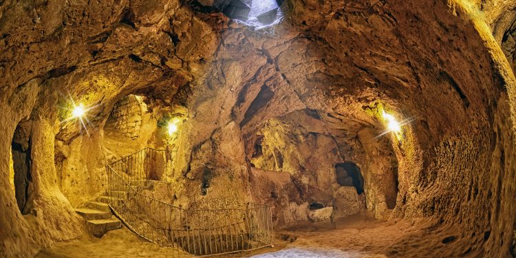


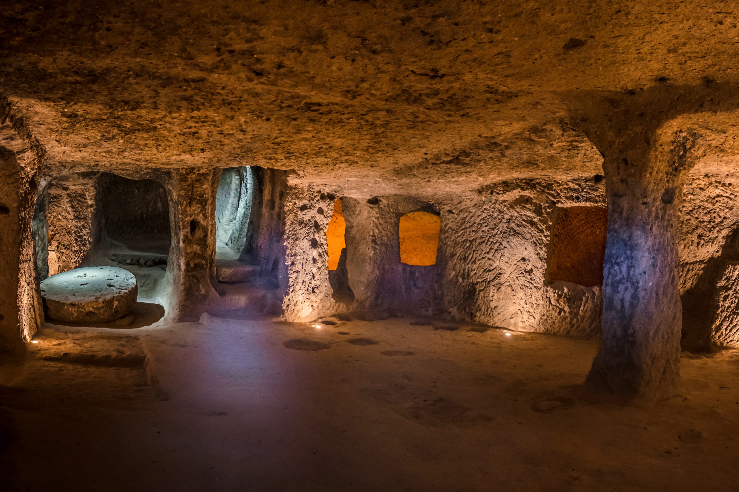
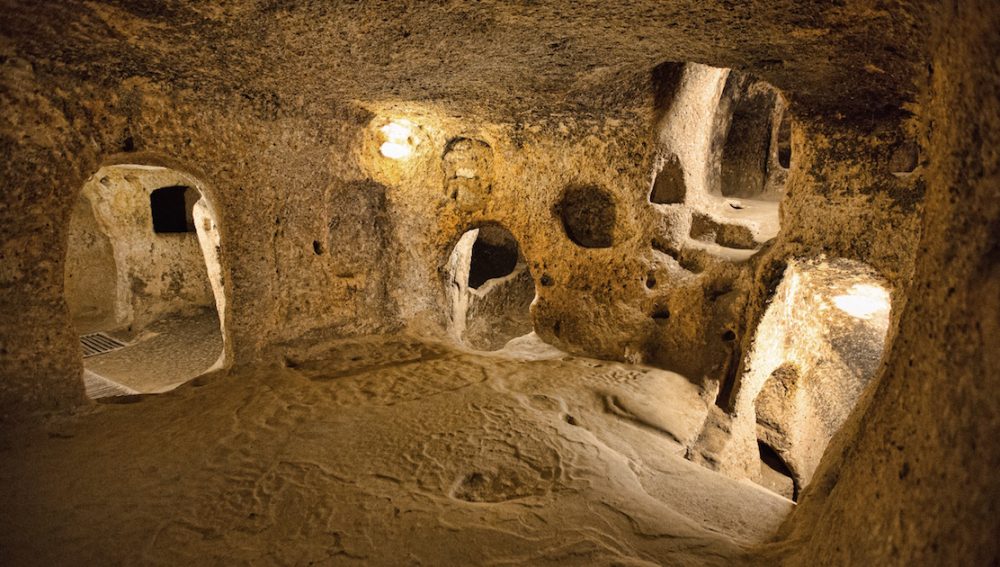

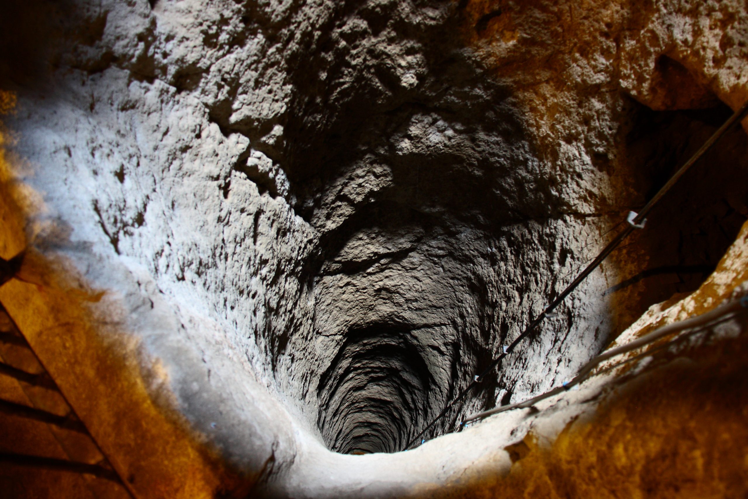

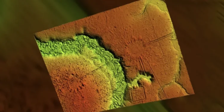

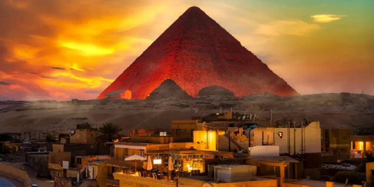
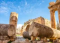
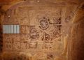
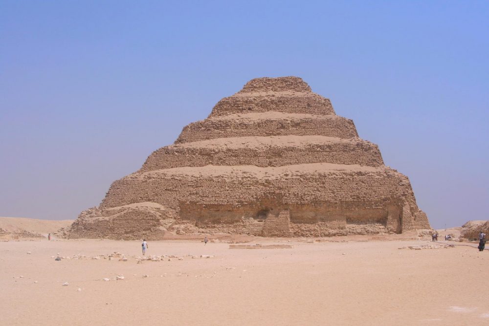
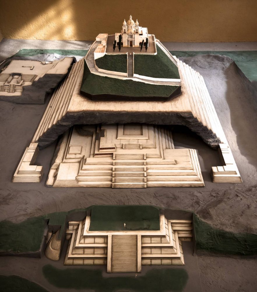
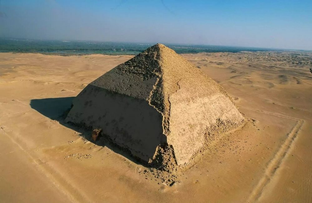
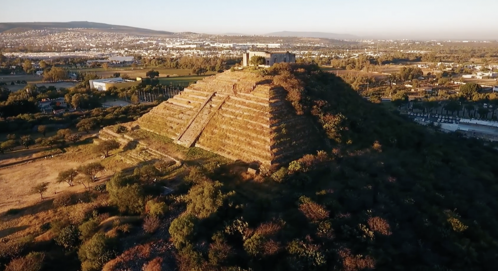

 21-05-2025 om 22:45
geschreven door peter
21-05-2025 om 22:45
geschreven door peter 


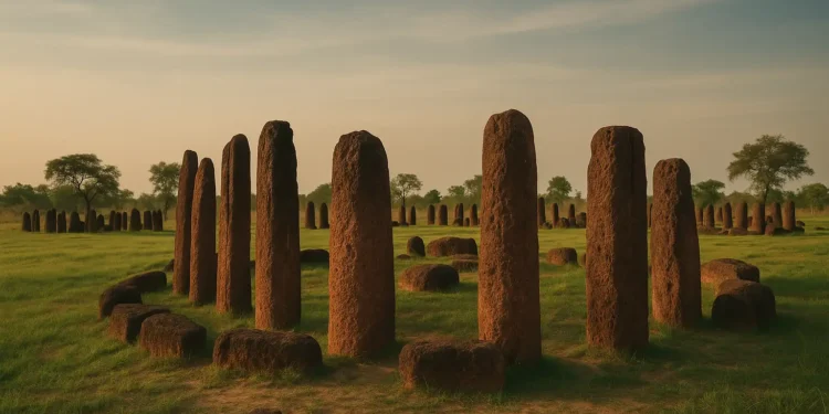


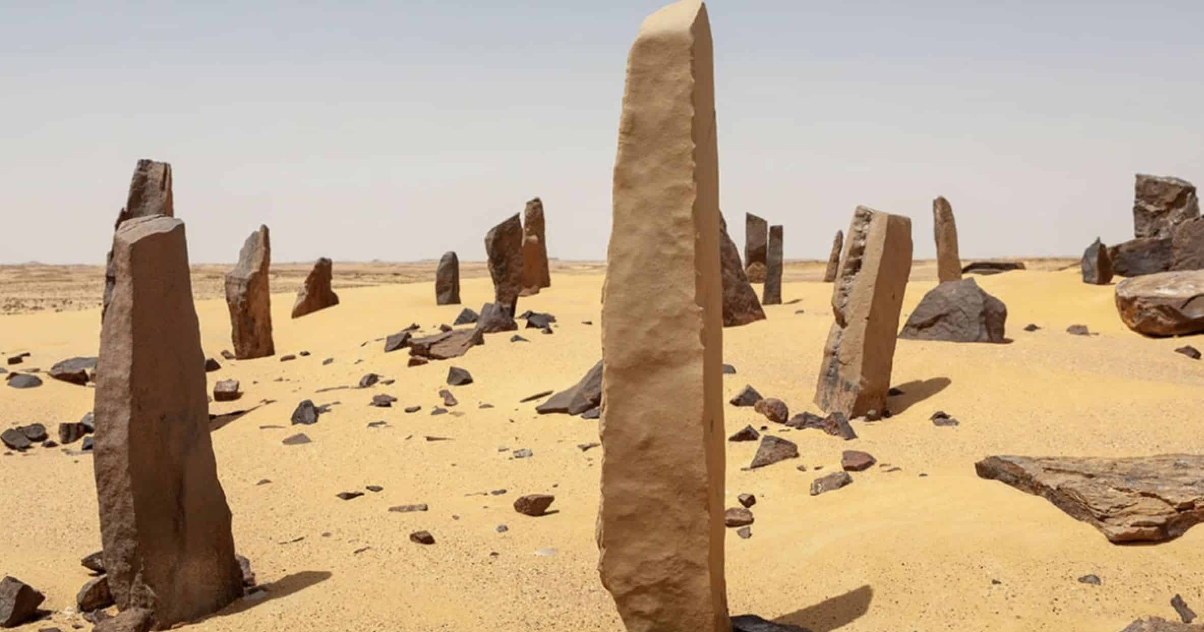
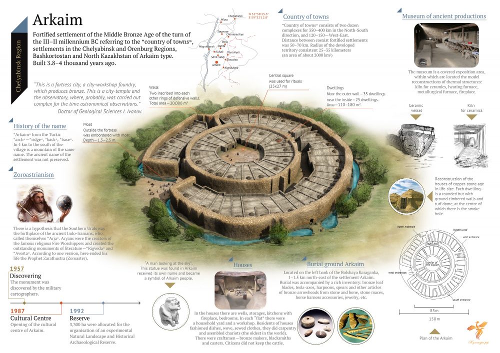
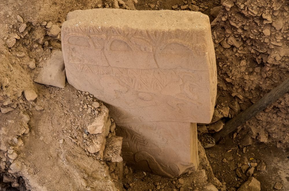
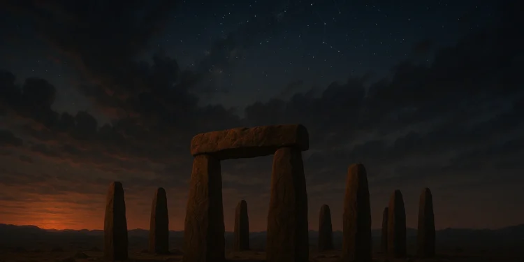

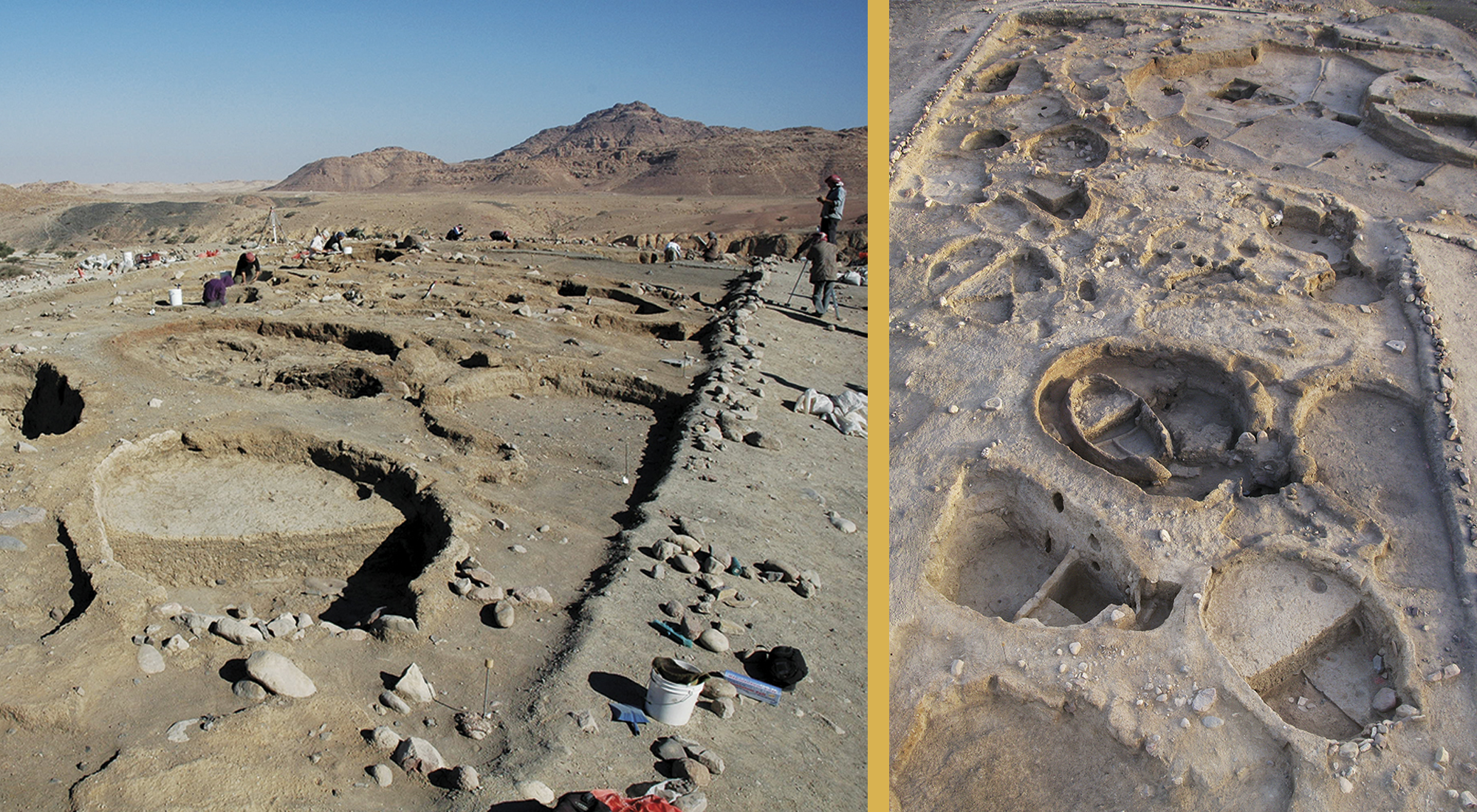
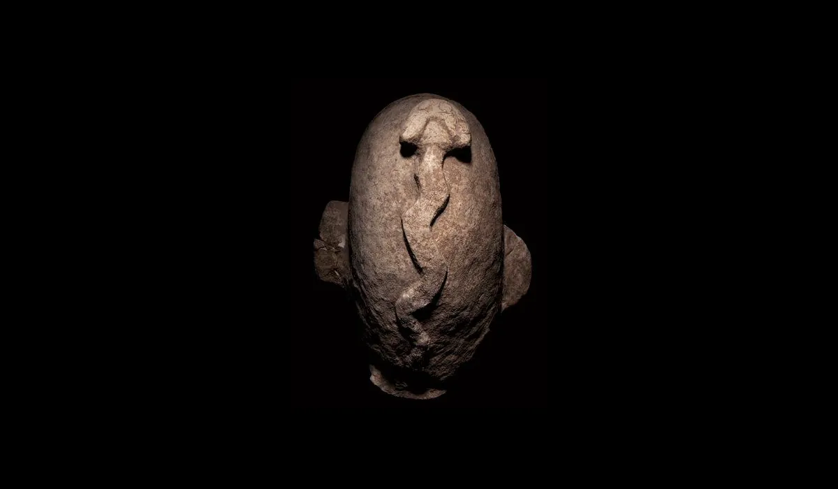


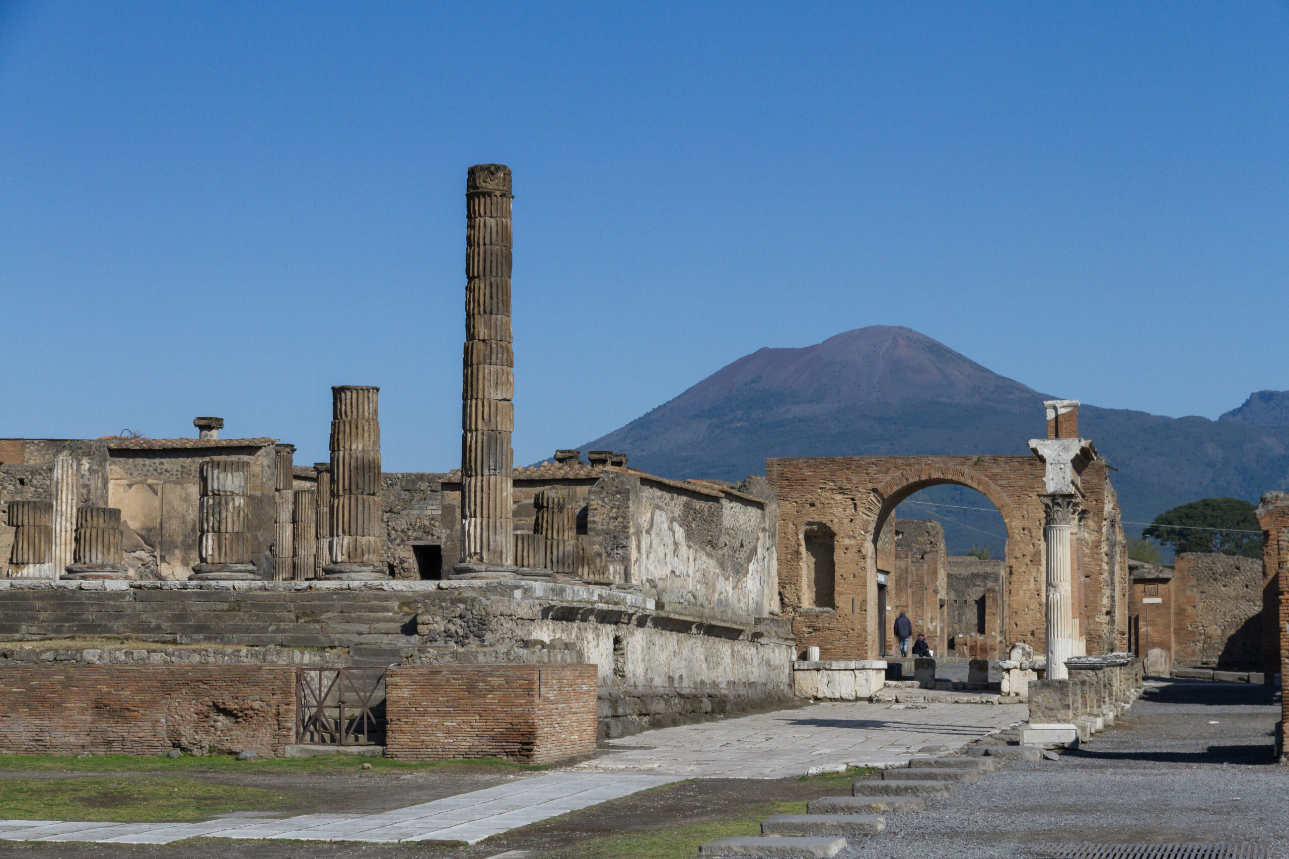
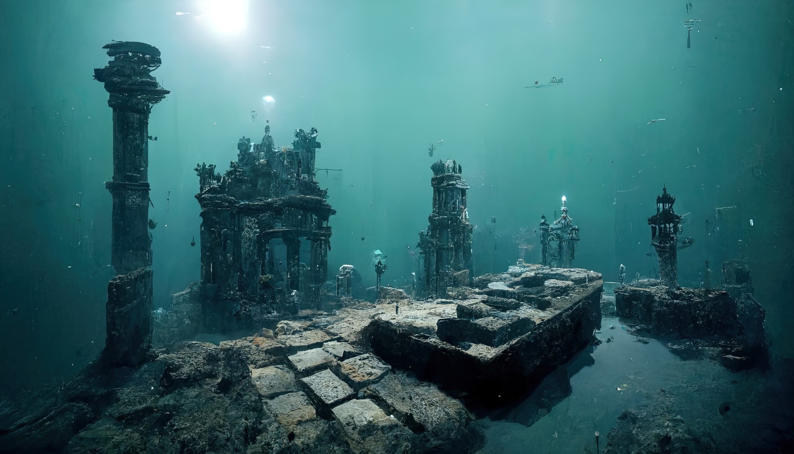

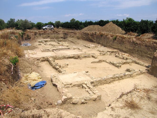
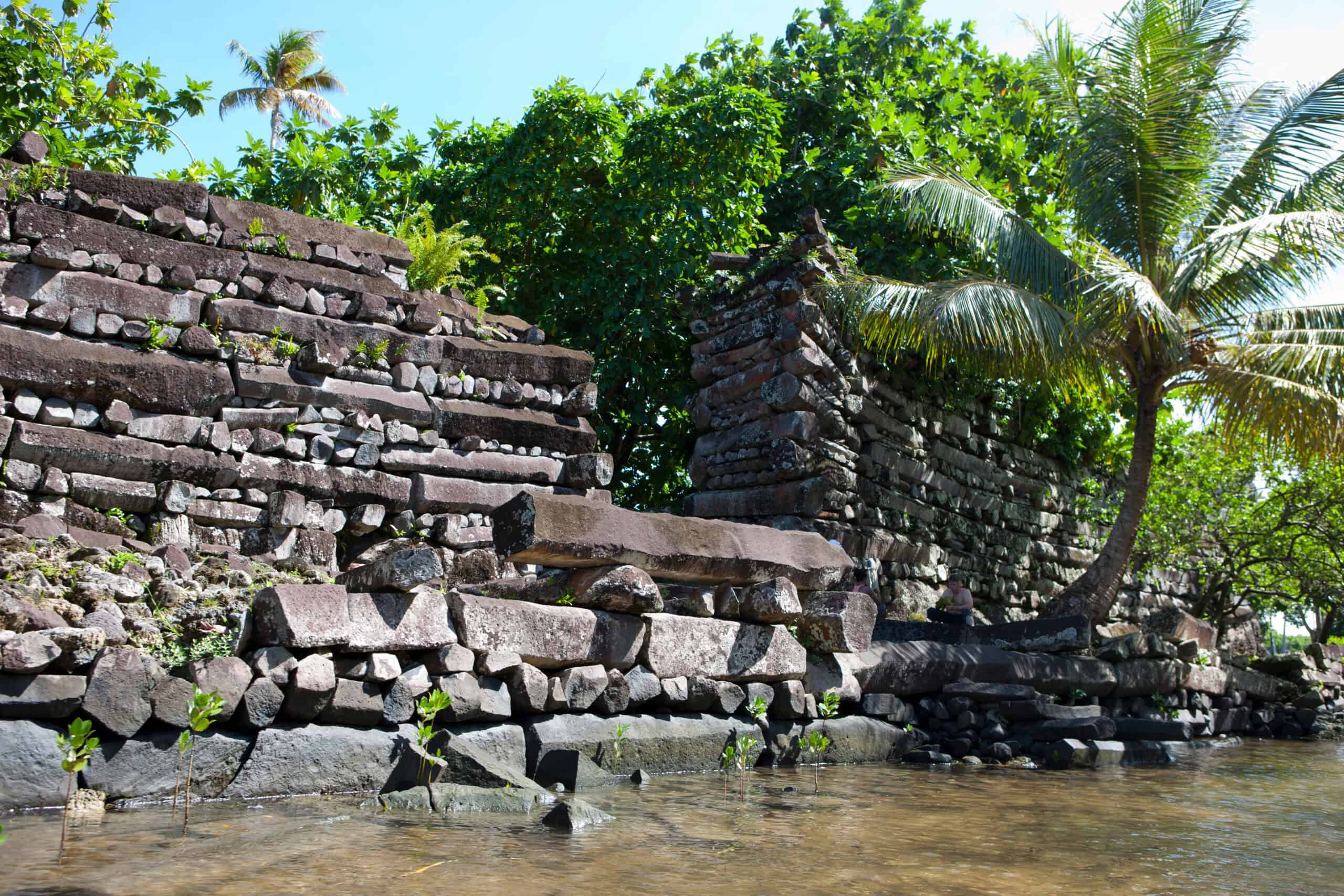

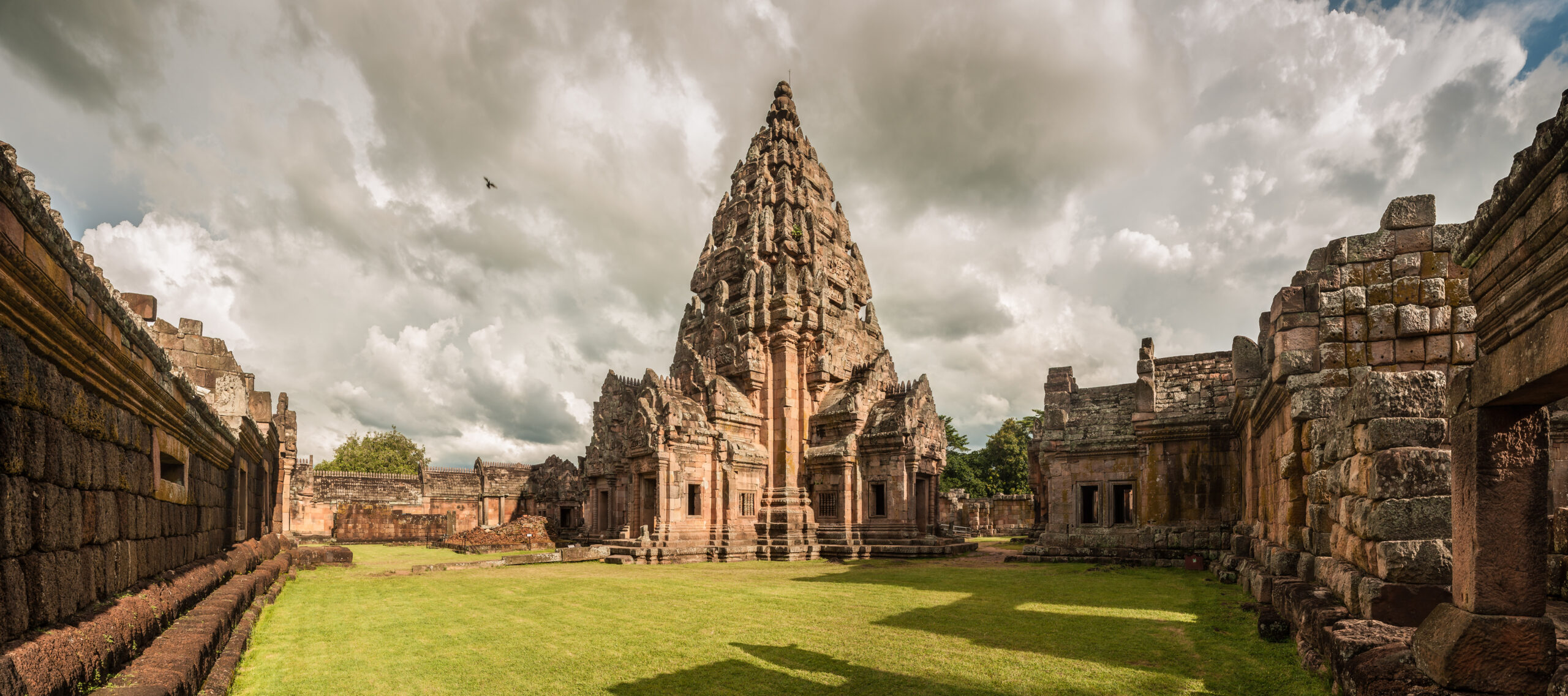
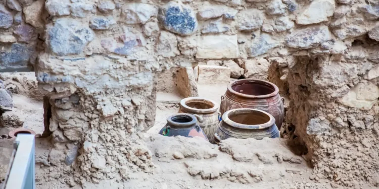


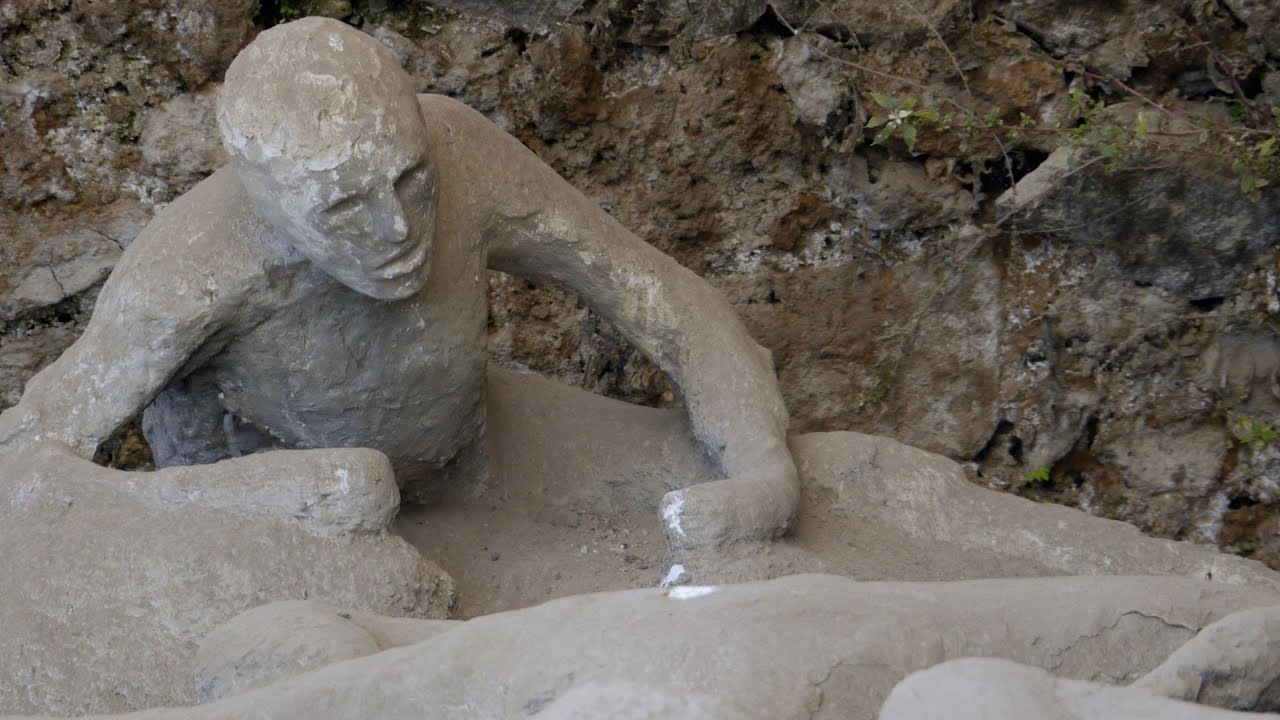

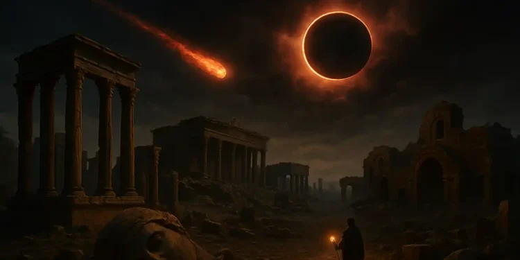


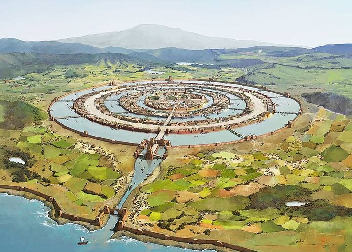

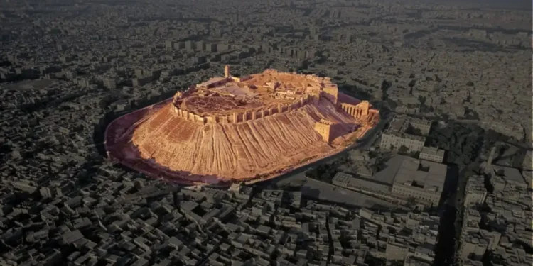

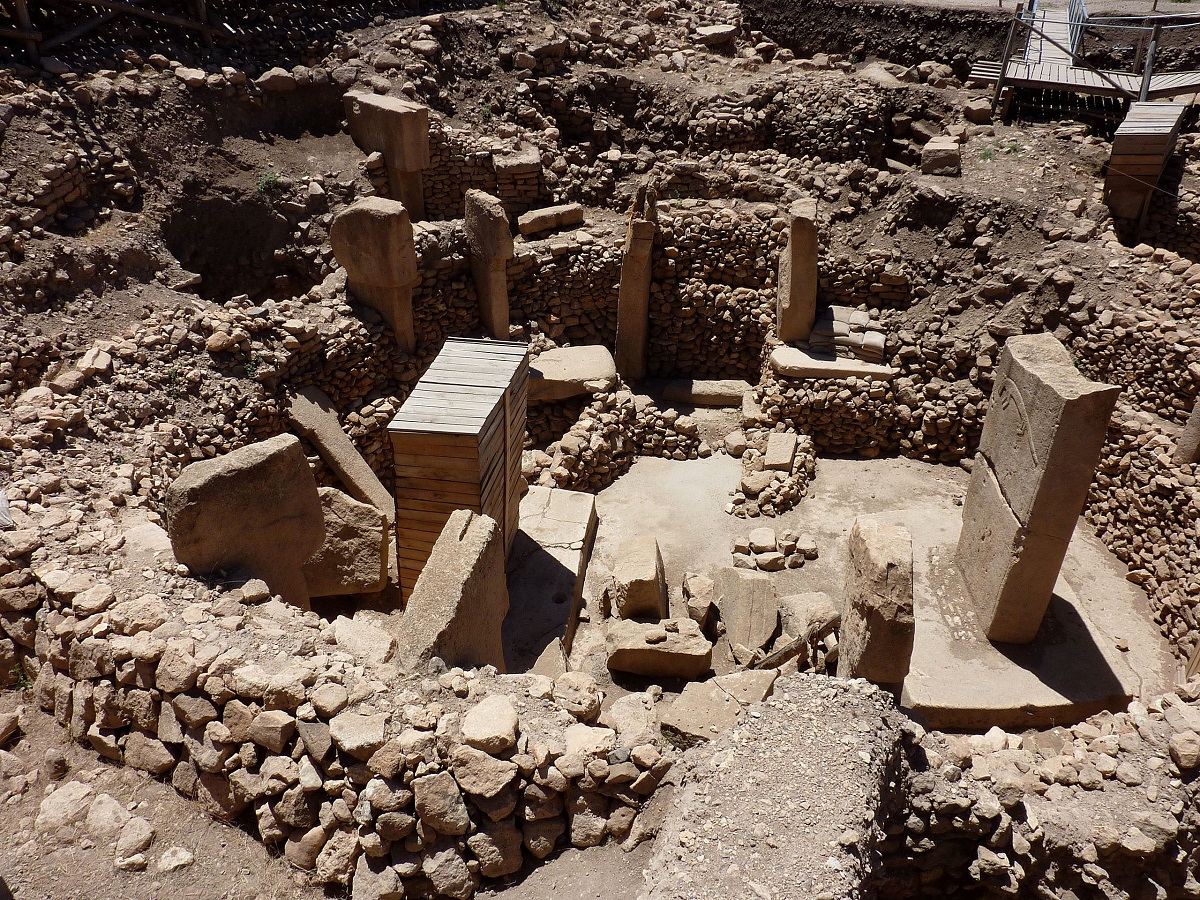
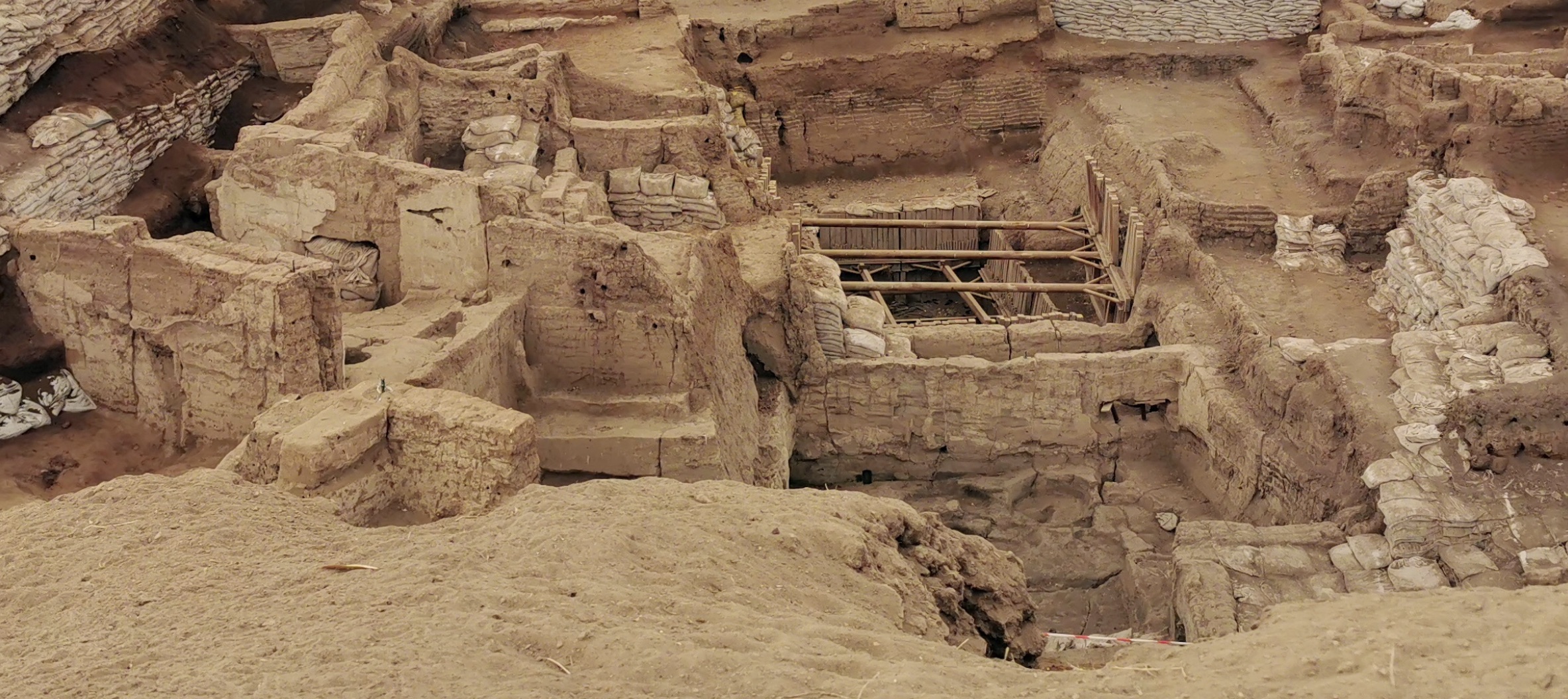
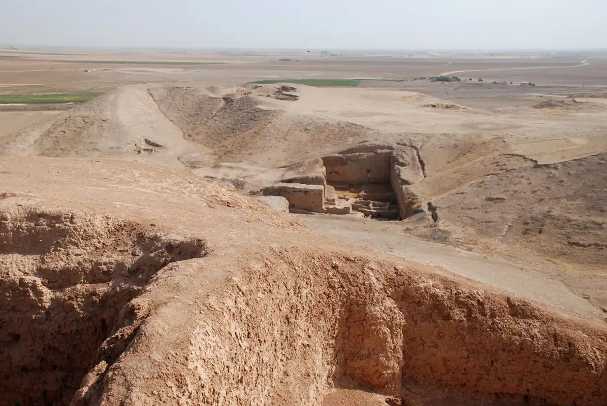
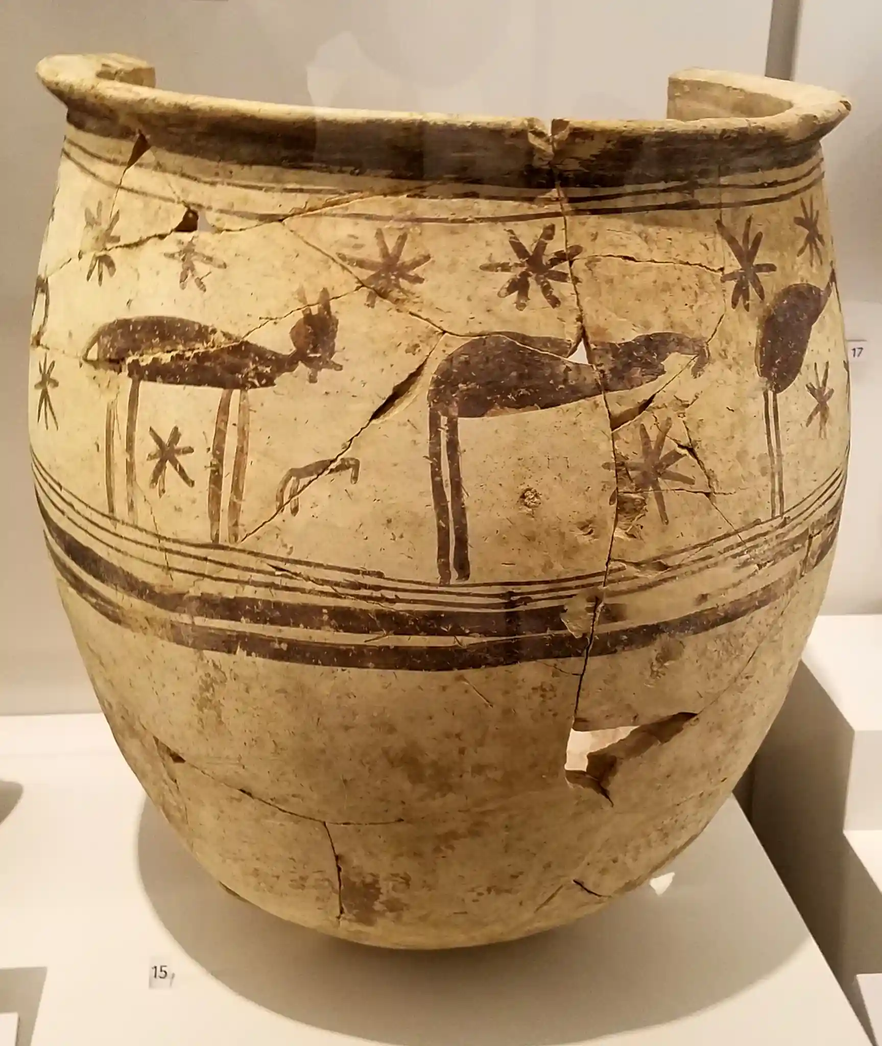

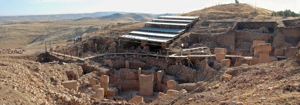


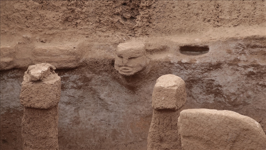
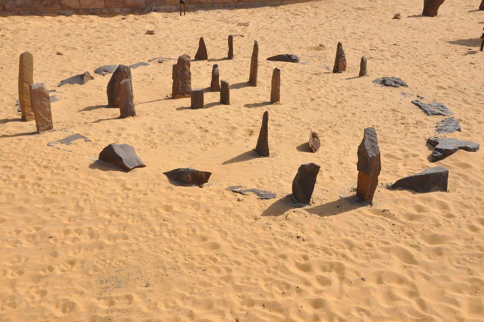
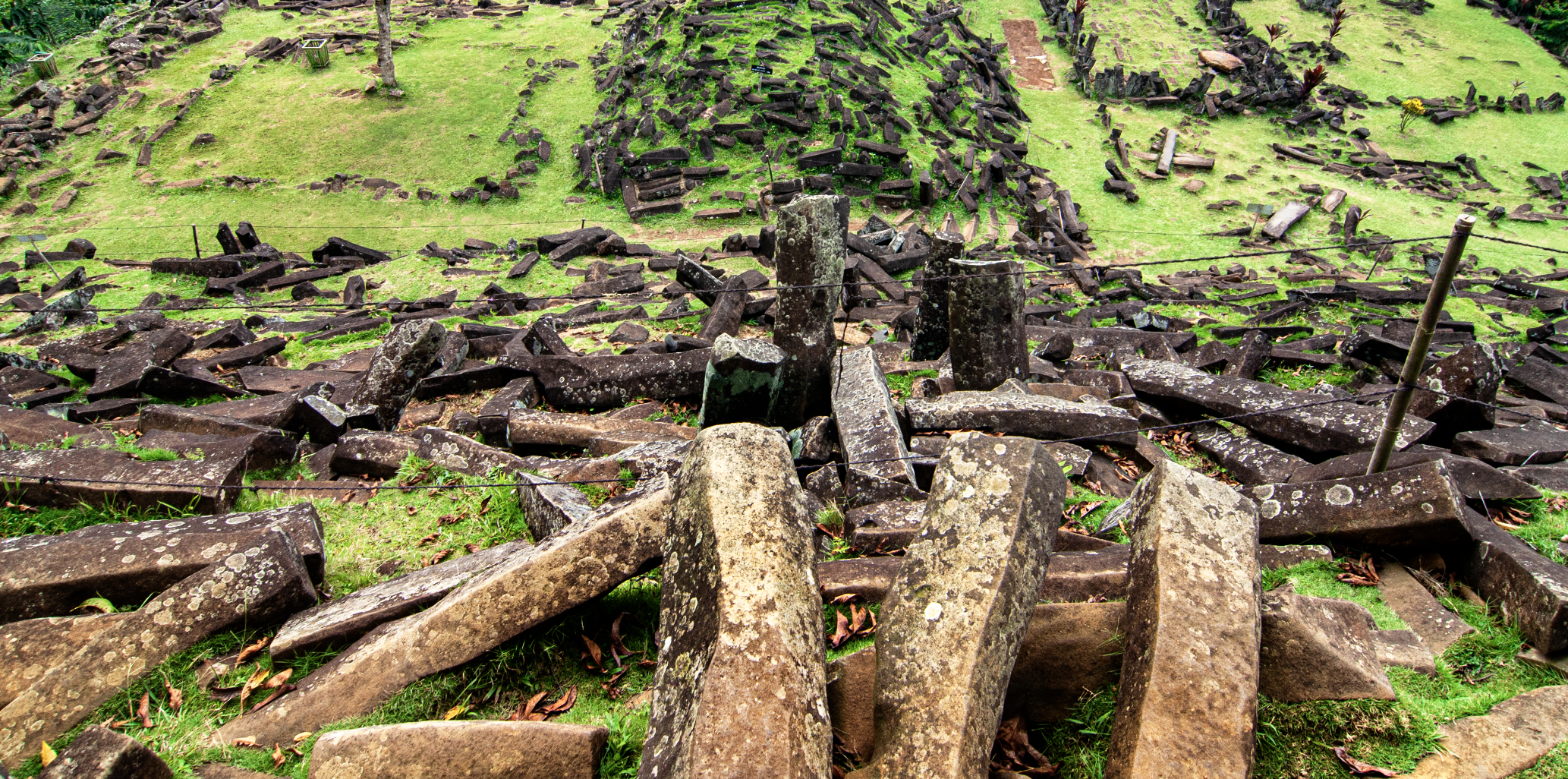

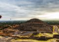

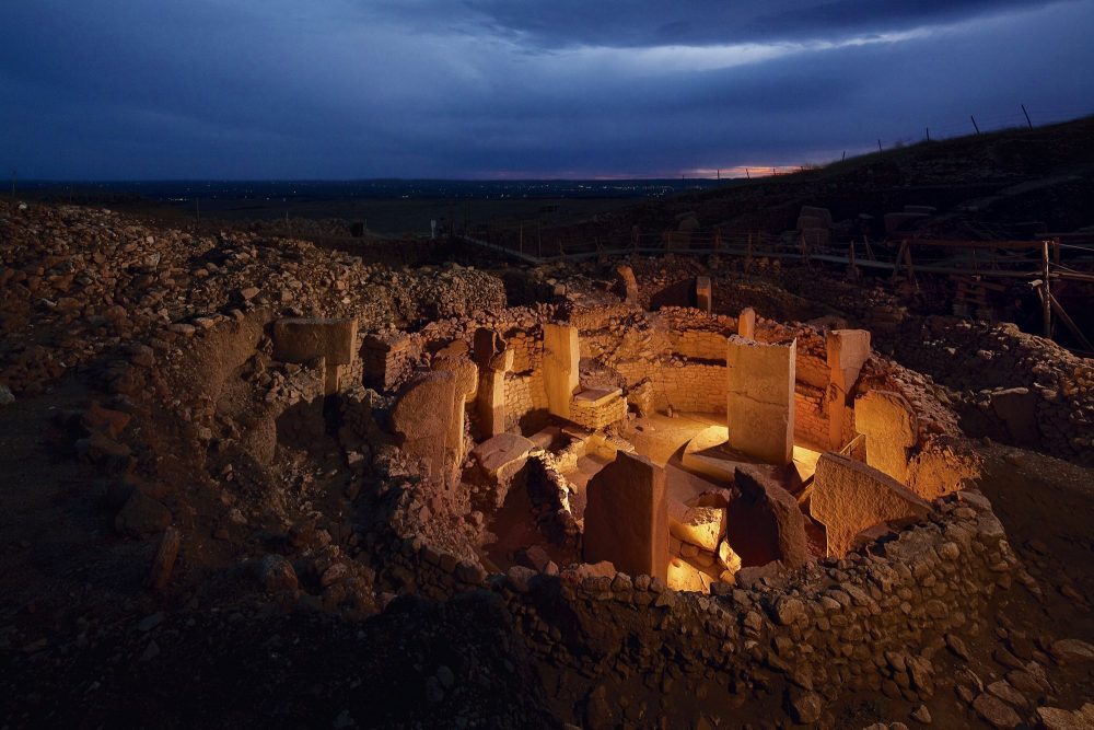


,_Akrotiri_--_2017_--_2975.jpg)
.jpg)
.jpg)