The purpose of this blog is the creation of an open, international, independent and free forum, where every UFO-researcher can publish the results of his/her research. The languagues, used for this blog, are Dutch, English and French.You can find the articles of a collegue by selecting his category. Each author stays resposable for the continue of his articles. As blogmaster I have the right to refuse an addition or an article, when it attacks other collegues or UFO-groupes.
Druk op onderstaande knop om te reageren in mijn forum
Zoeken in blog
Deze blog is opgedragen aan mijn overleden echtgenote Lucienne.
In 2012 verloor ze haar moedige strijd tegen kanker!
In 2011 startte ik deze blog, omdat ik niet mocht stoppen met mijn UFO-onderzoek.
BEDANKT!!!
Een interessant adres?
UFO'S of UAP'S, ASTRONOMIE, RUIMTEVAART, ARCHEOLOGIE, OUDHEIDKUNDE, SF-SNUFJES EN ANDERE ESOTERISCHE WETENSCHAPPEN - DE ALLERLAATSTE NIEUWTJES
UFO's of UAP'S in België en de rest van de wereld Ontdek de Fascinerende Wereld van UFO's en UAP's: Jouw Bron voor Onthullende Informatie!
Ben jij ook gefascineerd door het onbekende? Wil je meer weten over UFO's en UAP's, niet alleen in België, maar over de hele wereld? Dan ben je op de juiste plek!
België: Het Kloppend Hart van UFO-onderzoek
In België is BUFON (Belgisch UFO-Netwerk) dé autoriteit op het gebied van UFO-onderzoek. Voor betrouwbare en objectieve informatie over deze intrigerende fenomenen, bezoek je zeker onze Facebook-pagina en deze blog. Maar dat is nog niet alles! Ontdek ook het Belgisch UFO-meldpunt en Caelestia, twee organisaties die diepgaand onderzoek verrichten, al zijn ze soms kritisch of sceptisch.
Nederland: Een Schat aan Informatie
Voor onze Nederlandse buren is er de schitterende website www.ufowijzer.nl, beheerd door Paul Harmans. Deze site biedt een schat aan informatie en artikelen die je niet wilt missen!
Internationaal: MUFON - De Wereldwijde Autoriteit
Neem ook een kijkje bij MUFON (Mutual UFO Network Inc.), een gerenommeerde Amerikaanse UFO-vereniging met afdelingen in de VS en wereldwijd. MUFON is toegewijd aan de wetenschappelijke en analytische studie van het UFO-fenomeen, en hun maandelijkse tijdschrift, The MUFON UFO-Journal, is een must-read voor elke UFO-enthousiasteling. Bezoek hun website op www.mufon.com voor meer informatie.
Samenwerking en Toekomstvisie
Sinds 1 februari 2020 is Pieter niet alleen ex-president van BUFON, maar ook de voormalige nationale directeur van MUFON in Vlaanderen en Nederland. Dit creëert een sterke samenwerking met de Franse MUFON Reseau MUFON/EUROP, wat ons in staat stelt om nog meer waardevolle inzichten te delen.
Let op: Nepprofielen en Nieuwe Groeperingen
Pas op voor een nieuwe groepering die zich ook BUFON noemt, maar geen enkele connectie heeft met onze gevestigde organisatie. Hoewel zij de naam geregistreerd hebben, kunnen ze het rijke verleden en de expertise van onze groep niet evenaren. We wensen hen veel succes, maar we blijven de autoriteit in UFO-onderzoek!
Blijf Op De Hoogte!
Wil jij de laatste nieuwtjes over UFO's, ruimtevaart, archeologie, en meer? Volg ons dan en duik samen met ons in de fascinerende wereld van het onbekende! Sluit je aan bij de gemeenschap van nieuwsgierige geesten die net als jij verlangen naar antwoorden en avonturen in de sterren!
Heb je vragen of wil je meer weten? Aarzel dan niet om contact met ons op te nemen! Samen ontrafelen we het mysterie van de lucht en daarbuiten.
12-07-2025
Groundbreaking discovery in Egypt's Sphinx uncovers 'hidden' mystery that fuels theory of underground city
Groundbreaking discovery in Egypt's Sphinx uncovers 'hidden' mystery that fuels theory of underground city
The mystery of a 'underground city' beneath Egypt's pyramids has intensified after scientists revealed new scans showing a shaft plunging below the Great Sphinx.
Italian researchers, who made waves earlier this year with claims of vast structures hidden beneath the Pyramid of Khafre, now say they have identified a colossal vertical shaft leading and two chambersbelow the Sphinx.
While mainstream archaeologists have slammed the work as unscientific and speculative, the team insists their latest scans point to something extraordinary.
The scans detailed a massive shaft surrounded by a spiral-like staircase, decedending from the center of the Sphinx's base and down into two square structures, one at 2,000 feet and another 4,000 feet underground.
Armando Mei, an Egyptologist and co-author of the study, noted that similar underground features have now been detected beneath all three major pyramids, suggesting a unified architectural blueprint.
'The discovery proves that the Giza Plateau was engineered long before the dynastic era, possibly around 36,400 BCE, as my research suggests,' he added.
If confirmed, the findings could dramatically rewrite the history of ancient Egypt, challenging the long-held belief that the pyramids were built solely as royal tombs, and hinting instead at a forgotten civilization with advanced engineering skills.
The mystery of a 'underground city' beneath Egypt 's pyramids has intensified after scientists revealed new scans showing a shaft plunging below the Great Sphinx
But the researchers are shaking up that timeline, suggesting these legendary monuments may rest atop far older, hidden structures that could predate known history by tens of thousands of years.
It all began in March when the team announced four massive shafts and chambers were found under the Pyramid of Khafre using a type of sonar technology.
They employed cutting-edge SAR Doppler Tomography, a technique that uses satellite radar to detect tiny seismic movements.
By analyzing radar signals are and the timing or pattern of those signals when they bounce back, the team was able to create 3D maps revealing hidden subsurface structures. The technology has been published in a peer-reviewed journal.
However, latest work by Corrado Malanga from Italy's University of Pisa, Biondi and Mei has not yet been published in a scientific journal for the review of independent experts. They plan to publish a study in 2026.
'Our geophysical surveys beneath the Great Sphinx uncovered pillar-like formations remarkably similar to those beneath the Khafre and Menkaure pyramids,' explained Biondi.
'Even more compelling, our tomographic imaging revealed two large chambers nearly 2,000 feet below the surface.'
Italian researchers, who made waves earlier this year with claims of vast structures hidden beneath the Pyramid of Khafre, now say they have identified a colossal vertical shaft below the Sphinx
The scans also captured two large chambers, one at 2,000 feet and another 4,000 feet underground
The two massive chambers, each measuring 131 feet by 131 feet, appear to be connected by an underground shaft, according to recent findings.
The data collected also points to a network of hidden structures below the surface, possibly part of a vast underground city, potentially as expansive as the entire Giza Plateau itself.
Mei explained that their theory of a lost city draws from ancient Egyptian texts, particularly Chapter 149 of the Book of the Dead, which references the '14 residences of the city of the dead.'
'It describes certain chambers and some inhabitants of the city. That is why we believe it could be Amenti [realm of the dead], as described in ancient texts,' he said.
'Of course, we must be certain, but we believe this could be the case because the pyramids are located exactly where the texts say.
'The texts state that the pyramids were built on top of the city, sealing its entrance.'
Biondi added that the mysterious chambers found more than 4,000 feet below the pyramids may be linked to the legendary Hall of Records.
The shaft appears to be wrapped in a spiral-like structure
Armando Mei (center) and his team, which includes Corrado Malanga (right) and Filippo Biondi (left), took the world by storm last month when they discovered shafts and chambers more than 2,000 feet below the surface.
Despite its enduring allure, there is no solid evidence proving the Hall of Records exists.
The team proposes that an advanced civilization originally built the complex, but was destroyed around 12,000 years ago by a 'divine flood' triggered by an asteroid impact.
According to their theory, the pyramids are the lone surviving 'megastructure' from this ancient society.
Alternate historians, including Graham Hancock, a frequent guest on Joe Rogan's podcast, have long suggested that a sophisticated prehistoric civilization was wiped out by a global cataclysm, possibly a comet strike.
Researchers believe there are other structures reaching more than 4,000 feet below the surface. The scans captured structures extend along the northern side with a tuning fork shape
This theory holds that the catastrophic floods and upheaval erased most traces of this civilization, with survivors passing down critical knowledge of astronomy, engineering, and sacred architecture to later cultures such as the ancient Egyptians.
The researchers now hope to gain permission from Egyptian authorities to excavate beneath the Giza Plateau and put their findings to the test, potentially rewriting the story of human history.
'We have the right. Humanity has the right to know who we are because, right now, we don't,' Biondi said.
Giant sand mounds beneath the North Sea have puzzled scientists for years. Now, researchers have discovered that these mysterious structures were created by a geological process that has never been seen on such a huge scale.
Seismic data and rock samples from the northern North Sea, off the coast of Norway, suggest that these miles-wide mounds sank millions of years ago, lifting up older, less-dense "ooze" beneath. The findings could help scientists learn more about future carbon storage options, the researchers wrote in the new study, which was published June 21 in the journalCommunications Earth and Environment.
Researchers have known about these mounds buried beneath the seabed for years but haven't reached a consensus regarding the structures' origins. Proposed explanations have included landslide deposits, sandstone pushed up from below, or mud forced through brittle rock.
Now, using a three-dimensional seismic dataset covering the northern North Sea, along with rock samples, researchers examined the mounds and the surrounding regions. They found that the structures were surrounded by older, low-density "ooze," composed in large part of the fossil remains of ancient microorganisms.
The mounds were chemically similar to nearby sands that appear later in the geological record. In some places, the mounds were connected to these sands via fractures in the rock. This suggests that the mounds were made of younger sands that sank beneath the older, lighter ooze below.
The sunken sands have jumbled the expected pattern in the geological record. Usually, older layers of rock are buried deeper than younger sediment, leaving a record of the processes that shaped the landscape over time.
"This discovery reveals a geological process we haven't seen before on this scale," study co-authorMads Huuse, a geophysicist at the University of Manchester in the U.K., said in a statement. "What we've found are structures where dense sand has sunk into lighter sediments that floated to the top of the sand, effectively flipping the conventional layers we'd expect to see and creating huge mounds beneath the sea."
Earthquakes or changes in pressure may have caused the sands to behave like a fluid, thus enabling it to flow through fractures in the seabed and slip beneath rigid sections of the ooze. The researchers dubbed these large, sinking mounds "sinkites." The ooze rafts, buoyed upward, were named "floatites."
"This research shows how fluids and sediments can move around in the Earth's crust in unexpected ways," Huuse said.
The team originally studied these mounds as a possible location for carbon dioxide storage. Before beginning any carbon storage efforts in the region, scientists will need to understand how well and how safely the area can hold on to that carbon.
"Understanding how these sinkites formed could significantly change how we assess underground reservoirs, sealing, and fluid migration — all of which are vital for carbon capture and storage," Huuse said.
There's no doubt EasterIsland is geographically one of the most isolated places on Earth.
More than 2,000 miles off the coast of Chile, it was first settled by humans around AD 1200, who built its famous enlarged head statues.
Historically, the original inhabitants, known as the Rapa Nui, were assumed to have long been completely shut off from the wider world.
However, a new study by researchers in Sweden challenges this long-held narrative.
They say the 63.2 sq mile island in the southern Pacific was not quite as isolated over the past 800 years as previously thought.
In fact, the island was populated with multiple waves of new inhabitants who bravely traversed the Pacific Ocean from west to east.
'Easter Island was settled from central East Polynesia around AD 1200-1250,' study author Professor Paul Wallin at Uppsala University told MailOnline.
'The Polynesians were skilled sailors so double canoes were used.'
Located in the southeastern Pacific Ocean, Easter Island was first settled by humans around AD 1200, who built its famous enlarged head statues, called moai
There's no doubt Easter Island (pictured) in the southern Pacific is geographically one of the most isolated places on Earth
Due to its remote location, Easter Island is traditionally assumed to have remained socially and culturally isolated from the wider Pacific world.
This idea is reinforced by the fact that Easter Island's famous Moai statues, estimated to have been built between AD 1250 and 1500, are unique to the location.
The huge human figures carved from volcanic rock were placed on rectangular stone platforms called 'ahu' – essentially tombs for the people that the statues represented.
For their study, the team at Uppsala University compared archaeological data and radiocarbon dates from settlements, ritual spaces and monuments across Polynesia, the collection of more than 1,000 islands in the Pacific Ocean.
Their results, published in the journal Antiquity, show that similar ritual practices and monumental structures have been observed across Polynesia.
The experts point out that ahu stone platforms were historically constructed at Polynesian islands further to the west.
These rectangular clearings were communal ritual spaces that, in some places, remain sacred to this day.
'The temple grounds ahu [also known as marae] exist on all East Polynesian islands,' Professor Wallin added.
Map of the Pacific with the East Polynesian cultural sphere indicated. Note Easter Island (Rapa Nui) in a more isolated location further east
Pictured, ahu (a central stone platform) on Mo’orea, Windward, French Polynesia, southern Pacific Ocean
Archaeologists have analysed ritual spaces and monumental structures across Polynesia, questioning the idea that Easter Island (pictured) developed in isolation following its initial settlement
EASTER ISLAND TIMELINE
13th century: Easter Island (Rapa Nui) is settled by Polynesian seafarers.
Construction on some parts of the island's monuments begins.
Early 14th to mid-15th centuries: Rapid increase in construction
1600: The date that was long-thought to mark the decline of Easter Island culture.
Construction was ongoing.
1770: Spanish seafarers landed on the island. The island is in good working order.
1722: Dutch seafarers land on the island for the first time.
Monuments were in use for rituals and showed no evidence of societal decay.
1774: British explorer James Cook arrives on Rapa Nui
His crew described an island in crisis, with overturned monuments.
The team agree that an early population of people spread from the west of the Pacific to the east before encountering Easter Island and populating it around AD 1200.
But they argue that Easter Island was populated several times by new seafarers – not just once by one group who remains isolated for centuries as previously assumed.
'The migration process from West Polynesian core areas such as Tonga and Samoa to East Polynesia is not disputed here,' they say in their paper.
'Still, the static west-to-east colonization and dispersal suggested for East Polynesia and the idea that Rapa Nui was only colonized once in the past and developed in isolation is challenged.'
Based on their evidence, they also think ahu originated on Easter Island before the trend spread east to west across other western Polynesian islands during the period of AD 1300-1600.
It was only after this that Polynesian islands – including but not limited to Easter Island – might have become isolated from each other.
As hierarchical social structures developed independently – at Easter Island, Tahiti and Hawai'i for example – large, monumental structures were built to display power.
Overall, the study indicates there were robust 'interaction networks' between Polynesian islands, which allowed the transfer of new ideas from east to west and back again.
The Moai are monolithic human figures carved by the Rapa Nui people on Easter Island, between AD 1,250 and 1,500
Ultimately, arrival of European explorers at Easter Island in the 18th century led to a rapid decline of the population, brought on by murder, bloody conflict and the brutal slave trade – although the population there may have already been weakening.
Today, Easter Island is a UNESCO World Heritage Site with only a few thousand inhabitants.
But it attracts large numbers of tourists, largely thanks to its monumental and world-famous stone statues that stare sternly out over the island.
Tourism, which has grown exponentially on the island over the last 20 years, has come at a price, according to co-author Professor Helene Martinsson-Wallin.
'When I was there in the 1980s, the sandy beach was white and there were almost no people around,' she said.
'When I came back in the early 00s, I thought the sand looked blue, and when I looked closer I saw that it was due to tiny, tiny pieces of plastic washed up by the sea from every corner of the Earth.'
The Moai are monolithic human figures carved by the Rapa Nui people on Easter Island, between 1,250 and 1,500 AD.
All the figures have overly-large heads and are thought to be living faces of deified ancestors.
The 887 statues gaze inland across the island with an average height of 13ft (four metres).
Nobody really knows how the colossal stone statues that guard Easter Island were moved into position.
Nor why during the decades following the island’s discovery by Dutch explorers in 1722, each statue was systematically toppled, or how the population of Rapa Nui islanders was decimated.
Shrouded in mystery, this tiny triangular landmass, stranded in the middle of the South Pacific and 1,289 miles from its nearest neighbour, has been the subject of endless books, articles and scientific theories.
All but 53 of the Moai were carved from tuff , compressed volcanic ash, and around 100 wear red pukao of scoria.
What do they mean?
In 1979 archaeologists said the statues were designed to hold coral eyes.
The figures are believed to be symbol of authority and power.
They may have embodied former chiefs and were repositories of spirits or 'mana'.
They are positioned so that ancient ancestors watch over the villages, while seven look out to sea to help travellers find land.
But it is a mystery as to how the vast carved stones were transported into position.
In their remote location off the coast of Chile, the ancient inhabitants of Easter Island were believed to have been wiped out by bloody warfare, as they fought over the island's dwindling resources.
All they left behind were the iconic giant stone heads and an island littered with sharp triangles of volcanic glass, which some archaeologists have long believed were used as weapons
Rapa Nui Was NOT as Isolated As Previously Thought
For decades, archaeologists have painted a picture of Rapa Nui (Easter Island) as the ultimate frontier of Polynesian civilization - a remote outpost that developed in complete isolation after its initial settlement around 1200 AD. This narrative has dominated Pacific archaeology, portraying the island's famous moai statues and ceremonial complexes as the products of a society cut off from the wider Polynesian world.
However, groundbreaking new research from Uppsala University, published in Antiquity has shattered this long-held assumption, revealing that Rapa Nui was not merely a recipient of Polynesian culture but an active innovator whose ceremonial ideas spread back across the Pacific, influencing the development of sacred sites throughout East Polynesia.
The Westward Wave: How Easter Island Exported Sacred Architecture
The revolutionary findings, soon to be published in the prestigious journal Antiquity, present compelling radiocarbon evidence that challenges the traditional west-to-east cultural diffusion model. Professors Paul Wallin and Helene Martinsson-Wallin, leading experts in Pacific archaeology, have discovered that the complex marae temple structures - rectangular ceremonial clearings that served as the spiritual heart of Polynesian communities - actually originated earlier on remote Rapa Nui than on the supposedly more connected central islands.
A traditional marae temple structure on Raiatea in French Polynesia. These rectangular ceremonial complexes, once thought to have developed from west to east, now appear to have originated on remote Easter Island before spreading westward.
"The most important finding is that, based on C-14 dating, we can observe an initial west-to-east spread of ritual ideas," explains Professor Wallin in the Antiquity press release. "However, the complex, unified ritual spaces (known as marae) show earlier dates in the east." This discovery fundamentally rewrites our understanding of cultural exchange in the ancient Pacific, suggesting that innovation could flow in both directions across the vast oceanic distances.
The research team's comprehensive analysis of archaeological data across East Polynesia has revealed three distinct phases of ritual development that paint a far more nuanced picture of ancient Pacific civilization:
Phase One: The Initial Expansion (1200-1400 AD) During the first phase, ritual practices focused on fundamental activities like burials and communal feasting, marked by simple stone uprights. This period reflects the traditional west-to-east migration pattern, as settlers carried their ancestral practices from the core areas of Tonga and Samoa to the far reaches of the Pacific.
Phase Two: The Rapa Nui Innovation (1400-1600 AD) The second phase witnessed a revolutionary development: the emergence of sophisticated marae temple complexes. Contrary to all previous assumptions, radiocarbon dating reveals that these elaborate ceremonial structures first appeared on Rapa Nui before spreading westward through existing exchange networks to central East Polynesia. This represents a complete reversal of the expected cultural flow.
Phase Three: The Age of Monumental Expression (1600-1800 AD)The final phase saw increased isolation leading to internal cultural development. As hierarchical societies evolved independently on islands like Rapa Nui, Tahiti, and Hawaiʻi, massive, monumental structures were erected as displays of power and spiritual authority, including the iconic moai statues that would become Rapa Nui's most famous legacy.
Archaeologists have uncovered ancient inscriptions inside Egypt’s Great Pyramid that they say confirm who built the monument 4,500 years ago.
Ancient Greeks shared stories that the stunning monument was built by 100,000 slaves who worked in three-month shifts over 20 years.
But new discoveries inside the Great Pyramid have changed the narrative, showing it was constructed by paid, skilled laborers who worked continuously, taking one day off every 10 days.
Egyptologist Dr Zahi Hawass and his team recently explored a series of narrow chambers above the King’s Chamber using imaging technology, finding never-before-seen markings left by work gangs from the 13th-century BC.
They also unearthed tombs south of the pyramid, the eternal resting places of skilled laborers, complete with statues of workers muscling stones and 21 hieroglyphic titles like 'overseer of the side of the pyramid' and 'craftsman.'
'[The discoveries] confirm that the builders were not slaves. If they had been, they would never have been buried in the shadow of the pyramids,' Dr Hawass said during an episode of the Matt Beall Limitless podcast.
'Slaves would not have prepared their tombs for eternity, like kings and queens did, inside these tombs.'
The latest findings also shed light on how the pyramid was built, revealing that limestone from a quarry just 1,000 feet away was hauled to the site using a rubble-and-mud ramp, remnants of which were found southwest of the monument.
Dr Hawass is now working on a new expedition, funded by Beall, which will send a robot into the Great Pyramid, marking the first excavation of the structure in modern history.
The Great Pyramid of Giza is the largest Egyptian pyramid and was constructed by Pharaoh Khufu, who ruled during the Fourth Dynasty of the Old Kingdom
Egyptologist Dr Zahi Hawass shared the discoveries on the Matt Beall Limitless podcast this month
The Great Pyramid of Giza is the largest Egyptian pyramid and was constructed by Pharaoh Khufu, who ruled during the Fourth Dynasty of the Old Kingdom.
It is also one of three within the Giza plateau, the other two include the Pyramid of Khafre and the Pyramid of Menkaure, as well as the Great Sphinx.
All shrouded in mystery due to their unclear construction methods, precise astronomical alignment and still-debated purpose.
Inscriptions were previously found inside the Great Pyramid during the 19th century, sparking debate that the writings were forged hundreds of years after it was built.
'There was some debate on whether or not that could be a forgery, but now you're saying that you've discovered three more cartes within the King's Chamber,' Beall asked Dr Hawass.
The archaeologist then showed images never shared with the public, highlighting the names drawn onto the rock.
'They were found in chambers that are difficult and dangerous to access, and they use writing styles that only trained Egyptologists can accurately interpret,' said Dr Hawass.
'It’s nearly impossible that someone in recent times could have forged something like this. You must climb about 45 feet and crawl through tight spaces to even reach those chambers.'
Egyptologist Dr Zahi Hawass and his team recently explored a series of narrow chambers above the King’s Chamber using imaging technology, finding never-before-seen markings left by work gangs from the 13th-century BC
Hawass's team also unearthed tombs south of the pyramid, the eternal resting places of skilled laborers
The archaeologist admitted that some European visitors managed to enter and left their names scratched into the stone in the late 18th and 19th centuries.
'But the inscriptions we found are clearly much older, original graffiti from ancient Egyptian workers,' Dr Hawass added.
Alongside these inscriptions, the second major discovery was the tombs of the pyramid builders.
Dr Hawass and his team found tools inside the tombs, such as flint tools and pounding stones that would have been used in the Great Pyramid's construction.
'The base of the Great Pyramid is made from solid bedrock, carved 28 feet deep into the ground,' he said.
'This means that after marking the square base, the builders cut down into all four sides of the rock until they created a level platform of solid stone, no blocks, just bedrock.
'You can still see this today on the south side of Khufu’s pyramid.'
He continued to explain that the workers operated in teams, some cut the stones, others shaped them and the rest transported the material using wooden sleds pulled over the sand.'
He added that the rocks were then moved using ramps, which the archaeologist said he found evidence of.
+5
View gallery
Hawass's team also unearthed tombs south of the pyramid, the eternal resting places of skilled laborers, complete with statues of workers muscling stones
'The ramp had to come from the southwest corner of the pyramid and connect to the quarry,' said Dr Hawass,
'We excavated this area, and in the site labeled C2, we found remnants of the ramp, stone rubble mixed with sand and mud. When the ramp was dismantled, they didn’t remove every trace, and what was left behind is what we uncovered.'
Dr Hawass' colleague, Mark Lehner, has been excavating a site just east of the pyramid, uncovering what they are calling 'the worker's city.'
The team has uncovered facilities used for sorting salted fish, a large bakery for bread, barracks and the settlement where the laborers lived.
'There’s a popular myth that the workers ate only garlic, onions, and bread, but we found thousands of animal bones at the site,' Dr Hawass said.
'An expert from the University of Chicago analyzed them and found that the Egyptians slaughtered 11 cows and 33 goats every day to feed the laborers.
'This diet was enough to support around 10,000 workers per day.'
The conversation switched to the upcoming exploration of the Big Void, which Dr Hawass is leading.
The podcaster explained that they were working on a robot, no larger than a centimeter, which will travel through a tiny hole drilled into the side of the Great Pyramid.
The Big Void, discovered in 2017, stretches for at least 100 feet above the Grand Gallery, an ascending corridor that links the Queen’s chamber to the King’s in the heart of the pyramid.
Dr Hawass believes he will locate the lost tomb of Khufu inside the void.
'I think it's unlikely that it's a tomb, just because there's never been a tomb,' Beall said.
'There's never been a Pharaoh discovered in any of these in any of the main pyramids ever.'
The excavation is slated for around January or February next year.
RELATED VIDEOS
Who REALLY Built The Pyramids? Ancient History's Biggest Cover-Up
The Hidden World Beneath Egypt’s Pyramids—Revealed!
Archaeologists Unveil Stunning Discovery Inside Ancient Egyptian Pyramid!
Scientists who revealed an underground 'hidden city' in Egypt have announced the discovery of a second city they say 'proves' the existence of a massive subterranean complex linking the Giza pyramids 2,000 feet beneath the surface.
The newly-discovered shafts and chambers could rewrite history if confirmed to be true.
The team of Italian researchersfirst claimed to have uncovered vast underground structures below the Khafre pyramid in March, igniting fierce backlash from mainstream archaeologists who called the findings 'false' and lacking scientific basis.
Famed archaeologist Dr Zahi Hawass is the team's biggest critic, saying it is impossible for the ground-penetrating radar to see thousands of feet below the surface.
Undeterred by the scrutiny, the team has now reportedly detected similar shafts beneath the Pyramid of Menkaure, the smallest of the three main pyramids at Giza, months after their initial findings below Khafre.
The Giza complex, west of Cairo, includes the pyramids of Khufu, Khafre, and Menkaure, along with the Great Sphinx. All shrouded in mystery due to their unclear construction methods, precise astronomical alignment, and still-debated purpose.
Filippo Biondi, a radar expert from University of Strathclyde in Scotland and co-author of the research, told the Daily Mail that their data shows a 90 percent probability that the Menkaure shares the same pillars as Khafre.
The team arrived at the probability 'through objective analysis of the tomography data, which, as experimental measurements, strongly indicate that the structures we identified beneath Khafre are also present under Menkaure.'
'We firmly believe that the Giza structures are interconnected, reinforcing our view that the pyramids are merely the tip of the iceberg of a colossal underground infrastructural complex,' Biondi said.
'This network likely consists of a dense system of tunnels linking the main subterranean structures.'
The three pyramids in Giza are shrouded in mystery due to their unclear construction methods, precise astronomical alignment, and still-debated purpose
The controversial research, not yet peer-reviewed or published in a scientific journal, captivated the world when it was revealed, even mesmerizing podcast star Joe Rogan who called it 'fascinating.'
However, famed archaeologist Dr Zahi Hawass deemed the discovery 'bulls***' due to his scientists saying it is not possible for the technology to see that deep in the ground.
While the Italian researchers' findings have yet to be proven, or disproven, the team is still moving forward with their work.
Images of the pillars below Menkaure appear to be identical to those beneath Khafre, Biondi said.
'The measurements reveal pillar-like structures with consistent characteristics,' he added.
'Given that Menkaure is smaller than Khafre, we believe the number of pillars is likely even but fewer than those under Khafre.'
Those under Khafre were estimated to measure more than 2,000 feet long and feature what looked like spiral-like structures wrapping around each of the eight.
The pillars beneath Menkaure further support the team's theory that a 'megastucture' sits below the sands of the Giza plateau.
The team used their ground-penetrating radar to see if anything was below the Menkaure pyramid (right). The Giza complex, west of Cairo, includes the pyramids of Khufu, Khafre, and Menkaure, along with the Great Sphinx
Researchers found pillars similar to those beneath the Khafre pyramid, showing they span thousands of feet below the surface
When asked about the purpose of the hidden structures, Biondi said: 'At this stage, we’re still gathering information to thoroughly study the matter, but we can confidently say that the operation of this structure likely involves the natural elements: air, water, fire and earth.
'Discoveries like these under Menkaure challenge us to rethink our understanding of ancient Egyptian history and humanity’s past, opening new perspectives on our origins and capabilities.'
Biondi and his team proposed that the structures were built by a lost ancient civilization around 38,000 years old.
However, archaeologists have estimated the three pyramids to be only around 4,500 years old.
The Italian researchers' timeline is based on a theory that a highly advanced prehistoric society was wiped out by a global cataclysm, possibly caused by a comet impact, around 12,800 years ago.
Armando Mei (center) and his team, which includes Corrado Malanga (right) and Filippo Biondi (left), took the world by storm last month when they discovered shafts and chambers more than 2,000 feet below the surface
According to this theory, the resulting floods and chaos erased most traces of this civilization, whose survivors passed down knowledge of astronomy, engineering, and sacred architecture to later cultures, including the ancient Egyptians.
Dr James Kennett, a geologist at the University of California Santa Barbara and a major proponent of the comet-impact hypothesis, told the Daily Mail that a highly advanced Stone Age culture in North America — the Clovis people — mysteriously vanished at the same time the comet is believed to have struck Earth.
'There is evidence of a major population decline in North America beginning at 12,800 years ago,' he said.
'That lasted a few hundred years, and then they started to come back — but as a different culture.'
But last month, the mystery deepened when a team of Italian scientists said they found a vast city and structures stretching thousands of feet below the Khafre pyramid. Picture are enormous shafts with staircases around them
The said the technology captured enormous chambers (pictured) in the middle of the shaft
While Kennett can't confirm the same impact effects occurred in Egypt, he points to impact evidence found at Abu Hureyra in Syria, which is around 1,000 miles from Giza, as compelling.
If debris struck that region, he said, it could have triggered massive flooding from the Mediterranean Sea and Nile River, potentially engulfing parts of ancient Egypt.
The flood narrative echoes surprisingly well with ancient Egyptian mythology.
Andrew Collins, a researcher of prehistoric civilizations, notes that hieroglyphs on the walls of the Temple of Edfu — some 780 miles south of Giza — reference a devastating flood that wiped out a mysterious civilization referred to as the 'Eldest Ones.'
According to Collins, the temple's inscriptions (known as the Edfu Building Texts) describe a 'sacred domain' in the Giza region that was destroyed by an 'enemy serpent' plunging the world into darkness and submerging the land under a great flood.
Collins believes the enemy serpent could be a metaphor for a comet due to ancient cultures using the creature to symbolize celestial events.
The serpent in the Edfu Texts is described as a destructive force disrupting the primeval island, sometimes linked to a 'Great Leap' or a sudden, chaotic event like.
'[The text describes] them storing sacred objects in an underground structure called the Underworld of the Soul,' Collins told the Daily Mail.
'This I am sure relates to Giza's cave system and any structures it may contain.'
Though Collins' interpretations are widely rejected by mainstream Egyptologists, he argues that the mythical 'Island of Creation' mentioned in the texts may symbolize a long-lost civilization at Giza, a sacred homeland destroyed in a cataclysm and later memorialized in myth.
However, mainstream scholars counter that the Edfu inscriptions are symbolic and that there's no direct reference to Giza itself.
Researchers believe there are other structures reaching more than 4,000 feet below the surface. The scans captured structures extend along the northern side with a tuning fork shape
They interpret the texts as mythological, with the surviving gods migrating to Egypt after the flood, not originating there.
Still, Collins insists that the sophistication of ancient cultures like the Gravettian peoples of Russia, who built rectilinear dwellings, wore tailored clothing, and possibly tracked lunar movements as early as 30,000 years ago, suggests that the official timeline of human history may be missing some vital chapters.
'Just look at the immense sophistication of the Gravettian peoples of Sungir and Kostenki in Russia,' he said.
'As much as 30,000 years ago, they were building rectilinear structures that might well have been aligned to the moon, experimenting with agriculture and wearing tailored clothing. They looked and acted like people living in medieval times.'
RELATED VIDEOS
New Scan Reveals Massive Structure Hidden Under Khafre Pyramid
SAR Scans Reveal 8 Hidden Chambers Beneath Egypt’s Khafre Pyramid
Massive Structures Found Hidden Beneath The Pyramid of Khafre! ... This Could Change Everything!
A Florida retailer andpodcaster has unveiled a private collection of ancient Egyptian vases he believes could rewrite history.
Matt Beall, CEO of the retail giant Bealls Stores, has spent the last three years acquiring 85 hard-stone vessels carved from a range of stones, including granite, limestone and quartz.
The vases, carved from single blocks of hard stones, feature intricately shaped handles, finely hollowed interiors and bases accurate to thousandths of an inch.
'The explanation is that stone and copper chisels were used, that's absolutely ridiculous,' Beall said at the Cosmic Summit, a conference on alternative history held in North Carolina.
'There was certainly a lathe involved. But the tools needed to make these things aren't in the archaeological record.'
Beall, who also hosts the Matt Beall Limitless podcast, has spent countless hours scouring auction sites and antiquities dealers, acquiring pieces he believes hold the key to a lost technology. He has also teamed up with engineers and researchers to probe the mystery behind the vases' construction.
However, Beall's claims challenge traditional views of Egyptian craftsmanship and have sparked debate among scholars. While experts admire the ancient stonework, they say there’s no proof of lathes or advanced lost tools.
Matt Beall, CEO of Bealls Stores, has spent the last three years acquiring 85 hard-stone vessels carved from granite, limestone and quartz. He showcased his collection at the Cosmic Summit, a conference on alternative history held in North Carolina
The vases, carved from single blocks of hard stones like granite, limestone and quartz crystal, feature intricately shaped handles, finely hollowed interiors and bases accurate to thousandths of an inch
Over 40,000 similar vases have been recovered from sites like the Step Pyramid of Djoser, and many are dated to before 2800 BC. Despite their age, many exhibit surprising symmetry and fine detailing.
They are among the oldest artifacts of ancient Egypt, with some dating back over 6,000 years to the Predynastic period, which spanned from 4000 to 3000BC.
The earliest examples were found in graves, where they were likely used in religious or funerary rituals.
By the time of Egypt’s First Dynasty, around 3100BC, stone vases had become widespread and increasingly sophisticated, used to hold oils, perfumes or offerings, and were often buried with the dead.
Beall's controversial theory builds on observations made as far back as 1883, when famed British archaeologist Flinders Petrie discovered a trove of goods, noting signs that some vases may have been turned on lathes.
'The curves of vases are so regular, and the polish so fine, that it seems as if some mechanical means, such as a rotating appliance, must have been employed,' Petrie wrote in his studies.
While some archaeologists argue that such precision can be explained by highly skilled manual craftsmanship, refined over generations, Beall has put his money and time on Petrie's side.
Stone vases are among the oldest artifacts of ancient Egypt, with some dating back over 6,000 years to the Predynastic period from 4000 to 3000BC
'Interior tool marks are present on most, if not all, of these artifacts, which is pretty fascinating,' Beall said
'We know they were made before the third dynasty, so they could go way back to before the Younger Dryas,' said Beall.
The Younger Dryas is a controversial period proposed to have ended around 11,600 BC.
While not widely accepted by mainstream scholars, some fringe researchers have linked it to a cataclysmic event that may have wiped out a forgotten advanced civilization, possibly the makers of these vases.
Beall has been working with the Artifact Research Foundation, a team of metrologists and engineers who specialize in ancient technologies.
Together, they have used structured-light scanning, a method that projects light patterns to create highly accurate 3D models, on around 30 of the vases.
CT scans have been performed on 35, offering a deeper look at their internal structure and uniformity.
Beall has spent countless hours scouring auction sites and antiquities dealers online, acquiring pieces he believes hold the key to a lost technology
Beall pointed to CT scans of a thin granite vase, which revealed that both the top and sides are nearly perfectly round, with variations of less than one-thousandth of an inch, a level of accuracy rarely seen in ancient artifacts.
A separate study of 22 vases by Dr Max Fomitchev-Zamilov, a computer scientist from the Moscow Institute of Electronic Technology, uncovered shape errors as small as 15 microns, making them up to 10 times more precise than vases carved using modern machinery.
Dr Fomitchev-Zamilov also noted that many of the vases appeared to be perfectly centered, suggesting a highly controlled method for aligning and rotating the stone during carving, which is typically associated with machine tools like lathes.
However, the findings have not yet been peer-reviewed, and the researchers acknowledge the need for independent academic verification.
Some of the vases have openings that are smaller than a human finger, baffling experts on how ancient people made a small, precise hole and then removed all the material inside thousands of years ago.
A separate study of 22 vases by Dr Max Fomitchev-Zamilov, a computer scientist from the Moscow Institute of Electronic Technology, uncovered shape errors as small as 15 microns, making them up to 10 times more precise than vases carved using modern machinery
Some of the vases have openings that are smaller than a human finger, baffling experts on how ancient people made a small, precise hole and then removed all the material inside thousands of years ago
'Interior tool marks are present on most, if not all, of these artifacts, which is pretty fascinating,' Beall said.
'It's strong evidence of lathe use. You just don't get those fine, precise lines inside these objects unless they're being cut with a very sharp tool.
'Now, whether that tool was diamond-tipped or something else, we don't know. But these are some of the hardest stones on Earth.
'And to think those lines, these aren't spiral grooves, by the way, they're horizontal lines, cleanly cutting across the stone. So yes, we do see tool marks inside the material, but so far, no physical tool remnants have been found within the cuts.
RELATED VIDEOS
Ancient Egyptian relics 'rewrite everything' we know about history after 5000 years in the shadows
Ancient Egypt’s Most Mysterious Underground Discovery Yet
The detailed reconstruction brings the prehistoric hunter-gatherer to life, revealing an intriguing set of features.
A reconstruction of the environment that the Margaux woman once inhabited in what is now Belgium's Meuse Valley region. She lived around 10,500 years ago, during the Mesolithic period.
Researchers and artists have created a striking facial reconstruction of a Stone Age woman who lived roughly 10,500 years ago in what is now Belgium.
The detailed depiction of the prehistoric hunter-gatherer, known as the "Margaux woman," is based on various scientific data, including the remains of her skeleton and ancient DNA, according to a statement from Ghent University in Belgium.
The reconstruction — which was produced by the university's interdisciplinary Regional Outlook on Ancient Migration (ROAM) project, in collaboration with Dutch artists and twin brothers Adrie and Alfons Kennis — reveals an intriguing set of features.
ROAM research has indicated that the hunter-gatherer likely had blue or light eyes and a surprising "medium-toned" skin complexion, project leader Isabelle De Groote, a professor in the Department of Archaeology at Ghent University, told Live Science in an email. This skin tone appears to be slightly lighter than that of most other Western European individuals from the Mesolithic period (or Middle Stone Age) that scientists have studied so far.
Comparing her to other individuals who lived in roughly the same time period, such as the iconic Cheddar Man from England, reveals this "subtle but important" difference that highlights the variation already present in post-ice age Western Europe, De Groote said. "The skin pigmentation of the Margaux woman points to greater complexity of skin pigmentation within these populations and that it was more heterogenous than previously thought."
The full facial reconstruction of "Cheddar Man" on display at the National History Museum in London on Feb. 6.
(Image credit: JUSTIN TALLIS/AFP/Getty)
Cheddar Man belonged to the same Western European hunter-gatherer population as the Margaux woman, according to the statement. Previous research has suggested that he also had blue eyes, although his skin complexion is thought to have been slightly darker. Other members of this hunter-gatherer population shared a similar combination of dark skin and pale eyes.
The remains of the female hunter-gatherer first came to light in 1988 during an excavation of the Margaux cave near Dinant, in Belgium's Meuse Valley region. At the time, the genetic analysis techniques that informed the new reconstruction were not available.The research team first scanned the woman's skull and created a 3D-printed reproduction, De Groote said. The Kennis brothers then used this printed version to model the muscle and skin of the head. They did this using anatomical standards for the region while taking into account the age of the woman. Based on features of her skull, the researchers estimated that she would have been between 35 and 60 years old when she died.
The Margaux woman turned out to be related to Western European hunter-gatherers, including the famous Cheddar Man from Great Britain. Like him, she had blue eyes, but her skin was slightly lighter than that of many other individuals from the same period.
“This indicates greater diversity in skin pigmentation than we previously thought,” said Maïté Rivollat, chief geneticist of the project.
“This indicates greater diversity in skin pigmentation than we previously thought"
Her living environment was also accurately reconstructed based on archaeological data and scientific models. Campsites, hunting techniques and means of transport bring the world of more than 10,000 years ago back to life.
The team deduced her potential eye color and skin complexion using ancient DNA extracted from parts of her skull. They also considered the effect of suntanning to re-create her skin color, given that she likely lived a mobile, outdoor lifestyle.
Although facial reconstructions such as these can provide a fascinating window into the distant past, some elements are open to interpretation.
"Actual skin tone and eye colour is difficult to discern," De Groote said. "There is no exact answer in ancient DNA."
Deep in the Atlantic Ocean, scientists have discovered a haunting undersea world that may hold the blueprint forhow life began on Earth.
This vast field of mineral towers, called the Lost City, is the oldest known hydrothermal system in the ocean. Scientists believe its extreme conditions mirror the early Earth, offering clues to how the first life formsmight have emerged.
The Lost City Hydrothermal Field lie more than 2,300 feet beneath the surface, on the slopes of an underwater mountain in the Mid-Atlantic Ridge.
The Mid-Atlantic Ridge is a massive underwater mountain range that runs through the Atlantic Ocean. It marks the boundary between tectonic plates and is a hotspot for geological activity.
Researchers estimate the Lost City has existed for over 120,000 years, making it the longest-living hydrothermal vent field ever discovered.
In a recent breakthrough, scientists successfully recovered a core sample of mantle rock from the site. This rock is the deep Earth source that fuels the vent system.
The core sample could help scientists better understand the chemical reactions happening beneath the seafloor, reactions that produce hydrocarbons in the absence of sunlight or oxygen, serving as food for marine life.
These same reactions may have played a role in the origin of life on Earth billions of years ago.
The Lost City is made up of towering spires of carbonate rock, formed by chemical reactions between seawater and hot rock from beneath the seafloor
The Lost City is made up of towering spires of carbonate rock, some nearly 200 feet tall, formed by a unique geological reaction called serpentinization, where seawater interacts with mantle rock deep below the seafloor.
These reactions release methane and hydrogen gas, which fuel microbial life that survives without sunlight or oxygen, something rarely seen on Earth.
The site is located approximately nine miles west of the Mid-Atlantic Ridge axis, just south of the Azores islands.
Its isolated position means it has remained undisturbed by human activity for thousands of years, preserving an ecosystem that offers a window into Earth’s earliest conditions.
Each hydrothermal vent, nicknamed IMAX, Poseidon, Seeps, and Nature emits warm, alkaline fluids. These create a stable environment for life in one of the most extreme corners of the planet.
Now, with renewed global attention, scientists believe the Lost City may help explain how life first formed from non-living matter, an unsolved mystery in biology.
The site is located approximately 15 kilometers (about nine miles) west of the Mid-Atlantic Ridge axis, just south of the Azores. Its remote position places it far from human interference.
Unlike most hydrothermal systems powered by volcanic heat, the Lost City is powered by chemical energy from the Earth's mantle, giving it a distinct structure and chemistry.
Inside its towering chimneys, fluids reach up to 194 Fahrenheit, not boiling, but hot enough to fuel chemicals reactions.
These vents produce hydrocarbons, organic compounds made from carbon and hydrogen, which are considered the building blocks of life.
The site is special because its hydrocarbons form through deep Earth chemical reactions, not sunlight or photosynthesis. This makes the Lost City a rare second example of how life could begin.
Microbes inside these chimneys live in total darkness, with no oxygen, using methane and hydrogen as their only fuel.
On the outer surfaces, rare animals like shrimp, snails, sea urchins, and eels cling to the mineral-rich structures.
Larger animals are uncommon here likely because the energy supply is limited. Unlike surface ecosystems, there's no sunlight or abundant food chain, only chemical nutrients trickling out of the vents.
Microbiologist William Brazelton told Smithsonian Magazine: “This is an example of a type of ecosystem that could be active on Enceladus or Europa right this second.”
While the Lost City itself lacks mineable materials, nearby regions could be targeted for future deep-sea mining operations.
These are moons of Saturn and Jupiter, which have oceans beneath icy crusts, raising the hope that similar life could exist beyond Earth.
Some spires have grown to 60 meters tall over tens of thousands of years.
Scientists say they act like natural laboratories, showing how life might arise in environments without sun, plants, or animals.
In 2017, the International Seabed Authority (ISA) gave the Polish government a 15-year exploration license for an area of the Mid-Atlantic Ridge, which includes territory surrounding the Lost City.
Though Lost City itself lacks valuable minerals, nearby vent fields may contain polymetallic sulfides, a target for future deep-sea mining. That’s where the threat comes in.
Mining operations near hydrothermal vents can stir up sediment plumes, releasing toxic chemicals or particles that drift through the water column and harm nearby ecosystems, even if the site itself isn’t directly touched.
The Convention on Biological Diversity has already designated Lost City as an Ecologically or Biologically Significant Marine Area (EBSA), based on its uniqueness, biodiversity, and scientific value.
Being listed as an EBSA gives scientists leverage to argue for protective measures, though it carries no binding legal protection. Meanwhile, UNESCO is reviewing the site for World Heritage status, which could offer stronger international backing against mining and disturbance.
Scientists argue this is urgently needed. Once disturbed, such systems may never recover, and we could lose a living example of how life began.
LiDAR imagery showing ancient Maya structures beneath dense layers of vegetation.
Archaeologists have found evidence of ancient Maya cultivation fields under the wetlands of southern Mexico, which suggests that they grew a surplus of food, practicing a sophisticated market economy in ancient times. The ancient Mayan civilization extended through parts of Mesoamerica, encompassing Mexico and Central America.
Maya structures are hidden beneath the forest
The oldest evidence of Mayan civilization dates to around 1800 BC, but most cities flourished between 250 and 900 AD. When Spanish Conquistadores arrived in the 1500s, some larger cities were abandoned or destroyed. Nicholas Dunning, a professor at the University of Cincinnati, was part of a research team that found evidence of cultivation in irregularly shaped fields in Mexico that followed the paths of canals and natural water channels in Laguna de Terminos, the Gulf of Mexico.
UC geography professor Nicholas Dunning left, and assistant professor Christopher Carr have been studying ancient Maya sites in Mexico. Photo/Joseph Fuqua II/UC Creative Services.
Archaeologists hope to find evidence of a human population when the excavations began. Extensive farmland suggests that the ancient Maya grew a surplus of crops, especially cotton for the renowned textiles marketed throughout Mesoamerica. “It was a much more complex market economy than the Maya are often given credit for,” Dunning revealed in a statement.
Satellite images revealed a patchwork quilt of blocks along drainage ditches, suggesting they had been constructed in ancient times. The archaeologist also studied the images NASA took of the region using LIDAR technology, which can represent the contours of the soil beneath the canopy of trees and vegetation. “That’s the magic of LIDAR,” UC assistant research professor Christopher Carr said.
IMAGE SLIDER: University of Cincinnati researchers used satellite images (left) and Lidar images (right) to identify and confirm the locations of manmade structures such as ancient building foundations, irrigation canals, and farm fields in Mexico’s Yucatan Peninsula.
Graphic/ University of Cincinnati Geography.
A site that remained largely unknown
This analysis confirmed Dunning’s suspicions: the area was covered by ancient crop fields. The site remained unknown to researchers until seven years ago when the locals contacted archeologists about the site. “A forester working in the area said there seemed to be a network of ancient fields,” Dunning said.
“I looked on Google Earth and was like, ‘Whoa!’ It was an area in the Maya Lowlands that I’d never paid any attention to. And obviously, not a lot of other people had, either, from the perspective of looking at ancient agriculture.” LiDAR technology offers scientists a never-before-seen picture of the Earth’s surface, even after centuries of jungle growth hides the remains of ancient structures.
“It appears they developed fairly simply from modifications of existing drainage along the eastern edge of the wetlands,” Dunning said. “They probably deepened and straightened some channels or connected them in places, but then further expanded the fields with more sophisticated hydro-engineering.”
Tien redenen waarom een geavanceerde “Atlantis-achtige” moederbeschaving in het verre verleden mogelijk heeft bestaan
Tien redenen waarom een geavanceerde “Atlantis-achtige” moederbeschaving in het verre verleden mogelijk heeft bestaan
Het interieur van een oud Egyptisch tempel.
Shutterstock.
Inleiding
Het idee dat een geavanceerde, complexe beschaving ooit heeft bestaan vóór de bekende beschavingen uit de geschiedenis, zoals die van de oude Egyptenaren, Mesopotamiërs of de Indusvallei, wordt vaak geassocieerd met de mythe van Atlantis. Hoewel er geen definitieve archeologische bewijzen zijn voor het bestaan van Atlantis zoals beschreven door Plato, zijn er verschillende wetenschappelijke, geologische en archeologische argumenten die suggereren dat een hoogontwikkelde beschaving in het verre verleden mogelijk was. In dit artikel worden tien wetenschappelijk onderbouwde redenen besproken waarom een dergelijke “Atlantis-achtige” moederbeschaving mogelijk heeft bestaan.
1. Geologische bewijsvoering voor vroegere geavanceerde beschavingen
Geologische bewijzen suggereren dat er in het verleden geavanceerde beschavingen hebben bestaan die nu onder water liggen. Onderzoek naar oude landmassas en onderwaterstructuren wijst uit dat gebieden zoals de Azoren en de Bermuda-driehoek ooit droge, bewoonbare terreinen waren. De anomalieën in deze regio’s, zoals onderwaterconstructies en restanten van oude steden, kunnen wijzen op door mensen gemaakte bouwwerken uit een ver verleden. Sedimentlagen en tektonische verschuivingen tonen aan dat grote stukken land door natuurlijke rampen zoals tsunami’s, aardbevingen en zeespiegelstijgingen onder water zijn gezakt. Hierdoor zijn mogelijk hele beschavingen verloren gegaan, ingesloten door de zee en vergeten door de geschiedenis. Deze geologische aanwijzingen ondersteunen de hypothese dat er ooit hoogontwikkelde samenlevingen bestonden die nu slechts onder de zeespiegel liggen. Het bestuderen van deze bewijzen kan ons helpen meer te begrijpen over de technologische en culturele verwezenlijkingen van onze voorouders en de manier waarop natuurkrachten de geschiedenis hebben beïnvloed. Zo bieden geologische gegevens een fascinerend venster op een mogelijk veel rijkere en complexere menselijke geschiedenis dan tot nu toe werd aangenomen.
2. Archeologische anomalieën en onderwaterstructuren
Onderwaterarcheologie heeft de laatste decennia enkele opvallende en intrigerende ontdekkingen gedaan die de gangbare opvattingen over onze oude geschiedenis uitdagen. Een van de meest bekende en omstreden voorbeelden is de onderwaterstructuur bij Yonaguni, een eiland ten zuiden van Japan. Deze structuur bestaat uit grote, trapvormige rotsformaties en piramidale vormen die lijken op menselijke bouwwerken. Sommige onderzoekers geloven dat deze structuren resten zijn van een oude stad of een door de mens gemaakte constructie, terwijl anderen denken dat ze natuurlijk ontstaan zijn door natuurlijke erosie en geologische processen.
De controversie rondom Yonaguni is nog altijd niet opgelost. Indien de structuren inderdaad door mensen zijn aangelegd, betekent dit dat er mogelijk een oude, geavanceerde beschaving bestond die duizenden jaren geleden in de regio actief was. Dit zou de bestaande kennis over de geschiedenis van menselijke beschavingen aanzienlijk veranderen, omdat het zou wijzen op een hoge mate van technische en architectonische ontwikkeling in een periode waarin we dat niet verwachtten. Sommige wetenschappers speculeren dat deze onderwaterstructuren mogelijk verband houden met vroegere migraties of verloren beschavingen die door natuurrampen onder water zijn gekomen.
Naast Yonaguni zijn er ook andere onderwaterstructuren en anomalieën die de nieuwsgierigheid van archeologen en onderzoekers prikkelen. Onderzoek naar deze structuren wordt bemoeilijkt door de moeilijke duikomstandigheden en de voortdurende discussie over hun oorsprong. Of ze nu natuurlijk of door de mens gemaakt zijn, ze vormen een fascinerend venster op een mogelijk vergeten hoofdstuk uit de menselijke geschiedenis. Het bestuderen van dergelijke onderwaterstructuren kan ons nieuwe inzichten geven over de evolutie van menselijke samenlevingen en de mysteries van onze oude wereld.
3. Oudere technische kennis en mythologische overleveringen
Veel oude culturen beschikken over mythologische verhalen en overleveringen die spreken over een “gouden tijd” of een verloren beschaving met geavanceerde technologische kennis. Deze verhalen worden vaak beschouwd als symbolische herinneringen aan een periode waarin de mensheid grote technische prestaties leverde, waarvan de ware aard soms moeilijk te doorgronden is. Een voorbeeld hiervan is de oude Indusbeschaving, die bloeide rond 2500 v.Chr. in het huidige Pakistan en India. Deze beschaving stond bekend om haar indrukwekkende stadsplanning, met grid-achtige straten, geavanceerde sanitaire systemen en waterbeheer. De uitgebreide drainage en rioleringen getuigen van een hoog niveau van technische kennis en organisatievermogen, lang voordat dergelijke systemen in Europa gebruikelijk waren.
Daarnaast bevat het oude Egypte en Mesopotamië schriftteksten en overleveringen die wijzen op kennis van constructietechnieken, astronomische observaties en mogelijk zelfs mechanische apparaten. De bouw van tempels, piramides en sluizen vereiste geavanceerde kennis van bouwkunde en hydrauliek. De astronomische gegevens die in de oude Mesopotamische kleitabletten worden vermeld, suggereren dat deze beschaving een lange geschiedenis van technische ontwikkeling en wetenschap had, waarvan veel aspecten verloren zijn gegaan in de loop der eeuwen.
Deze mythologische en historische verhalen geven ons inzicht in de veronderstelde technologische hoogstandjes van oude beschavingen. Hoewel het moeilijk is om precies vast te stellen wat er werkelijk was, blijven deze overleveringen een fascinerend venster op een mogelijk vergeten verleden. Ze laten zien dat de mensheid al duizenden jaren bezig is met het ontwikkelen van technieken en kennis die soms ver vooruit lijken te lopen op de beschikbare middelen van toen. Het bestuderen van deze oude kennis en mythes kan ons helpen om een vollediger beeld te krijgen van de technologische geschiedenis van de mensheid.
Een afbeelding van een van de stenen zuilen op de site.
Shutterstock.
4. De mysterieuze aard van oude monumenten en constructies
De mysterieuze aard van oude monumenten en constructies fascineert mensen al eeuwenlang. Veel van deze structuren, zoals de piramides van Gizeh in Egypte, de tempels van Angkor Wat in Cambodja en megalithische bouwwerken in Europa en Amerika, vertonen een verbazingwekkende technische en astronomische precisie. Deze precisie is vaak moeilijk te verklaren met de technologie die men toentertijd tot beschikking had.
De piramides van Gizeh bijvoorbeeld, zijn zo nauwkeurig uitgelijnd dat ze bijna perfect in relatie tot de kaart van sterrenbeelden zijn geplaatst. Evenzo vertonen de bouwtechnieken in Angkor Wat een indrukwekkende mate van precisie en complexiteit, die verder gaat dan wat men zou verwachten van de beschikbare middelen uit die periode. Megalithische structuren zoals Stonehenge en de Nazca-lijnen in Peru lijken eveneens te wijzen op een diepgaande kennis van astronomie en geometrie.
Sommige onderzoekers zijn van mening dat deze monumenten niet slechts het resultaat zijn van eenvoudige bouwtechnieken, maar dat ze getuigen van een verloren kennis of technologie. Volgens deze theorieën zouden oude beschavingen beschikken over geavanceerde technieken die nu verloren zijn gegaan of ondergesneeuwd door de tijd. Deze ideeën worden ondersteund door de gedachte dat dergelijke precisie en complexiteit niet mogelijk waren met de primitieve hulpmiddelen uit die tijd.
Daarnaast is er de theorie dat deze monumenten mogelijk verbonden zijn met oude kennis over sterren, tijdmeting en kosmologische verschijnselen, die door de eeuwen heen verloren is gegaan. Het blijft een fascinerende vraag of deze structuren het resultaat zijn van eenvoudige menselijke inspanning, of dat ze wijzen op een hoger ontwikkelde oude beschaving met technologische kennis die wij nu slechts kunnen vermoeden. De zoektocht naar antwoorden blijft voortduren, waardoor oude monumenten een blijvende bron van mysterie en verwondering blijven
5. De plausibiliteit van een wereldwijde verspreiding van geavanceerde kennis
De plausibiliteit van een wereldwijde verspreiding van geavanceerde kennis is een intrigerend onderwerp dat al eeuwen de verbeelding van wetenschappers, historici en mystici beweegt. Het feit dat vergelijkbare mythes, bouwtechnieken en symboliek voorkomen in oude culturen die geografisch ver uiteen liggen, roept de vraag op of er ooit een gedeeld verleden of een universele bron van kennis bestaan heeft.
Veel oude beschavingen, zoals die van Egypte, Meso-Amerika, China en Mesopotamië, vertonen opvallende overeenkomsten in architectuur en astronomische kennis. De piramidevorm bijvoorbeeld, wordt niet alleen in Egypte gevonden, maar ook in Midden-Amerika, zoals bij de Maya en Azteken. Daarnaast vertonen deze culturen een indrukwekkend begrip van sterrenkunde, daterend uit periodes waarin men niet beschikte over de moderne technologie die wij nu kennen. Dit roept de vraag op of deze overeenkomsten het resultaat zijn van geïsoleerde ontwikkeling of van een gedeelde, mogelijk verloren gegane, kennis.
Een plausibele verklaring voor deze fenomenen is de hypothese van een ooit wereldwijde, geavanceerde beschaving die haar kennis over grote afstanden heeft verspreid. Volgens deze theorieën zou deze beschaving over technologische en culturele kennis beschikken gehad die wij nu niet meer volledig kunnen begrijpen of terugvinden. Het ontbreken van directe bewijzen maakt deze ideeën echter moeilijk te verifiëren. Toch blijft het fenomeen van wereldwijde overeenkomsten een fascinerend vraagstuk dat mogelijk wijst op een vergeten hoofdstuk in de geschiedenis van de mensheid.
Kortom, de plausibiliteit van een wereldwijde verspreiding van geavanceerde kennis kan niet volledig worden uitgesloten, maar vraagt om een open blik en verdere wetenschappelijke studie. Het blijft een intrigerende mogelijkheid dat onze oude voorouders deel uitmaakten van een wereldwijde gemeenschap met gedeelde technologische en culturele erfenis, waarvan de sporen misschien nog verborgen liggen onder het stof van de geschiedenis.
6. De mogelijkheid van catastrofale gebeurtenissen die beschavingen vernietigden
De mogelijkheid van catastrofale gebeurtenissen die beschavingen vernietigden, is een belangrijk onderwerp binnen de wetenschappelijke wereld. Onderzoek wijst uit dat de aarde door haar geschiedenis heen verschillende grote rampen heeft gekend, die mogelijk grote invloed hebben gehad op de menselijke beschavingen. Voorbeelden hiervan zijn massale uitbarstingen van supervulkanen, inslagen van meteorieten en ingrijpende zeespiegelstijgingen. Deze gebeurtenissen kunnen hele beschavingen hebben weggevaagd of ingrijpend veranderd, waardoor de menselijke geschiedenis mogelijk veel complexer is dan tot nu toe gedacht.
Een bekend voorbeeld is de hypothese dat de Toba-uitbarsting, ongeveer 74.000 jaar geleden, een wereldwijde klimaatverandering veroorzaakte. Deze uitbarsting was zo krachtig dat het mogelijk de aarde in een "volledige winter" dompelde, met als gevolg dat grote groepen mensen werden uitgedund. Sommige wetenschappers vermoeden dat zulke catastrofale gebeurtenissen niet alleen het klimaat, maar ook de ontwikkeling van beschavingen konden beïnvloeden. Het is mogelijk dat er ooit geavanceerde beschavingen bestonden die door een dergelijke ramp werden getroffen, waardoor hun kennis en technologie verloren gingen.
Dit verklaart mogelijk waarom we geen archeologische resten aantreffen van zulke oude beschavingen, ondanks dat ze mogelijk honderden of duizenden jaren geleden hebben bestaan. De vernietiging door natuurrampen kan hebben geleid tot het verlies van schrift, technologie en culturele overleveringen, waardoor deze beschavingen voor altijd uit het zicht zijn verdwenen. Het bestuderen van deze gebeurtenissen helpt ons niet alleen om het verleden beter te begrijpen, maar ook om te beseffen hoe kwetsbaar onze beschaving is voor natuurlijke rampen. Het onderstreept het belang van het voorbereiden op mogelijke toekomstige catastrofes en het beschermen van onze kennis en infrastructuur.
7..De aanwezigheid van anomalieën in oude kunst en symboliek
De aanwezigheid van anomalieën in oude kunst en symboliek is een fascinerend onderwerp dat veel vragen oproept over onze geschiedenis en de beschavingen die vóór ons hebben geleefd. Veel oude kunstwerken bevatten astronomische en wiskundige symbolen die moeilijk te verklaren zijn als louter artistieke expressie. Deze symbolen lijken vaak een dieper begrip van het universum te suggereren dat verder gaat dan de technologische kennis van de tijd waarin ze werden gemaakt.
Een voorbeeld hiervan zijn de oude Maya-kalenders. Deze complexe tijdweergaves bevatten niet alleen gegevens over de tijdlijn van de Maya's, maar ook symbolen en geometrische patronen die wijzen op een diepgaande kennis van astronomische verschijnselen zoals de banen van planeten en de beweging van de zon en maan. De precisie en complexiteit van deze kalenders suggereren dat de Maya's beschikten over geavanceerde astronomische inzichten, die mogelijk gebaseerd waren op observaties en theorieën die wij pas recent hebben ontwikkeld.
Daarnaast zijn er duizenden jaren oude rotsgravures gevonden in Zuid-Afrika en Australië, met complexe geometrische patronen en astronomische schema’s. Deze kunstwerken en inscripties vertonen patronen die niet gemakkelijk te verklaren zijn door eenvoudige religieuze of artistieke motieven. Sommige onderzoekers geloven dat deze symbolen een vorm van wetenschap of kennis uitdrukken, zoals het meten van tijd, sterrenbeelden of zelfs kosmologische ideeën.
Als deze symbolen en kennis het resultaat zijn van een oude, hoogontwikkelde beschaving, dan onderstrepen ze de mogelijkheid dat dergelijke beschavingen ooit hebben bestaan, lang voordat wij ze denken te hebben ontdekt. Het feit dat deze oude kunstwerken zo’n complexiteit en precisie vertonen, roept vragen op over de technische en intellectuele capaciteiten van onze voorouders. Het zou kunnen betekenen dat onze geschiedenis niet volledig bekend is en dat er nog veel te ontdekken valt over de evolutie van menselijke kennis en cultuur. Deze anomalieën in oude kunst en symboliek blijven een intrigerend bewijs dat er mogelijk oude beschavingen waren met een verbazingwekkend begrip van de kosmos.
Een oude Inca-muur in de stad Machu Picchu.
Shutterstock.
8. Technologische overblijfselen en artefacten die niet passen in de tijdsperiode
Een andere belangrijke aanwijzing dat er mogelijk een geavanceerde moederbeschaving heeft bestaan, zijn technologische overblijfselen en artefacten die niet passen in de bekende historische ontwikkeling. Deze vondsten roepen veel vragen op omdat ze niet overeenkomen met de technologie die we kennen uit de betreffende periode.
Een bekend voorbeeld hiervan is de Antikythera-motor, een oud Grieks mechanisme dat dateert uit ongeveer 100 v.Chr.. Dit apparaat wordt vaak beschouwd als het oudste analoge computer en was in staat complexe astronomische berekeningen uit te voeren, zoals het voorspellen van zonne- en maansverduisteringen. Het feit dat oude beschavingen zulke geavanceerde technologie ontwikkelden, suggereert dat hun kennisniveau mogelijk veel hoger was dan tot nu toe werd aangenomen. Sommige onderzoekers geloven dat soortgelijke machines of zelfs nog complexere apparaten in het verleden hebben bestaan, maar verloren zijn gegaan of nog niet ontdekt.
Daarnaast worden er soms vreemde structuren en objecten gevonden die niet eenvoudig kunnen worden verklaard door de technologie die beschikbaar was in de tijd waarin ze gemaakt zouden zijn. Bijvoorbeeld, de mysterieuze piramides in onder andere Zuid-Amerika en Egypte, waarvan sommige onderzoekers suggereren dat ze mogelijk met technieken zijn gebouwd die wij nu niet kennen. Ook ondergrondse constructies en tunnels die op onverklaarbare manieren zijn aangelegd, roepen vragen op over de technologische kennis die daar mogelijk achter schuilgaat.
Verder worden soms artefacten gevonden die niet passen binnen de historische context, zoals stukken gereedschap of kunstwerken met technieken die veel te geavanceerd zijn voor de periode waarin ze zouden zijn gemaakt. Deze vondsten leiden tot de hypothese dat er misschien verloren technologische kennis is, of dat de beschavingen die ze maakten, een veel hoger technologische niveau hadden dan wij nu aannemen.
Kortom, deze technologische overblijfselen en artefacten vormen een intriger bewijs dat er mogelijk geavanceerdere beschavingen in het verleden hebben bestaan dan de gangbare geschiedschrijving suggereert. Ze stimuleren het onderzoek naar onze vergeten geschiedenis en de mogelijkheid dat onze kennis van het verleden nog altijd incompleet is.
9. Mythologie en legendes die verwijzen naar verloren werelden
Veel oude mythologieën en legendes verwijzen naar verloren werelden, ondergrondse rijken of periodes van grote technologische en spirituele bloei die plotseling werden beëindigd. Een bekend voorbeeld is de Griekse mythe van Atlantis. Volgens de legende was Atlantis een uiterst geavanceerde beschaving die zich bevond op een eiland dat door een grote catastrofe onder de zee verdween. De verhalen vertellen dat de Atlantiërs een hoogstaande cultuur hadden met indrukwekkende technologieën en spirituele kennis, totdat een plotselinge ramp alles verwoestte. Hoewel er geen concreet wetenschappelijk bewijs is voor het bestaan van Atlantis, worden deze verhalen vaak geïnterpreteerd als symbolische herinneringen aan een verloren technologische en culturele hoogtijdagen.
Ook in de oude Egyptische mythologie worden verhalen verteld over beschavingen die door rampen werden getroffen. Bijvoorbeeld, de legende van de ondergang van de stad Helipolis, die volgens sommige bronnen door overstromingen werd verzwolgen. De Indusbeschaving, die bloeide rond 2500 v.Chr., verdween plotseling onder mysterieuze omstandigheden, wat aanleiding gaf tot speculaties over natuurrampen of invasies. In Noord-Amerika spreken inheemse volkeren over een tijd van grote spirituele en technologische bloei, gevolgd door een periode van ondergang en vergetelheid, waarbij sommige verhalen wijzen op catastrofale gebeurtenissen of veranderingen in het klimaat.
Deze verhalen over verloren werelden hebben vaak een symbolisch karakter. Ze kunnen verwijzen naar echte gebeurtenissen uit het verleden, zoals natuurrampen of oorlogen, die de beschavingen hebben uitgewist. Tegelijkertijd kunnen ze ook een collectief geheugen zijn van een hoogtepunt in menselijke ontwikkeling dat verloren ging. Het feit dat dergelijke verhalen wereldwijd voorkomen, suggereert dat veel culturen zich een herinnering hebben gehouden aan een ooit geavanceerde beschaving die uiteindelijk ten onder ging.
Kortom, mythologieën en legendes over verloren werelden bieden niet alleen een fascinerend inkijkje in de culturele verbeelding, maar kunnen ook wijzen op een gedeeld bewustzijn van een gemeenschappelijk verleden. Ze blijven intrigeren omdat ze misschien een sprankje waarheid bevatten over een tijdperk van grote technologische en spirituele ontwikkeling dat uiteindelijk werd overschaduwd door natuurrampen, oorlogen of andere catastrofale gebeurtenissen.
10. Geografische anomalieën en ondergrondse structuren
Geografische anomalieën en ondergrondse structuren vormen een fascinerend onderwerp dat onze kennis over de menselijke geschiedenis uitdaagt. Verschillende locaties over de hele wereld tonen structuren en verschijnselen die moeilijk te verklaren zijn binnen het reguliere archeologische paradigma. Een opvallend voorbeeld is de aanwezigheid van onderwaterstructuren nabij de kust van Cuba en de Bahama’s. Deze structuren worden vaak geïnterpreteerd als resten van oude landmassa’s of door de oceaan bedekte steden. Sommige onderzoekers suggereren dat deze onderwaterstructuren de bewijzen kunnen zijn van hoger ontwikkelde beschavingen die duizenden jaren geleden op deze plaatsen gevestigd waren. Bijvoorbeeld, onderwaterfoto’s en sonarbeelden tonen vaak complexe bouwwerken die niet passen binnen de bekende prehistorische technologieën.
Daarnaast worden ondergrondse netwerken en gangen gevonden onder bekende oude steden, zoals Göbekli Tepe in Turkije. Deze ondergrondse systemen wijzen op een complex en mogelijk georganiseerd ondergronds bouwwerk. Sommige theorieën veronderstellen dat deze ondergrondse netwerken deel uitmaakten van een groter, wereldomspannend netwerk dat dient als communicatiesysteem of als schuilplaats. Het feit dat dergelijke structuren vaak moeilijk te dateren zijn en dat ze op plekken liggen waar men geen reguliere archeologische activiteit verwacht, versterkt de gedachte dat er mogelijk oude beschavingen waren met geavanceerde bouwtechnologieën.
De anomalieën onder water en onder de grond suggereren dat menselijke beschavingen mogelijk veel ouder en geavanceerder waren dan tot nu toe wordt aangenomen. Er wordt bijvoorbeeld gedacht aan het bestaan van een verloren wereld, waarbij onderwater- en ondergrondse structuren de sporen zijn van een grote, vergeten beschaving. Het feit dat dergelijke structuren zich op verschillende continenten kunnen bevinden, wijst mogelijk op een soort wereldomspannend netwerk of een gedeeld cultureel erfgoed dat verloren is gegaan door de loop der eeuwen.
Kortom, deze geografische anomalieën en ondergrondse structuren vormen een intrigerend puzzelstuk dat onze kijk op de geschiedenis kan veranderen. Ze roepen vragen op over de technologische vaardigheden van oude volkeren en over de mogelijkheid dat de menselijke geschiedenis veel complexer is dan wij nu aannemen. Het onderzoeken van deze structuren en anomalieën kan ons mogelijk leiden naar nieuwe inzichten over de evolutie van menselijke beschavingen en hun mogelijke connecties over de hele wereld.
Eindconclusie
Het samenbrengen van deze verschillende aanwijzingen – anomalieën in kunst en symboliek, technologische overblijfselen, mythologische verhalen en geografische anomalieën – kan niet eenvoudig worden genegeerd. Hoewel veel van deze gegevens door sceptici worden afgedaan als toeval of interpretatiefouten, vormen ze samen een krachtig pleidooi voor de mogelijkheid dat een geavanceerde “Atlantis-achtige” moederbeschaving in het verre verleden heeft bestaan. Het is mogelijk dat dergelijke beschavingen niet alleen de fundamenten legden voor onze huidige samenleving, maar ook dat ze over kennis en technologie beschikten die wij nog maar net beginnen te begrijpen. Het onderzoeken van deze anomalieën en het openhouden van de mogelijkheid dat onze geschiedenis niet volledig is, kan leiden tot nieuwe inzichten over de menselijke evolutie en de ware aard van onze vermeende geschiedenis. Uiteindelijk opent deze zoektocht de deur naar het begrijpen van onze ware oorsprong en de potentiële rijkdom van verloren kennis die in het verleden verborgen ligt.
Human Mastery Over Extreme Environments Happened Before the Migration Out of Africa
For almost 300,000 years, humans were African. But whereas our previous human cousins had already made their way into Eurasia, our own species was more than 200,000 years confined to the mother continent. Then, around 50,000 years ago, came the revolution.
There was a great migratory surge — and it held. As opposed to previous failed forays into the broader world, thismigration sowed all modern non-African peoples living today. One question plagued scientists for a long time: why this wave? What gave this effort success when so many others had been unsuccessful?
Now, a revolutionary new international study in Nature might have solved the puzzle — not through identifying tools or mutations, but by mapping how our forebears dominated an expanding variety of environments. From about 70,000 years ago, humans did not merely manage to survive in Africa — they prospered in deserts, rainforests, mountains, and grasslands. They became, in the words of the scientists, "the ultimate generalist."
Andrea Manica, Professor of Evolutionary Ecology in the University of Cambridge’s Department of Zoology, who co-led the study with Professor Eleanor Scerri from the Max Plank Institute of Bioanthropology in Germany, said in a press release: “Around 70,000-50,000 years ago, the easiest route out of Africa would have been more challenging than during previous periods, and yet this expansion was big - and ultimately successful.”
A Climate Map of Prehistory
The team, led by researchers from the Max Planck Institute of Geoanthropology, University of Cambridge, and the Natural History Museum (UK), put together a huge dataset incorporating archaeological remains and environmental reconstructions of rainfall, vegetation, and temperature in Africa from 120,000 to 14,000 years ago.
They examined data from fossil deposits, ancient plant and animal fossils, and computer simulations that track how humans might have interplayed with these dynamic systems. Using techniques employed in ecology, they followed the course of our species' "niche" — what kinds of environments we were able to inhabit — over time.
What they discovered was a tipping point at about 70,000 years ago: humans began to migrate to tropical rainforests in West and Central Africa, dry deserts such as the Sahara, and regions with extreme annual temperature fluctuations.
"Human beings have been thriving in difficult environments for at least 70,000 years," stated Dr. Emily Hallett of Loyola University Chicago, a lead author of the study, in an interview with Live Science. It was this ecological flexibility, she says, that would have provided a vital advantage to humans as they set out entering Eurasia — not during an easy climatic opportunity, but when it was tough.
A Continental Renaissance: Adaptability Before the Great Leap
Earlier migrations out of Africa — some of which took place as long ago as 270,000 years — did not persist. The genetic imprints of those early sojourners cannot be seen in modern populations. So, what made the 50,000-year migration work?
Surprisingly, the authors discovered no smoking gun in the guise of technological innovations or climatic fortune. Rather, it appears that something more insidious and social was at play.
The scientists propose a probable cause: cross-fertilization of cultures. As human populations migrated to varied environments, their contact zones increased as well. Increased contact equated to increased ideas, improved methods, and greater innovation — not from any one innovation, but from a web of commonalities. A feedback loop of learning, adaptation, and mobility reinforcing itself.
"It could be tied to various African populations coming into contact with each other and exchanging their ideas and ways of living in various conditions more and more," explained evolutionary biologist Dr. Michela Leonardi to the Natural History Museum. "In the long run, the greater exchange of ideas would assist Homo sapiens to spread its territory even further… [making] our species even more adaptative."
That flexibility paid off in evolutionary gold: resilience. By becoming jacks-of-all-trades, early humans were suddenly capable of conquering drastically different ecosystems — and emerging triumphant.
The Generalist Edge: Older Than You Thought
Though Homo sapiens had been evolving to fit a broad range of African landscapes for millennia, it was this later-stage adaptability that probably provided them with the tenacity to propagate across the world.
"What we're seeing around 70,000 years ago is Homo sapiens as the ultimate generalist," Manica said. "Expanding into increasingly extreme environments… that newfound flexibility provided a comparative advantage 50,000 years ago, enabling them to succeed in novel and in some cases very difficult environments."
And the records reveal it wasn't a gradual march to greener fields. Between 70,000 and 50,000 years ago, forests didn't suddenly burst open and deserts didn't turn green — rather, conditions were worse than in earlier dispersal periods.
Previous migrations had employed "green corridors" of Saharan-Arabian rainfall. This second migration, scientists contend, prevailed not because the world was friendlier — but because humans had become resilient.
Rather than waiting for perfect conditions, modern humans adapted to what was there. While we’ve long admired our ancestors for their tools, fire-making, and symbolic art, it may have been the less flashy trait of ecological adaptability that ultimately changed the course of history.
That realization, according to Professor Eleanor Scerri of the Max Planck Institute, takes us one step closer to learning not only the "Out of Africa" tale — but the whole sweep of human evolution. "Our ecological flexibility is part of what enabled our species to disperse across the globe and thrive in each habitat we encountered."
Top image: Cultural adaptability through the cross-breeding of cultures and ideas in groups.
Strange structures under water, google earth map, UFO UAP Sighting News. 📰 archeology discovery 🤠
Strange structures under water, google earth map, UFO UAP Sighting News. 📰 archeology discovery 🤠
Date of discovery: June 15, 2025
Location of discovery: 8°41'48"S 115°26'36"E
Location name: Jungutbatu, Bali island, Indonesia
Now I have been to Bali island once about 15 years ago and its got a lot of mysterious cultural phenomenon that we in the US would not understand. I just loved it! I'm 70% sure this is an underwater city, because the only way to confirm that is to fly there and see for yourself diving. I remember seeing lots of ruins in Bali. But the long rectangles do resemble ancient homes foundations built side by side. This is a curious situation here. What ever it is...it's mind boggling. So many unknown things on the bottom of the ocean left to find.
Scott C. Waring - UFO Sightings Daily
Strange structures under water, google earth map, UFO UAP Sighting News. 📰archeology discovery?
De Verborgen Stad Onder de Piramides: Een Fascinerende Theorie
De Verborgen Stad Onder de Piramides: Een Fascinerende Theorie
De piramides van Egypte, vooral de Grote Piramide van Gizeh, blijven tot op de dag van vandaag een bron van mysterie en fascinatie voor archeologen, historici en avonturiers. Naast hun indrukwekkende architectuur en historische betekenis, bestaan er geruchten en theorieën die suggereren dat er onder deze iconische monumenten een verborgen stad of ondergrondse structuur zou kunnen liggen. Een van de meest intrigerende theorieën is die van een ondergrondse stad onder de piramides, die mogelijk eeuwenlang verborgen is gebleven. In dit artikel duiken we dieper in deze fascinerende theorie en de bewijzen die eraan ten grondslag liggen.
De oorsprong van de theorie
De oorsprong van de theorie over een verborgen stad onder de piramides ligt in de waarnemingen en speculaties van 19e-eeuwse ontdekkingsreizigers en archeologen. Tijdens hun expedities in Egypte stuitten zij op complexe ondergrondse structuren en tunnels die aanvankelijk als natuurlijke formaties werden beschouwd, maar later als menselijke bouwwerken werden geïdentificeerd. Deze vondsten wekten nieuwsgierigheid en leidden tot de hypothese dat de oude Egyptenaren mogelijk uitgebreide ondergrondse netwerken hadden aangelegd voor religieuze, administratieve of beveiligingsdoeleinden.
In de loop der jaren werden er ook oude teksten en inscripties gevonden die mogelijk verwijzingen bevatten naar verborgen ruimtes of geheime kamers. Sommige onderzoekers vermoeden dat deze ondergrondse constructies dienden als opslagplaatsen voor waardevolle artefacten of als geheime locaties voor rituelen. Daarnaast speelden de grote mysteries rondom de bouwtechnieken en het doel van de piramides een rol bij het ontstaan van deze theorie.
Recente archeologische opgravingen en technologieën, zoals ground-penetrating radar en 3D-scans, hebben de interesse in ondergrondse structuren verder versterkt. Zo werden er in de buurt van de piramides van Gizeh ondergrondse tunnels en kamers ontdekt die mogelijk deel uitmaken van een groter, nog onontdekt complex. Hoewel bewijs voor een volledige ondergrondse stad nog ontbreekt, blijven deze bevindingen de theorie over een verborgen ondergrondse wereld onder de piramides ondersteunen en inspireren tot verder onderzoek
Kunstenaarsherinterpretatie van de vermeende verborgen stad die onder de piramides van Gizeh zou liggen,
TRT World
Bewijzen en ontdekkingen
Hoewel er tot op heden geen definitief bewijs is voor een volledige ondergrondse stad onder de piramides van Gizeh, zijn er verschillende interessante vondsten en aanwijzingen die de mogelijkheid ondersteunen dat er meer onder de oppervlakte ligt dan tot nu toe bekend is. Deze bevindingen wekken de nieuwsgierigheid van archeologen en onderzoekers en dragen bij aan de mystiek rondom de oude Egyptische bouwwerken.
Ondergrondse tunnels en kamers
Een van de meest veelbelovende ontdekkingen werd gedaan in 2017 door een Chinees archeologisch team. Tijdens hun onderzoek onder de Grote Piramide van Gizeh gebruikten ze geavanceerde technologieën zoals grondradar en seismisch onderzoek. Uit deze technieken bleek dat er een netwerk van tunnels en kamers onder de piramide aanwezig is, waarvan sommige nog niet volledig zijn onderzocht. Deze ruimtes kunnen mogelijk dienen als opslagplaatsen, rituele kamers of zelfs als ontsnappingsroutes voor de farao’s en priesters. Het feit dat delen van deze ondergrondse structuren nog niet volledig zijn onderzocht, laat ruimte voor verdere ontdekkingen. Sommige onderzoekers speculeren dat er onder de piramide wellicht een heel ondergronds complex ligt dat nog niet in kaart is gebracht, wat de theorie versterkt dat er een verborgen ondergrondse stad of uitgebreide structuren onder de piramide kunnen liggen.
Geofysisch onderzoek
Naast archeologisch onderzoek wordt er ook veel gebruik gemaakt van geofysische technieken om ondergrondse structuren te detecteren. Hierbij wordt gebruik gemaakt van grondradar, elektromagnetische inductie en seismische metingen. Deze methoden hebben anomalieën en structuren aangewezen die niet overeenkomen met de bekendste bouwwerken van de piramides. Sommige van deze anomalieën kunnen wijzen op gangen, kamers of tunnels die nog niet zichtbaar zijn op het oppervlak. Onderzoekers geloven dat deze ondergrondse routes mogelijk dienden voor rituelen, opslag of als ontsnappingswegen. Een interessant aspect is dat sommige van deze structuren zich op strategische locaties bevinden, bijvoorbeeld onder de tempelcomplexen of nabij de piramide zelf. Dit geeft aan dat ze mogelijk een speciale functies hadden in het oude Egypte.
Sporen van oude constructies
Naast technologische bewijzen verwijzen ook oude teksten, kaarten en legendes naar ondergrondse ruimtes en tunnels in de omgeving van de piramides. Sommige oude Egyptische inscripties en grafteksten spreken over ondergrondse gangen en verborgen kamers die door de farao’s of priesters gebruikt werden. Daarnaast bestaat er een oude kaart uit de 19e eeuw die schematisch ondergrondse structuren rondom de piramides toont, al is de betrouwbaarheid hiervan niet volledig vastgesteld. Hoewel de exacte locatie en functie van deze ondergrondse constructies vaak onduidelijk blijven, ondersteunen ze de theorie dat de oude Egyptenaren mogelijk uitgebreide ondergrondse netwerken hadden aangelegd voor rituelen, opslag of verdediging.
Samenvatting
De verzameling van deze bewijzen en ontdekkingen wijst erop dat er onder de piramides van Gizeh mogelijk meer ligt dan slechts de bekende bouwwerken. De ondergrondse tunnels, kamers en anomalieën die met moderne technologieën worden aangetoond, vormen een fascinerend puzzelstuk in het begrijpen van de oude Egyptische cultuur en architectuur. Hoewel er nog geen sluitend bewijs is voor een volledige ondergrondse stad, suggereren deze ontdekkingen dat de ondergrondse wereld onder de piramides complex en mogelijk zeer groot is. Toekomstig archeologisch onderzoek en technologische innovaties kunnen mogelijk nog meer verborgen structuren aan het licht brengen, waardoor we een beter beeld krijgen van de mysterieuze ondergrondse netwerken die mogelijk door de oude Egyptenaren zijn aangelegd. De voortdurende zoektocht naar deze ondergrondse wereld blijft een boeiend hoofdstuk in de archeologie en de geschiedenis van het oude Egypte.
Waarom zou er een ondergrondse stad zijn?
De vraag waarom er een ondergrondse stad of complex zou bestaan onder de oude Egyptische piramides is een intrigerende en complexe kwestie die al decennia lang wetenschappers, archeologen en onderzoekers bezighoudt. De ondergrondse structuren, die soms worden aangeduid als ‘ondergrondse steden’, ‘kamers’, tunnels of geheime gangen, roepen vele vragen op over hun functie, oorsprong en betekenis. In dit essay worden de belangrijkste theorieën en mogelijke motieven besproken, ondersteund door archeologische bevindingen, historische context en wetenschappelijke analyses.
Religieuze en rituele doeleinden Een van de meest gangbare theorieën is dat de ondergrondse structuren bedoeld waren voor religieuze en rituele doeleinden. In de oude Egyptische cultuur speelde de dood en het hiernamaals een centrale rol, en veel structuren waren ontworpen om de overgang van de farao’s en belangrijke figuren naar het hiernamaals te faciliteren.
a. Begraafplaatsen voor farao’s en elite: Sommige onderzoekers geloven dat de ondergrondse complexen dienden als grafkamers of crypte-achtige ruimtes waar farao’s en hoge priesters werden begraven. De piramides zelf worden vaak gezien als monumenten voor de farao’s, maar de ondergrondse kamers zouden extra ondergrondse grafkamers kunnen zijn, bedoeld om de farao’s te beschermen tegen plundering en kwaadwillende geesten. Deze ondergrondse ruimtes zouden ook kunnen dienen als opslagplaatsen voor de spullen die de overledene nodig had in het hiernamaals, zoals voedsel, voorwerpen en symbolische artefacten.
b. Rituele centra en ceremonies: Daarnaast zouden de ondergrondse ruimtes dienen voor religieuze rituelen die gericht waren op de verering van goden zoals Osiris, Anubis en Hathor. De ondergrondse gangen zouden symbolisch de overgang tussen de wereld van de levenden en die van de doden vertegenwoordigen, en rituelen mogelijk gemaakt hebben die de ziel van de overledene konden begeleiden. Sommige theorieën suggereren dat deze ondergrondse kamers ook fungeren als plekken voor geheime ceremonies die niet voor het grote publiek bestemd waren, en dat ze een belangrijke rol speelden in de voorbereiding op de reis naar het hiernamaals.
c. Verborgen betekenis en symboliek: De ondergrondse structuren kunnen ook een symbolische betekenis hebben, zoals het vertegenwoordigen van de onderwereld of de ‘Duat’ (de Egyptische onderwereld). De complexiteit en het labyrintachtige karakter van sommige ondergrondse netwerken zouden de reis van de zielen door de onderwereld kunnen symboliseren, en zo de spirituele reis van de overledene ondersteunen. Deze symboliek zou ook kunnen verwijzen naar een dieper esoterisch inzicht dat de oude Egyptenaren hadden over de kosmos en de overgang tussen leven en dood.
Veiligheid en geheimhouding Een andere belangrijke reden voor de constructie van ondergrondse complexen was de behoefte aan veiligheid en geheimhouding. In een samenleving waar waardevolle artefacten, hiërarchische documenten en religieuze relikwieën werden bewaard, was bescherming tegen diefstal, plundering of ongewenste bezoekers van groot belang.
a. Opslagplaatsen voor waardevolle artefacten: De ondergrondse ruimtes konden dienen als geheime opslagplaatsen voor juwelen, goud, religieuze voorwerpen en hiërarchische documenten. Het gebruik van ondergrondse tunnels en kamertjes maakte het mogelijk om deze schatten te beschermen tegen gravende buitenaars en plunderaars.Door ze onder de grond te plaatsen, werden ze minder zichtbaar en moeilijker te vinden voor indringers, wat het risico op diefstal aanzienlijk verkleinde.
b. Schuilplaatsen en schermutselingen: In tijden van conflicten of bedreigingen konden ondergrondse gangen en kamers dienen als schuilplaatsen voor belangrijke functionarissen, priesters of zelfs de farao zelf. Het ondergronds netwerk bood een veilige haven waar men kon ontsnappen of zich kon verbergen. Deze ondergrondse complexen zouden ook kunnen functioneren als geheime bunkers of schuilplaatsen tijdens aanvallen of invallen door vijandige groepen.
c. Geheime doorgangen en routes: Het bestaan van geheime doorgangen onder de piramides en andere bouwwerken zou ook strategisch kunnen zijn geweest, bijvoorbeeld voor het discreet verplaatsen van mensen of voor rituelen die niet openbaar mochten zijn. Sommige onderzoekers vermoeden dat ondergrondse tunnels mogelijk dienden als ontsnappingsroutes of geheime routes tussen verschillende tempelcomplexen, waardoor de Egyptenaren in tijden van nood snel konden vluchten of belangrijke personen konden verplaatsen zonder dat dit werd opgemerkt.
Wetenschappelijke en technische kennis De constructie van uitgebreide ondergrondse netwerken en structuren wijst mogelijk op een geavanceerde technische en hydrologische kennis van de oude Egyptenaren.
a. Hydrologie en waterbeheer: De oude Egyptenaren hadden uitgebreide kennis van waterbeheer, vooral rondom de Nijl. Het is mogelijk dat ondergrondse tunnels en kamers werden gebouwd om water te controleren, te verzamelen of te beheren, vooral in tijden van droogte of overstroming. Sommige theorieën suggereren dat ondergrondse waterreservoirs of kanalen onderdeel waren van het complexe watersysteem dat de regio beheerde. Het gebruik van ondergrondse waterbakken, sluizen en afwateringssystemen zou hebben geholpen om het land vruchtbaar te houden en overstromingen te voorkomen.
b. Bouwtechnieken en materialen: De ondergrondse structuren getuigen van technische vaardigheden, zoals het gebruik van speciale stenen, cement en technieken om gangen stabiel te houden. Het feit dat men in staat was om ondergrondse kamers te bouwen die vele eeuwen standhielden, wijst op een geavanceerde kennis van ondergrondse bouwtechnieken en stabiliseringsmethoden. Het gebruik van trilplaatstechnieken, holle stenen en waterdichtingstechnieken zou hebben bijgedragen aan de duurzaamheid van deze ondergrondse constructies. Daarnaast was het waarschijnlijk dat de oude Egyptenaren experimenteerden met verschillende bouwmaterialen en methoden om de integriteit van deze netwerken te waarborgen, vooral in het vochtige ondergrondse milieu.
c. Geotechnische kennis:Het bouwen van uitgebreide ondergrondse netwerken vereiste een diepgaand begrip van de geologie en de eigenschappen van de bodem. De oude Egyptenaren zouden inzicht hebben gehad in de draagkracht van verschillende bodemsoorten, drainage en de stabiliteit van ondergrondse structuren. Het feit dat zij dergelijke complexe systemen konden ontwerpen en onderhouden, wijst op een geavanceerde kennis van geotechniek en bodemmechanica.
d. Astronomische en geometrische kennis: Sommige ondergrondse structuren zijn mogelijk afgestemd op astronomische of geometrische principes, zoals het aligneren van tunnels met sterrenbeelden of specifieke astronomische gebeurtenissen. Dit zou kunnen betekenen dat de oude Egyptenaren een geavanceerd begrip hadden van geometrie en astronomie, wat hen in staat stelde om ondergrondse netwerken te koppelen aan religieuze of astronomische symboliek.
e. Doel en gebruik:Hoewel sommige ondergrondse structuren nog niet volledig begrepen worden, suggereren theorieën dat ze mogelijk dienden voor rituele doeleinden, opslag van waardevolle goederen, geheime communicatie of als schuilplaatsen. Het gebruik van dergelijke ondergrondse netwerken weerspiegelt een hoog niveau van planning en organisatie binnen de oude Egyptische samenleving.
Egyptoloog Zahi Hawass is een van de strengste critici van de hypothese dat er een stad onder de piramides van Gizeh ligt, Egypte, 8 januari 2025.
(APPhoto/Khaled Elfiqi)
Kortom, de constructie en het ontwerp van deze ondergrondse netwerken tonen aan dat de oude Egyptenaren beschikten over een zeer geavanceerde combinatie van hydrologische, bouwkundige, geotechnische en astronomische kennis. Deze expertise stelde hen in staat om complexe, duurzame systemen te ontwikkelen die niet alleen functioneel waren, maar mogelijk ook symbolisch of ritueel van aard.
Volgens critici is het onmogelijk om door de rotsen heen te kijken die de piramides van Gizeh vormen.
(Khaled Desouki/Pool via AP)
Controverse en skeptische geluiden
Hoewel de theorie over een verborgen stad onder de piramides van Egypte bijzonder intrigerend is en veel nieuwsgierigheid opwekt, wordt deze niet breed geaccepteerd binnen de mainstream wetenschappelijke gemeenschap. De voornaamste reden hiervoor is het ontbreken van onweerlegbaar bewijs dat daadwerkelijk wijst op een uitgebreide ondergrondse structuur of een vergeten stad. Archeologen en Egyptologen wijzen erop dat veel van de beweringen gebaseerd zijn op interpretaties van anomalieën en ondergrondse waarnemingen die niet altijd eenduidig te verklaren zijn.
Een van de meest gehoorde kritieken is dat de zogenaamde 'ondergrondse kamers' of 'doorgangen' vaak ontstaan door natuurlijke geologische processen. De regio rondom Gizeh, waar de piramides liggen, bestaat uit kalksteen en sedimentgesteenten die door miljoenen jaren van natuurlijke erosie en aardbevingen kunnen leiden tot scheuren en holtes. Sommige onderzoekers stellen dat de waargenomen anomalieën eenvoudig natuurlijke formaties zijn, zonder dat hier menselijke bouwkundige activiteiten aan ten grondslag liggen.
Daarnaast is er het probleem van de interpretatie van technische gegevens. Bijvoorbeeld, bepaalde radar- en seismische scans die worden aangevoerd als bewijs voor ondergrondse structuren, kunnen ook worden verklaard door natuurlijke verschillen in de samenstelling van de ondergrond. Het is niet altijd mogelijk om met de beschikbare technologieën met volledige zekerheid te concluderen dat de gevonden structuren door mensen gemaakt zijn of dat ze een architectonisch plan vertegenwoordigen.
Ook wordt betoogd dat de verhalen over een verborgen stad onder de piramides vaak worden versterkt door pseudowetenschappelijke theorieën, samenzweringstheorieën en speculatie. Sommige onderzoekers waarschuwen dat deze theorieën de geschiedenis en archeologie ondermijnen door te veel te vertrouwen op interpretaties zonder voldoende bewijs. Ze benadrukken dat de immense leeftijd van de piramides, meer dan 4.500 jaar, en de complexiteit van de bouwtechnieken destijds, al voldoende bewijs bieden voor de ingenieuze vaardigheden van de oude Egyptenaren, zonder dat uit die wetenschap per se een ondergrondse stad hoeft te voort te komen.
Tot slot is er ook kritiek op de manier waarop sommige van deze theorieën worden gepromoot in populaire media en documentaires. Deze brengen vaak sensationele verhalen die niet altijd gebaseerd zijn op gedegen archeologisch onderzoek. Hierdoor ontstaat de indruk dat er sprake zou zijn van een grote geheimenis die nog moet worden ontrafeld, terwijl de meeste experts juist pleiten voor een meer genuanceerde en wetenschappelijk verantwoorde benadering.
Kortom, hoewel de theorie over een verborgen stad onder de piramides fascinerend blijft en veel mensen blijft intrigeren, is het bewijs op dit moment onvoldoende om deze claims serieus te nemen binnen de wetenschappelijke gemeenschap. De controverse blijft bestaan, en verder onderzoek met behulp van geavanceerde technologieën en een kritische blik is noodzakelijk om de waarheid te achterhalen.
Conclusie
De aantrekkingskracht van een ondergrondse stad onder de piramides van Egypte blijft een intrigerend onderwerp dat zowel wetenschappers als liefhebbers fascineert. Verschillende geofysische onderzoeken, zoals seismische scans en grondradarmetingen, hebben aanwijzingen opgeleverd die de mogelijkheid van ondergrondse structuren ondersteunen. Zo zijn er bijvoorbeeld anomalieën gevonden onder de Grote Piramide van Gizeh, die mogelijk wijzen op verborgen gangen of kamers. Daarnaast worden oude teksten en legendes vaak aangehaald om het mysterie te onderbouwen, hoewel er geen sluitend bewijs is dat deze daadwerkelijk verwijzen naar een ondergrondse stad.
Tegelijkertijd blijft het bewijs beperkt en is er nog geen onomstotelijke ontdekking gedaan. Archeologisch onderzoek is complex en kostbaar, en de Egyptische autoriteiten zijn vaak terughoudend vanwege het beschermen van het erfgoed. Toch blijven technologische innovaties, zoals 3D-scanning en geavanceerde detectiemethoden, veelbelovend. Toekomstige expedities en onderzoek kunnen mogelijk de sluier oplichten over deze mysterieuze ondergrondse wereld. Het idee van een verborgen stad onder de piramides prikkelt onze nieuwsgierigheid en zet aan tot verdere exploratie. Uiteindelijk kan deze zoektocht ons niet alleen meer inzicht geven in de bouwtechnieken en functies van de piramides, maar ook in de geschiedenis en cultuur van de oude Egyptenaren. Het blijft een boeiend hoofdstuk in de archeologische en mysterieuze geschiedenis van Egypte.
I found evidence of a pre-historic American Indian culture dating back to 900-1200AD, but...can I save it? Utah Discovery News.
I found evidence of a pre-historic American Indian culture dating back to 900-1200AD, but...can I save it? Utah Discovery News.
Wow, while hiking I discover ancient evidence that is from 900-1200 AD (time Fremont existed) that has gone over looked in Utah till right now. I found undeniable proof of the Fremont tribe, a tribe so old, that American Indians call them the “ancient people” or “the old ones” who lived in the lands before them.
This is important, but how do you get a state to recognize the area as a historical significant location to protect it. It's close to an impending threat that will in the coming years, destroy it entirely, wiping the evidence away of this rare and little know about Fremont tribe.
I will make some videos on it, and share it with you all. But the Fremont no longer exist, since they. were absorbed into other tribes long ago. I will update soon on this discovery...it's big...and I'm not talking figuratively.
So I guess, I don't just find ancient alien artifacts on other planets and moons in NASA photos, I don't just find ancient cities and artifacts on Google Earth Map...I also do it in real life.
The scrolls were first discovered by a Bedouin shepherd inside the West Bank's caves of Qumran between 1946 and 1947.
(Image credit: Menahem Kahana/AFP via Getty Images)
Many of the Dead Sea Scrolls may be older than experts thought, according to an artificial intelligence (AI) analysis.
Consisting of about 1,000 ancient manuscripts etched onto animal skin, papyrus and copper, the Dead Sea Scrolls contain the earliest known versions of texts from the Hebrew Bible — including copies of the books of Genesis, Exodus, Isaiah, Kings and Deuteronomy — and date from the third century B.C. to the first century A.D.
Now, scientists have used an AI program, dubbed Enoch, to analyze the handwriting patterns on the scrolls, revealing that they may be older than experts thought. The study authors say their findings, published June 4 in the journal PLOS One, are a significant step in dating some of the earliest versions of the Bible. However, not all experts are convinced.
Imagine standing on the shores of the modern-day Black Sea about 8,000 years ago. Instead of brackish waves, you would have seen a calm freshwater lake surrounded by fertile plains and forested hills. That landscape changed dramatically around 7,600 years ago. Marine geologists William Ryan and Walter Pitman, after years of sediment analysis and sonar scans, proposed that a catastrophic flood had occurred when rising Mediterranean waters surged through the Bosporus Strait. This event rapidly transformed the Black Sea from a freshwater lake into a vast saltwater basin.
Sediment cores taken from the seabed reveal ancient shorelines more than 100 meters below present sea level, supporting the idea of a sudden inundation. While this event occurred after the last Ice Age, it remains one of the most dramatic post-glacial sea-level changes. It has led some researchers to wonder whether human settlements—perhaps even early civilizations—were lost beneath the rising waters.
Echoes Beneath the Waves
Over the past two decades, researchers have mapped submerged landscapes along the Black Sea’s former shoreline. Using sonar and underwater drones, they’ve documented features that appear to show organized shapes and linear patterns. While some formations resemble terraces or walls, these interpretations remain speculative. No peer-reviewed study has yet confirmed the presence of definitive pre-Holocene architecture beneath the Black Sea.
Still, the surrounding basin was once fertile and habitable. Archaeological evidence from the nearby Anatolian and Balkan regions shows Neolithic communities thriving in the millennia leading up to the flood. It’s plausible that similar groups occupied now-submerged lowlands. If so, their settlements may have been erased swiftly, with little trace left behind—except perhaps in the memories of their descendants.
Evidence of complex human activity at the end of the Ice Age does exist—above sea level. Göbekli Tepe, located in southeastern Turkey (one of my absolute favorite sites), was constructed around 9600 BCE, shortly after the Younger Dryas cold snap. The site features towering limestone pillars, some up to 10 tons, carved with animals, symbols, and abstract motifs. Its builders used advanced quarrying and organizational skills, even though they had no pottery, no written language, and no domesticated crops.
The sophistication of Göbekli Tepe challenges the traditional view that complex societies only emerged after agriculture. While the people who built it were likely hunter-gatherers, they clearly had the social coordination and symbolic systems often associated with later civilizations. This raises the question: Could Göbekli Tepe represent a surviving cultural lineage—descendants of an earlier, now-lost society forced to adapt after environmental collapse? Or is Göbekli Tepe a civilization on its own? Lost to time? If you believe there is a possibility, read this article I wrote a while back.
Atlantis Reconsidered
References to lost civilizations are not limited to scientific theories. Plato’s tale of Atlantis, often regarded as a philosophical allegory, has inspired generations of researchers to search for real-world parallels. Around the globe, underwater features have stirred debate: the Yonaguni Monument off Japan, structures in the Gulf of Khambhat off India, and the Bimini Road near the Bahamas.
The Bimini Road, in particular, consists of large, flat stones arranged in a roughly linear path just offshore. While many geologists identify it as natural beachrock shaped by erosion and wave action, a few researchers argue the stones show signs of human modification. No definitive tools or artifacts have been found to confirm this, and mainstream science considers the formation natural. However, its ambiguity keeps it in the public eye and reflects a broader curiosity about what the oceans might be hiding.
Supporting evidence includes peaks in platinum levels, nanodiamonds, and tiny glass-like spheres found in geological layers from that time. However, the scientific community remains divided. Critics point to the lack of a definitive crater, while proponents argue the explosion may have occurred in the air or on ice, leaving minimal physical trace.
If the hypothesis is correct, such an event could have devastated early societies, particularly those concentrated in vulnerable lowland regions. Any civilization that had emerged by then may have been scattered or reduced to small bands of survivors, their cultural memory passed on through story, symbol, and myth.
Hidden in Oral Tradition
Across the world, traditional stories tell of great floods, fire from the sky, and civilizations destroyed in cataclysm. The Mesopotamian Epic of Gilgamesh recounts a massive deluge. In Hindu texts, Manu survives a divine flood. Native American, Aboriginal Australian, and African oral traditions include tales of fire, shaking earth, and rising seas.
Historians caution against taking myths at face value. Still, the shared elements in these narratives are striking. While independent invention is possible, some scholars suggest these stories may preserve collective memories of real events—filtered through generations and transformed by cultural lenses. If so, they could offer clues to a time when humanity faced disasters so profound that only myth could preserve their meaning.
The Pursuit of Proof
The biggest challenge in confirming a pre-Ice Age civilization is the passage of time itself. Sea levels rose more than 120 meters after the last glacial maximum, submerging vast coastal areas where early populations likely lived. Underwater environments accelerate decay: wood, bone, and textiles degrade rapidly; storms and currents bury or break structures.
Yet technology is closing the gap. Multibeam sonar, underwater LIDAR, submersible drones, and satellite topography have revealed ancient coastlines, submerged forests, and even stone tools off modern coasts. The North Sea’s “Doggerland,” once a land bridge between Britain and Europe, has yielded Mesolithic artifacts and evidence of human habitation. Similar efforts in the Mediterranean, Black Sea, and Indian Ocean may one day reveal even older remains.
Rethinking Human History
The possibility of advanced human cultures existing before the Ice Age challenges a long-standing assumption: that complexity only began with farming. Sites like Göbekli Tepe already stretch that assumption. If further evidence of submerged or forgotten civilizations emerges, it would force a fundamental rethinking of our timeline.
We would need to ask: how many times have humans risen, innovated, and then fallen—only to rise again? History, it seems, may be cyclical rather than linear. Climate events, impacts, and floods may have wiped out not just species, but whole societies—some of which left only the faintest traces behind.
Looking Forward by Looking Back
At present, no conclusive proof exists for a pre-Ice Age civilization. But the growing body of anomalies, underwater features, and ancient sites like Göbekli Tepe ensures that the question won’t go away. It remains one of archaeology’s most provocative frontiers. I see, for example, Göbekli Tepe as the ultimate proof of a civilization BEFORE civilization. I see it as a period in human history that is not included in history books. I see this site, and all of the sites around it, as a smoking gun that Earth did have advanced civilizations in the past, but mainstream experts are perhaps just too lazy or afraid to admit it.
I think that the drive to uncover these lost histories is not merely academic, it’s human. Every excavation, every dive, every sonar ping reflects our desire to understand where we came from. In the oceans’ depths and in the stories we tell, hints of a forgotten past continue to whisper. Whether those whispers grow into evidence remains to be seen. I see Göbekli Tepe as a history breaker. Isn’t it time for our history books to change?
A room in the deep interior of the underground city of Derinkuyu. Depositphotos.
It takes time for your eyes to adjust underground. In Derinkuyu, even artificial light falls strangely against the rough-cut walls. The carved tunnels narrow and widen at irregular intervals. Stone staircases descend in switchbacks. Air drifts through vertical shafts. In places, the space feels close and silent. In others, it carries a low, natural echo. There is no sunlight here, but there is architecture. And now, there is sound.
Derinkuyu: The Ancient Underground City Designed to Outlast the Surface
More than 60 meters below the surface of central Turkey, the remains of Derinkuyu form one of the most complex underground settlements in the world. The city reaches down seven levels, with chambers for sleeping, cooking, worship, and gathering. At its height, it may have held as many as 20,000 people. What was once hidden as a defensive structure has become one of the region’s most studied archaeological sites. Now, thanks to new work by Sezin Nas, a researcher at Istanbul Galata University, its sound is also being reconstructed.
Nas specializes in interior architecture and acoustic environments. She has created a 3D virtual soundscape of Derinkuyu based on its spatial forms and material properties. Her focus was not on modern reverb or sonic art, but on physical acoustics, how stone, void, and structure shaped what people heard as they moved through the city.
A new study uses 3D modeling to recreate the sounds of daily life in Derinkuyu, an ancient underground city in Turkey.
Credit: Wikimedia Commons / Nevit Dilmen CC BY 3.0
Reconstructing Derinkuyu’s acoustic design
To build the sound model, Nas selected three spaces for detailed analysis: a church, a domestic living area, and a kitchen. These areas were chosen for their function and variation in spatial volume. Using architectural surveys and acoustic simulation tools, she mapped the surfaces, volumes, and materials. Then, she modeled how sounds, voices, tools, footsteps, fire, would behave in each room.
Derinkuyu was not silent. It was carved from soft volcanic rock called tuff, which absorbs some frequencies but carries others. Ventilation shafts, often mistaken for simple air ducts, served as both airflow systems and vertical communication lines. Nas emphasized this dual function. A single shaft could move both air and sound across levels, linking different parts of the city without direct sightlines.
These design features were not secondary. They were structural. In Nas’s model, sound is shown to travel in ways that mirror social and architectural priorities. Openings near cooking areas allowed for shared sensory cues. Narrow passageways between levels blocked sound, creating acoustic boundaries that likely shaped patterns of privacy and control.
One of the rooms of the intricately carved undergrounds city of Derinkuyu.
Depositphotos.
Derinkuyu was not the only underground city in Cappadocia, but it is the deepest and most spatially complex. Most of the surviving tunnels were cut by hand during the Byzantine period, though earlier phases may date back even further. The site’s layout reflects both practical and defensive concerns. Entrances were concealed. Rolling stone doors could be used to block off corridors. Livestock was housed below ground. Water was sourced from wells that reached deep into the rock.
For centuries, these spaces were known locally but remained undocumented by formal archaeology. Since their rediscovery in the 1960s, sites like Derinkuyu have been measured, mapped, and visited by millions of tourists. Yet until Nas’s work, few efforts had been made to study how they sounded when they were inhabited.
Nas presented her findings at the 188th Meeting of the Acoustical Society of America in May 2025. She described Derinkuyu as an “interior environment on an urban scale,” distinct from open-air soundscapes typically studied in urban acoustics. By reconstructing its sonic behavior, she argues, researchers can better understand how residents used space, communicated, and structured their routines.
The soundscape is not a guess. It is built from data. Nas’s model incorporates not only geometry but also human behavior. Different rooms produce different reverberation times. Kitchens absorb more sound due to their lower ceilings. Churches echo longer. In between, passageways create acoustic transitions that affect how one space flows into another.
Tunnels in every direction make the enormous Derinkuyu complex.
The region of Cappadocia, where Derinkuyu is located, has long been shaped by geology. The area’s soft volcanic substrate allowed for extensive excavation. Entire villages were carved directly into rock faces. By the early medieval period, Christians fleeing persecution expanded these spaces into multi-level underground complexes.
Derinkuyu may have been occupied intermittently over many centuries. Archaeological evidence points to phases of construction and reuse, often tied to periods of threat. Its layout includes features like defensive bottlenecks, food storage rooms, and central gathering spaces. Everything about it was designed to support life under siege.
The physical conditions underground are stable. Temperatures remain constant year-round. The architecture protects against both heat and cold. But living underground also shaped experience in other ways. Light was scarce. Sound carried differently. The absence of wind and open air created an environment defined by enclosed resonance. Nas’s model captures those differences in a way that drawings and photographs cannot.
Architectural design shaped how sound traveled
A collection of images from the underground tunnels of Derinkuyu. Credit: Sezin Nas
“There is a notable gap in the literature regarding the acoustic environment and soundscape of underground cities,” Nas said.
Her research reveals that the city’s ventilation shafts served not only for airflow but also for communication. Voices and sounds could carry between rooms and levels, creating an interconnected audio environment.
“This multifunctional use of the ventilation system strongly highlights the exceptional construction process of the site and plays a central role in shaping its soundscape,” she said.
“Listening to the reconstructed soundscape provides insights into how sound influenced spatial experience, communication practices, and social organization within the underground city.”
Virtual soundscape revives the sounds of daily life in Derinkuyu, the ancient underground city of Turkey
To reconstruct the sound environment, Nas analyzed three key spaces: a church, a kitchen, and a living area. She studied their acoustic properties – how sound would bounce, echo, and fade – based on size, material, and use. The result is a 3D virtual soundscape that reimagines what the city may have sounded like in its prime.
Nas presented her findings on Wednesday during the 188th Meeting of the Acoustical Society of America and the 25th International Congress on Acoustics, held from May 18 to 23.
Sound as a bridge to cultural memory
“Derinkuyu underground city is considered an interior environment on an urban scale,” Nas said. “Listening to the reconstructed soundscape provides insights into how sound influenced spatial experience, communication practices, and social organization within the underground city.”
She hopes her work with the sounds of ancient life in Turkey will encourage greater use of soundscapes in historical research. Beyond technical insight, she views the study as a way to honor and preserve a forgotten layer of cultural identity.
“This research also highlights the role of historical sound environments,” Nas said. It is “an important and often overlooked component of cultural heritage.”
A tool for future design
Beyond archaeology, Nas sees potential for applying this work to modern planning. As urban development pushes into underground infrastructure, understanding how sound behaves in buried environments becomes increasingly important. Most studies of urban acoustics focus on surface cities. Underground spaces are treated as isolated exceptions.
An image of the underground city of Derinkuyu. Depositphotos.
Derinkuyu offers a counterexample. It was not a tunnel or a bunker. It was a functioning urban environment, carved to support collective life. Its soundscape reflects that design. Nas argues that acoustic modeling can contribute to both historical preservation and future construction.
More broadly, the project adds a new dimension to how we study ancient environments. Architecture is often recorded visually. Sound is harder to capture. But for people living in places like Derinkuyu, sound was part of how space was navigated, understood, and controlled. Children learned where they were by the echo of a footstep. Adults heard voices through shafts before they saw faces. The city’s structure taught people how to listen.
What Derinkuyu reveals
The 3D reconstruction of Derinkuyu is not a re-creation of ancient life. It doesn’t guess what people were thinking or feeling. What it does is document how space worked, how it changed sound, and how those changes shaped experience.
Sound was never separate from architecture. It was one of the ways people understood where they were. A child would know a main room by the way it echoed. A parent might hear a pot drop two levels above. The structure itself trained people to listen.
This kind of work is rare. Archaeology usually records what can be drawn or photographed. Sound is harder. It fades. But in places like Derinkuyu, it never really disappeared. The shape of the rooms, the angles of the walls, and the width of the shafts still control how noise moves. That information is still there, waiting to be measured.
By treating sound as something worth studying, not just as an effect, but as part of how a space functioned, Nas adds something to the record that was missing. Not a story, not a theory, but a way to hear a place that once stayed quiet to the outside world. Fascinating!
Derinkuyu Turkey – Explore the Largest Underground City in the World!
Was there an unknown ancient civilization in the Amazon?
Was there an unknown ancient civilization in the Amazon?
LiDAR has revealed roads, ditches, and lost cities under the Amazon rainforest, pointing to an ancient civilization in the Amazon that reshapes what we thought we knew.
Was there an unknown ancient civilization in the Amazon? This is a LiDAR scan showing the remnants of cities.
Was there ever an unknown ancient civilization in the Amazon? Hear me out.
From above, the Amazon appears continuous and unbroken. Dense canopy stretches in every direction, with no visible trace of roads, towns, or walls. Only rivers interrupt the green, winding through a forest that seems untouched.
But when LiDAR technology is used to remove the forest from view, the surface underneath tells a different story. Across parts of the basin, the ground is cut with straight roads, enclosed plazas, large circular ditches, and geometric earthworks. These forms are measured, repeated, and aligned. They do not follow the patterns of erosion or chance. They follow planning.
Some sites cover dozens of hectares. Others are linked by raised paths that extend for kilometers. The scale suggests more than scattered settlement.
For centuries, the Amazon was seen as a wilderness, barely touched by humans. European explorers described thick forests and small, scattered tribes. Later expeditions confirmed this view. They found no stone cities or temples, no written records, no roads or farmland, only isolated communities and a forest that seemed to resist human order.
But earlier accounts had mentioned something different. In the 1500s, explorers like Francisco de Orellana claimed to see large towns along the Amazon River, linked by roads and bordered by cultivated fields. These reports were dismissed as fantasy. The dominant view held that the rainforest’s poor soil could not support agriculture on a large scale, let alone dense population or city building.
The image of a wild, untouched Amazon became an academic fact. The idea of an ancient civilization in the Amazon was pushed to the margins.
LiDAR exposes a buried past
LiDAR, short for Light Detection and Ranging, works by firing rapid laser pulses from an aircraft toward the ground and measuring how long it takes for each pulse to return. In open areas, it maps elevation. In dense forest, it does something more remarkable: it penetrates the tree canopy and captures the shape of the land beneath. When processed, the data strips away vegetation and reveals the raw terrain, down to features less than a meter across.
This tool has transformed archaeology in heavily forested regions, where traditional excavation is slow and limited by visibility. In the Amazon, its impact has been nothing short of revelatory.
Over the past decade, coordinated efforts by research teams in Brazil, Bolivia, and Peru have used LiDAR to scan key regions of the basin. The work is ongoing, but even the earliest surveys changed the conversation. In Acre, western Brazil, more than 450 geoglyphs were identified—massive geometric structures built by shaping the soil into perfect squares, circles, and complex enclosures. These features, often connected by long straight paths, were first spotted in deforested areas but were later confirmed beneath intact forest using LiDAR.
Further south, in the Bolivian department of Beni, LiDAR scans published in Naturein 2022 revealed more than twenty pre-Columbian settlements belonging to the Casarabe culture. These sites were hidden under forest cover, but the scans showed large mounds, platform complexes, central plazas, and long causeways linking settlements across kilometers. Some of the mounds rose over 20 meters and were flanked by defensive ditches and canals. Unlike anything previously documented in Amazonia, these features displayed a high level of planning and construction.
In eastern Peru, similar patterns are now emerging. Preliminary surveys around the Ucayali River basin have uncovered networks of raised fields, canals, and fish ponds, all pointing to long-term human occupation and land management.
What archaeologists are uncovering in the Amazon is not a scatter of isolated villages but networks, and landscapes shaped by sustained human effort. The settlements mapped so far reveal patterns of construction that point to planning across entire regions. Causeways connect one site to the next. Defensive ditches and canals follow coordinated alignments. Plazas, mounds, and platform structures repeat with variations in scale, not concept. These are not random clearings in the forest. They are parts of a larger system built and maintained by organized populations over generations.
These discoveries provide tangible evidence for something once considered speculative: that an ancient civilization in the Amazon modified its environment at scale, building cities, roads, and agricultural systems across a region long believed too hostile to support permanent settlement.
The Casarabe culture and its forest cities
In the Bolivian lowlands of the Llanos de Mojos, a seasonally flooded region once thought too unstable for dense settlement, LiDAR has revealed more than twenty pre-Hispanic sites buried beneath forest cover. These were not isolated hamlets or short-lived encampments. The scans show tiered platform mounds, wide rectangular plazas, elevated causeways, and large reservoirs, built not for survival, but as part of a planned system.
These structures belonged to the Casarabe culture, which occupied the region between 500 and 1400 CE. Their cities were constructed from earth and timber, materials that blend back into the forest over time. But what remains shows scale, repetition, and organization. Roads run in straight lines for up to ten kilometers. Mounds rise in tiers above the wetland floor. Defensive ditches form outer rings around settlements.
Some of the largest sites cover more than 100 hectares. Between them, smaller communities appear at regular intervals, connected by raised paths. This distribution suggests a regional layout, not just individual settlements. The population spread across these networks may have numbered in the tens of thousands, though no definitive count exists.
Earlier assumptions held that the Llanos de Mojos could not support permanent habitation. The Casarabe defied that view by modifying the landscape itself. They raised fields above flood zones, constructed storage ponds, and directed water flow through canals. Their forest cities did not rely on stone, but they were built with knowledge, labor, and long-term intent.
Traces across the Amazon basin
The evidence uncovered in Bolivia aligns with a broader pattern found throughout the Amazon. In Brazil’s Acre state, aerial surveys and LiDAR scans have recorded more than 450 geoglyphs: large geometric earthworks shaped into circles, squares, and intersecting forms. Many of these structures date back as far as 1000 BCE. They are often aligned to cardinal directions and grouped in clusters, suggesting recurring design principles rather than isolated construction. While their precise function is still being examined, their scale and consistency indicate planned effort across multiple generations.
Elsewhere in the basin, other signs of deliberate landscape modification have emerged. In parts of Brazil, Peru, and Bolivia, archaeologists have documented networks of raised agricultural fields, canal systems, and fish ponds. These were not experimental features but large-scale infrastructure. Their design reflects an understanding of seasonal flooding, water management, and soil preservation.
One of the most enduring traces of past habitation is the widespread presence of Terra Preta, or “dark earth.” This soil is markedly different from the naturally acidic and nutrient-poor soil that dominates the region. It contains high concentrations of charcoal, bone fragments, plant material, and organic waste. Created through the controlled use of fire and composting over time, Terra Preta retains its fertility for centuries. It is found in patches across the basin, often near ancient habitation zones, and sometimes in layers several meters deep.
The existence of Terra Preta suggests that farming in the Amazon was not only possible but sustained through intentional soil management. Its spread, coupled with the engineered landscape features, supports the presence of an ancient civilization in the Amazon that worked with its environment at scale, designing for stability rather than short-term subsistence.
Collapse and forest return
The forest did not dismantle these systems. It covered what people no longer maintained.
Following European arrival in the sixteenth century, infectious diseases—smallpox, measles, influenza—moved faster than colonizers themselves. They spread along trade routes and rivers, reaching communities deep in the interior. With no immunity, Indigenous populations declined rapidly. In many regions, the loss exceeded 80 percent within a few generations.
As populations fell, infrastructure fell with them. Roads became impassable. Canals and reservoirs clogged with sediment. Agricultural fields, once raised above seasonal floods, were abandoned and overtaken by vegetation. Without labor to clear and repair, the landscape returned to forest.
Trees grew over plazas. The causeways disappeared beneath vines and soil. Without stone architecture or written archives, little survived in a form visible to later explorers. Most accounts dismissed the forest as untouched wilderness.
Oral memory endured in some communities, but it lacked the physical evidence needed to reshape historical understanding. That evidence remained underground, until LiDAR began revealing the patterns once more.
What counts as civilization
The evidence of an ancient civilization in the Amazon challenges long-standing assumptions shaped by stone-built cultures. In many regions, complexity has been measured by the presence of masonry, inscriptions, and centralized rule. None of these elements are prominent in the archaeological record of the Amazon. Yet the patterns revealed by LiDAR—straight roads, tiered mounds, structured settlements, and water systems, show consistent planning over large areas.
The infrastructure in these regions was made from earth, not stone. Roads were built by raising and compacting soil. Ditches were cut with precision and served as boundaries, drainage, or transport channels. Plazas and platform mounds follow repeating dimensions. These features required organized labor, tools, and long-term upkeep. Their scale and repetition suggest cultural norms that extended across settlements.
In several areas, specific tree species are found in higher densities near archaeological sites. These include Brazil nut, cacao, and palms useful for food or construction. The distribution patterns are not random. Researchers studying forest composition have identified these clusters as possible indicators of past cultivation or forest management. Some trees may have been planted, protected, or selected over generations. These practices shaped the surrounding ecology and altered the forest structure in ways still visible today.
There are no monumental ruins, but the remains are consistent. Canals, causeways, mounds, and engineered soils appear together. The data supports long-term settlement and resource planning across regions previously thought to be sparsely occupied. The evidence reflects systems designed to function within the forest, using available materials and knowledge adapted to seasonal change.
The traces left behind do not resemble those of known empires, but they show sustained presence and control over terrain. What survives is not a monument, like we see elsewhere. What we are seeing in the amazon is a record of construction, maintenance, and adaptation across generations. This, too, fits within the definition of civilization.
What remains to be uncovered
Now there is an unimportant thing to remember. Less than one-tenth of one percent of the Amazon has been mapped with LiDAR. In that limited coverage, archaeologists have already recorded hundreds of geoglyphs, roads, and settlement sites. The findings suggest that large parts of the forest may still contain the remains of pre-Columbian construction, buried under vegetation and unrecorded.
Research teams in Brazil and Bolivia continue to expand the scanned areas. Each survey adds new features, ditches, mounds, causeways, canals, that had not been visible by satellite or ground inspection. In some cases, previously studied sites have been reinterpreted in light of this new data. Patterns have become clearer. Settlements once thought isolated are now understood as connected.
Elsewhere in the basin, sites are being lost. Deforestation for pasture, timber, and agriculture is clearing land faster than it can be studied. Earthworks that remained intact for centuries are being cut through by machines or leveled for planting. In many areas, no record is made before the ground is altered.
The distribution of known sites suggests that the visible record represents only a fraction of what exists. Large regions with similar soil, river access, and forest cover remain unscanned. The scale of human modification across the basin is still being measured. Until more of the forest floor is revealed, the full extent of ancient activity remains incomplete.
Why are pyramids everywhere? A global pattern or universal logic
Why are pyramids everywhere? A global pattern or universal logic
Ancient pyramids appear on almost every continent, built by civilizations that never met. Is it coincidence, convergent logic, or a forgotten connection?
Why are pyramids everywhere? This is a beautiful photo of the Great Pyramid at sunset.
Why are pyramids everywhere? In the Egyptian desert, the pyramids stand still under a shifting sky. Their limestone blocks, weathered and pale, still hold their lines after more than four thousand years. The shape is deliberate: wide at the base, narrowing as it climbs, ending in a point that once caught the sun.
Half a world away, the jungle presses against broken stone. In Guatemala, temple steps rise above the trees, stacked high by Maya masons who built for ceremony, not burial. Their pyramids were climbed, not sealed. The shape is familiar, but the meaning was different.
The most well-known of these is the tomb of Qin Shi Huang, which remains sealed beneath a massive earthen pyramid surrounded by a buried army of terracotta soldiers.
These structures have no shared blueprint. Their builders never met, never traded, never wrote of one another. They spoke different languages and worshipped different gods. Still, the shape repeats. From the Andes to the Nile, from the Sahara to the Yangtze, the pyramid keeps showing up, always rising, always reaching.
A rare view of the summit of the Great Pyramid of Giza.
The shape that touches the sky
The pyramid is not just a symbol. It’s a shape grounded in physics and built from the simplest logic of weight and balance. A wide base. Sloping sides. As the structure rises, it narrows. That design doesn’t happen by accident. When you stack stone or mudbrick and let gravity do the rest, the most reliable shape you get is a pyramid. The weight holds itself together. It pushes down, not out. And because of that, pyramids can stand for thousands of years without columns or internal framing. They’re not easy to build, but we are told and reassured by mainstream
In Egypt, the earliest pyramid-like structures are believed to have begun as mastabas: rectangular tombs with flat tops and sloped sides. Around 2600 BCE, that changed. Djoser, a king of Egypt’s Third Dynasty, commissioned his architect, Imhotep, to stack mastabas into tiers. That experiment became the Step Pyramid at Saqqara, the first pyramid in Egypt. Later builders and architects are believed to have refined the idea, smoothing the angles and expanding the scale. By the time of Khufu, the shape had reached its peak: the Great Pyramid at Giza, aligned almost perfectly to the cardinal points, built from more than two million blocks of stone.
Step pyramid of Djoser. Credit: Jumpstory
Some of those blocks are still difficult to explain. The core limestone came from quarries nearby, but the smooth outer casing, now mostly gone, came from Tura, across the river. The granite beams above the King’s Chamber, some weighing more than 50 tons, were transported from Aswan, over 800 kilometers to the south. No records explain how they were moved. Ramps are the leading theory, but no ramp system found so far fully accounts for the scale, precision, and elevation involved. For all the study and excavation, the logistics behind the Great Pyramid remain one of archaeology’s most persistent puzzles. And one of my favorite mysteries about the pyramids.
In Central America, the pyramid took on a different role. The Maya, Aztec, and earlier cultures like the Olmec built stepped pyramids not as tombs but as stages. These were sites of ceremony, processions, and offerings to the gods. Temples sat at the top. Staircases ran down the middle. Unlike the sealed pyramids of Egypt, these were designed to be climbed. Many were built over earlier structures, layer by layer, as each new ruler added their mark to the past. One of the largest pyramids on Earth is located in North America, in the city of Puebla. It is called the Great Pyramid of Cholula.
How the Pyramid of Cholula supposedly looked like.
Back to Africa and Egypt. To the south of Egypt, in what is now Sudan, the Nubian pyramids rose after Egypt’s golden age had faded. The Kingdom of Kush built hundreds of small, narrow pyramids in the desert near Meroë and Napata. They were sharper in angle, often just 6 to 30 meters tall, but their purpose was similar, to honor and bury kings, queens, and elites. They reflected Egypt’s influence, but with distinct local style.
In China, the shape appears again. The burial mound of Qin Shi Huang, the first emperor to unite China, was built in the 3rd century BCE and shaped like a low, flat pyramid. It’s still sealed. Remote sensing suggests a vast complex beneath the soil, rivers of mercury, miniature palaces, walls — but the tomb itself remains untouched. Other imperial mausoleums in the region follow the same form: wide at the base, rising to a flat point, then covered in earth and left to blend into the hills.
Independent invention or shared idea?
As much as some would like to believe otherwise, there’s no evidence that ancient Egypt and the civilizations of the Americas ever made contact. The oceans were too wide, the timelines too far apart. They didn’t share a language, trade goods, or leave behind anything that connects them. And yet, both built pyramids. Large, angular, enduring. The resemblance has confused and intrigued scholars for over a century. It still does. But most experts agree: it’s coincidence.
Archaeologists call it convergent design. The pyramid solves practical problems. If you’re stacking stone or mudbrick and want the structure to last, gravity does most of the planning for you. Build up, and the shape naturally tapers. It’s stable. It’s strong. And if the base is wide enough, it will stand for a very long time. Just look at the pyramids in Egypt.
One of the most curious ancient Egyptian megastructures – the Bent Pyramid. Credit: Yann Arthus-Bertrand
The pyramid is what happens when you stack stone long enough, said one archaeologist when I was living in Mexico (Yup, I lived there for over 15 years). He argued that it is the most efficient way to build tall without needing much engineering.
That’s true in theory maybe. The shape is efficient. But in practice, building a pyramid wasn’t easy. It took organization, manpower, and long-term planning. Moving heavy stone, lifting it into place, and keeping the structure aligned over dozens of vertical meters demanded far more than instinct. So we have to remember that these weren’t casual constructions. Some pyramids, like for example Cholula, took several generations to build.
And also, practicality wasn’t the only reason pyramids were built, either. In many places, height carried symbolic weight. Mountains were often seen as sacred, places where gods lived or where the living could reach toward the sky. By building upward, people recreated that connection. A pyramid placed the dead, the divine, or the ceremonial high above the ground. That elevation wasn’t just by chance or just because a king back in the day wanted something pointy.
The shape also served power. A pyramid stands out. It can be seen from far away. It doesn’t need decoration to feel important. It can be built over time, layer by layer, each generation adding to the one before (just like cholula). It doesn’t crack or lean, well at least not if it was built right. For rulers who wanted to mark the land, or be remembered long after they were gone, it was a shape that worked.
A pattern across continents
Each region built its own kind of pyramid, shaped by the materials they had, the way their societies worked, and what they believed. In Egypt, mainstream experts maintain that the pyramids were tombs (I kind of disagree). In Mesoamerica, they were said to have been used as temples. In China, they sealed emperors underground. In Sudan, they marked the graves of royalty. The designs varied, but the basic form stayed the same, wide at the base, rising to a point.
In Egypt, pyramid construction reached its height during the Old Kingdom. As political power and resources declined, it is believed that the building slowed and eventually stopped. In Mesoamerica, the tradition lasted much longer. The Maya were still building pyramids into the 15th century, often adding new layers on top of older ones. In Sudan, the Napatan and Meroitic kingdoms revived the form long after Egypt had moved on. Their pyramids were smaller and steeper, but just as symbolic.
The Chinese pyramids are harder to spot. Most are covered in earth and blend into the landscape. The largest belongs to Qin Shi Huang, the first emperor of a unified China. His tomb has never been opened, but surveys suggest there’s a vast underground complex beneath it, palaces, walls, and rivers made of mercury.
A screengrab showing an aerial view of the Pyramid of El Cerrito. Image Credit: Video Master Producciones / Youtube.
Why the pyramid worked
If you asked me to reply logically, I would probably say that a pyramid holds its own weight. That’s the simplest reason it shows up in so many ancient cultures. The wider the base, the more weight it can carry above. When people were building with stone, without mortar or steel, this mattered. You could stack layer after layer, and the shape would stay intact. It didn’t need columns or supports. It stayed up because of the way it was built. The question remains, however, how some of the supermassive stones were transported in ancient Egyp, and stacked to the height the stones were stacked. But then again…The structure wasn’t the only reason. Height made a difference. A pyramid could rise above everything around it. In open landscapes, it became a fixed point on the horizon. For rulers, that visibility meant power. It gave their cities a center. It reminded people who was buried there, or who held the land.
In many places, height also carried spiritual meaning. Mountains were seen as sacred. They stood between the world of people and the world of gods. By building upward, ancient cultures brought that idea into daily life. A pyramid wasn’t a mountain, but it borrowed the shape. It gave form to beliefs that were otherwise invisible.
There are other ideas, too. Some people believe that different pyramid-building cultures inherited the design from a lost civilization. Others say there was contact between continents long before recorded history. A few suggest more unusual explanations. Archaeologists don’t accept these theories, because they aren’t supported by evidence. But their persistence shows how much mystery the pyramid still holds. For something made of stone, it remains hard to pin down.
Beste bezoeker, Heb je zelf al ooit een vreemde waarneming gedaan, laat dit dan even weten via email aan Frederick Delaere opwww.ufomeldpunt.be. Deze onderzoekers behandelen jouw melding in volledige anonimiteit en met alle respect voor jouw privacy. Ze zijn kritisch, objectief maar open minded aangelegd en zullen jou steeds een verklaring geven voor jouw waarneming! DUS AARZEL NIET, ALS JE EEN ANTWOORD OP JOUW VRAGEN WENST, CONTACTEER FREDERICK. BIJ VOORBAAT DANK...
Druk op onderstaande knop om je bestand , jouw artikel naar mij te verzenden. INDIEN HET DE MOEITE WAARD IS, PLAATS IK HET OP DE BLOG ONDER DIVERSEN MET JOUW NAAM...
Druk op onderstaande knop om een berichtje achter te laten in mijn gastenboek
Alvast bedankt voor al jouw bezoekjes en jouw reacties. Nog een prettige dag verder!!!
Over mijzelf
Ik ben Pieter, en gebruik soms ook wel de schuilnaam Peter2011.
Ik ben een man en woon in Linter (België) en mijn beroep is Ik ben op rust..
Ik ben geboren op 18/10/1950 en ben nu dus 75 jaar jong.
Mijn hobby's zijn: Ufologie en andere esoterische onderwerpen.
Op deze blog vind je onder artikels, werk van mezelf. Mijn dank gaat ook naar André, Ingrid, Oliver, Paul, Vincent, Georges Filer en MUFON voor de bijdragen voor de verschillende categorieën...
Veel leesplezier en geef je mening over deze blog.


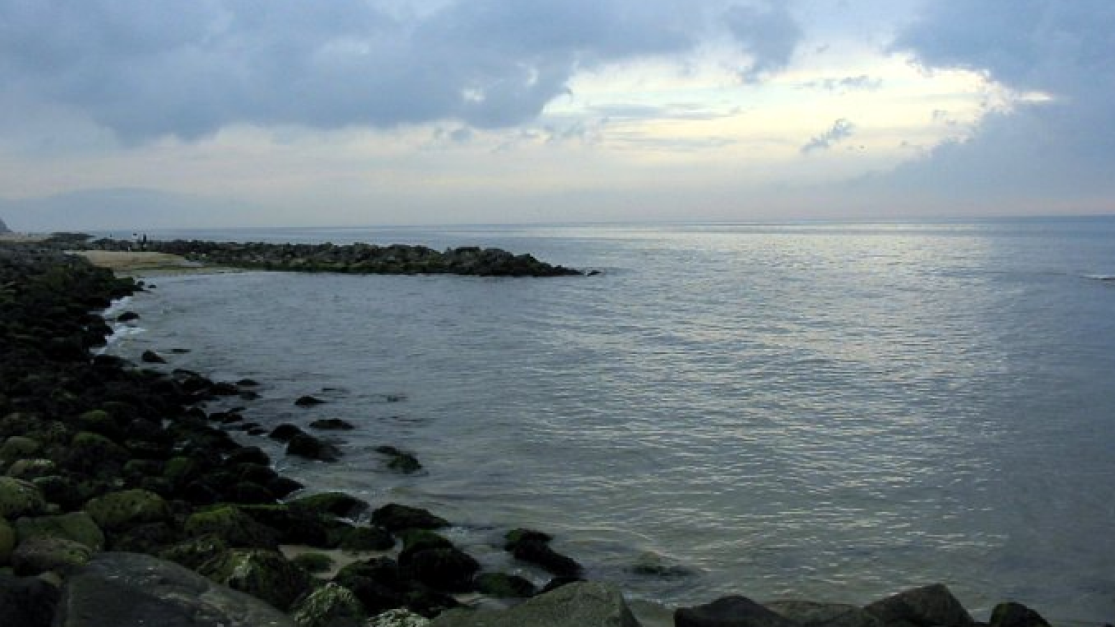


 07-07-2025 om 23:46
geschreven door peter
07-07-2025 om 23:46
geschreven door peter 


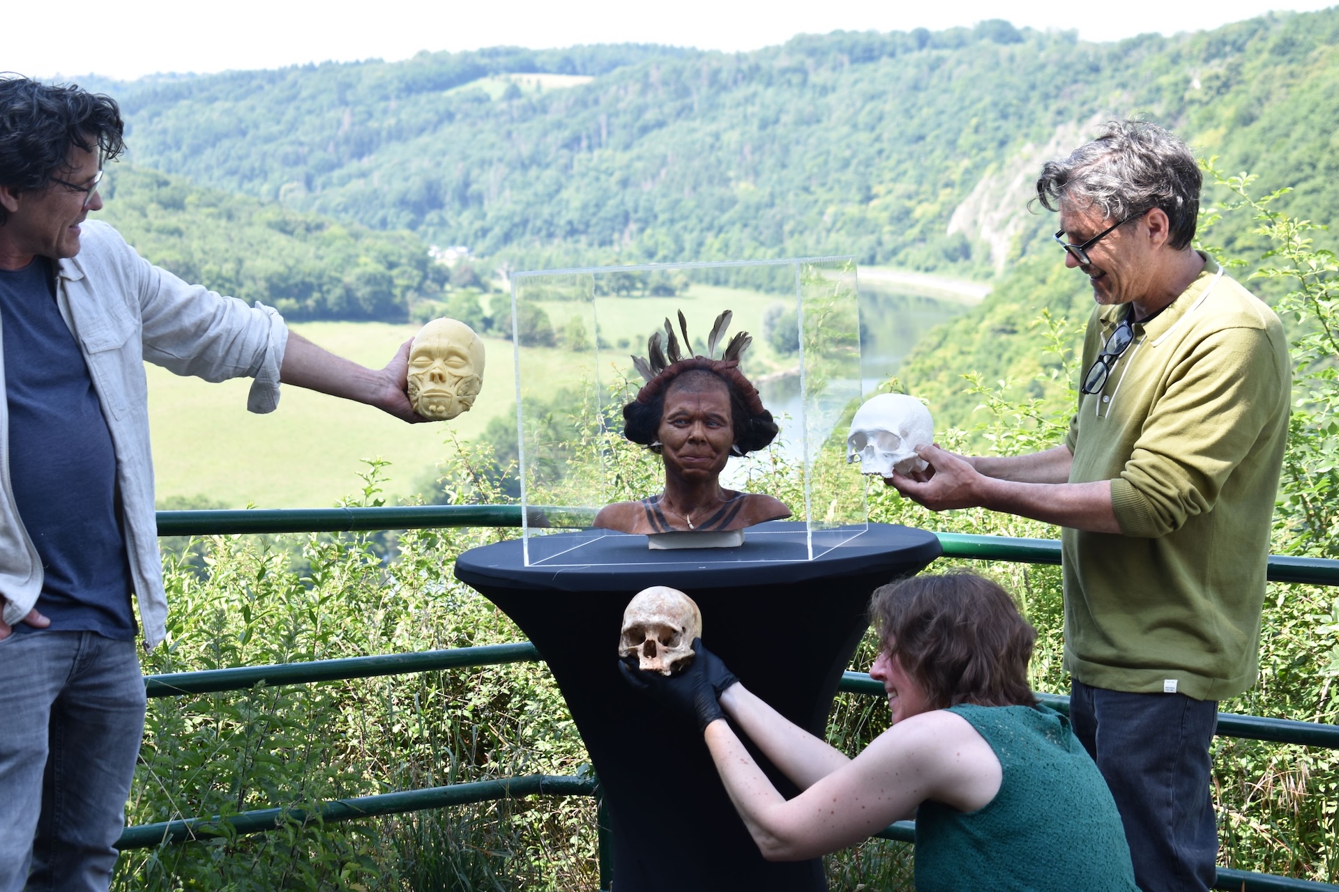
.avif)


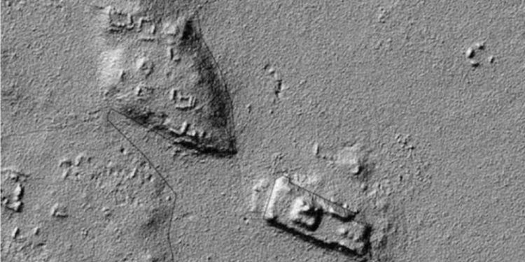
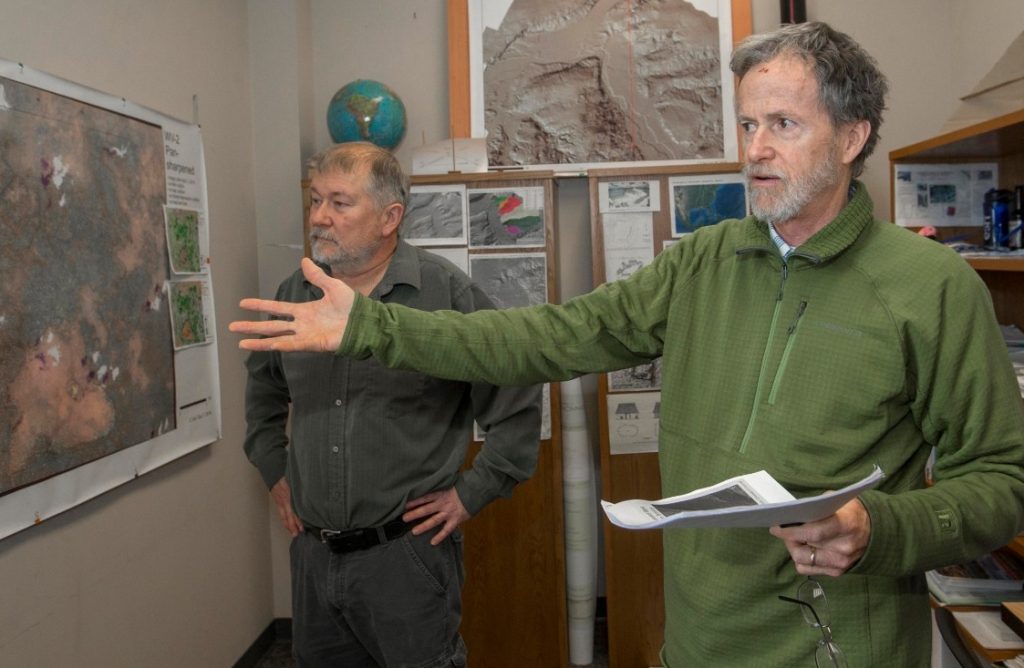


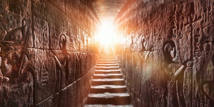
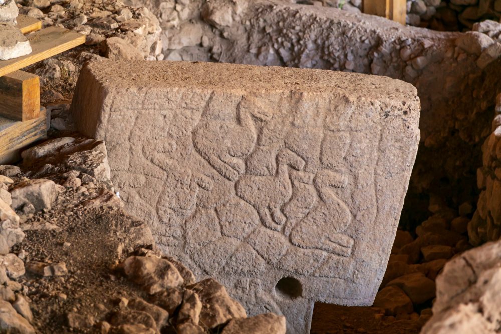
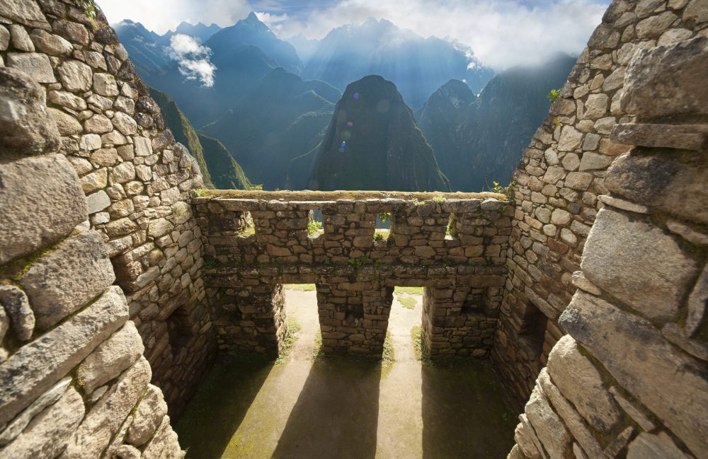

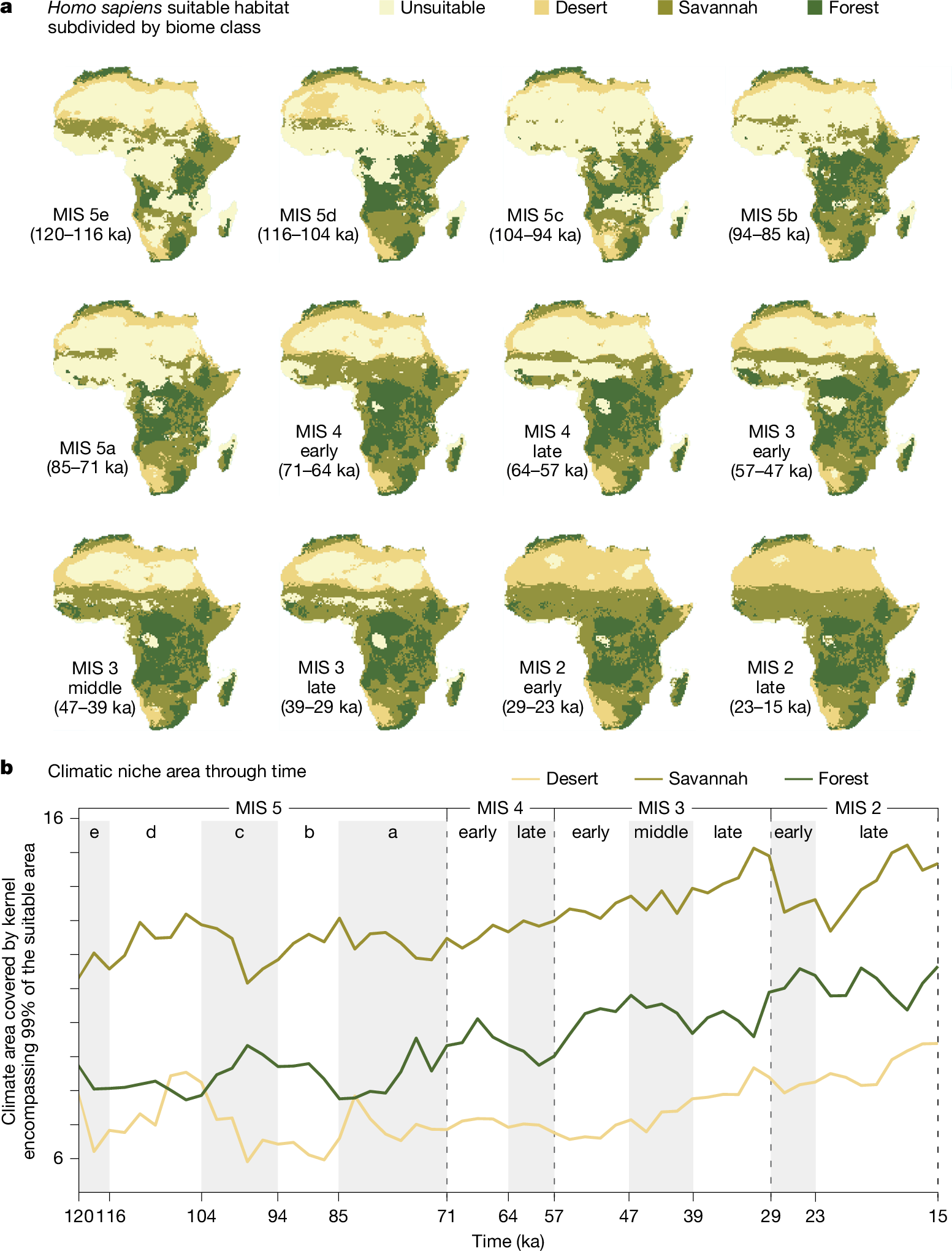


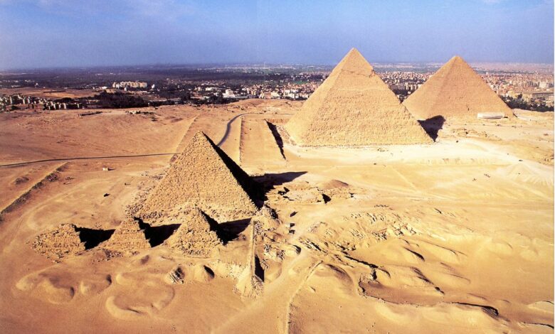
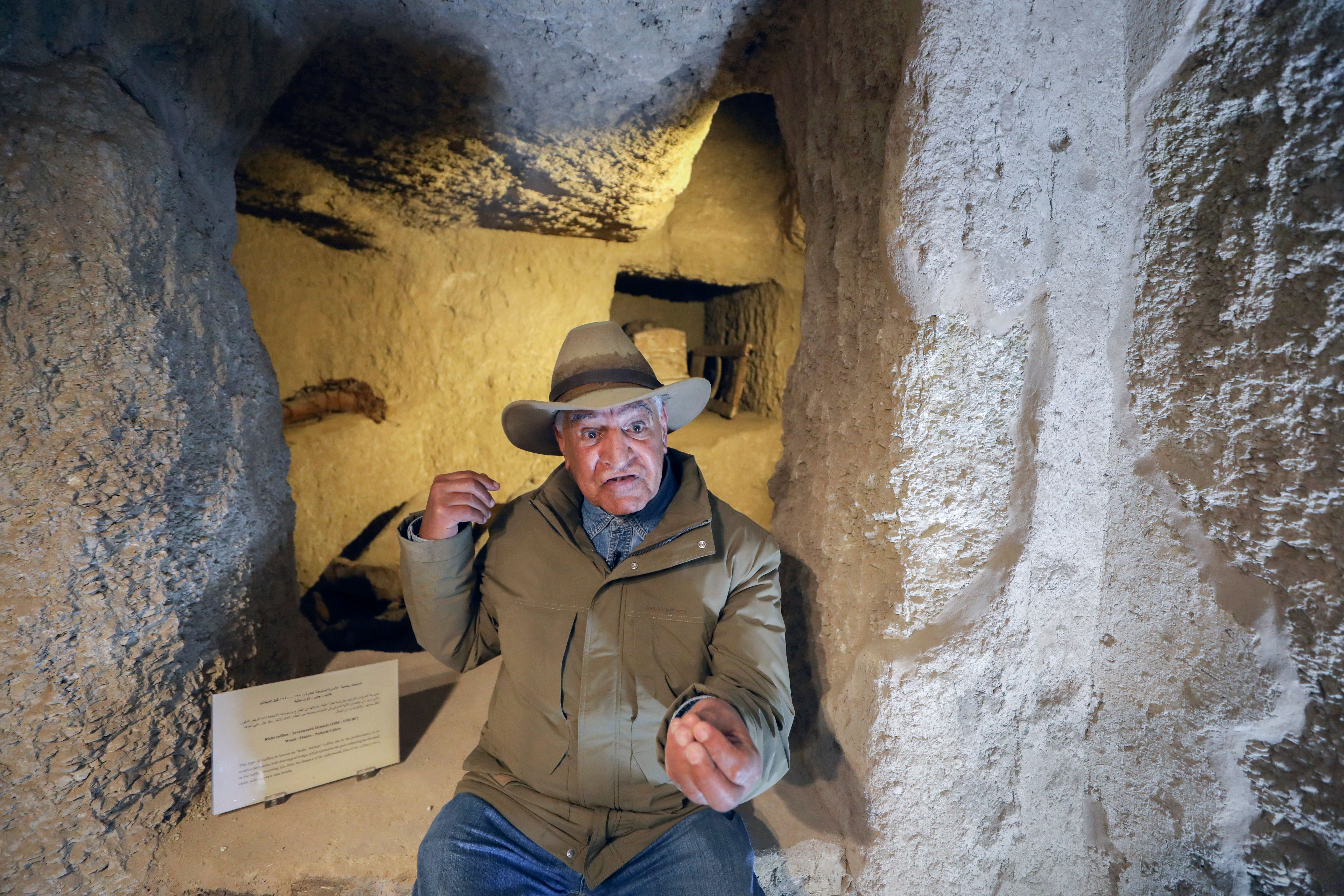


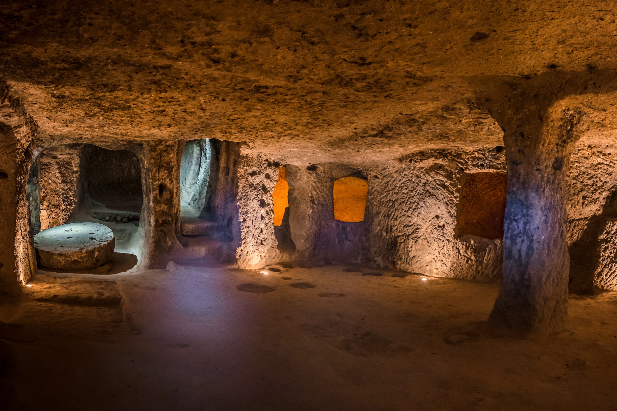
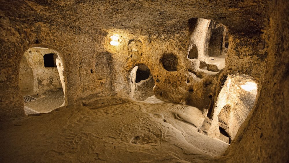

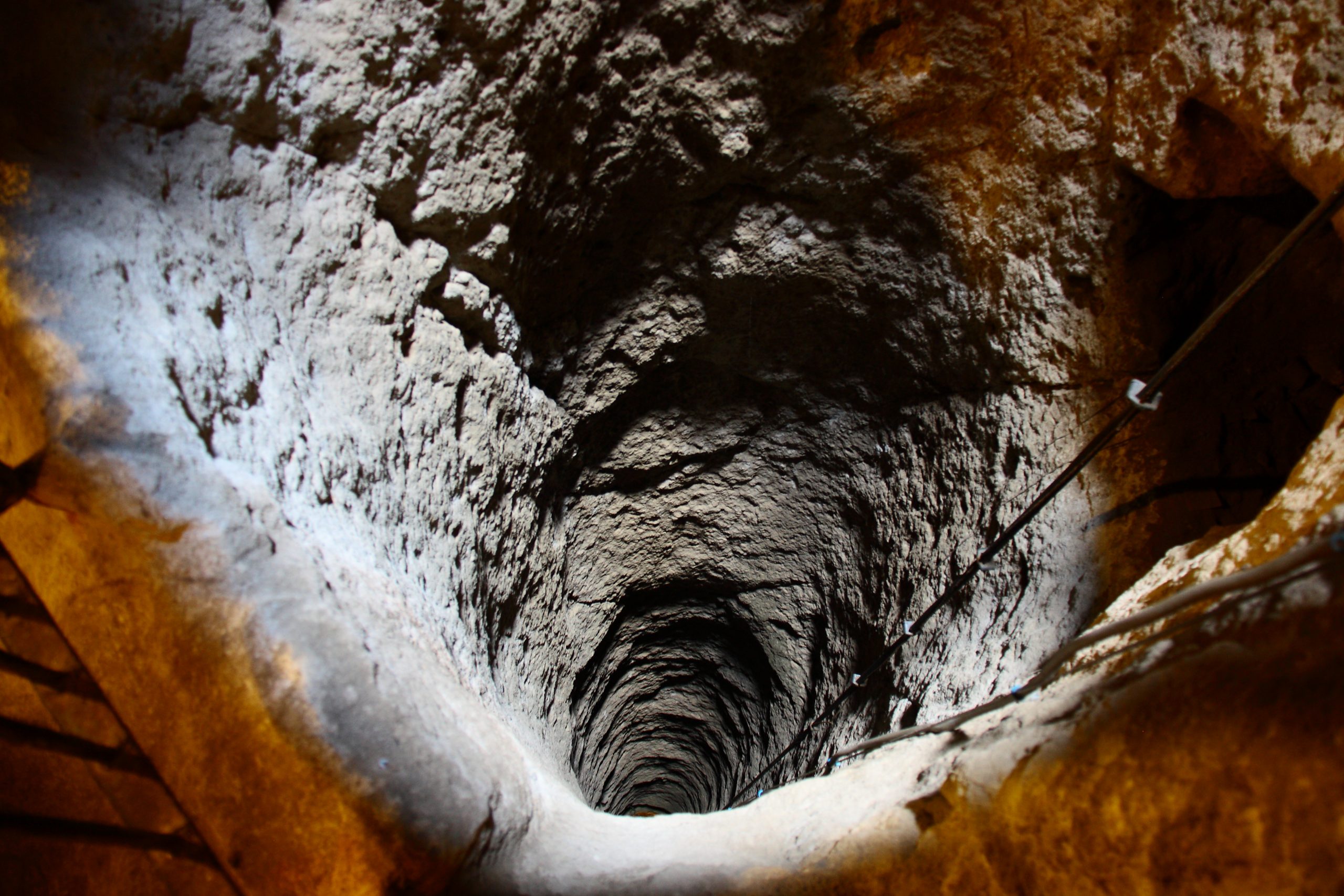
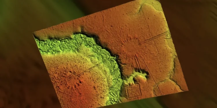


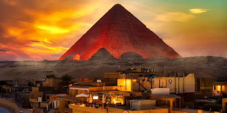

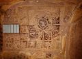
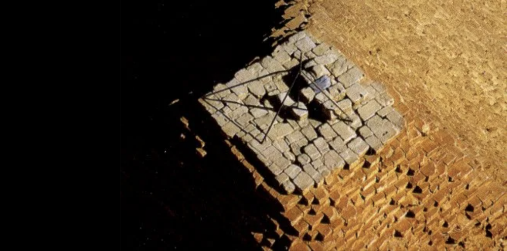
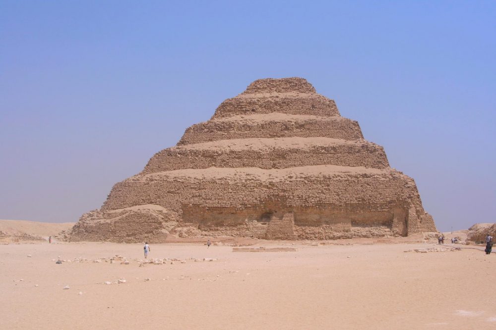
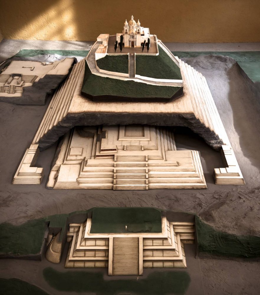
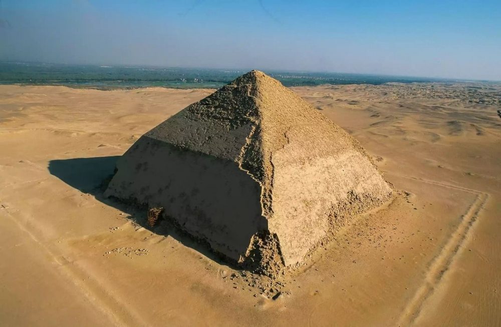


